11 Most Beautiful Hiking Trails In Arizona To Explore In 2026
Arizona has a way of stopping you in your tracks, literally. I have stood on canyon rims at sunrise, squeezed through narrow slot canyons, and watched desert wildflowers bloom at my feet, all within the same state.
The variety here is staggering, from sky-high volcanic peaks near Flagstaff to the red rock wonderland of Sedona and the lush riparian corridors of Oak Creek Canyon.
If you have been searching for your next big outdoor adventure, this list of the most beautiful hiking trails in Arizona will give you plenty of reasons to lace up your boots and hit the trail in 2026. Even now, I can picture the dust on my boots and that satisfying tiredness that shows up right when I get back to the car.
1. Bright Angel Trail, Grand Canyon National Park, South Rim
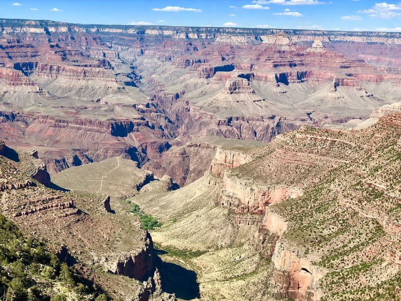
Few trails in the world can match the sheer drama of stepping onto Bright Angel Trail at the South Rim of Grand Canyon National Park in Arizona.
The path winds down through nearly two billion years of exposed rock, with each switchback revealing a new layer of color, from creamy limestone to deep red Hakatai shale.
Starting near Grand Canyon Village, the trail descends about 9.5 miles to the Colorado River, though most day hikers turn around at the 1.5-mile or 3-mile rest houses. Water stations are available seasonally, which makes planning your turnaround point much easier.
Morning light is genuinely magical here, painting the canyon walls in shades of amber and copper that no photo fully captures. The climb back up is the real workout, so start early, carry more water than you think you need, and let the canyon walls keep you company on the way out.
I always take a quick pause at a wide overlook on the return, just to catch my breath and remind myself how far down the trail has already pulled me.
2. South Kaibab Trail, Grand Canyon National Park, South Rim
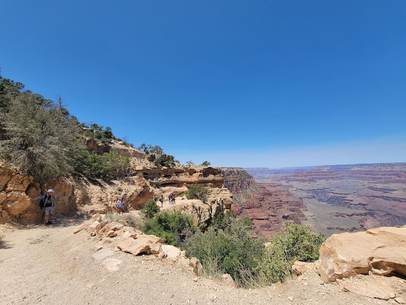
If Bright Angel Trail is the canyon’s welcoming handshake, South Kaibab Trail is its bold, unfiltered stare. This route at Grand Canyon National Park’s South Rim offers zero shade and absolutely zero apology for it, rewarding hikers with some of the most unobstructed panoramic views in the entire park.
Access is typically by shuttle from the South Rim, since private vehicles are not permitted at the trailhead. The trail follows exposed ridgelines rather than creek drainages, meaning every step comes with a view that stretches across the full width of the canyon.
Ooh Aah Point at 0.9 miles is a crowd favorite for good reason, delivering jaw-dropping scenery without a brutal commitment. Cedar Ridge at 1.5 miles is another solid turnaround for day hikers.
Carry plenty of water, sunscreen, and salty snacks, because this trail earns every bit of the effort you put into it.
I like starting in the cool hush of early morning, when the canyon feels endless and the first sun hits the ridgeline like someone slowly turning up the brightness.
3. Humphreys Peak Trail, Flagstaff, San Francisco Peaks
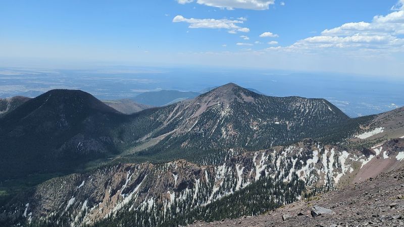
Standing at 12,633 feet, Humphreys Peak is the highest point in Arizona, and the trail that leads there is every bit as rewarding as the bragging rights that come with reaching the top.
The hike begins at the Arizona Snowbowl trailhead area on Snow Bowl Road near Flagstaff and climbs through dense spruce-fir forest before breaking above treeline into open alpine tundra.
The round trip covers about 9 miles with roughly 3,400 feet of elevation gain, so this one asks for a solid fitness base. Summer afternoons bring fast-moving thunderstorms, which means an early start is not just smart but genuinely important for safety.
The tundra zone near the summit hosts rare endemic plants found nowhere else on Earth, a detail that always makes me slow down and look more carefully at the ground beneath my boots.
Reaching that summit with the entire Colorado Plateau spread out below you is one of those moments that stays with you long after the trail dust has settled.
4. West Fork Trail 108, Oak Creek Canyon, Sedona Area
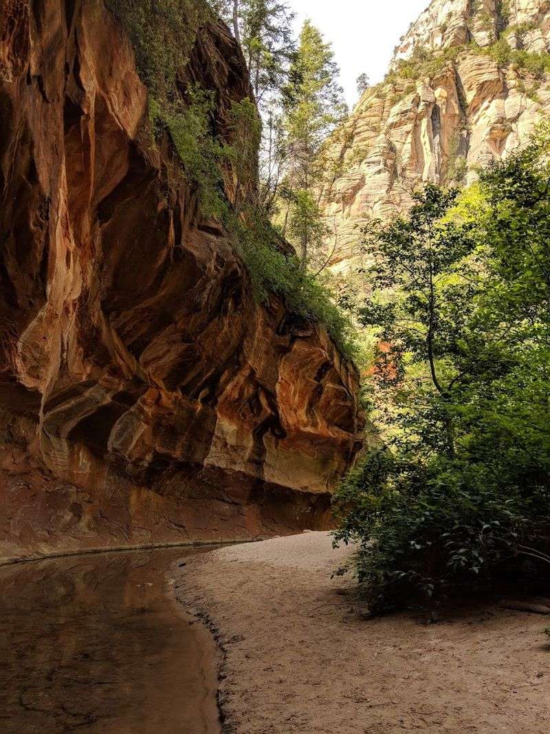
Oak Creek Canyon north of Sedona holds one of Arizona’s most beloved secrets, and West Fork Trail 108 is its crown jewel.
The hike begins near the Call of the Canyon area off Highway 89A, immediately drawing you into a cool, shaded corridor of canyon walls draped in ferns, wildflowers, and towering ponderosa pines.
The first three miles are well-maintained and family-friendly, featuring around a dozen creek crossings that range from easy rock hops to knee-deep wades depending on the season. Fall transforms this trail into a riot of gold and orange, making it one of the most photographed autumn hikes in the entire Southwest.
Beyond the maintained section, the canyon narrows and the route becomes more of an adventure, requiring swimming through pools in certain conditions. Even if you turn around at the three-mile mark, the scenery delivers far more than most trails manage in twice the distance.
5. Cathedral Rock Trail, Sedona
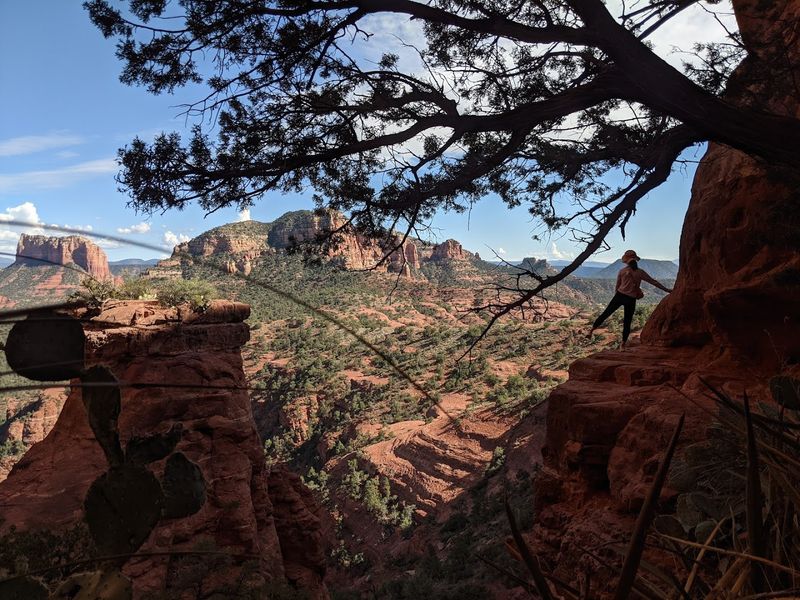
Cathedral Rock is Sedona’s most recognizable silhouette, and the trail that takes you up to its saddle might just be the most thrilling short hike in the entire state.
The route begins in the Cathedral Rock Trail area of Sedona’s Red Rock country and covers only about 1.5 miles round trip, but what it lacks in distance it more than makes up for in vertical scrambling and sheer visual drama.
The upper section requires using hands and feet to navigate steep sandstone slabs, which adds a genuine adventure feel that surprises first-time visitors expecting a leisurely stroll. Grippy footwear is a must, and trekking poles are more of a hindrance than a help on the final push.
Reaching the saddle between Cathedral Rock’s spires rewards you with a sweeping view of the Verde Valley that stretches all the way to distant mountain ranges. Sunset visits are popular, though arriving early gives you the rock almost entirely to yourself.
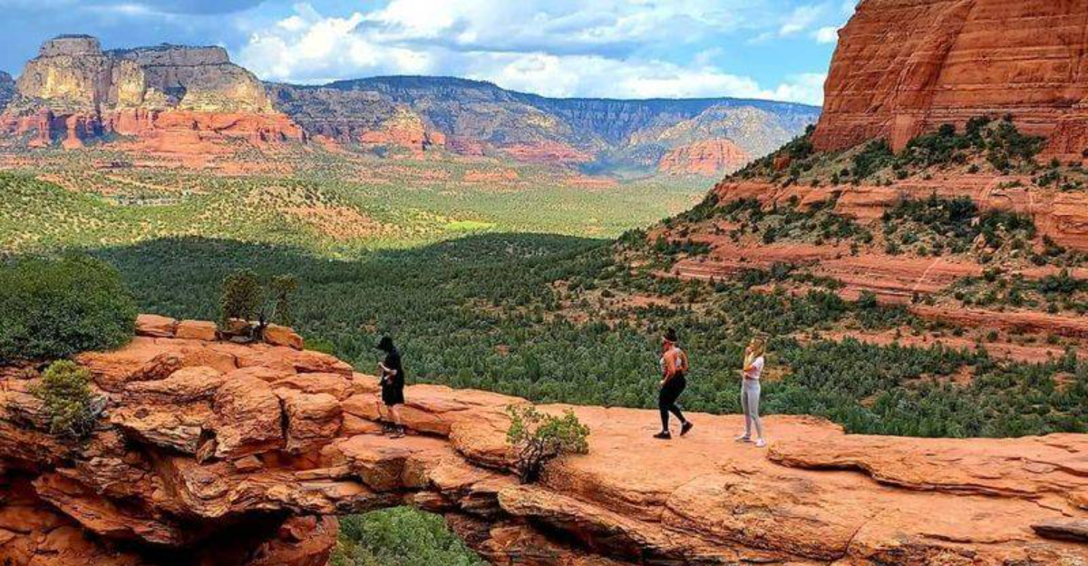
6. Devil’s Bridge Trail, Sedona
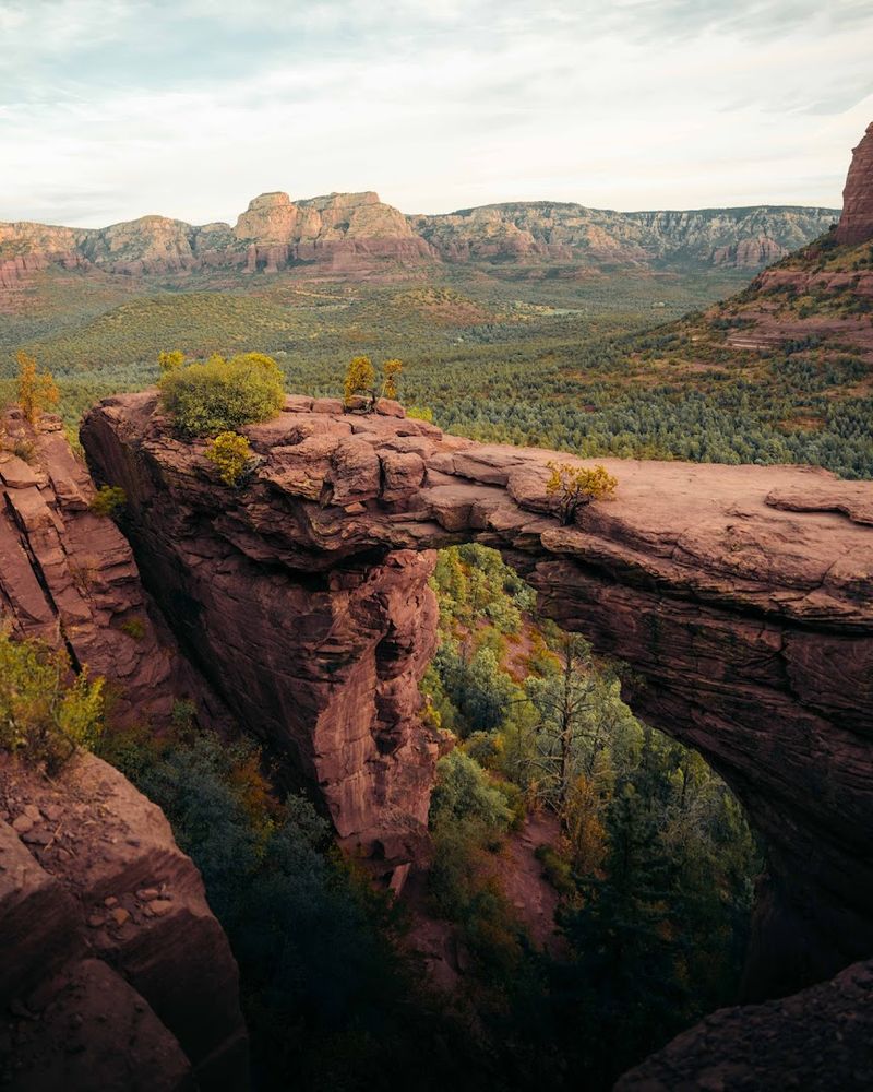
There is a particular kind of thrill that comes from standing on top of a natural sandstone arch with nothing but open air and red canyon below your feet, and Devil’s Bridge in Sedona delivers exactly that.
The trail is commonly approached via Dry Creek Road in the Mescal area, with road conditions sometimes affecting whether you drive all the way to the trailhead or add extra miles on foot.
The hike itself covers roughly 4 miles round trip with moderate elevation gain, winding through classic Sedona scrubland before the arch comes into sudden view above a final rocky scramble.
The bridge itself spans about 54 feet and stands roughly 45 feet above the canyon floor, making the walk across it a memorable experience for anyone comfortable with heights.
Permits are required for private vehicle access on certain days, so checking current regulations before you go saves a lot of frustration. Early morning visits reward you with cooler temperatures and far fewer crowds jostling for the perfect arch photo.
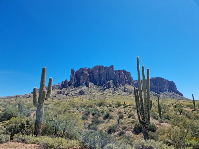
7. Fremont Saddle Via Peralta Trail, Superstition Wilderness
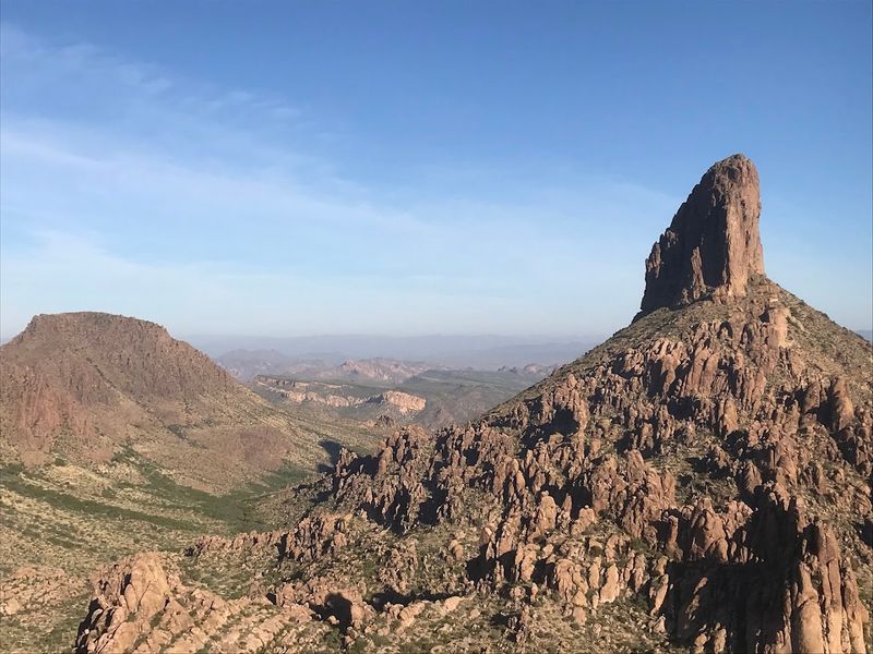
The Superstition Wilderness east of Phoenix holds a legendary reputation, and the Peralta Trail to Fremont Saddle is the hike that earns it.
The trailhead sits at the end of Peralta Road near Apache Junction, launching you into a landscape of jagged volcanic rock, towering saguaro cacti, and canyon corridors that feel genuinely remote despite being less than an hour from the city.
The round trip to Fremont Saddle covers about 4.6 miles with around 1,300 feet of elevation gain. The payoff at the saddle is one of the most dramatic views in the entire Sonoran Desert, with Weaver’s Needle, a volcanic spire tied to countless legends about hidden gold, rising directly in front of you.
Spring wildflower season turns the lower canyon into a colorful display worth planning a trip around. Start early during warmer months, because this exposed desert trail heats up fast and the midday sun has absolutely no mercy out here.
8. Flatiron Via Siphon Draw, Lost Dutchman State Park
Lost Dutchman State Park near Apache Junction sits in the shadow of the Superstition Mountains, and the Siphon Draw Trail to the Flatiron is hands-down one of the most demanding and rewarding hikes the Phoenix area has to offer.
The trail begins within the park’s trail system and starts gently enough through saguaro-dotted desert before the terrain shifts dramatically upward.
The upper section leading to the Flatiron is a genuine scramble, requiring route-finding skills and comfortable movement over steep, loose rock. The Flatiron itself is a large, tilted rock formation perched above a dramatic cliff face, and reaching it feels like a real accomplishment rather than just a casual stroll.
The round trip covers around 5.8 miles with over 2,800 feet of elevation gain, numbers that earn serious respect. Attempting this one in summer without a very early start is a decision you will regret, so plan accordingly and bring more water than feels reasonable.
9. Heart Of Rocks Loop, Chiricahua National Monument
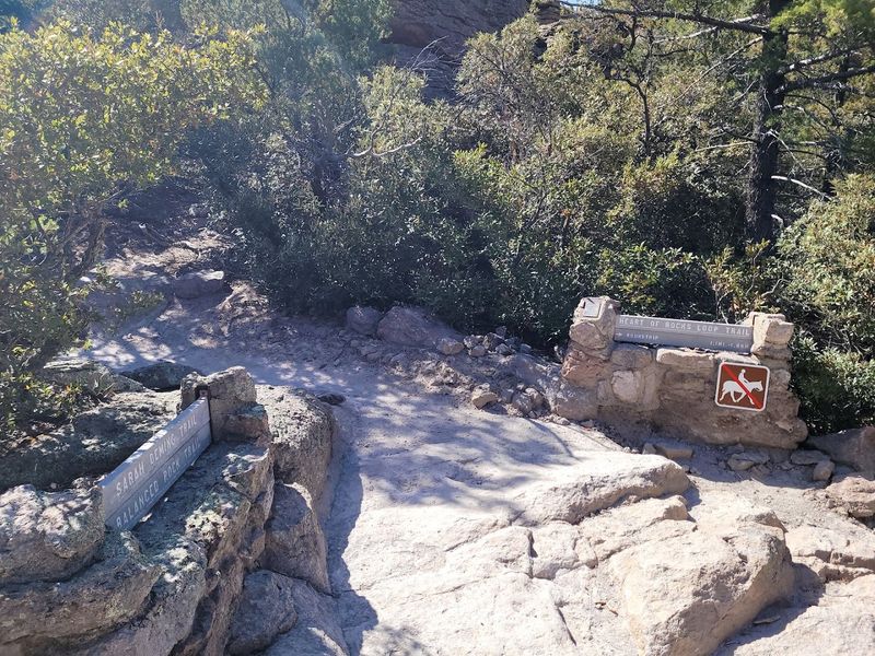
Tucked away in the far southeastern corner of Arizona, Chiricahua National Monument is one of the most underrated landscapes in the entire Southwest.
The Heart of Rocks Loop takes you through the monument’s most dramatic terrain, where millions of years of volcanic activity and erosion have sculpted towering columns, balanced boulders, and spires that seem to defy gravity with casual confidence.
The loop covers about 7 miles when combined with approach trails from the monument’s trail network, passing formations with names like Big Balanced Rock, Punch and Judy, and Duck on a Rock.
The playful geology here encourages a slower pace, because every turn reveals something new worth stopping to examine.
Chiricahua sits at around 5,400 feet in elevation, which keeps temperatures noticeably cooler than the Phoenix area even in summer. The relative remoteness of the monument means crowds are rare, making this one of those trails where you might spend entire hours hearing nothing but wind and birdsong.
10. Wasson Peak, Saguaro National Park West, Tucson
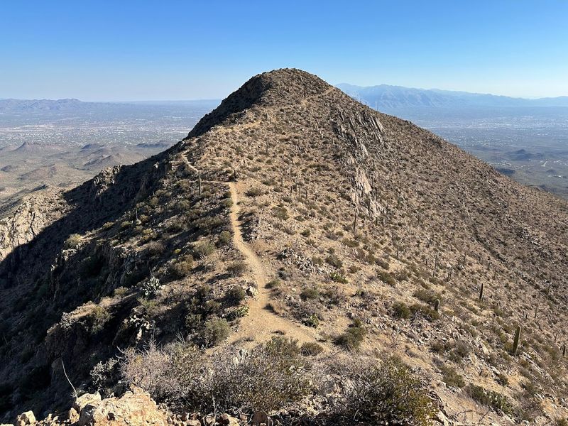
Saguaro National Park West on the outskirts of Tucson is a living museum of the Sonoran Desert, and the hike to Wasson Peak puts you right in the middle of one of the densest saguaro forests you will ever walk through.
Common routes include the Hugh Norris Trail and the King Canyon Trail, both starting within the western district of the park.
The Hugh Norris approach covers about 7.8 miles round trip with around 1,800 feet of elevation gain, while the King Canyon route offers a slightly shorter alternative with its own distinct character. Both trails pass through a remarkable density of mature saguaros, some estimated to be over 150 years old, which gives the landscape a quietly ancient feeling.
Wasson Peak stands at 4,687 feet, and the summit view stretches across Tucson, the Santa Catalina Mountains, and miles of desert basin in every direction. Spring visits add blooming saguaro flowers to the scene, a bonus that makes the hike feel like something genuinely special.
11. Havasupai Trail To Havasu Falls Area, Hualapai Hilltop To Supai
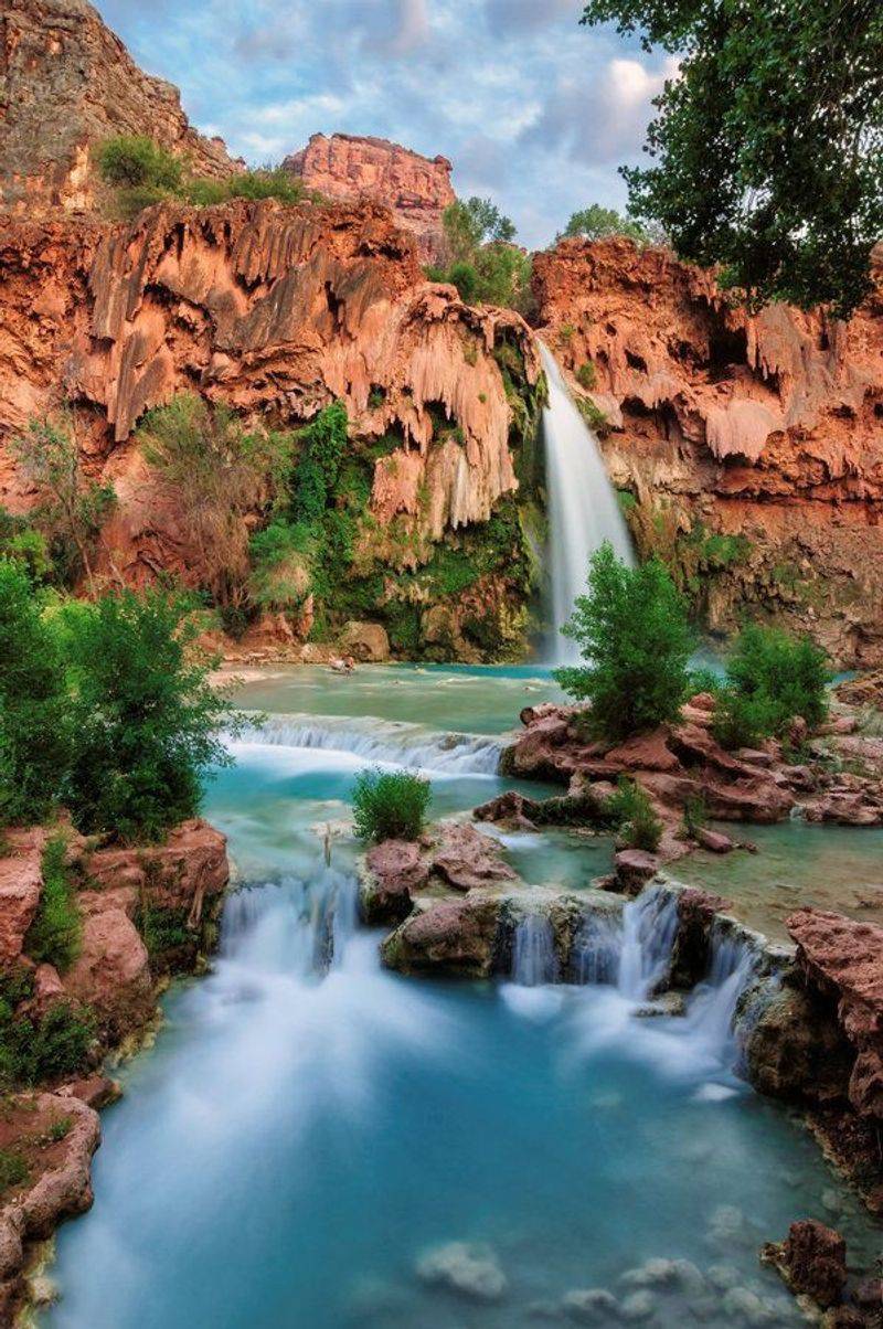
No list of Arizona’s most beautiful hiking trails is complete without mentioning the route that leads to Havasu Falls, a series of striking turquoise waterfalls hidden deep within a side canyon of the Grand Canyon on Havasupai tribal lands.
The journey begins at Hualapai Hilltop at the end of Indian Road 18, where a 10-mile trail descends roughly 2,000 feet into Havasu Canyon to reach the village of Supai.
Permits and reservations are required and strictly enforced, with availability often selling out months in advance. The tribe manages access carefully, and respecting their rules is not optional but genuinely important for preserving this sacred landscape.
The falls themselves owe their vivid turquoise color to high calcium carbonate content in the water, a geological quirk that makes every photo look almost too good to be real.
Camping near the falls for multiple nights is the preferred way to experience the canyon, giving you time to visit multiple waterfalls and truly absorb a place that feels unlike anywhere else on Earth.