
10 Quiet Hikes In Colorado To Add To Your 2026 Bucket List
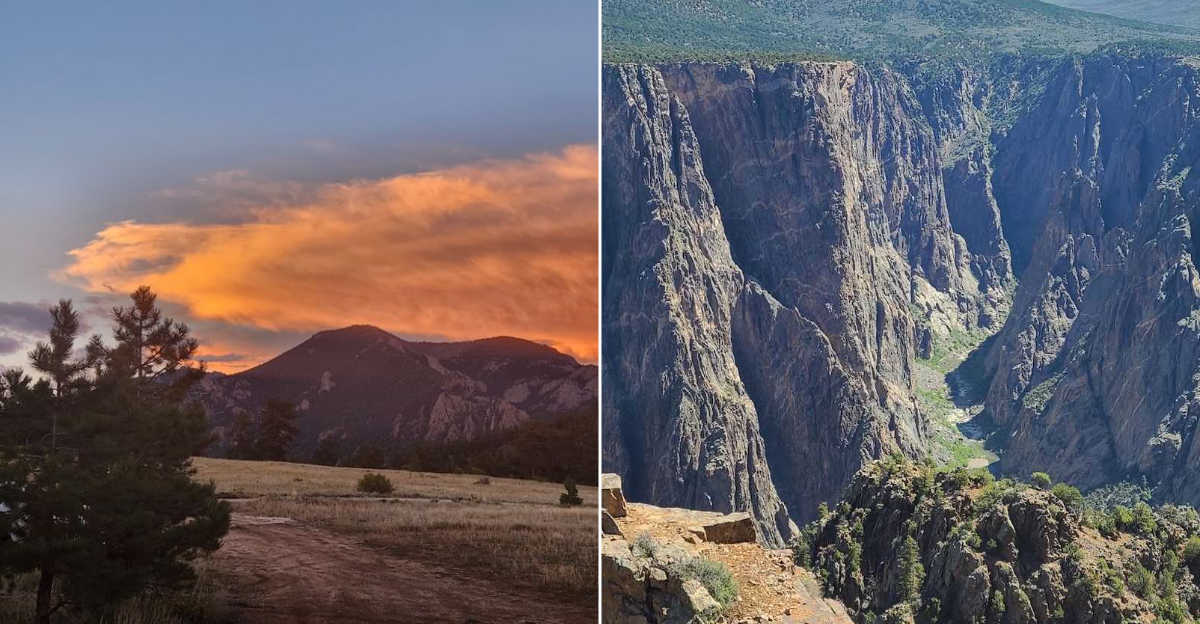
The trails worth remembering are rarely the ones with the loudest reputation.
Beyond the famous summits and crowded overlooks, quieter routes climb through canyons, forests, and high ridgelines where the only soundtrack is wind, water, and your own footsteps.
Across the backcountry of Colorado, these ten hikes trade packed parking lots for space to notice the details: wildflowers at your boots, shadows moving across stone, and views that arrive without an audience.
Some demand stamina, others reward patience, but every trail offers the kind of silence that follows you home.
Lace up carefully, bring more water than you think you need, and leave the rush behind. For a 2026 bucket list built around real adventure, the lesser-known paths scattered throughout Colorado deserve serious attention.
The reward is not just the view. It is the rare feeling that, for a few miles, the landscape belongs entirely to you and no one else.
1. Coal Creek Trail No. 581
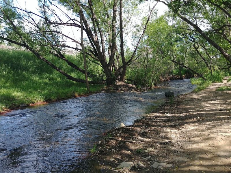
Eight and a half miles of forested ridge-walking east of Pagosa Springs, and you might not see another soul the whole time. Coal Creek Trail No. 581 is a point-to-point route that demands a car shuttle or a willing hiking partner with a second vehicle, but that mild inconvenience is exactly what keeps it blissfully quiet.
The trail connects Fawn Gulch Road (Forest Road 666) to East Fork Road (Forest Road 667), crossing terrain that feels genuinely remote without requiring technical skills. Tall conifers shade most of the route, and the ridgeline sections open up just enough to remind you how far you are from anything resembling a parking lot crowd.
Go in late summer when the wildflowers are still hanging on and the afternoon thunderstorms haven’t fully committed to ruining your afternoon. Bring more water than you think you need, wear layers, and resist the urge to rush.
This trail rewards the hikers who slow down, look around, and actually notice what a Colorado forest sounds like when no one else is in it.
2. Whitehead Trail No. 674
Silverton is one of those Colorado towns that looks like a movie set and draws people in like a magnet. Most visitors snap a photo from the main street and call it a day.
Whitehead Trail No. 674 is for the ones who want to earn their view.
Accessed from Deer Park Road off Kendall Mountain Road, roughly six miles east of town, this 9.3-mile one-way route climbs into alpine meadows sitting between 11,600 and 12,800 feet. The air is thinner, the scenery is genuinely staggering, and the foot traffic is almost nonexistent compared to the more publicized San Juan routes nearby.
Start early because afternoon lightning at this elevation is not a suggestion to turn around, it is a requirement. The meadows at the upper elevations feel almost otherworldly, especially in July when the wildflowers are competing for attention.
Whitehead Trail rewards hikers who are comfortable with high-altitude exposure and a little route-finding confidence. Plan the car shuttle in advance, bring trekking poles, and consider this one of the best-kept secrets in the entire San Juan range.
3. Prater Ridge Trail
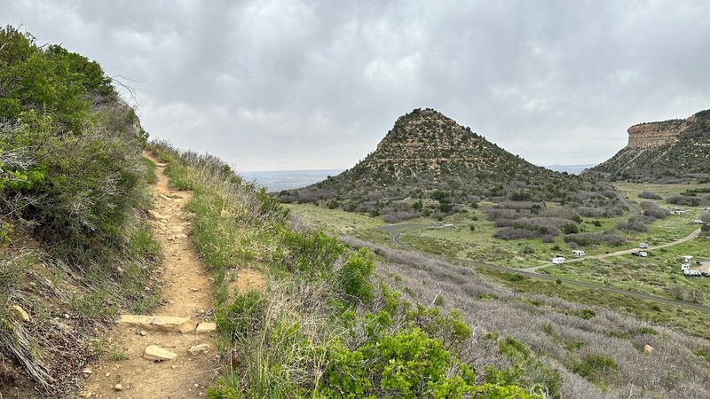
Mesa Verde National Park is famous for cliff dwellings, and rightly so. But somewhere between the tour buses and the ranger-guided alcove visits, most people completely overlook the fact that there are actual hiking trails here worth a full morning of your time.
Prater Ridge Trail begins at Morefield Campground (4 Morefield Campground Road, Mesa Verde National Park, CO 81330) and covers 7.8 miles round trip. Hikers can commit to the full ridge or branch off onto the shorter north or south loops once they’ve climbed onto the mesa top.
Either way, the payoff is a landscape that feels ancient and unhurried.
The pinyon-juniper forest up here has a particular smell in the heat of the day that is hard to describe but impossible to forget. Wildlife sightings are common, including mule deer and wild turkeys that seem entirely unbothered by human presence.
Compared to the crowded cliff dwelling viewpoints, Prater Ridge is practically deserted. Pack lunch, start by 8 a.m. in summer, and give yourself permission to linger on the ridge longer than your original itinerary suggested.
4. Picketwire Canyonlands Trail
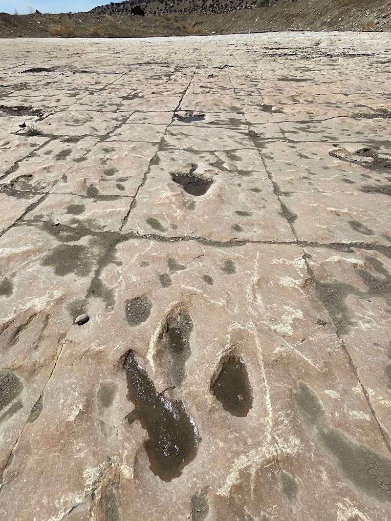
There are roughly 1,300 dinosaur footprints embedded in the rock along the Purgatoire River, and almost nobody visits them. That sentence should be enough to get you in the car.
Picketwire Canyonlands Trail starts at Withers Canyon Trailhead on Forest Road 218A, south of La Junta, and runs 11.2 miles round trip to the dinosaur tracksite. Withers Canyon is the only public trail access into this stretch of canyonlands, which means no crowds and no shortcuts.
The trail descends into the Purgatoire River Valley and follows the river toward the tracksite, with the longer route continuing toward historic Rourke Ranch.
Southeastern Colorado does not get nearly the attention it deserves, and this trail is proof of what gets overlooked when everyone chases the mountains. The canyon walls are quietly dramatic, the river adds a pleasant soundtrack, and the tracksite itself is humbling in a way that no museum replica ever quite manages.
Go in spring or fall to avoid the brutal summer heat of the valley floor. Bring plenty of water regardless of season, and plan for a full day out.
5. Warner Point Trail
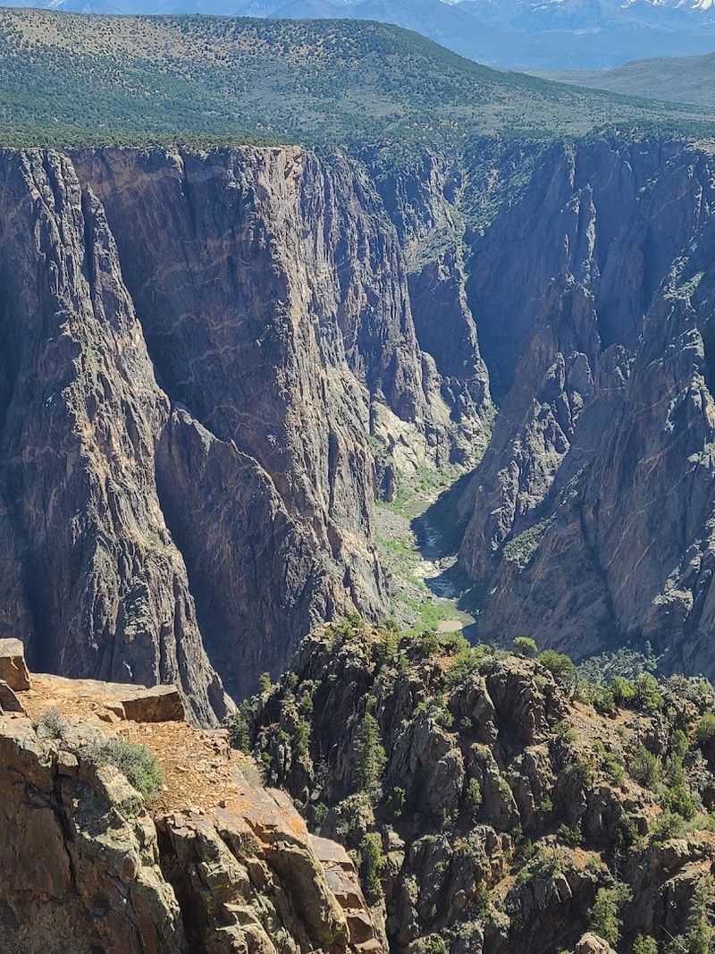
Black Canyon of the Gunnison is one of those places that stops conversation cold the moment you look over the edge. Warner Point Trail, accessed from High Point at the end of South Rim Road, takes you to one of the most dramatic overlooks in the entire park without asking much in return.
At roughly 1.6 miles round trip, this is the shortest hike on the list, but do not let that fool you into treating it casually. The views here are vertigo-inducing in the best possible way, and the trail sits at the far end of the park road, well past the quick-stop overlooks where most visitors cluster and take photos and leave.
The trail was officially reported open and dry for the 2026 season, which makes this the year to go.
Morning light hits the canyon walls in a way that makes the dark Precambrian rock glow almost purple. Pair this hike with a picnic at High Point and you have a half-day outing that punches well above its mileage.
The park address is 9800 Highway 347, Montrose, CO 81401, and the drive out South Rim Road is worth every mile.
6. Gould Loop Trail
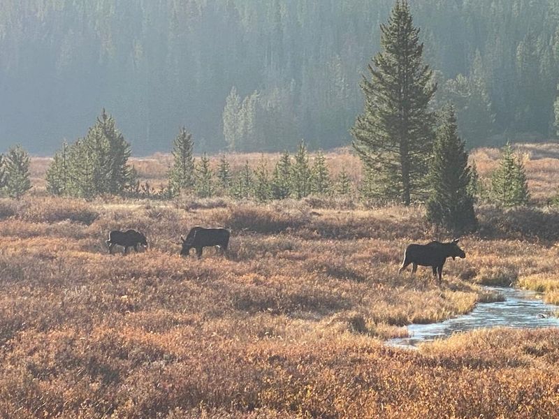
North Park does not show up on most Colorado hiking shortlists, and that is precisely why it belongs on yours. The Gould Loop Trail at State Forest State Park (56750 Highway 14, Walden, CO 80480) covers 6.5 miles of terrain that feels genuinely off the radar.
The loop explores a landscape of open meadows and conifer forest that has a slower, gentler rhythm than the dramatic alpine zones further south. Moose sightings are legitimately common in this part of the state, which adds a welcome element of surprise to any morning hike.
The trail remains available while the Michigan Ditch and American Lakes sections nearby are temporarily closed for mitigation work, so Gould Loop is getting a rare moment in the spotlight.
State Forest State Park is a low-key gem that rewards visitors who are willing to drive a little further north than the usual mountain corridor. The park entry fee applies, but the relative solitude on the trail feels like an extraordinary return on a modest investment.
Bring binoculars, move quietly through the meadow sections, and do not be surprised if the moose are completely unimpressed by your presence.
7. Big South Trail No. 944
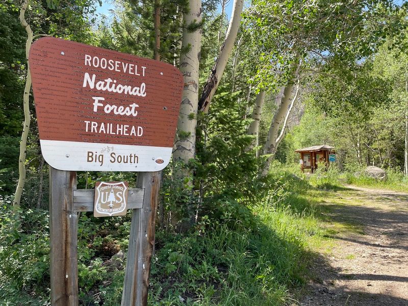
The Cache la Poudre River corridor is one of Colorado’s underappreciated hiking destinations, and Big South Trail No. 944 follows it into wilderness territory with almost no fanfare. The trailhead sits on CO-14, approximately 49 miles west of its junction with US-287, right beside Big South Campground.
Within half a mile, you are inside Comanche Peak Wilderness, and the world outside it starts to feel irrelevant. The trail can be hiked up to 10.4 miles one way, making it flexible enough for a casual out-and-back or a serious full-day push.
One firm warning: do not attempt the Poudre River ford when water is running high. Spring snowmelt turns that crossing into a genuine hazard, and no view downstream is worth the risk.
Late summer and early fall are the sweet spots here, when the water levels drop and the canyon cottonwoods start turning gold. The sound of the river is constant and deeply satisfying, the kind of white noise that makes every other thought temporarily irrelevant.
Pack a lunch, find a flat rock near the water somewhere around mile four, and eat it slowly. That is the whole plan, and it is a very good one.
8. Blair Lake Trail No. 2048
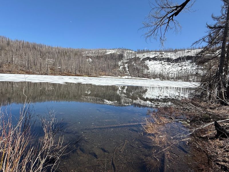
The Flat Tops Wilderness sits in a part of Colorado that most people drive through rather than stop in, which is their loss and your gain. Blair Lake Trail No. 2048 connects Crater Trailhead to Patterson Creek Trailhead north of New Castle, covering 6.2 miles point to point through terrain the Forest Service itself describes as remote and rugged.
Spruce forest, open meadows, and several mountain lakes mark the route, each one feeling like a reward for the effort of getting there. A high-clearance four-wheel-drive vehicle is recommended for trailhead access, and that requirement alone filters out a significant portion of the casual hiking crowd.
This is genuinely backcountry-adjacent hiking without requiring overnight gear.
The Flat Tops plateau has a personality unlike anywhere else in Colorado. It feels more like Montana up there, broad and windswept and indifferent to your schedule.
Plan the car shuttle in advance, check road conditions before you go, and give yourself plenty of daylight buffer. The lakes along the route are worth stopping at properly, not just photographing and moving on.
Bring your lunch and a willingness to sit quietly beside water that has probably not seen a visitor in days.
9. China Wall and Meeker Trails
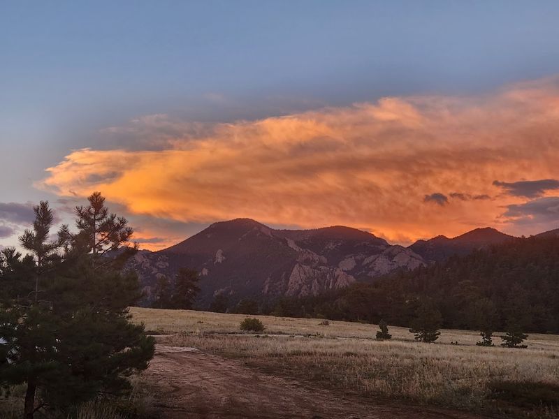
Northwestern Colorado hiking is its own category, and most people have not discovered it yet. The China Wall and Meeker Trails system at Sanderson Hill Park, accessed from Sanderson Drive in Meeker (trailhead coordinates 40.051067, -107.920833), offers approximately 11 miles of interconnected trails with no trail-use fee and almost no foot traffic on a typical weekday.
The system climbs and follows sections of the ridge locally known as China Wall, a distinctive geological feature that gives the whole area a storybook quality you do not expect from a town park. Hiking is permitted throughout, and the interconnected layout means you can design your own route based on energy and ambition rather than following a single prescribed path.
Meeker is a small ranching town with a genuine lack of pretension, and the trails around it reflect that same quality. No interpretive signs every hundred yards, no paved access road, no gift shop at the trailhead.
Just a ridge, some open sky, and the satisfying sensation of being somewhere that has not been optimized for tourism yet. Go before that changes.
Bring a paper map or a downloaded offline route, and tell someone where you are headed before you start.
10. East Canyon Preservation Trail
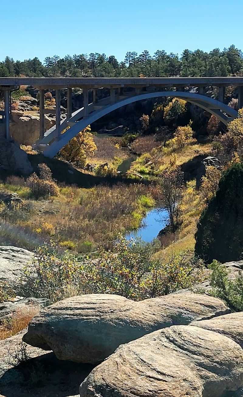
Castlewood Canyon State Park (2989 S State Highway 83, Franktown, CO 80116) is close enough to the Denver metro area that it could easily be overrun, and the central loops often are. The East Canyon Preservation Trail is a different story entirely.
At 3.9 miles, this hiking-only route is open from May through October and does not allow dogs. Those two rules together create a noticeably quieter atmosphere than the rest of the park.
No scrambling dogs, no retractable leashes across the path, no barking echoing off the canyon walls. Just the sound of wind and boots on sandstone.
The canyon geology here is genuinely striking, with layered rock walls that glow orange and gold in morning light. For a Front Range hike, the sense of seclusion is remarkable, and the preservation designation means the trail sees lighter maintenance traffic than the main park loops.
This is a strong candidate for an early October morning when the scrub oak turns and the air has that first real bite of autumn in it. Arrive by 8 a.m. on weekends to secure a parking spot before the main lot fills with visitors headed to the shorter central trails.