
10 Quiet Maine Coastal Towns That Haven’t Been Ruined By Tourists Yet
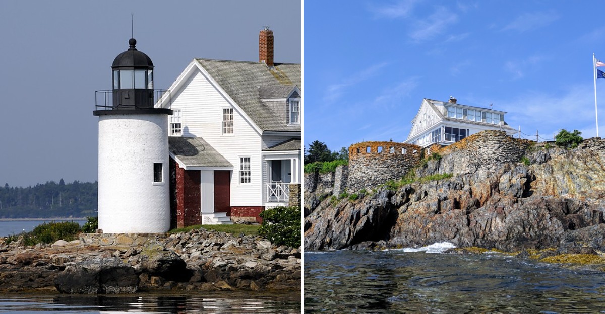
A bridge on this list is built from granite blocks stacked in a loose crisscross, with no mortar holding them together. The tide pours straight through the gaps twice a day.
I love that the solution to fast water was basically to let it pass.
That bridge is just one oddity on the quiet side of the Maine coast. Another stop has a beach covered in smooth, colored stones instead of sand. A different one sits so far east you can walk across a bridge into Canada.
These towns still run on lobster boats, tide charts, and small general stores. Souvenir shops are scarce, and that’s a big part of the charm.
You come for the views and stay for the slow pace. I can’t think of a better reason to skip the crowded highways during summer.
Stonington
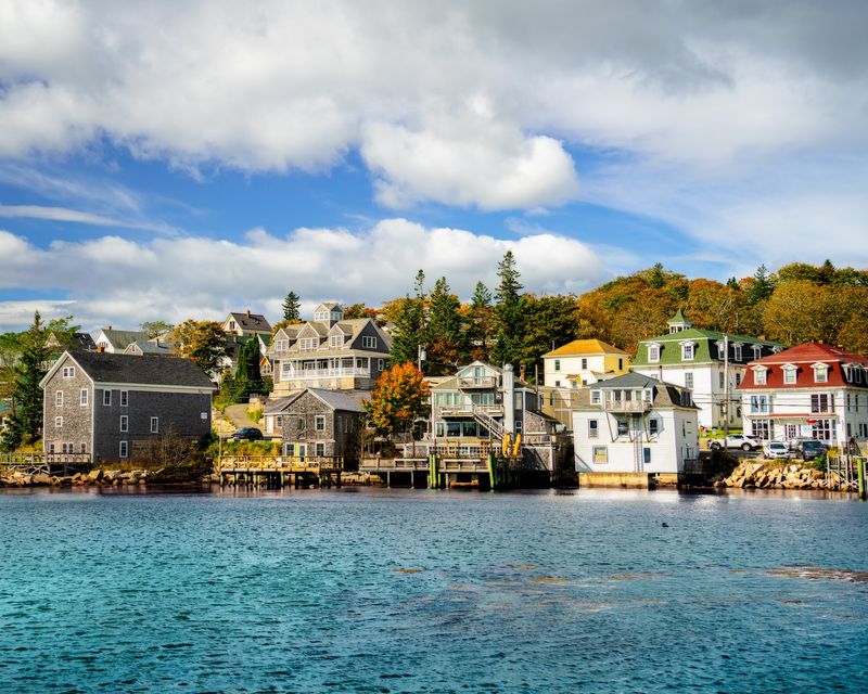
Granite from this harbor town’s quarries once shipped far beyond Deer Isle. Today, though, the most famous thing coming out of the water here is lobster.
Stonington sits at the southern tip of Deer Isle, reached by a long, narrow suspension bridge from Sedgwick. That drive alone makes the trip feel like an adventure.
The harbor ranks among the most productive lobster ports in Maine. You’ll see a big fleet of working boats, and they set the town’s rhythm more than any tour bus.
Main Street hugs the waterfront in a compact stretch of old buildings. You can stroll it in a few minutes, which leaves plenty of time to stare at the water.
Culture shows up in a big way at the Stonington Opera House. The historic hall hosts plays, music, films, and community events during the summer season.
Want to go farther? The mail boat ferry to Isle au Haut leaves from Stonington, and part of that island belongs to Acadia National Park.
Nearby, the Deer Isle area has quiet preserves with trails through spruce woods and along rocky shore. Bring good shoes, since coastal paths can get rooty and wet.
Morning is a smart time to explore, when boats head out and the harbor comes alive. By afternoon, many of them return with their catch.
Stonington rewards patient travelers who like real working towns. Just remember the fishermen have jobs to do, so give the docks plenty of room.
Address: Stonington, ME 04681
Lubec
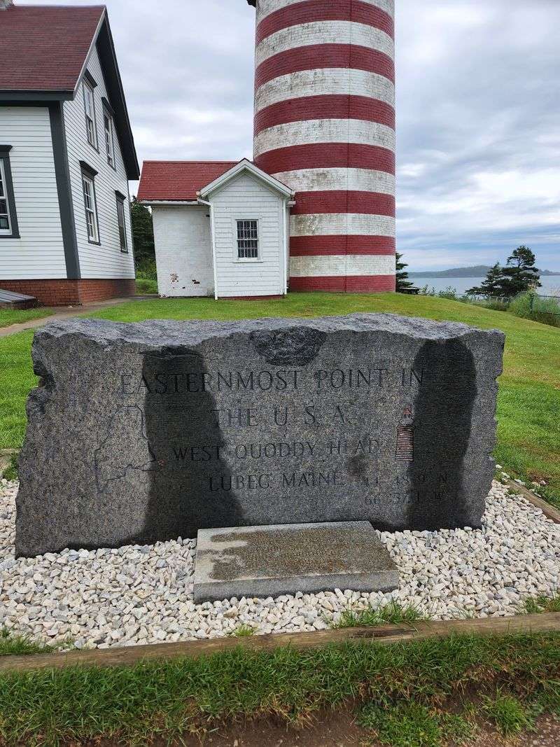
Bragging rights come easy when you’re the easternmost town in the contiguous United States. On some mornings, Lubec’s sunrise beats most of the country to the punch.
The star attraction is West Quoddy Head Light, painted in bold red and white stripes like a candy cane. The current tower dates to 1858, though the first light here went up in 1808.
Quoddy Head State Park surrounds the lighthouse with about five miles of trails. The Coastal Trail follows tall cliffs, while the Bog Trail shows off sub-arctic plants you’d expect much farther north.
Back in town, Water Street lines the Lubec Narrows. The McCurdy Smokehouse Museum tells the story of the fish smoking business that once filled this waterfront.
Yarn lovers, take note. Wags and Wool calls itself the easternmost yarn store in the country, selling Maine yarns and handmade gifts.
Need a treat? Monica’s Chocolates on County Road handles sweet cravings, and HD and Sons Seafood sells lobster to take out or cook yourself.
For an easy stroll, Mowry Beach offers a 48-acre preserve with an accessible trail. It’s a nice choice when the cliffs feel like too much climbing.
Then there’s the Franklin Delano Roosevelt Bridge, which links Lubec to Campobello Island in New Brunswick, Canada. Pack your passport, because you’ll be crossing an international border.
With about 97 miles of shoreline, Lubec gives you plenty of room to wander. Out here, quiet comes standard.
Address: Lubec, ME 04652
Castine
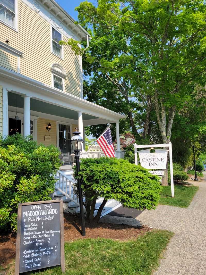
History buffs, brace yourselves, because this little peninsula changed hands more times than a hot potato. French, British, Dutch, and American forces each controlled Castine at different points.
Fort George, built by the British in 1779, still shows its earthen walls on a hill above town. That same year, the American Penobscot Expedition tried to take it and failed badly.
Signs scattered around the village explain historic sites as you walk. It’s like an outdoor museum that happens to have a harbor.
Castine sits where the Bagaduce River meets Penobscot Bay. Getting here means leaving Route 1 far behind, which helps keep the streets calm.
The town is home to Maine Maritime Academy, which trains future ship officers and engineers. You may spot the academy’s big training ship tied up at the waterfront.
Elm-shaded streets lead past grand homes from the 1700s and 1800s. Bring a camera, since the white clapboard houses look straight off a postcard.
Near the tip of the peninsula, Dyce Head Light keeps watch over the bay. A short path nearby heads toward the shore for wide water views.
Souvenir shops are scarce, so Castine feels more like a village than an attraction. You come here to walk, read the markers, and watch sailboats drift past.
Sunset from the town dock is a fine way to end the day. Find a spot and let the bay do the talking.
Address: Castine, ME 04421
Cutler
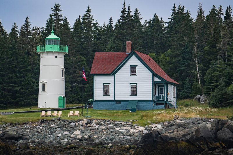
Out in Cutler, your closest neighbors might be seals. Around 500 people live here, and the wild coastline does most of the talking.
The big draw is the Cutler Coast Public Land, a stretch of the Bold Coast with trails along high cliffs. The Coastal Trail looks straight out over the open Atlantic.
Hikers should plan ahead, since the longer loops are rugged and remote. Bring water, layers, and extra time, because fog can roll in fast.
The harbor itself is a working one, sheltered and full of moored fishing boats. Wharves line the shore, and the business here is lobster, not trinkets.
At the harbor mouth sits Little River Lighthouse on its own small island. The American Lighthouse Foundation restored it, and guests can even book overnight stays in season.
On the horizon, you’ll notice a cluster of very tall radio towers. They belong to a Navy communication station that has stood near town for decades.
Cutler is about as far from resort life as you can get in Maine. There are no big hotels or busy shopping strips, and that’s the whole point.
Pack a lunch before you arrive, since services are limited. A picnic on the cliffs beats a restaurant table anyway.
Quiet trails, a working harbor, and a lighthouse you can sleep in make a strong case. Few towns this small offer so much open space.
Address: Cutler, ME 04626
Winter Harbor
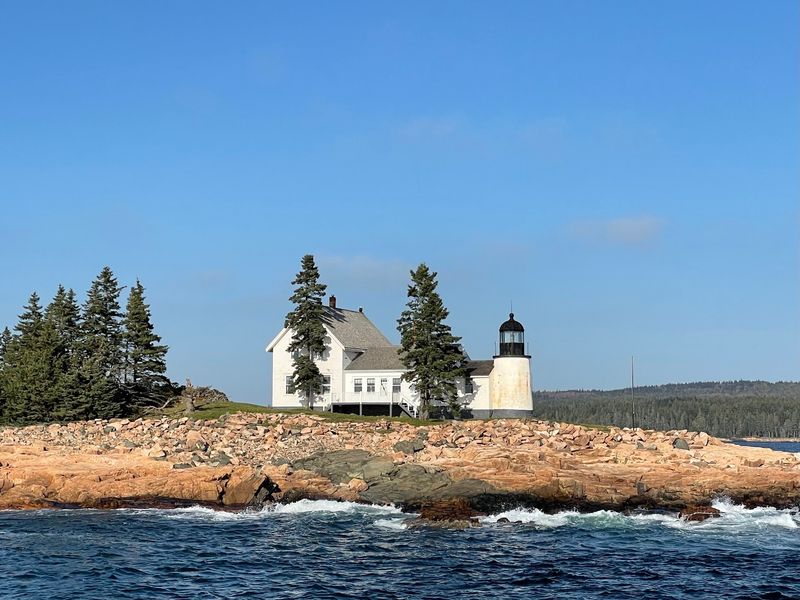
Across Frenchman Bay from the busy side of Acadia, a much calmer view of the same mountains awaits. You get the scenery without the traffic jams.
Winter Harbor sits on the Schoodic Peninsula, home to the only part of Acadia National Park on the mainland. Schoodic Point is famous for waves smashing onto wide pink granite ledges.
A one-way loop road circles much of the peninsula. Pull-offs let you stop, stretch, and watch the surf whenever you like.
The free Island Explorer bus serves the Schoodic area in summer. That makes it easy to leave your car parked and skip the hunt for spaces.
The town itself has around 500 residents and a short, simple main street. Lobster boats bob in the harbor, which stays working rather than fancy.
Each August, the town hosts the Winter Harbor Lobster Festival. Expect a parade, lobster boat races, and plenty of lobster.
Cyclists can ride the loop road and the park’s bike paths near Schoodic Woods. Traffic here is far lighter than on Mount Desert Island.
Campers can find a site at Schoodic Woods Campground, run by the park. It sits close to the loop road and hiking trails.
Want Acadia with elbow room? Winter Harbor is your answer.
Address: Winter Harbor, ME 04693
Jonesport
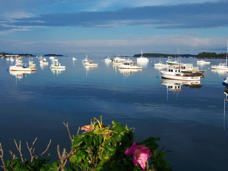
Lobster boats here don’t just haul traps. Around the Fourth of July, they race.
Jonesport sits on Moosabec Reach, a channel between the mainland and Beals Island. A bridge links the two, and both towns share a long boatbuilding history.
The Jonesport-Beals style of lobster boat is well known along the coast. Builders here have shaped these hulls for generations.
About 1,200 people call Jonesport home, and most of the action happens at the water. Clamming and lobstering still drive the local economy.
Cross the bridge to Beals and head for Great Wass Island Preserve, owned by The Nature Conservancy. Trails wind through jack pine forest and out to granite shoreline.
The preserve is known for rare plants and coastal bogs. Watch your step, since some sections get wet and rocky.
Bird watchers will want binoculars for the reach and the islands beyond. Patience pays off out here.
Jonesport isn’t built around visitors, and you’ll notice that quickly. Services are modest, so fill your gas tank and pack snacks.
The race day crowds come and go, but the working harbor stays. That steady routine is what makes the town feel so grounded.
Sunsets over the reach are a fine reward after a long drive Down East. Park near the water and enjoy the show.
Address: Jonesport, ME 04649
Brooklin
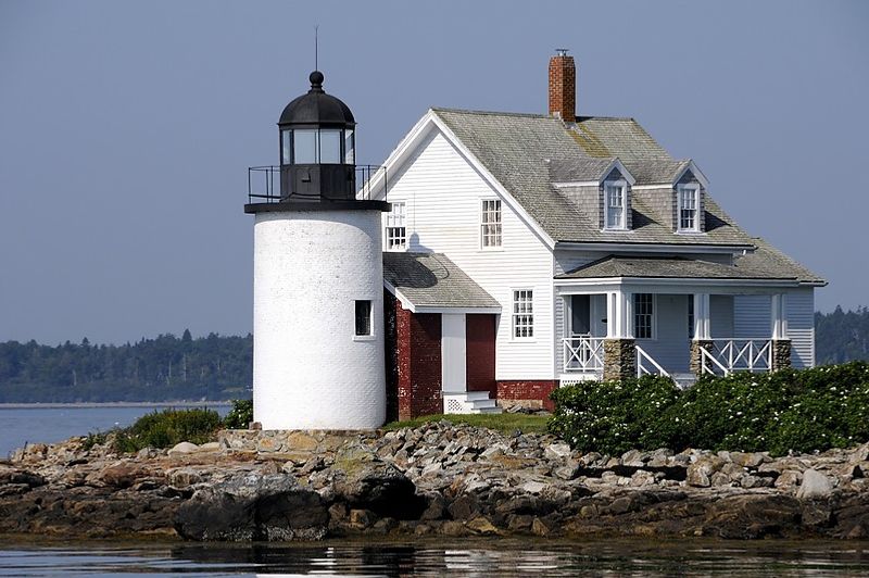
A spider named Charlotte has roots in this tiny town. E.B.
White lived on a farm in North Brooklin, where he wrote Charlotte’s Web.
Brooklin sits at the southern end of the Blue Hill Peninsula, facing Eggemoggin Reach and Blue Hill Bay. Roughly 800 people live here among woods, fields, and quiet coves.
Boats are the real celebrities, though. WoodenBoat magazine is based in Brooklin, and its WoodenBoat School teaches boatbuilding and seamanship courses in summer.
The school’s campus sits right on Eggemoggin Reach. Classic wooden sailboats on the water make the view look like an old painting.
Brooklin Boat Yard builds custom yachts, many of them wooden. Even if you don’t sail, the craftsmanship is fun to admire from a respectful distance.
Need supplies? The Brooklin General Store is a handy stop for groceries and basics before you explore.
Back roads curve past old farmhouses and stone walls. Drive slowly, because the views pop up when you least expect them.
Looking for more to do? Blue Hill and Deer Isle are both an easy drive away for galleries and hikes.
There’s no highway rushing through, and no strip of tourist shops. That simple fact keeps the pace slow and the roads peaceful.
Brooklin proves a small town can be famous without getting crowded. It keeps its head down and its boats polished.
Address: Brooklin, ME 04616
Machiasport
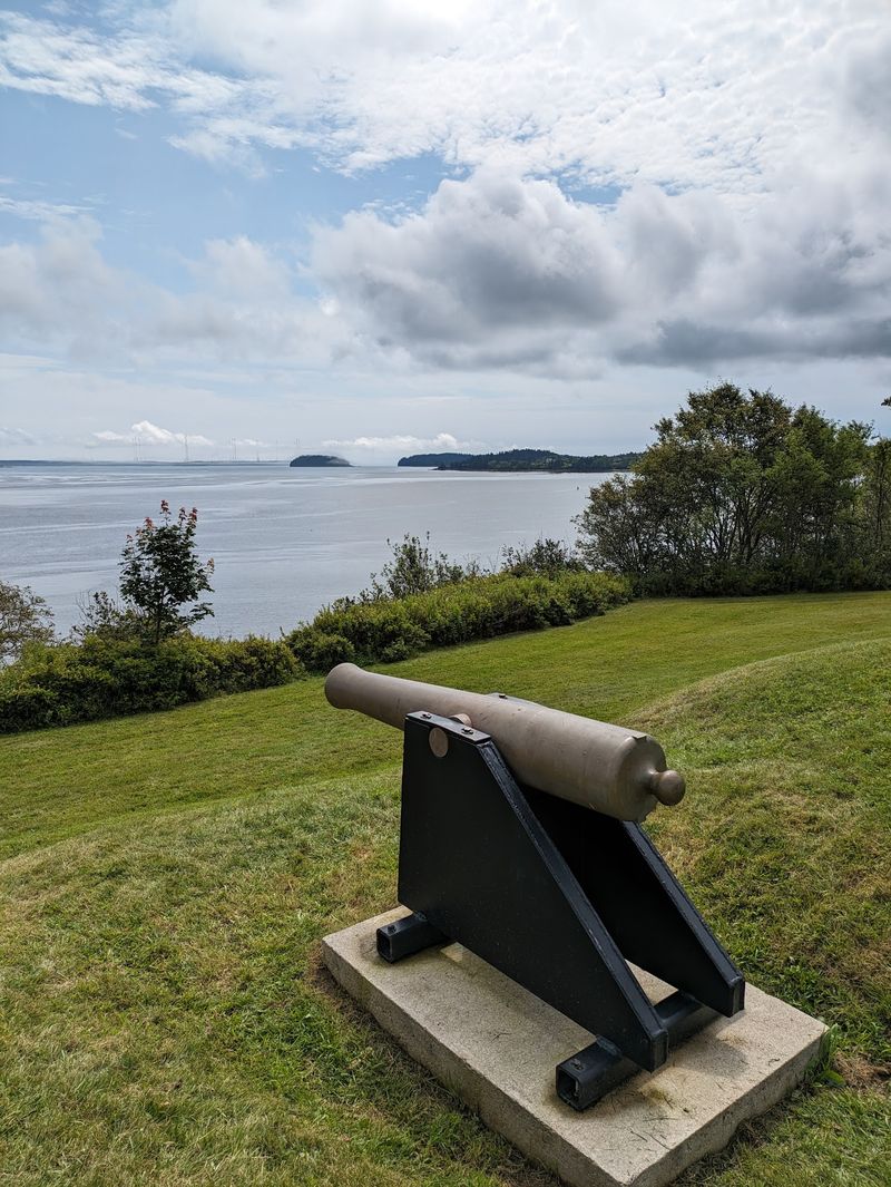
The first naval battle of the American Revolution unfolded near here. In June 1775, local men captured the British ship Margaretta in the Machias Bay area.
Fort O’Brien State Historic Site in Machiasport marks that era. You can still see earthworks from a fort that guarded the river.
Then there’s Jasper Beach, which trades sand for smooth, polished stones. The rocks are famous for rattling as waves pull back across them.
Colors range from deep red to gray and green. Admire them, but leave them on the beach for the next visitor.
Bucks Harbor is a small fishing community inside town limits. Boats rest on their moorings while the tide rises and falls.
Machiasport has fewer than 1,000 residents spread along the bay. Homes sit scattered across rocky points and quiet roads.
The town lines the tidal Machias River as it opens into Machias Bay. Tides here run big, so check a chart before heading down to the shore.
Neighboring Machias has grocery stores and restaurants if you need supplies. It’s just a short drive up the road.
High-volume tourism never really found this corner of Maine. That leaves the beaches, fort, and harbors open for slow exploring.
Machiasport suits anyone who likes history mixed with sea air. Few places pack this much story into such a peaceful setting.
Address: Machiasport, ME 04655
Harpswell
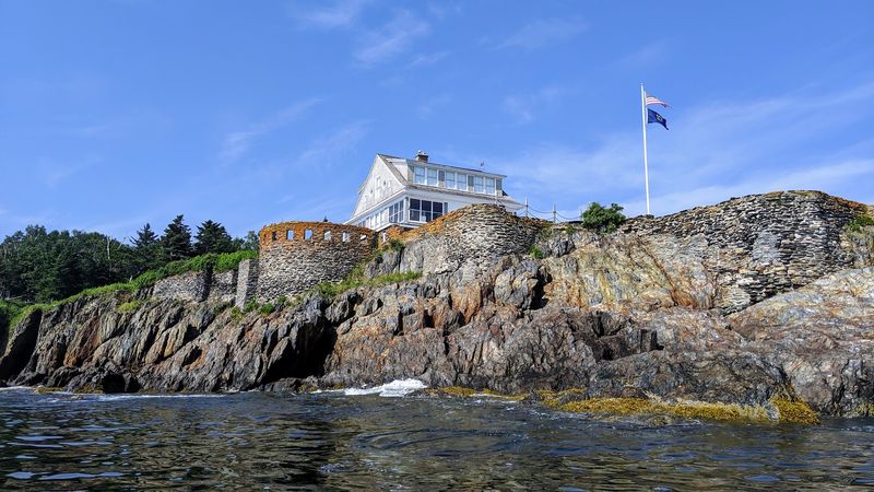
More than 200 miles of coastline is a lot for a town you might miss on a map. Harpswell stretches across peninsulas and islands in Casco Bay.
The famous Cribstone Bridge connects Orr’s Island to Bailey Island. Granite blocks stacked in a crisscross pattern without mortar let the tide rush right through.
The bridge opened in 1928 and is a National Historic Civil Engineering Landmark. It’s believed to be the only cribstone bridge of its kind in the world.
On Bailey Island, the Giant’s Stairs trail follows the rocky shore. Look for the step-like ledges of rock that give the path its name.
Harpswell takes its open spaces seriously. Local land trusts protect forests, meadows, and shoreline trails open to the public.
Lobster co-ops and working wharves dot the coves. Fishing is still a big part of daily life here.
The town is spread out, so expect to drive between spots. Each peninsula feels like its own little village.
Brunswick sits just to the north, which makes Harpswell easy to reach. Even so, it feels a world away from busy Route 1.
Quiet coves beat crowded boardwalks any day of the week. Here, the nature preserves get more attention than gift shops.
Pack a picnic and pick a cove. That might be the best plan for a slow Maine afternoon.
Address: Harpswell, ME 04079
Swans Island
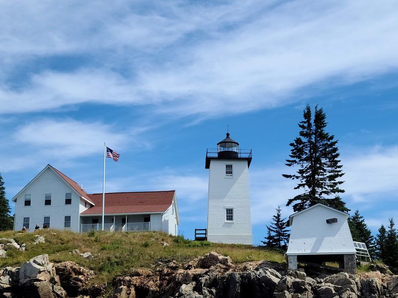
Getting here takes a boat ride, and that sets the pace from the start. The Maine State Ferry runs from Bass Harbor on Mount Desert Island, and the crossing takes about 40 minutes.
About 350 people live on Swans Island year-round. Fishing remains the heart of the island economy.
The island takes its name from James Swan, who bought it in the late 1700s. His big development plans never really took off, which feels like good news now.
Burnt Coat Harbor is the island’s best-known harbor. Hockamock Head Light stands at its entrance, and the grounds are open for visitors to explore.
The lighthouse is a short walk from a parking area. Rocky shore nearby makes a fine perch for watching boats come and go.
Roads loop around the island and work well for biking. Some hills get steep, so take your time.
Services are limited, so plan meals and lodging before you go. Check the ferry schedule carefully, especially outside of summer.
Commercial development is minimal, and you won’t find chain stores. What you get instead is open water, quiet roads, and working harbors.
Days here move with the ferry schedule and the tides. Your phone may stay in your pocket longer than usual.
When the last boat leaves, the island grows even quieter. That’s when you’ll know you picked the right spot.
Address: Swans Island, ME 04685