
10 Scenic Drives In Arkansas Where The Fall Color Steals The Show
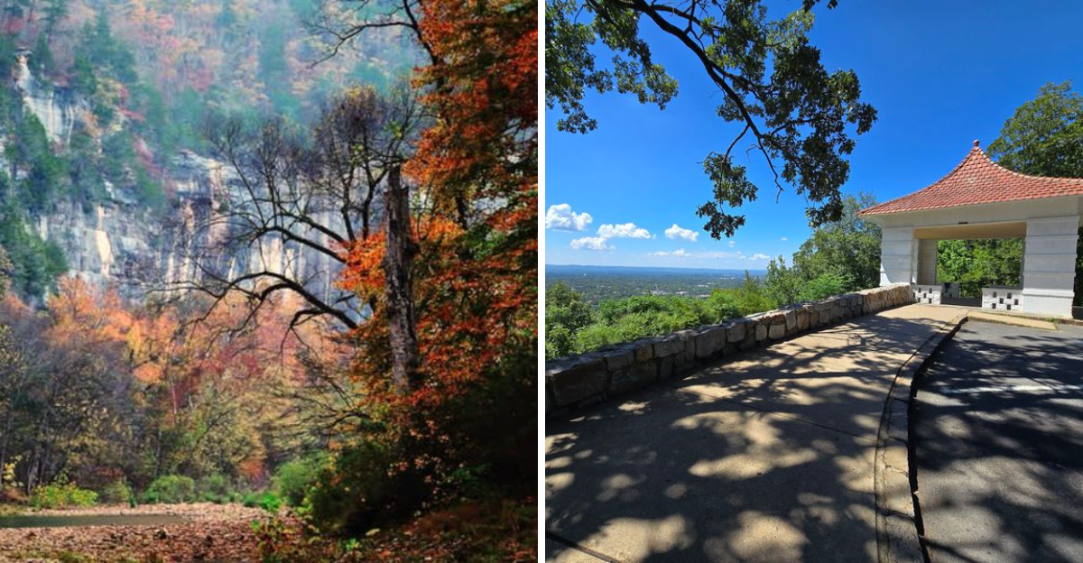
You know a scenic drive is good when nobody in the car is asking how much farther. That happens a lot in Arkansas once fall color starts working its way through the Ozarks and Ouachitas.
Roads that feel familiar in summer suddenly look different, with bright hardwoods lining the curves and high overlooks opening onto miles of autumn-covered ridges. Some drives are all about the climb.
Others follow quieter valleys where the scenery unfolds slowly beside the road. Either way, October gives you plenty of excuses to pull over and stay awhile.
A short trail can turn into an hour outside, and a roadside overlook can easily become the photo you remember most. You do not need a packed itinerary to enjoy these routes.
Give yourself time and keep the day flexible. Let the road decide where you stop.
These ten drives make the journey itself feel like the destination.
1. Pig Trail Scenic Byway, Ozark
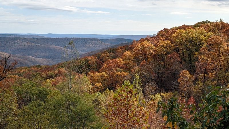
Motorcyclists have a nickname for AR-23, and it is affectionate. The Pig Trail Scenic Byway runs out of Ozark, Arkansas, corkscrewing north into the Boston Mountains through the Ozark National Forest.
The road wraps itself in hardwoods so thick that autumn feels like driving through a lit lantern. Hickory yellows, oak russets, and sweetgum reds press right up to the pavement, and the curves keep the view changing every few seconds.
Take it slow, because the turns are tight and leaf litter can make the shoulders slick. My advice is to start early, when fog still hangs in the hollows and the light comes in sideways through the canopy.
The Mulberry River crossing makes a natural pause. Paddlers and anglers gather near the water, and flat rocks along the bank double as excellent picnic seating for anyone who packed sandwiches.
Small pull-offs appear now and then, so keep an eye out rather than stopping mid-curve. Cell service comes and goes in the deeper stretches, which is honestly part of the charm.
Fuel up in Ozark before you climb, since services thin out fast once the forest closes in around you.
Few roads in the region reward patience with color quite this generously.
2. Scenic 7 Through The Arkansas Grand Canyon, Jasper
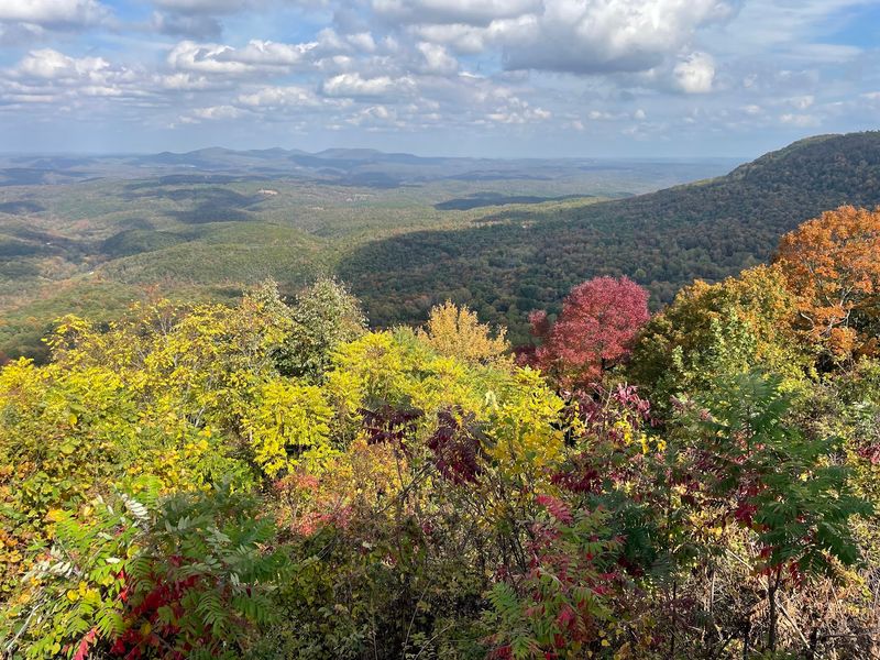
Locals call the valley below Jasper the Arkansas Grand Canyon, and once you stand at the overlook, the nickname stops sounding like bragging.
AR-7 passes right through Jasper, Arkansas, zipcode 72641, and this stretch through the Ozark National Forest ranks as the state’s first designated scenic byway. Ridges roll off toward the horizon while the Buffalo River threads through the wooded bottomland far below.
Autumn turns the whole bowl into layers of copper and flame. The higher overlooks catch morning mist rising off the river, and photographers stake out spots well before the sun clears the ridgeline.
Pull-offs are marked and paved in several places, which makes the drive friendly for families with restless kids in the back seat. Jasper itself has a compact downtown where you can grab pie and coffee before continuing north or south.
Traffic picks up on October weekends, so a weekday trip gives you elbow room at the railings. Bring binoculars, because hawks ride the thermals along these bluffs all afternoon.
Continue toward Harrison or double back toward Russellville, and the color keeps performing either direction.
Honestly, no photo I took here came close to matching the view in person.
3. Talimena Scenic Drive, Mena
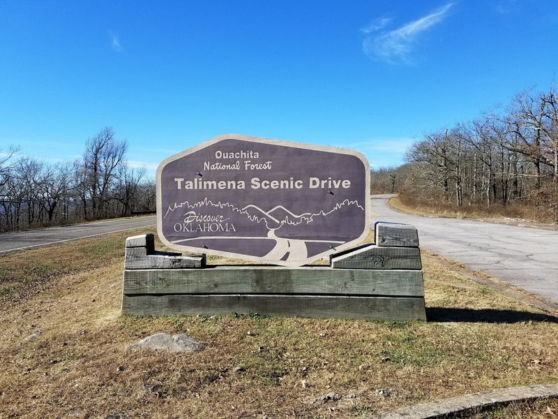
Clouds sometimes sit in the valleys here while you cruise along in sunshine above them. The Talimena Scenic Drive begins on AR-88 out of Mena, Arkansas, zipcode 71953, and climbs straight onto the spine of the Ouachita Mountains.
Rich Mountain carries the road along one of the highest ridgelines in the state, and the National Scenic Byway designation is well earned. Overlooks come one after another, each framing forested valleys and creek bottoms stitched together in gold and burgundy.
Queen Wilhelmina State Park sits directly on the route, making it the obvious lunch stop. The lodge grounds have easy walking paths, and the view from the picnic area is the kind you linger over.
Wind up here can be brisk, so a windbreaker beats a t-shirt in late October. Services are limited along the ridge, though Queen Wilhelmina State Park has a lodge and restaurant.
The Ouachita National Forest surrounds nearly every mile, which keeps the scenery uninterrupted by buildings or billboards.
Quiet is the real souvenir on this one, especially at the far western overlooks near sunset.
4. Mount Magazine Scenic Drive, Paris
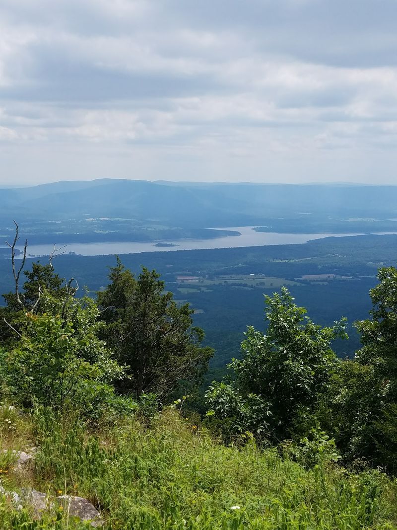
Climb high enough on AR-309 and you run out of Arkansas to climb. The Mount Magazine Scenic Drive tops out at the state’s tallest peak, reached by way of Paris, Arkansas, zipcode 72855.
Elevation is the secret ingredient in autumn. Trees near the summit turn earlier than those in the valley, so a single afternoon can show you three different stages of color as you gain altitude.
Mount Magazine State Park spreads across the top with overlooks, hiking trails, and the sandstone ledges of Cameron Bluff Overlook Drive. That short side loop delivers big views for very little effort, which suits anyone traveling with grandparents or toddlers.
Hang gliders sometimes launch from the bluffs when conditions cooperate, and watching them ride the air above a red-and-gold forest is a memory that sticks.
Trails range from paved and easy to rocky and steep, so check the park map before choosing. Weather at the summit can differ from the valley below, so layers are your friend.
The town of Paris makes a practical base with a pleasant square and a few places to eat.
Reaching the highest ground in the state and finding it wrapped in color felt like a fair trade for the drive up.
5. Mount Nebo Scenic Drive, Dardanelle
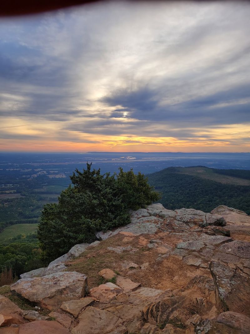
Switchbacks with attitude greet drivers on State Highway 155 out of Dardanelle, Arkansas, zipcode 72834. The climb to Mount Nebo State Park is short, steep, and completely worth the tight steering.
Long trailers are discouraged on this road for good reason, so leave the big rig at the bottom. Once you reach the top, the payoff is a flat-topped mountain ringed with overlooks facing the Arkansas River Valley and Lake Dardanelle.
Autumn colors spread out below like a quilt tossed over the whole valley. Late afternoon is my favorite window, when the water catches light and the ridges deepen to rust.
The Bench Trail circles the mountain just below the rim, passing springs, rock shelters, and plenty of leaf-covered switchbacks. Mountain bikers share several routes, so a bell or a friendly heads-up goes a long way.
Mount Nebo is also recognized as a Trail of Tears National Historic Trail Site, giving the mountain a solemn layer of history alongside the scenery.
Rustic cabins and picnic pavilions make it easy to stretch a drive into a full afternoon.
Sunset from the west rim ended my visit better than any restaurant could have.
6. Petit Jean Mountain Drive, Morrilton
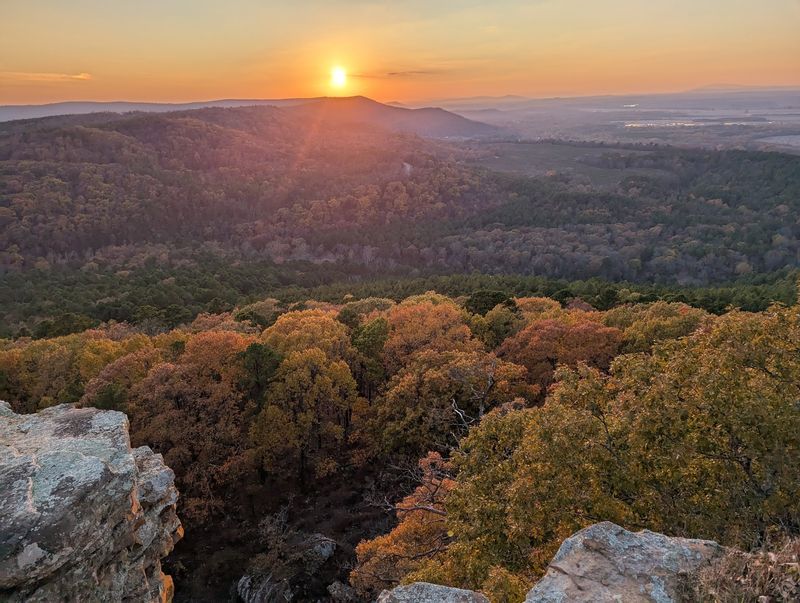
Waterfalls, weird rock formations, and a mountain full of maples make this route an easy sell. Petit Jean Mountain Road leads out of Morrilton, Arkansas, zipcode 72110, up to the oldest state park in the state.
Petit Jean State Park built its reputation on Cedar Falls, a tall ribbon of water tumbling into a shaded canyon. The trail down is rocky and returns uphill, so decent shoes matter more than a fancy camera.
Along the mountain roads you will find turnouts near Stout’s Point and the Palisades, where the valley opens up beneath layers of colored treetops. Rain the week before your trip usually means a stronger waterfall, which is a handy planning trick.
Cedar Creek and the surrounding hollows hold their color a little longer thanks to shade and moisture. Sunsets framed by fiery hardwoods are a regular occurrence here in late October.
Stone structures built by early park crews still stand, adding a rugged, handmade character to the grounds. The lodge and picnic areas make it simple to turn a drive into a slow weekend.
Between the falls and the overlooks, Arkansas rarely packs this much variety into one mountain.
Come hungry, leave tired, and count the leaf photos later.
7. Devil’s Den Scenic Drive, West Fork
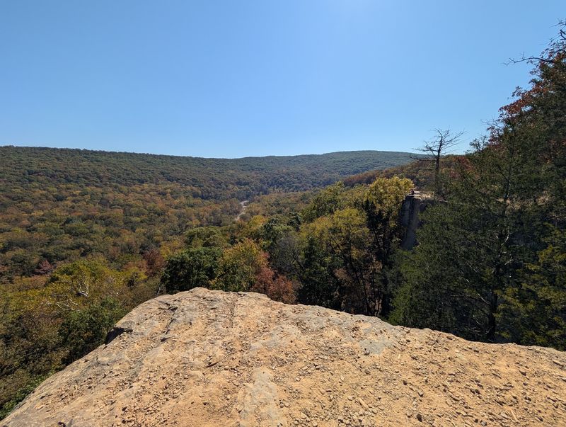
Descending into a hollow feels backwards after so much mountain climbing, and that twist is exactly what makes AR-74 fun. The road runs from West Fork, Arkansas, zipcode 72774, down into Devil’s Den State Park.
Sandstone crevices, mossy boulders, and cave openings give the park its rugged personality. Autumn adds color to steep hillsides on both sides of the Lee Creek Valley, and the narrow road hugs those slopes closely.
The Yellow Rock Trail earns its popularity with a ledge view over the valley that looks especially dramatic when the hardwoods peak. Give yourself a couple of hours and take water, since the climb warms you up quickly.
Backpackers head for the Butterfield Hiking Trail, while mountain bikers and horseback riders share other routes across the park. Cave areas are closed to protect bats, so respect the signs.
Grades on the approach road are steep with hairpin turns, so downshift instead of riding your brakes. Fall weekends fill the campground fast, and reservations save disappointment.
Stone bridges and a small dam built by early crews sit near the creek and photograph beautifully with leaves overhead.
My favorite part was how quiet the hollow got once the cars thinned out.
8. Hot Springs Mountain Scenic Drive, Hot Springs
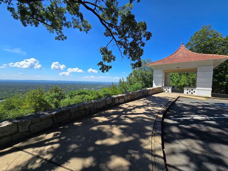
City sightseeing and leaf-watching rarely share the same afternoon, yet Hot Springs pulls it off. Hot Springs Mountain Drive begins at the end of Fountain Street off Central Avenue in Hot Springs, Arkansas, zipcode 71901, and curls up through forest inside Hot Springs National Park.
Stone overlooks along the way frame the rooftops of downtown with colorful treetops in the foreground. The whole loop is short, paved, and gentle enough for drivers who would rather skip white-knuckle switchbacks.
Bathhouse Row sits at the bottom of the hill, so you can pair a morning of historic architecture with an afternoon of foliage. Thermal springs bubble out along the promenade, and the walking paths connect the mountain to the town.
Trails branching off the drive are well marked and shaded, with the Hot Springs Mountain Trail circling the slope through oak and hickory. Fall temperatures make those paths far more pleasant than a summer visit.
Parking near the top can tighten up midday, so an early arrival helps. Picnic tables tucked among the trees are ideal for a takeout lunch from downtown.
The mix of steam, stone, and autumn color makes this stop feel unlike anywhere else in Arkansas.
Downtown lights at dusk make a fitting encore after the drive.
9. Boxley Valley Scenic Drive, Ponca
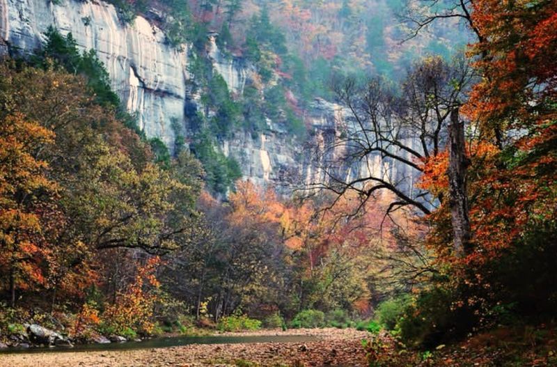
Wild elk graze in open fields here, and traffic slows to a crawl every evening because of it. AR-43 runs through Boxley Valley near Ponca, Arkansas, zipcode 72670, and few stretches of pavement anywhere feel this peaceful.
Steep Ozark ridges and pale limestone bluffs wall in a broad pastoral valley. When the hardwoods turn, the contrast between golden pastures and blazing hillsides is remarkable.
Early morning and late evening give the best chances to spot the elk herd. Use the designated pull-offs rather than stopping on the road, keep a respectful distance, and never approach the animals during their autumn rutting season.
Old barns and a historic mill building line the route, hinting at generations of farming families who worked this land. Photographers show up with long lenses and folding chairs, settling in for the show.
Ponca sits at the north end and serves as a launch point for Buffalo National River paddling and hiking. The Lost Valley trailhead nearby leads to bluff shelters and a seasonal waterfall.
Fog often fills the valley at sunrise, which makes for moody photos and slower driving.
Watching bull elk bugle beneath colored bluffs remains one of my favorite autumn memories.
10. Highway 12 Through Hobbs State Park, Rogers
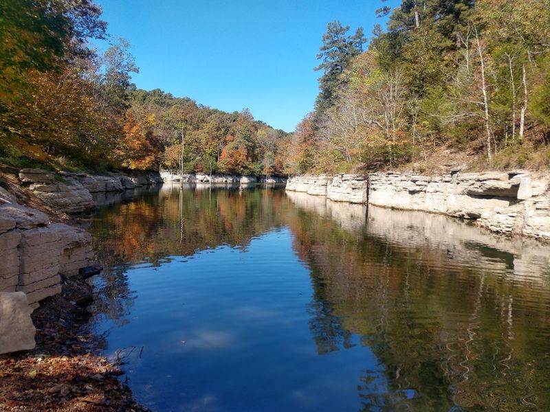
Big lake views and quiet woods make this the mellow pick of the bunch. Highway 12 slices through Hobbs State Park – Conservation Area at 20201 AR-12, Rogers, Arkansas, zipcode 72756.
Rolling terrain covered in Ozark oak, hickory, and shortleaf pine turns the roadside into a patchwork of rust, amber, and evergreen. The pines keep some green in the mix, which actually makes the reds pop harder.
Hobbs is the largest state park in the state, and its trail system welcomes hikers, mountain bikers, and horseback riders. Paths wander over ridge tops and down into hollows, with glimpses of Beaver Lake appearing once the leaves start thinning.
The visitor center is a smart first stop for maps and current trail conditions. Rangers there can point you toward whichever loop is peaking that week.
Hunting is permitted in parts of the conservation area during certain seasons, so wearing bright colors is a wise habit. Signage is clear, and the main trails near the center are family friendly.
Rogers and nearby Beaver Lake marinas offer plenty of food and lodging, making this an easy day trip for anyone based in northwest Arkansas.
End the drive with a lakeside stroll and call the season officially celebrated.