13 Scenic Drives In Colorado For A Road Trip You Won’t Forget
Colorado is home to some of the most breathtaking mountain roads in America, where every turn reveals towering peaks, wildflower meadows, and valleys that look like they belong on a postcard.
Whether you’re a road trip veteran or just looking for an excuse to blast your favorite playlist while surrounded by jaw-dropping scenery, these scenic drives deliver adventure, beauty, and memories that’ll last a lifetime.
From high-altitude passes that’ll make your ears pop to historic mining routes that whisper tales of the Old West, Colorado’s byways offer something special for every traveler.
Buckle up and get ready to discover thirteen unforgettable routes that prove the journey really is just as amazing as the destination.
1. Trail Ridge Road (Rocky Mountain National Park)
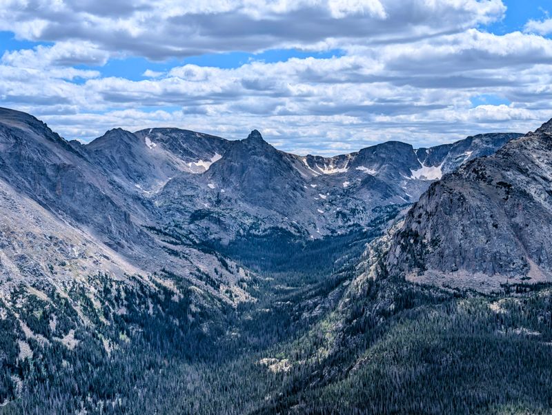
Picture yourself driving higher than most commercial jets fly, and you’ve got Trail Ridge Road—the crown jewel of Rocky Mountain National Park that’ll literally take your breath away (partly from the altitude, partly from the views).
This magnificent stretch of US 34 connects Estes Park to Grand Lake and climbs to a staggering 12,183 feet, making it the highest continuous paved road in North America.
Along the way, you’ll cruise through ecosystems that change faster than a Colorado weather forecast, from montane forests to alpine tundra where tiny wildflowers cling to life above treeline.
Elk, bighorn sheep, and marmots often make cameo appearances, so keep your camera ready and your snacks secured.
The road typically opens between late May and early June and closes in late October, depending heavily on snowfall and weather conditions, so timing is everything.
Plan for at least three hours to make the 48-mile journey, with plenty of stops at overlooks that’ll have you questioning if you’re still on Earth or somehow landed in a fantasy novel.
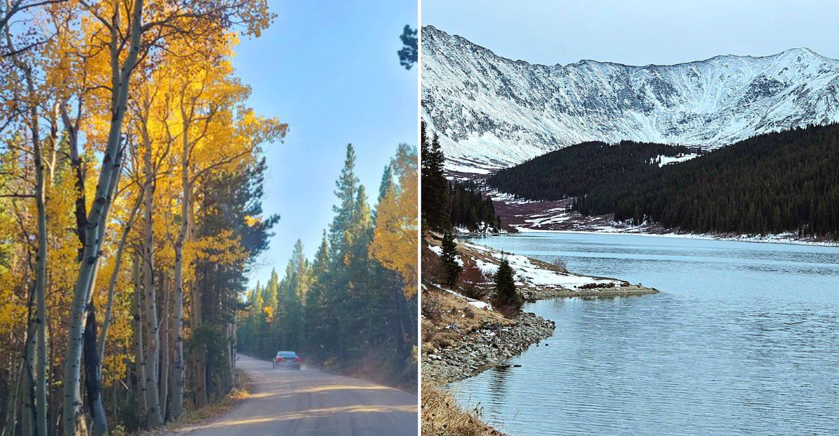
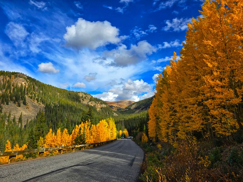
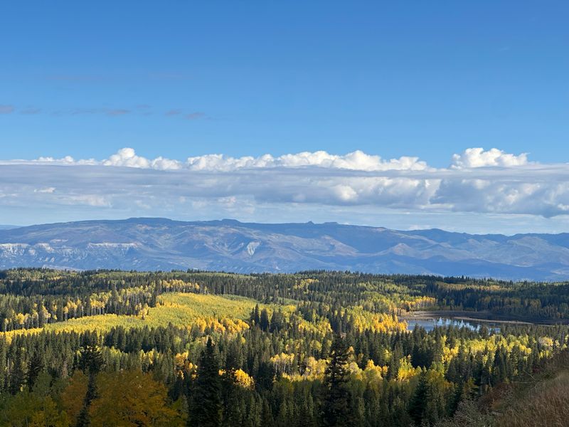
2. Peak to Peak Scenic Byway
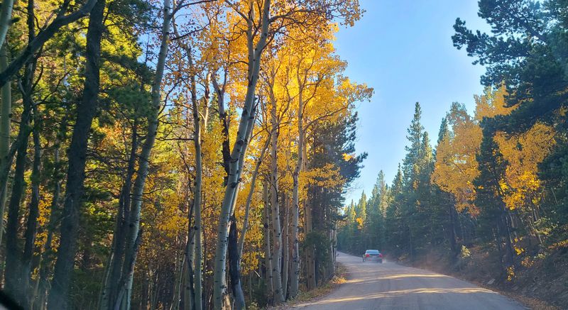
Autumn in Colorado reaches peak perfection along this golden corridor that connects Black Hawk, Central City, and Estes Park via CO 7 and CO 72.
The Peak to Peak Scenic Byway earned its name honestly—you’ll spot the Continental Divide’s greatest hits parading across your windshield like celebrities on a red carpet.
This 55-mile journey takes you through charming mountain towns where old mining history meets modern mountain culture, and where every coffee shop seems to have a view worth a thousand Instagram likes.
Fall foliage here is legendary, with aspen groves turning the hillsides into rivers of gold and amber that shimmer in the September sunshine.
But don’t sleep on summer either, when wildflowers paint the meadows and roadside picnic spots practically beg you to pull over.
Winter transforms the route into a snow-globe scene, though you’ll want good tires and a sense of adventure for those months.
3. Cache la Poudre–North Park Scenic Byway
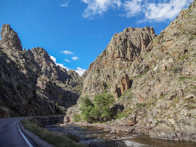
Following the only Wild and Scenic River in Colorado, CO 14 between Fort Collins and Walden delivers a feast for the senses that rivals any fancy restaurant—except the views are free and the dress code is nonexistent.
The Cache la Poudre River crashes and tumbles alongside the road through Poudre Canyon, creating a soundtrack of rushing water that’ll make you forget whatever podcast you had queued up.
As you climb westward, ponderosa pines give way to dense forests and eventually the wide-open grasslands of North Park, where antelope roam and the sky stretches forever.
This 101-mile route passes excellent fishing spots, hiking trailheads, and rustic lodges that look like they’ve been welcoming travelers since the frontier days.
Cameron Pass sits at the route’s high point (10,276 feet), offering alpine scenery that’ll make you pull over just to stare.
It’s less crowded than many Colorado drives, which means more elbow room for your road trip shenanigans.
4. Guanella Pass Scenic Byway
Short but mighty, Guanella Pass Road packs more wow-factor per mile than just about any drive in the Rockies, connecting Georgetown to Grant over a 11,669-foot pass that’ll have you feeling on top of the world.
This 22-mile gem winds through terrain so gorgeous it almost seems unfair to other roads—think cascading waterfalls, beaver ponds reflecting mountain peaks, and tundra wildflowers that bloom in impossible colors.
The summit offers views of multiple 14,000-foot peaks, including the iconic Mount Bierstadt, which hikers tackle via a trailhead right off the pass.
Autumn transforms the aspen groves into golden cathedrals that glow in the afternoon light, while summer brings a carpet of alpine blooms that’d make any botanist weep with joy.
The road is generally open from around Memorial Day until late November, weather permitting, though snowstorms can trigger earlier or temporary closures.
Budget about an hour for the drive, or three if you’re a chronic photo-stopper like most visitors.
5. Lariat Loop Scenic Byway
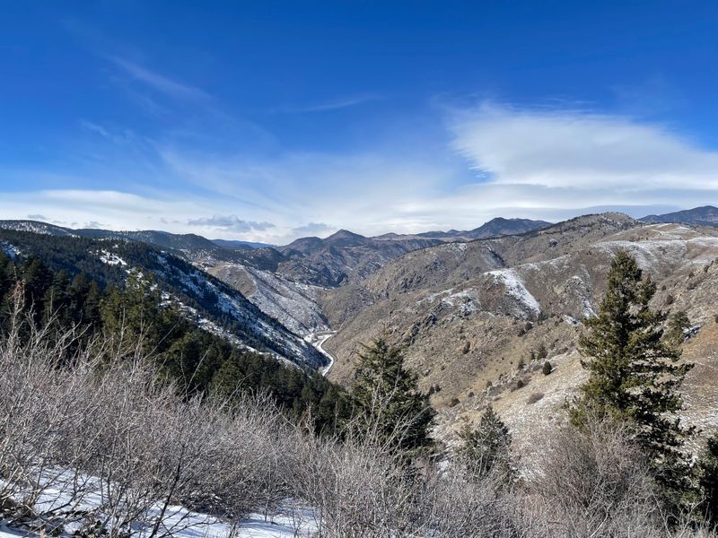
Denver’s backyard playground unfolds along this 40-mile loop connecting Golden, Morrison, and Evergreen via CO 93, Lookout Mountain Road, and Bear Creek Road—proof that you don’t need to drive for hours to find spectacular scenery.
The route climbs through foothills where red rocks meet pine forests, offering glimpses of the sprawling metro area below and the high peaks beyond.
Buffalo Bill’s grave sits atop Lookout Mountain, where the legendary showman requested to be buried with a view that never gets old (spoiler: the view delivers).
Red Rocks Amphitheatre lies just off the route, where geology and acoustics conspired to create one of the world’s most stunning concert venues.
Evergreen Lake provides a picture-perfect mountain town stop, with shops and restaurants that feel a world away from the city despite being just 30 minutes from downtown Denver.
This drive works beautifully year-round, making it perfect for those spontaneous “let’s go for a drive” moments when you need a quick escape.
6. Gold Belt Tour Scenic & Historic Byway
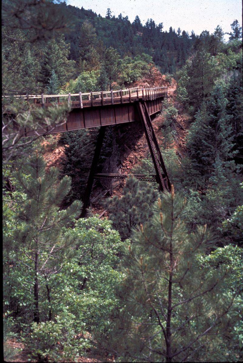
Time-travel through Colorado’s gold rush glory days on this loop connecting Cañon City and Cripple Creek via CO 9, US 24, CO 67, and the legendary Phantom Canyon Road.
This roughly 131-mile journey follows old railroad grades and mining routes where prospectors once struck it rich, and where ghosts of boom-town days still linger in abandoned structures and weathered headframes.
Phantom Canyon Road itself is an adventure—a narrow, unpaved former railroad bed that winds through a dramatic canyon where the walls close in and history feels tangible.
Cripple Creek still channels its Wild West heritage with casinos, museums, and Victorian buildings that transport you to the 1890s.
The Royal Gorge Bridge hangs nearby, where you can gaze down at the Arkansas River from a dizzying 956 feet up.
Summer and fall offer the best driving conditions, though the route’s lower elevations mean it’s accessible more of the year than high mountain passes.
Pack your sense of adventure and maybe a spare tire, this one’s got character.
7. Collegiate Peaks Scenic Byway
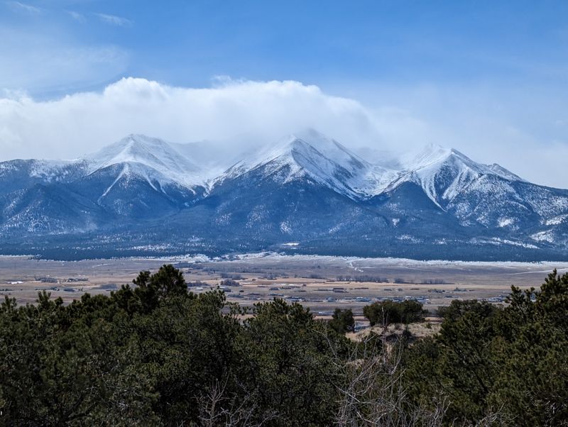
Mother Nature decided to show off when she sculpted the Collegiate Peaks, and this 57-mile stretch of US 24 and US 285 between Granite and Poncha Springs offers front-row seats to the spectacle.
Eight 14,000-foot peaks—named after prestigious universities like Harvard, Yale, Princeton, and Columbia—dominate the skyline in a display of geological grandeur that’ll make you feel wonderfully small.
The Arkansas River parallels much of the route, drawing rafters and kayakers who tackle world-class whitewater while you cruise by in climate-controlled comfort.
Historic railroad towns like Buena Vista serve as perfect pit stops, with breweries, cafes, and outfitters ready to fuel your next adventure.
Hot springs bubble up throughout the area, offering the perfect après-drive activity for tired muscles and road-weary souls.
Summer brings wildflowers and endless sunshine, while fall paints the aspen groves in shades that photographers dream about.
The route is generally drivable year-round, though winter weather can occasionally cause temporary closures or hazardous conditions.
8. Top of the Rockies Scenic Byway
Oxygen becomes optional on this sky-high loop connecting Leadville, Twin Lakes, Aspen, and Minturn via US 24, CO 82, and CO 91—a 115-mile journey through Colorado’s most elevated real estate.
Independence Pass crests at 12,095 feet, where the road narrows to a thrilling ribbon of asphalt clinging to mountainsides that plunge dramatically into valleys below.
Leadville itself sits at about 10,150 feet, making it the highest incorporated city in the United States and a living museum of mining history where saloons and Victorian homes tell tales of silver boom days.
Twin Lakes reflects the surrounding peaks so perfectly that you’ll struggle to tell where mountains end and water begins.
The descent into Aspen reveals why this town became synonymous with mountain luxury—the scenery is absolutely ridiculous in the best possible way.
Independence Pass is seasonal, typically opening in late May and closing in early November depending on snowpack and weather conditions.
Budget a full day to explore properly, with stops for photos, hikes, and maybe a celebratory beverage at altitude.
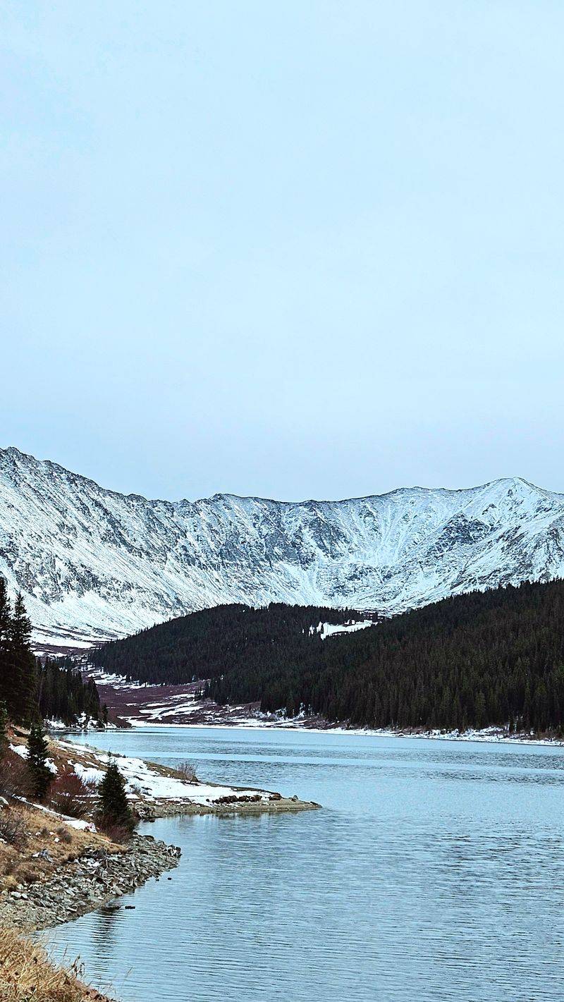
9. Silver Thread Scenic Byway
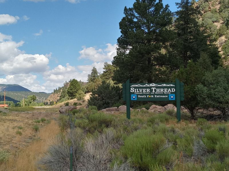
CO 149 stitches together some of Colorado’s most remote and stunning territory, connecting South Fork, Lake City, Creede, and Gunnison in a 117-mile ribbon of pure mountain magic.
This route earned its “Silver Thread” name from the mining history woven throughout the region, where prospectors chased silver dreams through these rugged mountains.
Lake City sits as Colorado’s most intact Victorian mining town, where false-fronted buildings and painted ladies transport you straight back to the 1880s.
The road climbs over Slumgullion Pass, where a massive ancient landslide created a geological wonderland that still creeps downhill at a glacial pace.
Wildflowers here go absolutely bonkers in July, carpeting meadows in colors that seem too vibrant to be real.
This is one of Colorado’s less-traveled byways, meaning you’ll share the road with more wildlife than tourists, elk, deer, and even the occasional black bear make appearances.
The route is not subject to a standard seasonal closure, but winter travel can be challenging and requires careful preparation.
10. San Juan Skyway Scenic Byway
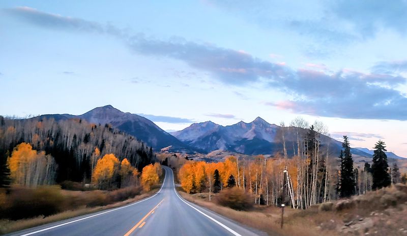
Buckle up for Colorado’s most famous loop—a 236-mile circuit via US 160, US 550, CO 145, and CO 62 that connects Durango, Silverton, Ouray, Telluride, and Ridgway in one jaw-dropping package.
The Million Dollar Highway section between Silverton and Ouray ranks among America’s most thrilling drives, with cliff-hugging curves, no guardrails, and views that’ll have your passengers either gasping in awe or praying for mercy.
Telluride hides at the end of a box canyon so gorgeous that early settlers later popularized the nickname “to-hell-you-ride,” a colorful legend rather than a confirmed origin of the town’s name.
Ouray calls itself the “Switzerland of America” without a hint of modesty—and honestly, the comparison holds up when you’re soaking in hot springs surrounded by towering peaks.
Autumn transforms this route into a masterpiece, with aspen groves blazing gold against red mountain peaks and evergreen forests.
Plan at least two days to do this drive justice, with stops for hiking, hot springs, historic mining tours, and plenty of photo opportunities that’ll clog your phone’s memory.
11. West Elk Loop Scenic Byway
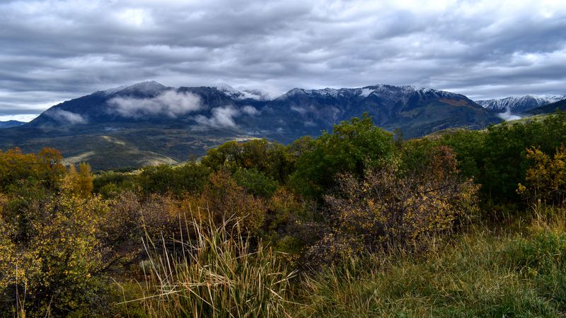
Fly under the radar on this 205-mile loop using CO 133, CO 135, US 50, and CO 92 near Carbondale, Crested Butte, Paonia, and Gunnison—a route that delivers big scenery without the crowds.
The West Elk Mountains rise in distinctive volcanic formations that look like nature’s own sculpture garden, with spires and pinnacles that catch the light in magical ways.
Crested Butte reigns as Colorado’s wildflower capital, where July brings an explosion of alpine blooms that’ll make your eyes happy and your allergy medication work overtime.
The route passes through fruit orchards around Paonia, where roadside stands sell peaches, apples, and cherries that taste like sunshine in a bag.
Kebler Pass Road branches off as a spectacular detour through one of the largest contiguous aspen groves in North America, a forest so vast and golden in fall that it feels like driving through liquid gold.
Black Canyon of the Gunnison National Park sits nearby, offering side-trip opportunities to peer into one of America’s deepest and most dramatic gorges.
This loop works beautifully from late spring through mid-fall, with each season painting the landscape in different colors.
12. Grand Mesa Scenic Byway
CO 65 climbs from I-70 near Palisade to Cedaredge over the world’s largest flat-topped mountain—a 63-mile journey that transitions from desert orchards to alpine forests faster than you can say “microclimate.”
Grand Mesa rises to over 10,000 feet, creating a high-altitude playground dotted with more than 300 lakes that shimmer like scattered jewels across the forested plateau.
The contrast is stunning: you’ll start among peach orchards and vineyards in the Grand Valley, then climb through scrublands and pine forests before emerging onto the mesa’s cool, lake-studded summit.
Fishing here is legendary, with trout lurking in practically every body of water—some lakes are so close to the road you could cast from your car window (though we don’t recommend that).
Fall transforms the aspen groves into golden waves that ripple across the mountainsides, while summer offers escape from the valley heat below.
While portions of the route are often accessible outside summer, conditions and closures can vary, especially in winter, so checking current road status is essential.
13. Rim Rock Drive (Colorado National Monument)
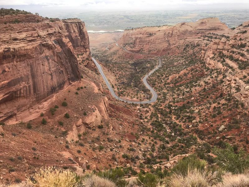
Colorado’s western slope throws a curveball with Rim Rock Drive—a 23-mile route through Colorado National Monument near Grand Junction that trades alpine peaks for soaring red rock canyons that’d make Utah jealous.
This dramatic drive clings to canyon rims where sheer sandstone cliffs plunge 500 feet to the desert floor, creating a landscape that feels more like Mars than the Rockies.
Monoliths with names like Independence Monument and Kissing Couple rise from the canyon floor in defiant towers of ancient rock, sculpted by millions of years of wind and water.
The road was constructed primarily during the 1930s through New Deal–era programs, with early advocacy and trail work led by monument champion John Otto.
Desert bighorn sheep cling to impossibly steep slopes, while golden eagles soar on thermals rising from the sun-baked canyon walls.
Rim Rock Drive is open year-round, though temporary closures can occur due to weather, rockfall, or maintenance.
Plan for about two hours to drive it properly, with stops at overlooks that’ll have you marveling at geology’s greatest hits.