
The Easy 1.4-Mile Washington Trail That Offers Huge Views Without The Long Hike
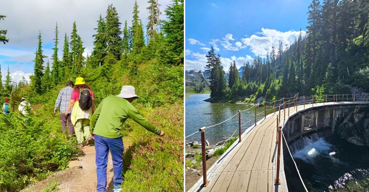
There is a special kind of panic that sets in when someone says, “Oh, it’s just a short walk,” and suddenly you’re scaling a cliff face like a mountain goat with asthma.
So, when I decided to tackle a famous little Washington loop, I packed enough emergency snacks for a Himalayan expedition, just in case. Turns out, I completely overreacted.
This breezy 1.4-mile trek is the unicorn of the hiking world: it requires zero athletic prowess yet somehow serves up postcard-worthy scenery that’ll make your social media followers think you’re a hardcore outdoorsy type.
If your ultimate outdoor fantasy involves maximum pine trees and minimum heavy breathing anywhere in Washington, grab your sneakers.
We’re going on an adventure that won’t require CPR at the end. I want to walk you through the lakes, the lava rock, the fall colors, the odd bit of history hiding under the water, and every practical detail I wish I had known before my first visit.
Bring water, bring layers, and bring a little curiosity, because the payoff per step here is honestly hard to beat anywhere in the North Cascades.
A Big-Mountain Payoff Packed Into 1.4 Miles
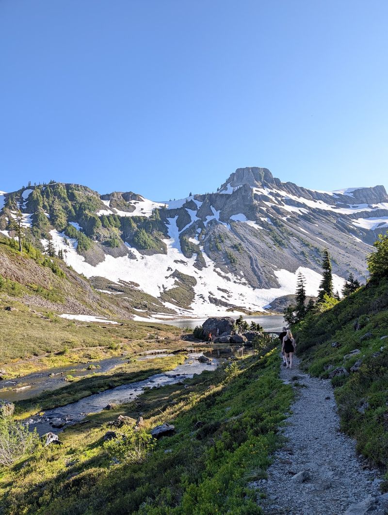
Short trails rarely brag, but Bagley Creek Loop Trail in Mount Baker National Forest, Washington, has earned the right. The loop runs roughly 1.4 miles around Lower and Upper Bagley Lakes, with elevation gain hovering near 150 to 167 feet depending on which map you trust.
I finished it in under an hour while stopping constantly, and I never once felt like I was working for the scenery. Table Mountain looms above the basin, Mount Herman and Goat Mountain fill the northern skyline, and Mount Shuksan makes its famous appearance from the higher stretches of the path.
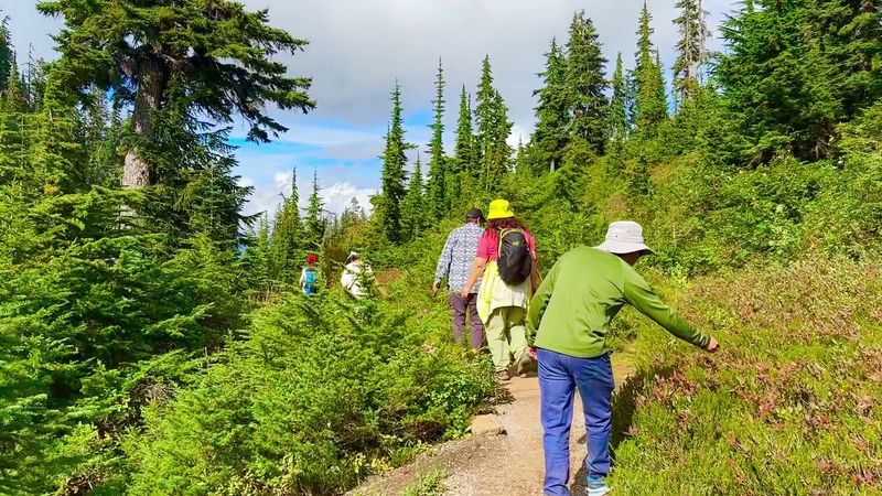
That ratio of effort to reward is what makes the walk so useful. Anyone who can comfortably manage a mile on mostly level ground can handle it, which opens the North Cascades up to grandparents, small kids, and travelers who arrived with sneakers instead of boots.
My honest advice is to plan double the time you think you need. The distance is small, the photo stops are not, and rushing here would be a genuine waste of good light.
Finding The Trailhead Off Mount Baker Highway
Getting here is refreshingly simple, which I appreciated after some Cascade drives that require a spreadsheet. State Route 542, better known as the Mount Baker Highway, carries you east from Bellingham for about 56 miles, past Maple Falls, and climbs into the Heather Meadows area.
The trail starts near the Bagley Lakes parking lot, and there is a second access point close to the Austin Pass Picnic Area if the first lot has filled up. Both put you within a couple of minutes of the water.
Parking itself costs nothing, but a Federal Recreation Pass needs to be displayed, so I keep mine clipped to the visor all summer. Rangers do check.
The final miles of highway are winding and narrow in places, and mountain drivers sometimes stop suddenly for views. I stayed patient, used the pullouts, and arrived with my coffee still upright, which felt like a small victory worth mentioning.
The Double-Arched Stone Bridge Everyone Photographs
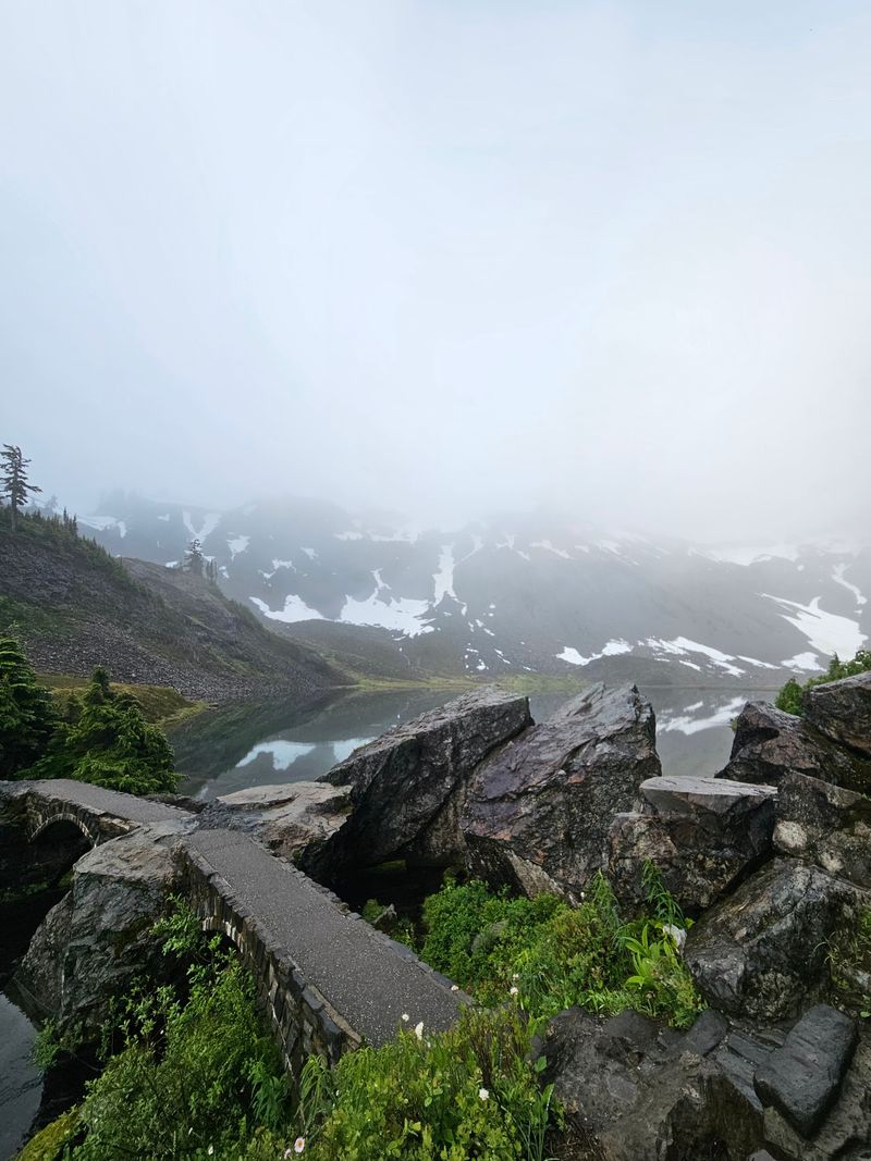
Halfway around the loop I found the structure that shows up on nearly every photo of this basin: a stubby double-arched stone bridge crossing Bagley Creek between the two lakes.
Built from local rock, it looks like it grew out of the hillside rather than being placed there. Water rushes under both arches, and on calm mornings the reflection completes a near-perfect circle in the pool below.
I crossed it four times, mostly because standing in the middle gives you Table Mountain on one side and the lake on the other. Photographers gather here at sunrise for good reason.
For families, the bridge makes a natural turnaround point if the little ones lose steam. It sits close to the midway mark, so an out-and-back from the parking lot still delivers the best water views without committing to the full circuit.
Give other visitors a moment to get their shot before you claim the railing. Bridge etiquette goes a long way up here.
Lower And Upper Bagley Lakes, Side By Side
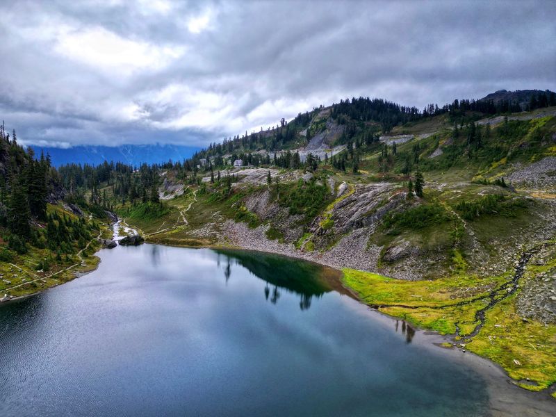
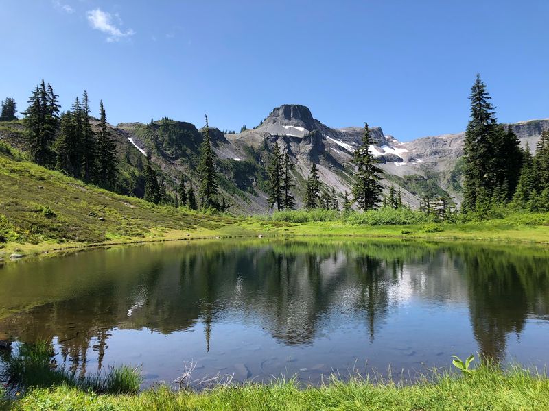
Two lakes for the price of one short walk is a bargain I will always take. Lower Bagley Lake sits closest to the parking area, wide and calm, while Upper Bagley Lake tucks itself deeper into the basin against steeper rock.
Their color shifts with the light, going from steely gray under clouds to a clear green when the sun climbs high. I dipped a hand in during August and can confirm the water stays properly cold all year.
The path hugs the shoreline for most of the loop, so you rarely lose sight of the water. Small streams feed in from the slopes, gurgling loud enough to hear before you see them.
Anglers do fish these lakes, and I watched one patient soul work the shallows near the outlet while sandpipers picked along the gravel nearby.
My favorite spot is a flat rock on the upper lake’s south shore. Perfect for a sandwich and absolutely nothing else.
Volcanic Rock, Basalt Columns, And Wandering Boulders
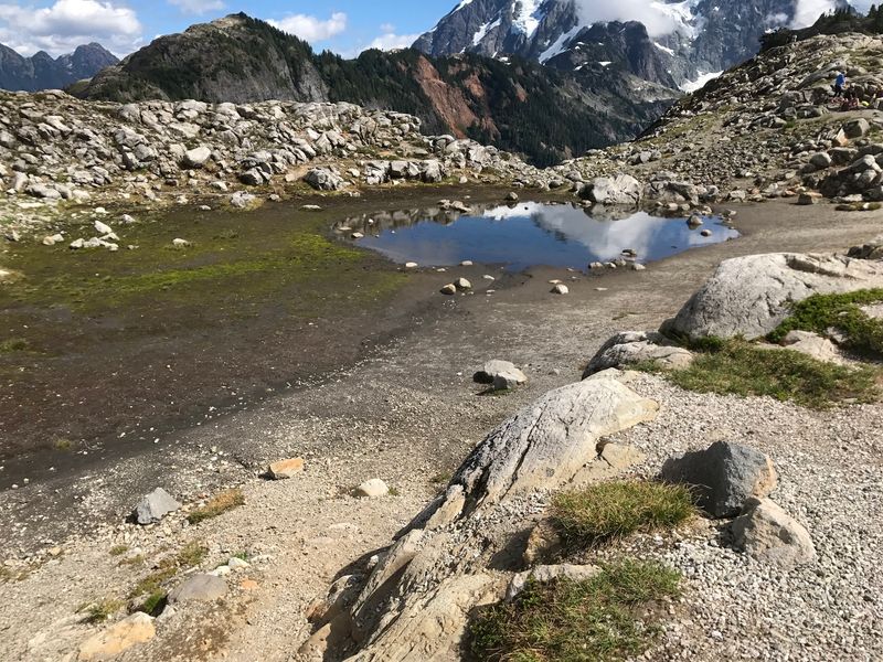
Geology nerds, this loop is your playground. The trail cuts past dark basalt columns, chunky lava rock, and glacial erratics that were carried here by ice and simply dumped when it melted.
Mount Baker built this landscape with fire, and glaciers spent thousands of years rearranging the furniture. Standing beside a boulder the size of a small car, sitting alone on smooth ground, drives that story home better than any sign could.
I like pointing the columns out to kids because the shapes look almost stacked by hand. They formed as lava cooled and cracked into rough pillars, a process that took no human help whatsoever.
The rocks also explain the trail surface, which is gritty and occasionally uneven. Footing is generally solid, though I would skip sandals in favor of shoes with real tread.
Look for scratches and grooves on the flatter slabs. Those are glacier signatures, and once you spot one you start seeing them everywhere.
Wildflower Season Turns The Basin Loud
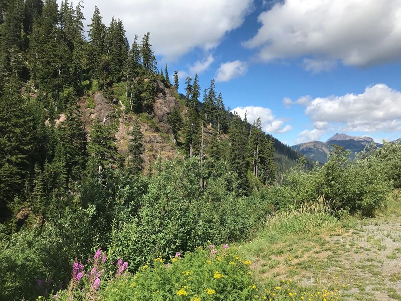
Late summer is when the meadows stop whispering and start shouting. Snow lingers here well into June, so the growing season is short and the flowers make up for it by blooming all at once in July and August.
Patches of color line the slopes between rock outcrops, and butterflies bounce from bloom to bloom in the warm middle of the day. I spent an embarrassing amount of time crouched over a single cluster with my phone camera.
Because the season runs late, a visit in early July might still show you snow patches beside fresh growth. Both in one frame is a treat worth planning around.
Please keep boots on the trail. Subalpine plants take years to recover from a single shortcut, and the loop is short enough that no one needs to invent a new route.
Bring bug spray. The flowers attract pollinators, and mosquitoes crash the party without an invitation.
Autumn Colors That Rival Any East Coast Drive
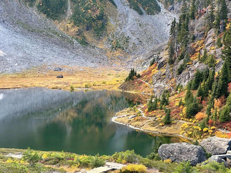
Ask me for one week to visit and I will say late September without hesitation. Mountain ash and huckleberry bushes ignite across the basin in scarlet, orange, yellow, and gold, and the contrast against gray rock and blue water is almost theatrical.
Fall color usually peaks from late September into early October, though a cold snap can move the schedule forward. I check recent photos online before committing to a date.
Huckleberries ripen around the same time, and a handful straight off the bush tastes like the reason the season exists. Bears think so too, so stay alert and make noise.
Crowds show up for the colors, especially on weekends when the highway to Artist Point is still open. That road typically closes by mid-October once snow settles in.
The light in autumn sits lower and softer, which flatters every photo you take. I came home with more keepers from one October morning than from an entire July trip.
Birds, Butterflies, And A Diving Little Show-Off
My favorite trail companion here weighs about as much as a deck of cards. Water ouzels, also called dippers, work the rushing sections of Bagley Creek, bobbing on wet rocks and then plunging straight underwater to hunt.
Watching one vanish into whitewater and pop up unbothered downstream never stops being funny. Sandpipers patrol the gravel shorelines, and various songbirds move through the scrubby growth along the slopes.
Butterflies show up in force during flower season, drifting across the path at ankle height. Kids tend to notice them before adults do.
I pack a small pair of binoculars, which costs almost nothing in weight and completely changes how much you see. Even without them, sitting quietly near the creek for ten minutes usually produces something.
Keep dogs leashed throughout the developed Heather Meadows recreation area. That rule protects wildlife, and honestly it protects your dog from a very cold unplanned swim.
A Lodge, A Dam, And The Ghosts Of The 1920s
Not everything in this basin is natural. Civilian Conservation Corps crews worked in the area during the 1920s, shaping trails and structures that visitors still use today.
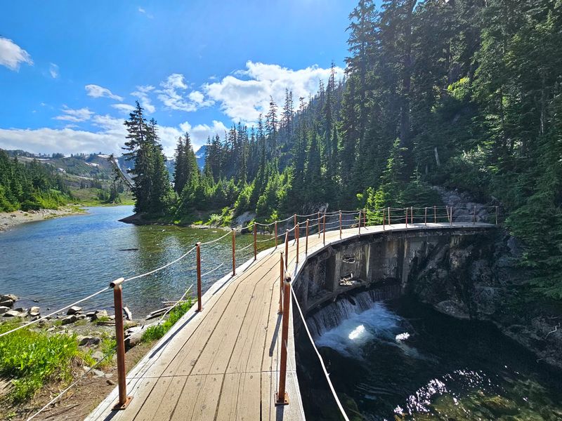
The dam on Lower Bagley Lake is the odd leftover. It once helped generate power for the grand Mount Baker Lodge, which stood in Heather Meadows until fire claimed the building in 1931.
Standing at the outlet, I tried to picture guests in wool coats arriving by rough mountain road for a stay in what was then one of the Northwest’s showpiece mountain hotels. All that ambition, and now just concrete and cold water.
Learning that history changed how I saw the loop. The stonework, the bridge, and the paths all connect to a period when Americans were building access to wild places by hand.
Fun detail worth knowing: the lakes carry the Bagley name, but the real headliner remains the volcano that made the whole neighborhood.
Best Months To Go And What The Snow Decides
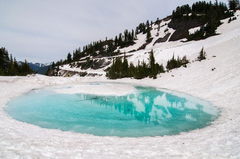
Snow runs this show, not the calendar. June through September is the realistic window for a snow-free walk, and mid-summer through early fall is when the trail truly shines.
Early June visits often still involve crossing white patches, which can hide the path and make footing tricky. By July the loop is usually clear and the flowers are moving in.
The Mount Baker Highway section above Heather Meadows toward Artist Point generally closes by mid-October as storms arrive. After that, the area shifts into a winter identity.
Nordic skiers and snowshoers do access Heather Meadows in the cold months when avalanche conditions allow, but that is a different trip requiring different skills and gear.
Before any drive up, I check the Mount Baker-Snoqualmie National Forest website for road and trail updates. Mountain weather here changes fast enough to make yesterday’s report useless, and a five-minute check has saved me a long pointless drive more than once.
Stretching The Day With Chain Lakes And Wild Goose
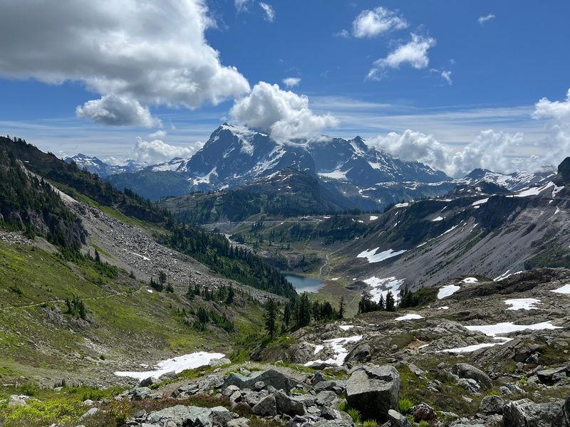
If 1.4 miles leaves you wanting more, the neighborhood has options. The Chain Lakes Trail branches off into a 7.3-mile moderate loop that climbs past several alpine lakes with steady views of Mount Baker and Mount Shuksan.
The Wild Goose Trail offers another connection, linking the Bagley Lakes area upward toward Artist Point for hikers who want elevation without a full-day commitment.
I have done the short loop as a warm-up and then continued onto Chain Lakes on the same morning, which made for one of my better days in the Cascades. Starting early is the trick, since parking fills and afternoon weather can turn.
Weekdays and early mornings are noticeably quieter. On a Saturday in October, the lot near the lakes can look like a parade staging area.
Standing on the stone bridge one last time before driving home, I understood why people keep returning to a walk that barely qualifies as exercise. Some places just give more than they ask.