
These 12 Michigan Drives Turn Every Fall Weekend Into A Reason To Cancel Plans
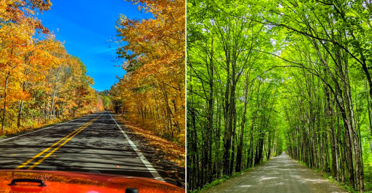
Fall color in Michigan does not politely appear. It takes over. I have driven these routes in October more times than I can count, and every year I swear the reds are deeper and the golds stretch further than memory allows.
One road climbs to a ridge where you can see two countries and an entire copper-mining history laid out below. Another passes under a canopy so thick the GPS signal gives up entirely.
A third follows the lake shore with turnouts that make you late for dinner on purpose.
The routes here are not long, but they are dense. Every bend reveals a different shade of copper, amber, or rust. Packing a camera is not optional.
I filled memory cards on a single afternoon and still reached for my phone. Fall in Michigan turns eight drives into reasons to cancel every other plan, and the colors never once disappoint.
12. Brockway Mountain Drive
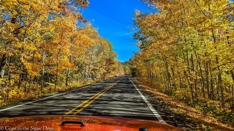
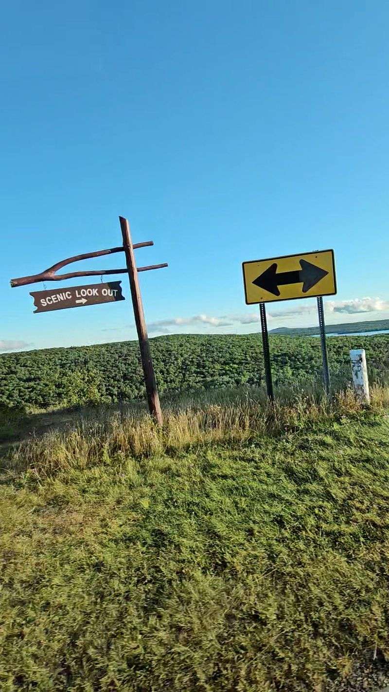
Wind seems to own Brockway Mountain, rushing over the ridge while Lake Superior spreads below like hammered blue metal in autumn. The paved 8.8-mile road climbs above Copper Harbor, reaching broad overlooks where maple colors roll across thousands of wooded acres below.
Built during the 1930s, the route gave Depression-era workers jobs while creating one of Michigan’s boldest scenic drives for future travelers.
Clear days may reveal Isle Royale far offshore, although haze often turns that distant island into a faint gray suggestion instead. Bring binoculars, warm layers, and patience because popular pullouts become crowded when fall color approaches its late September or early October peak.
Sunset looks spectacular here, but descending afterward requires slower driving, working headlights, and careful attention to deer crossing the winding roadway. Check local conditions before leaving because fog, strong winds, early snow, or maintenance can quickly change a seemingly simple mountain outing.
11. Copper Country Trail National Byway / US-41
Copper history rides beside you on US-41, appearing in sandstone buildings, old mine sites, and communities shaped by workers from overseas. The national byway runs north from the Portage Lake Lift Bridge toward Copper Harbor, following the peninsula’s historic copper mining region closely.
Calumet deserves an unhurried stop for its substantial architecture and Keweenaw National Historical Park sites that explain industry, immigration, labor, and community.
Farther north, towns thin out while hardwoods crowd the highway, turning routine miles into a moving gallery of crimson and gold. Start with fuel, snacks, and downloaded directions because cell coverage becomes unreliable and evening services may close earlier outside the summer season.
Watch speed limits through communities, leave room for cyclists, and avoid sudden roadside stops when a promising photograph appears around another bend. Travelers with one day should choose several meaningful stops instead of racing the full corridor and seeing everything through glass alone.
10. Covered Road, US-41 From Delaware To Copper Harbor
Branches knit together above US-41 north of Delaware, creating a leafy hallway that grows brighter and stranger during peak color season. Unlike a formal overlook, the attraction keeps moving, with yellow birches and red maples flickering across the windshield at every curve.
Sunlight filters through gaps overhead, making wet pavement shine and giving even an ordinary family car a surprisingly cinematic entrance north.
Despite the secluded mood, this remains an active highway, so stopping in travel lanes for photographs is unsafe and inconsiderate to others. Use established turnouts, keep children away from traffic, and clean the windshield beforehand because roadside dust can spoil otherwise excellent pictures.
Morning offers softer light and fewer vehicles, while damp leaves after rain may increase stopping distance along shaded portions of road. Continue toward Copper Harbor for food and shoreline walks, but confirm seasonal hours since many businesses reduce schedules after the busiest months.
9. Sand Dune Drive, M-26 Between Eagle River And Eagle Harbor
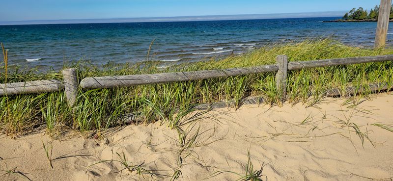
Sand, forest, and steel-blue water meet along M-26, where Lake Superior repeatedly steals attention from the bright trees across the road. Between Eagle River and Eagle Harbor, the highway passes Great Sand Bay and other shoreline openings backed by weather-shaped sandy bluffs nearby.
On windy days, waves pound the coast with enough force to send mist upward, while sheltered woods remain quiet and copper-colored.
Great Sand Bay provides a sensible place to pause, stretch, study the water, and photograph dunes without blocking narrow road shoulders. Wear sturdy shoes because loose stones shift underfoot, and never turn your back on Superior when large waves reach the beach.
Roadside waterfalls and small communities encourage detours, yet daylight disappears quickly behind autumn clouds, so keep an eye on the clock. Pack out every wrapper, avoid climbing fragile dune faces, and leave rocks where collecting is restricted or property boundaries remain unclear.
8. M-26, Eagle River To Copper Harbor
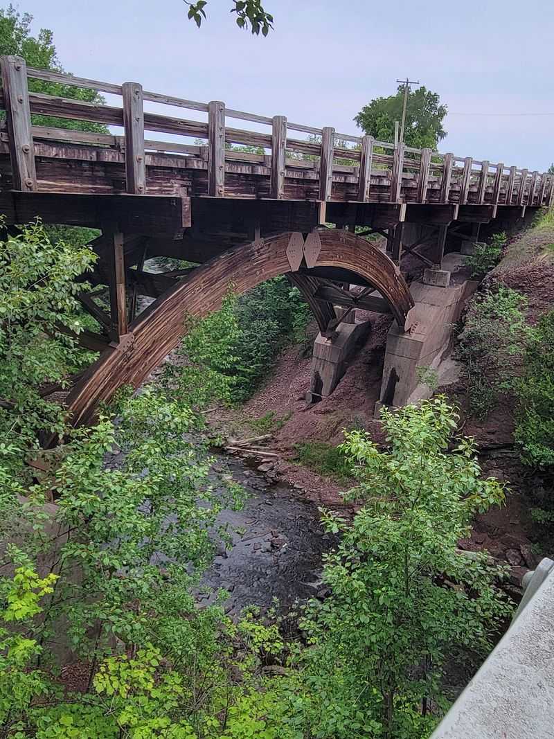
A waterfall beside the highway feels almost suspiciously convenient, yet Jacob’s Falls genuinely tumbles near M-26 between Eagle River and Copper Harbor. The route hugs portions of Lake Superior, slipping past forest, rocky shorelines, Eagle Harbor, and reminders of the peninsula’s maritime history.
Nearby, the Jampot sells preserves and baked goods made by monks, although operating dates and hours should always be checked beforehand.
Eagle River also offers a roadside waterfall, while Eagle Harbor has a historic lighthouse complex managed as part of local museum attractions. Allow several hours because short distances become long afternoons once beaches, falls, and changing lake light begin competing for your attention.
Parking areas can fill during peak foliage weekends, so arrive early and never improvise a space along blind curves or soft shoulders. Cooler temperatures do not tame Lake Superior, making respectful distance from breaking waves essential during storms and strong northwest winds here.
7. Covered Drive, Stanton Township
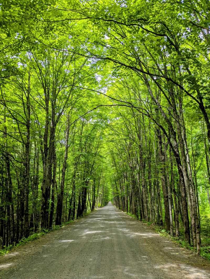
West of Houghton, a narrow road slips beneath close hardwood branches and trades polished sightseeing for something quieter and more intimate. Often called Covered Drive, the unpaved route passes through Stanton Township toward Redridge, where historic industrial remains recall the copper era.
Redridge’s unusual steel dam dates from the early twentieth century and once supported water needs connected with nearby stamp mill operations.
Loose gravel, potholes, fallen branches, and muddy patches can appear, making daylight travel and moderate speed far wiser than hurried exploring. Check current road access before starting, especially after storms, and avoid assuming every side track welcomes public vehicles or curious walkers.
A printed map helps when phone service fades, while water, a spare tire, and basic emergency supplies provide sensible reassurance here. Autumn’s canopy rewards slow travel, but residents still use these roads, so pull aside carefully and never trespass for a better photograph.
6. Gay-Lac La Belle Road / South Shore
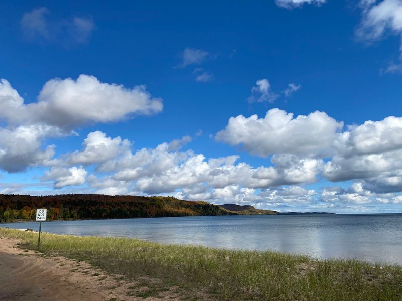
The southern Keweenaw feels broad and windswept, with forest openings revealing Lake Superior and distant landforms across blue-gray Keweenaw Bay waters. Gay-Lac La Belle Road links two small communities while passing quiet woods, shoreline views, wetlands, and traces of former copper industry.
In Gay, the towering stamp mill smokestack remains an unmistakable landmark from operations that processed rock for the Mohawk and Wolverine mines.
The surrounding stamp sands also tell a difficult environmental story, since eroding mining waste has harmed important fish spawning habitat nearby. Observe ruins from safe, lawful areas because unstable structures, sharp debris, private property, and contaminated industrial ground can present genuine hazards.
Brunette Park offers picnic facilities and shoreline access nearby, though travelers should verify seasonal services before depending on open restrooms there. Keep fuel levels comfortable, carry lunch, and expect sparse businesses along a route whose greatest luxury is its generous breathing room.
5. Freda Road
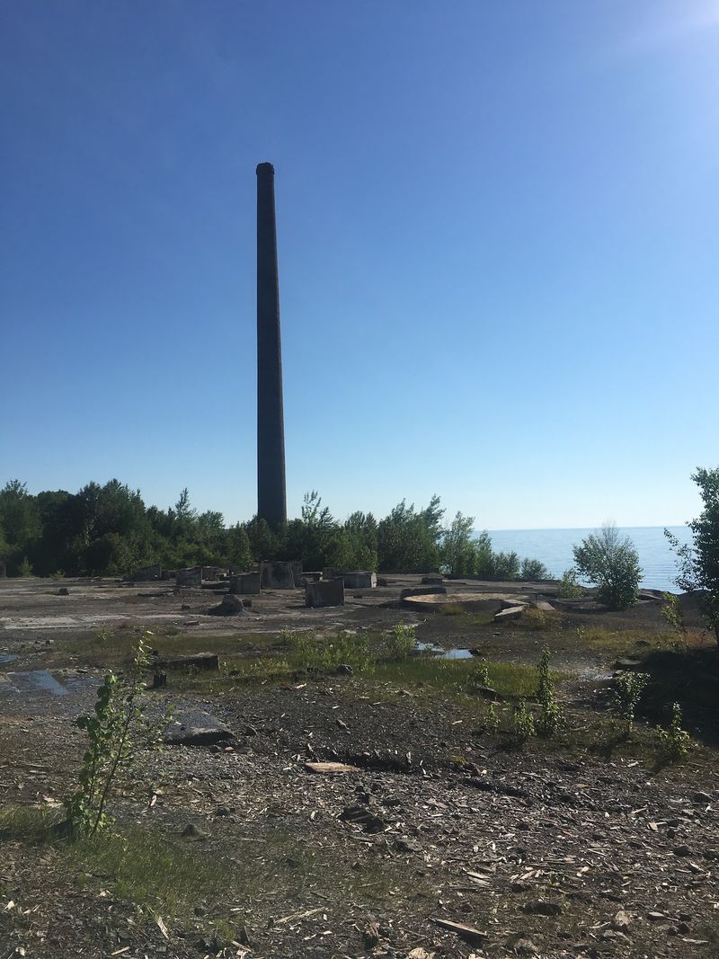
Freda announces itself through absence: fewer houses, thicker woods, and industrial remains standing above a remote stretch of Lake Superior shoreline. The former company settlement served the Champion Mine’s stamp mill, where copper-bearing rock was crushed and processed before the operation closed.
A tall smokestack and concrete structures still mark that history, contrasting sharply with maples reclaiming the surrounding landscape each autumn.
The road becomes rougher near the old site, and changing conditions may make some sections unsuitable for low-clearance vehicles after heavy rain. I keep extra daylight available here because fog, fading sun, and unfamiliar intersections can make the return trip feel unexpectedly longer.
Respect private property and warning signs, since old industrial ruins may be unstable even when they look solid from the roadside nearby. Black stamp sands along the coast offer a striking view, but strong waves and loose ground demand deliberate, careful footing always.
4. Calumet Waterworks Road
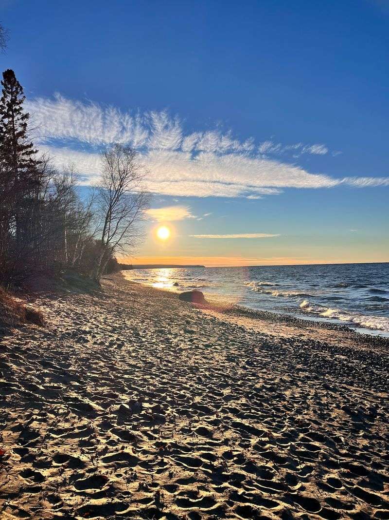
Lake Superior waits at the end of Calumet Waterworks Road, turning a simple forest drive into an afternoon by the water. The route leaves historic Calumet and reaches Calumet Waterworks Park, where a rocky beach invites slow walks and close inspection.
Locals also call the recreation area Bucky’s, a friendly nickname that suits its picnic tables, open shoreline, and relaxed atmosphere.
Beachcombers search for agates, while nighttime visitors sometimes use ultraviolet lights to find fluorescent sodalite-bearing rocks commonly called Yooperlites along Superior. Follow collecting rules, limit what you take, and remember that identifying promising stones usually requires patience rather than frantic digging around.
Pack a windproof jacket because temperatures beside the lake can feel much colder than conditions several miles inland near town. Sunset can be wonderful, but leave enough light for packing up and watch for deer while driving back through wooded areas.
3. Gratiot Lake Road
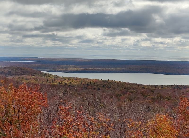
Quiet arrives quickly on Gratiot Lake Road, where dense woods replace town noise and flashes of water appear between autumn branches. Gratiot Lake is Keweenaw County’s largest inland lake, surrounded by a watershed protected in part through local conservation work and stewardship.
Nearby sanctuary lands include trails and elevated viewpoints, but visitors should consult current maps because access points and conditions may change.
Good footwear matters on uneven, sometimes wet paths, and blaze-orange clothing is sensible during Michigan hunting seasons in surrounding forest areas. Drivers should expect gravel, limited cellular service, and wildlife, especially around dawn or dusk when deer are more likely to cross.
Carry drinking water and avoid relying on lakeside facilities, since this is a quieter outing than a developed scenic park visit. Calm weather creates sharp foliage reflections, while wind breaks the picture into glittering pieces that somehow make the landscape feel wilder.
2. Mohawk-Gay Road
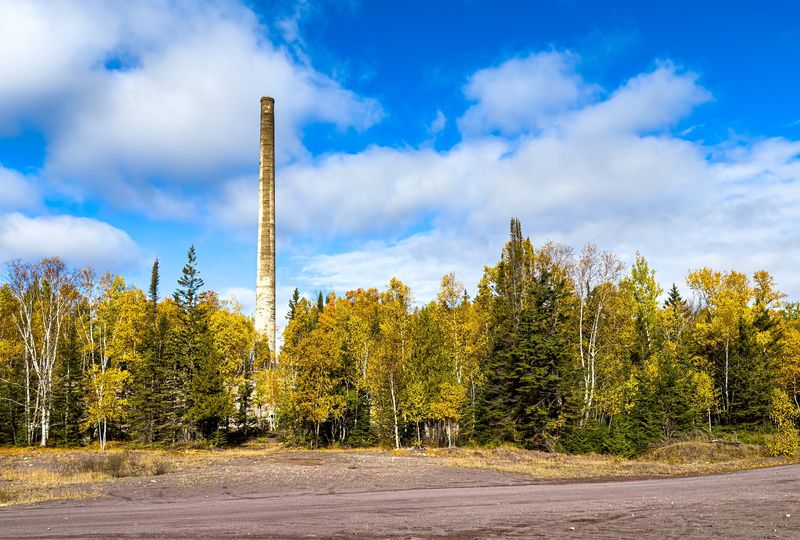
About twelve miles separate Mohawk and Gay, yet the county road between them feels pleasantly removed from the peninsula’s busier routes. Trees crowd much of Mohawk-Gay Road, delivering especially strong color around late September and early October, depending on annual weather patterns.
Mohawk grew around copper mining and gave its name to mohawkite, a rare copper-arsenic mineral associated with the nearby mine.
Gay developed near the Mohawk and Wolverine stamp mills, whose surviving smokestack still towers beside the Lake Superior shoreline today. The community retains homes, a 1927 schoolhouse, and the memorably named Gay Bar, so describing it as abandoned misses present-day life.
Drive gently through both communities, respect residents, and avoid entering industrial ruins or wandering onto property without clear public access. Before leaving US-41, fill the tank and save directions offline because services and reliable signals become less certain toward the coast.
1. Five Mile Point Road
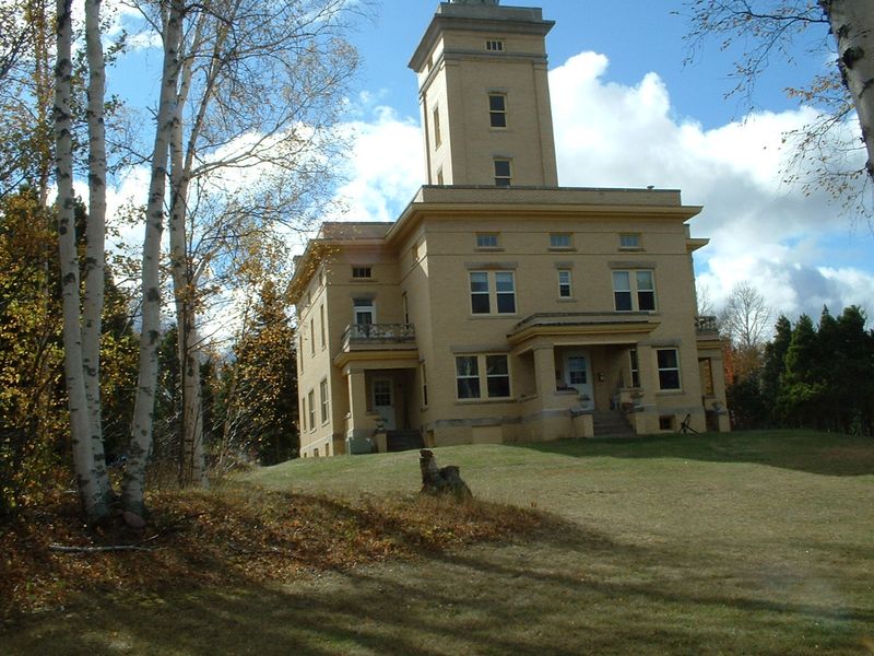
Freighters sometimes slide across the horizon beyond Five Mile Point Road, looking impossibly neat against Lake Superior’s rough, changeable water. The western Keweenaw route runs through mixed forest near beaches where birch, maple, spruce, and pine frame wide lake views beautifully.
Sand Hills Lighthouse, completed in 1919, adds maritime character, but visitors should remember that the historic property is privately owned today.
Use marked public access points rather than crossing private land, and park completely away from traffic on this relatively quiet road. Beach stones tempt collectors, although local rules, ownership boundaries, and protected areas determine whether removing anything is allowed at each location.
On clear afternoons, watch for migrating birds, fishing boats, and sudden bands of weather moving across the lake. A thermos of coffee and a blanket make longer roadside pauses more comfortable, especially when wind off Superior turns colder than expected.
Evening light often warms the shoreline, making an early supper and a later sunset stop a practical autumn plan for families. Bring a flashlight, warm hat, and offline map because darkness settles fast, temperatures drop sharply, and cellular coverage can be inconsistent.