
These 12 Stunning Natural Wonders Are Actually In Michigan
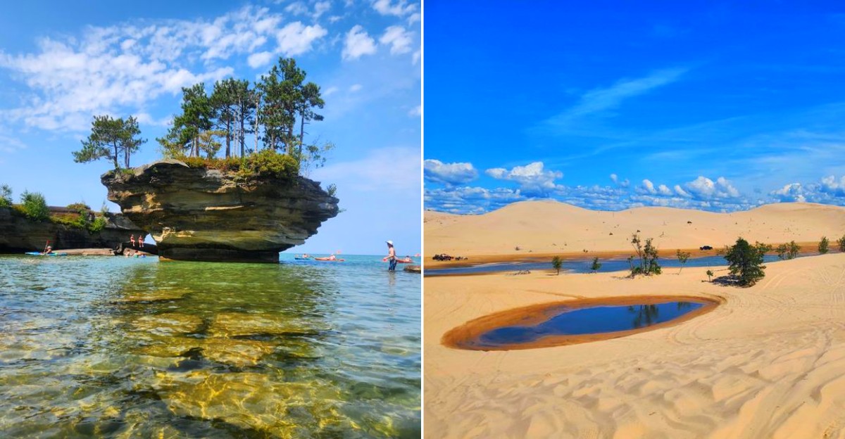
Michigan gets credited with Great Lakes coastline and cherry festivals. The state holds natural formations that belong in a fantasy novel rather than a Midwest travel guide.
Start with an underwater spring so clear that visitors pull themselves across it on a cable raft. You stare forty feet down through the water at ancient tree trunks drifting below.
Turnip Rock juts out of Lake Huron like a turnip-shaped pillar crowned with trees. You can reach it only by kayak. The Eben Ice Caves form every winter when snowmelt freezes over sandstone cliffs.
Curtains of ice create passages you can walk behind. Grand Sable Dunes rise two hundred seventy-five feet above Lake Superior on a perched dune system found in only a handful of places worldwide.
Twelve natural wonders spread across Michigan prove that the state keeps its most jaw-dropping scenery far from the usual tourist corridors and hidden in plain sight.
12. Kitch-iti-kipi At Palms Book State Park
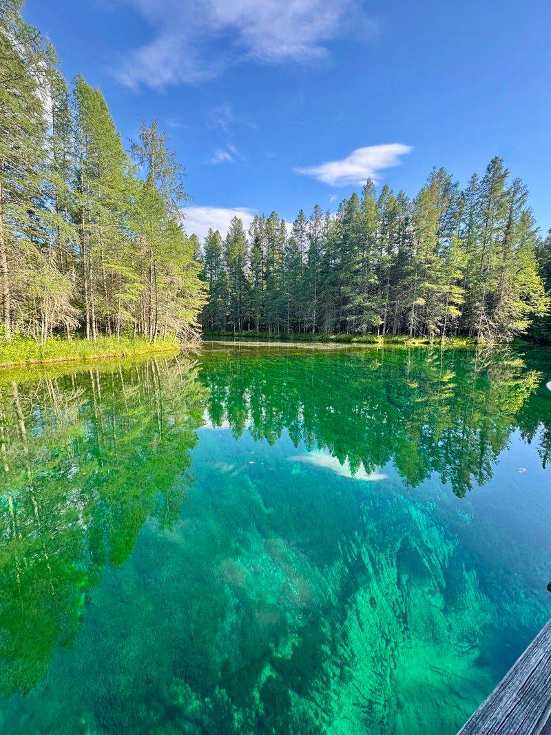
At first glance, Kitch-iti-kipi looks like someone poured green glass into a cedar forest. Michigan’s largest freshwater spring sends more than 10,000 gallons per minute through limestone fissures, keeping the water near 45 degrees all year.
Sand clouds dance on the bottom, while trout drift through startlingly clear depths.
A short paved route in Palms Book State Park reaches a self-operated observation raft. Turn the wheel slowly and look through its center opening for the best underwater view.
The path and raft are designed for broad access, though busy summer days can bring a wait.
Swimming and fishing are prohibited, which helps protect the spring’s unusual clarity. Arrive early, carry mosquito repellent, and pair the visit with nearby Manistique.
Even quiet voices feel loud here, so let bubbling water and the creaking raft supply the soundtrack for several peaceful, unhurried minutes beneath the pines.
11. Turnip Rock Near Port Austin
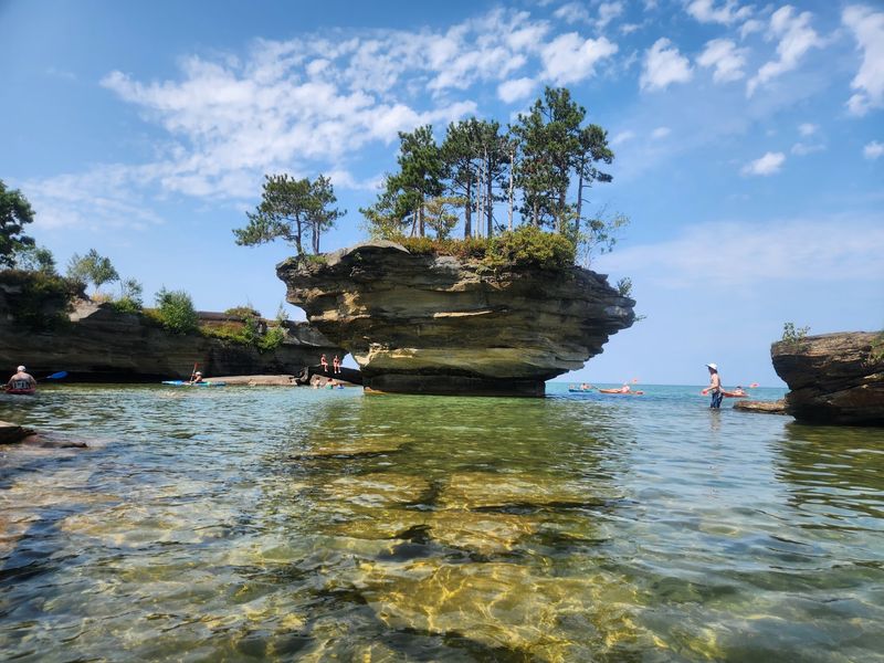
A stone turnip wearing a tiny forest sounds like folklore, yet Lake Huron has one near Port Austin. Waves carved the soft limestone base into a narrow pedestal while tougher rock remained above.
Trees now crowd its cap, making the formation seem wonderfully out of scale.
Private property surrounds the shoreline, so visitors should approach from the water rather than crossing land. The roughly seven-mile round-trip paddle from Port Austin passes cliffs, coves, and small sea caves.
It suits prepared paddlers, not anyone hoping for a casual float.
Check the marine forecast, wind direction, and water temperature before launching because Lake Huron can change quickly. Wear a life jacket, carry drinking water, and keep a respectful distance from rocks during rough conditions.
Guided kayak trips are a smart choice for beginners. Calm mornings often bring the smoothest water and clearest reflections around this curious landmark.
10. Silver Lake Sand Dunes Near Mears
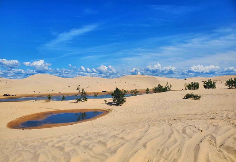
Sand squeaks underfoot here, and suddenly Michigan feels much farther west. Silver Lake Sand Dunes covers nearly 2,000 acres between Silver Lake and Lake Michigan, with pale ridges shaped by steady wind.
Glaciers supplied the sand, but the landscape remains active and keeps shifting today.
Separate zones allow different kinds of adventure. Hikers can wander without meeting vehicles in the pedestrian area, while licensed off-road machines use a designated section.
Never cross boundary markers, and expect every climb to demand more energy than its smooth slope suggests.
Sun protection, water, and closed shoes make the outing more comfortable because shade is scarce. Wind can erase tracks quickly, so note landmarks and follow posted routes.
Nearby Little Sable Point Lighthouse adds a bright red landmark beside Lake Michigan. Climb its tower when open, then watch evening light stretch shadows across dunes that rarely hold one shape for long.
9. Eben Ice Caves Near Deerton
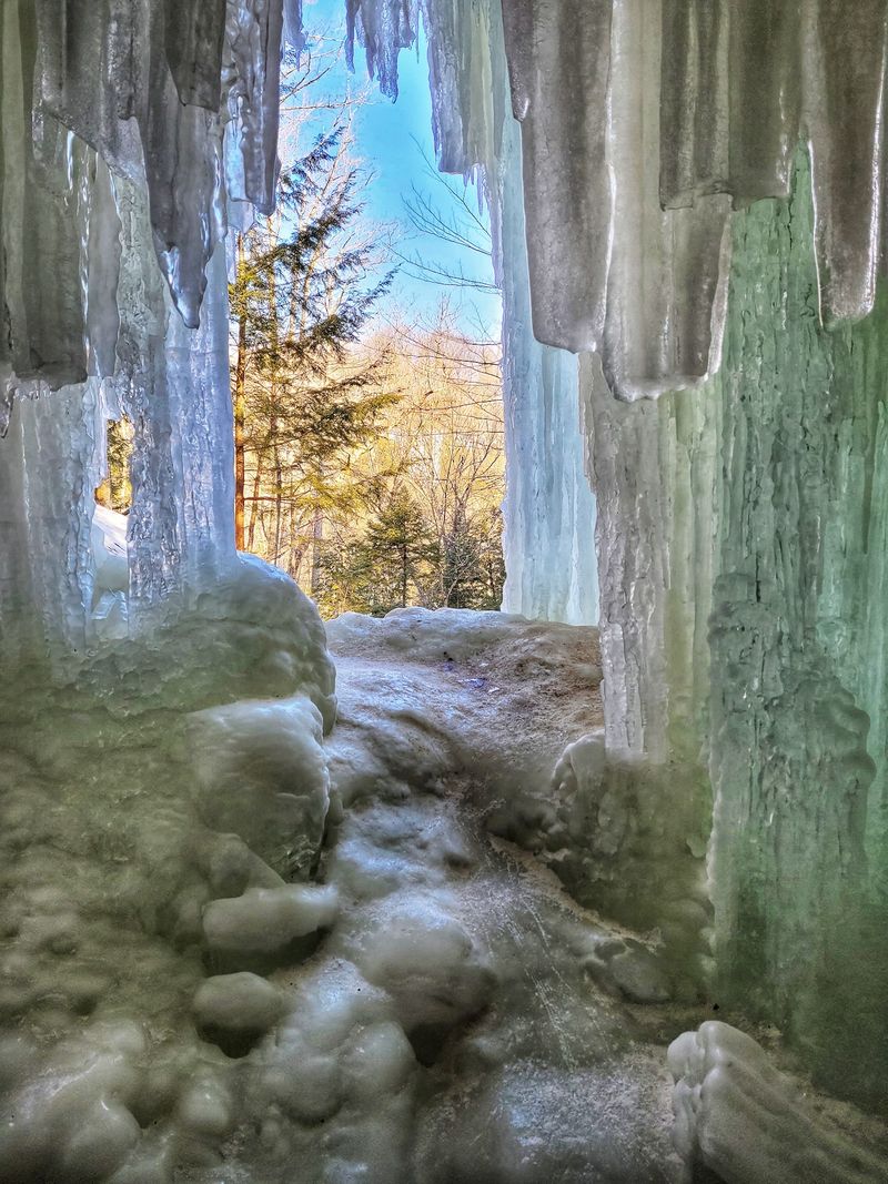
Winter performs its best magic quietly at the Eben Ice Caves. Water seeps over sandstone ledges, freezes, and gradually builds blue-white curtains, columns, and sheltered spaces that resemble caves.
Their size and shape depend on temperature, snowfall, and recent thaws, so no two seasons look identical.
Reaching them usually involves a roughly two-mile round-trip walk across private farmland opened for visitor access, followed by a wooded trail with uneven hills. Deep snow and polished ice can turn a moderate hike into serious work.
Ice cleats are essential, and trekking poles add welcome balance.
Visit only during sustained cold, commonly between January and March, and confirm current conditions locally before driving. Dress in waterproof layers, protect exposed skin, and avoid standing beneath loose ice.
Parking arrangements may change, so follow signs and respect the landowners. The frozen walls are beautiful, but careful footing deserves more attention than any photograph.
8. Grand Sable Dunes At Pictured Rocks
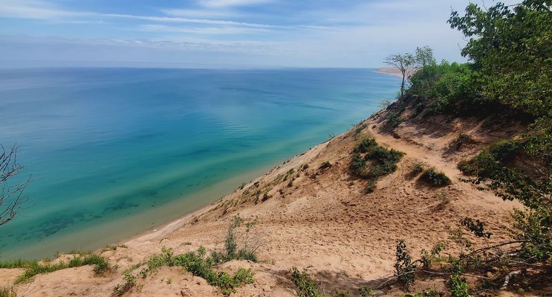
Lake Superior looks surprisingly small from the crest of Grand Sable Dunes. Rising nearly 300 feet in places, these perched dunes stretch for about five miles along the eastern end of Pictured Rocks National Lakeshore.
Retreating glaciers left sandy material, and wind later pushed it over older glacial ridges.
The Grand Sable Dunes Trail near the visitor center provides a manageable introduction, with interpretive information and broad shoreline views. Stay on marked paths because dune plants have shallow roots and recover slowly after trampling.
Steep lakeside slopes can also collapse or leave climbers stranded below.
Bring layers, even in summer, since Lake Superior winds can feel sharp without warning. Morning often offers clearer air, while late light emphasizes ripples across the sand.
Combine the walk with nearby Sable Falls or the Grand Marais shoreline. From above, the meeting of forest, sand, and enormous blue water feels almost mathematically neat.
7. Grand Island Ice Curtains Near Munising
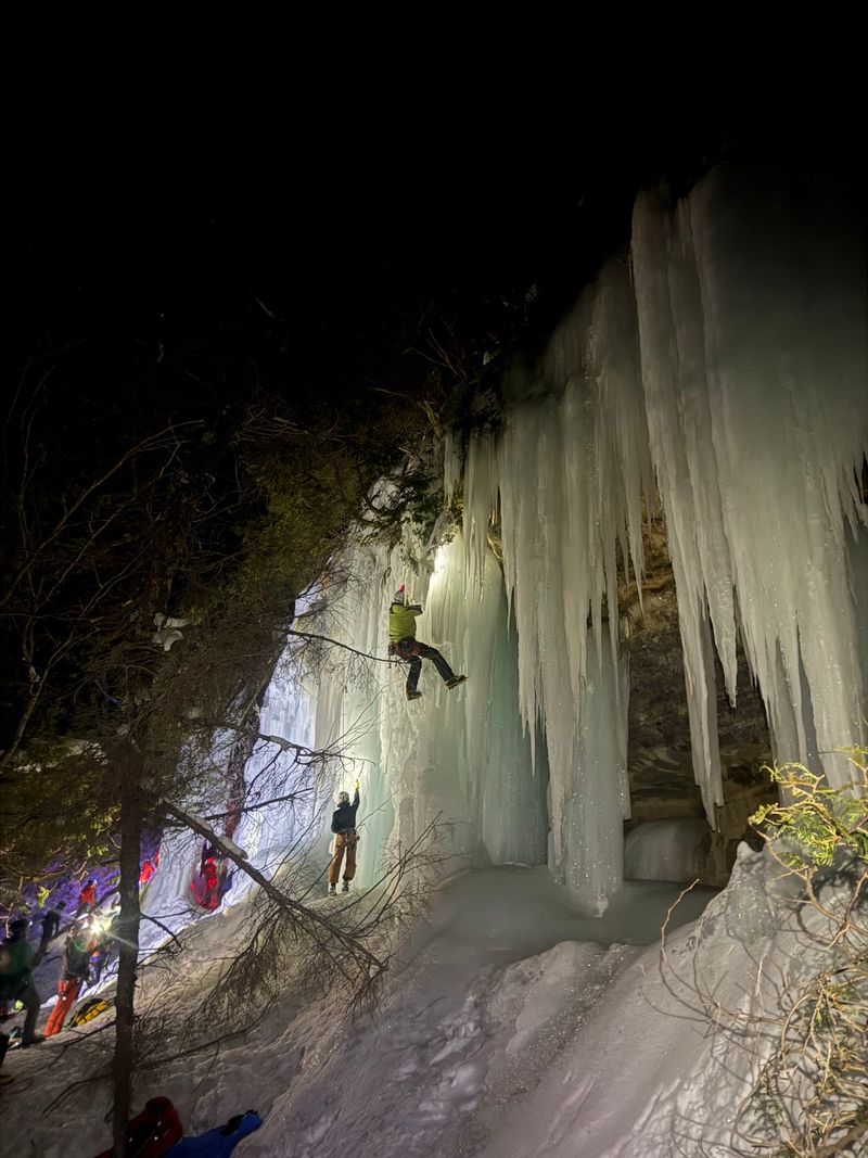
Across the channel from Munising, winter sometimes hangs enormous blue drapes on Grand Island’s cliffs. Seeping groundwater freezes along sandstone walls, building ice curtains and columns that may rise more than 100 feet.
Sunlight reveals turquoise shadows, amber rock, and delicate ridges within the thicker formations.
Sand Point Beach can provide distant views without requiring a hazardous crossing, especially when binoculars or a long camera lens are handy. Traveling onto Lake Superior ice carries serious risk because currents, pressure cracks, and changing weather can weaken it.
Never assume footprints prove that a route is safe.
Conditions are most dramatic during long cold periods, generally in midwinter, but formation and access vary yearly. Consult current guidance from Pictured Rocks National Lakeshore and local authorities before visiting.
Waterproof boots, traction aids, insulated layers, and an early return plan are sensible. Admired from a secure viewpoint, the cliffs still look like a frozen cathedral wall.
6. Tahquamenon Falls Near Paradise
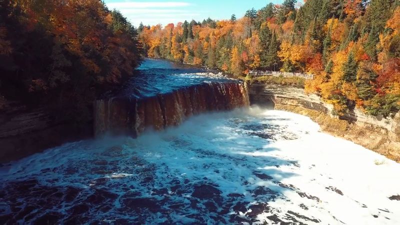
The color catches everyone first: Tahquamenon Falls pours over the ledge like foaming tea. Natural tannins enter the river from cedar, spruce, and hemlock wetlands upstream, creating its rich amber tone.
The Upper Falls drops about 50 feet and spans nearly 200 feet, with especially forceful flow during spring.
Well-developed paths and viewing platforms make the main overlooks straightforward to reach, although some routes include stairs. The Lower Falls consists of smaller cascades surrounding an island farther downstream.
Allow time for both areas rather than treating one as an afterthought.
Autumn brings brilliant leaves and large crowds, while winter replaces the forest noise with deep quiet. Wear sturdy footwear because mist and fallen leaves can make surfaces slick.
State park entry requirements apply, and seasonal services vary. I like pausing away from the busiest railing, where the river’s low rumble becomes something felt through the ground.
5. Lake Of The Clouds In The Porcupine Mountains
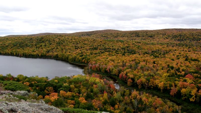
Some overlooks reveal everything at once, but Lake of the Clouds keeps details tucked between wooded ridges. The long inland lake lies below an escarpment in Porcupine Mountains Wilderness State Park, surrounded by one of the Midwest’s largest old-growth forest areas.
In fall, red and gold trees make the dark water appear even deeper.
A short paved route and accessible ramp lead from the parking area to the main viewpoint. Hikers wanting a longer look can explore the Escarpment Trail, where rocky ground, exposed edges, and changing weather require care.
Carry a map because cell service may be unreliable.
Sunrise provides soft light and fewer people, but fog can hide the scene without apology. Pack extra layers, drinking water, and insect repellent during warmer months.
Stay behind barriers at overlooks and protect plants by using established trails. The quiet scale rewards patience more than a hurried photograph ever could.
4. Ocqueoc Falls Near Ocqueoc
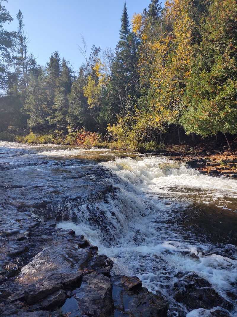
Michigan’s Lower Peninsula is not famous for waterfalls, which gives Ocqueoc Falls a cheerful underdog quality. The Ocqueoc River tumbles across layered limestone in several low drops, forming a broad, rocky pool.
Rather than towering dramatically, the falls invite visitors close enough to hear every splash and gurgle.
A paved route provides barrier-free access from the parking area, and swimming is permitted at the falls. Water shoes are highly useful because submerged rocks can be sharp, slippery, and uneven.
Check water levels before entering, supervise children closely, and never depend on a gentle appearance after heavy rain.
Summer afternoons can become lively, so an early visit offers more room beside the water. Picnic facilities and nearby trails make it easy to extend the stop beyond a quick swim.
Pack out all litter and avoid soaps in the river. Its modest height is precisely what makes the place so friendly.
3. Laughing Whitefish Falls Near Munising
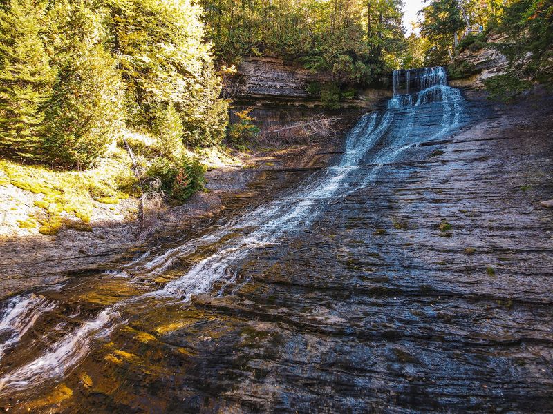
Instead of dropping cleanly from a cliff, Laughing Whitefish Falls skitters down rock like spilled silver beads. Water spreads across many small ledges, creating a graceful fan roughly 100 feet high.
Spring usually brings the fullest display, while dry summer weather may narrow the flow toward one side.
The upper forest trail is fairly gentle and passes maple, beech, hemlock, and tall white pine. Three viewing areas offer different angles, but reaching the lowest deck requires descending about 155 wooden steps.
Remember that every downward step must be climbed on the return.
Rain can leave the stairs and boardwalks slick, so shoes with reliable tread matter. Bug spray helps during warm, still days, and a light jacket suits the cooler gorge.
Remain on platforms because surrounding slopes are steep and fragile. Listen carefully near the bottom, where countless small impacts explain the waterfall’s unusually musical name.
2. Warren Dunes State Park Near Sawyer
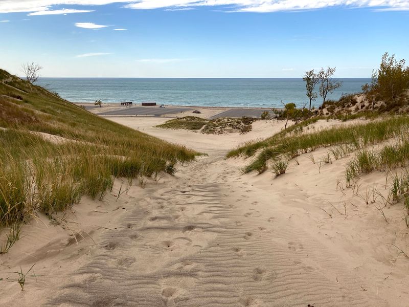
One minute involves climbing sand; the next involves discovering sand in every pocket. Warren Dunes State Park protects dramatic ridges rising as high as 260 feet above Lake Michigan, along with three miles of beach.
Strong legs earn sweeping views over water, woods, and rolling dune country.
Visitors climb designated slopes, swim, paddle, picnic, and sometimes try sandboards or sleds where conditions and park rules allow. The steepest ascents are harder than they look, especially under midday sun.
Bring plenty of water and pause often rather than racing straight upward.
Lake Michigan can produce cold water, waves, and dangerous currents, so observe beach warnings before swimming. Windproof layers help during spring and fall, when the shoreline feels wonderfully spacious.
Campgrounds make overnight stays possible, though reservations are wise in summer. On exceptionally clear days, distant Chicago may appear across the lake, looking almost like a pencil mark.
1. Sleeping Bear Dunes National Lakeshore Near Empire
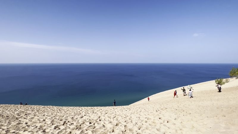
From a high overlook, Lake Michigan resembles polished metal beside the pale Sleeping Bear dunes. Glaciers shaped the hills more than 10,000 years ago, while wind continued building perched dunes above the shoreline.
The area’s name also recalls an Anishinaabek story about a mother bear and her cubs.
The official Dune Climb offers a demanding sandy route, but reaching Lake Michigan and returning can take several hours. Carry ample water, wear sun protection, and turn back before exhaustion arrives.
Never descend steep bluff faces near overlooks, since climbing back can require rescue and cause erosion.
Pierce Stocking Scenic Drive, when open, provides major views with much less effort. Trails, beaches, forests, historic farm areas, and inland lakes reward a stay of several days.
Check National Park Service alerts for closures, weather, and seasonal facilities. However you explore, marked routes protect both visitors and delicate dune plants.