This Arizona Bridge Dares Drivers To Face One Of The Scariest Drives In The State
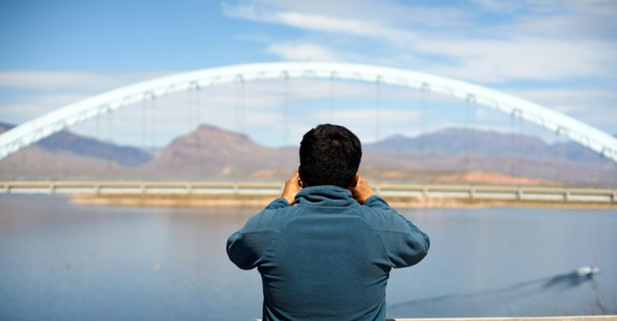
What gets me about this Arizona drive is how quickly it stops feeling ordinary and starts feeling like a real test of your nerves. As you get closer to the bridge, there is this strange moment where it almost feels like the ground disappears and you are suddenly suspended above the lake with nothing but open space, rock, and water in every direction.
I would be lying if I said it did not make me grip the steering wheel a little tighter, because the whole crossing feels far more dramatic once you are actually up there. The pavement seems narrower than you expect, the drop feels bigger, and your eyes keep wanting to wander toward the sparkling water and rugged scenery all around you.
That mix of fear and awe is what makes it so memorable. It is the kind of drive that raises your pulse but also makes you incredibly glad you did it once you reach the other side.
The Record-Breaking Engineering Behind The Bridge
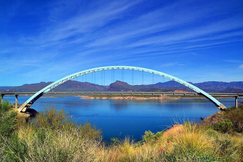
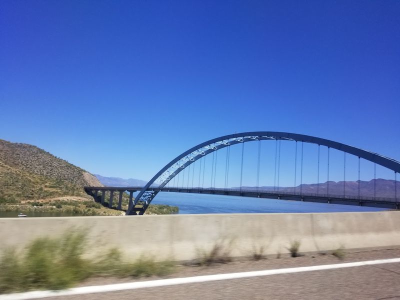
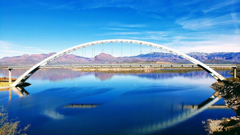
Not every bridge gets to hold a North American record, but this one does it with style. The Theodore Roosevelt Lake Bridge is the longest two-lane, single-span, steel-arch bridge on the entire continent.
That title is not just a fun fact for trivia night. It means that when you drive across, there are no support columns rising from the water below you. The entire structure carries itself through one sweeping arch of steel, and that engineering feat is both impressive and slightly terrifying to think about mid-crossing.
Completed in 1990, the bridge connects Gila and Maricopa counties along State Route 188 in central Arizona. Engineers spent years designing a structure that could handle the dramatic terrain and the weight of modern vehicles.
The American Consulting Engineers Council recognized it in 1995 as one of the top twelve bridge designs in the United States, placing it alongside celebrated landmarks like the Brooklyn Bridge and the Golden Gate Bridge. That is remarkable company for a bridge tucked away in the Arizona desert.
What It Feels Like To Actually Drive Across
The moment your tires leave solid ground and hit the bridge deck, something shifts in your chest. The road narrows in your perception, the water spreads out on both sides, and the sky opens up in a way that feels almost too big. Some drivers describe it as exhilarating.
Others admit they kept their eyes glued forward and their speed steady. There is no shame in either reaction, because the bridge genuinely commands your attention in a way that most roads simply do not.
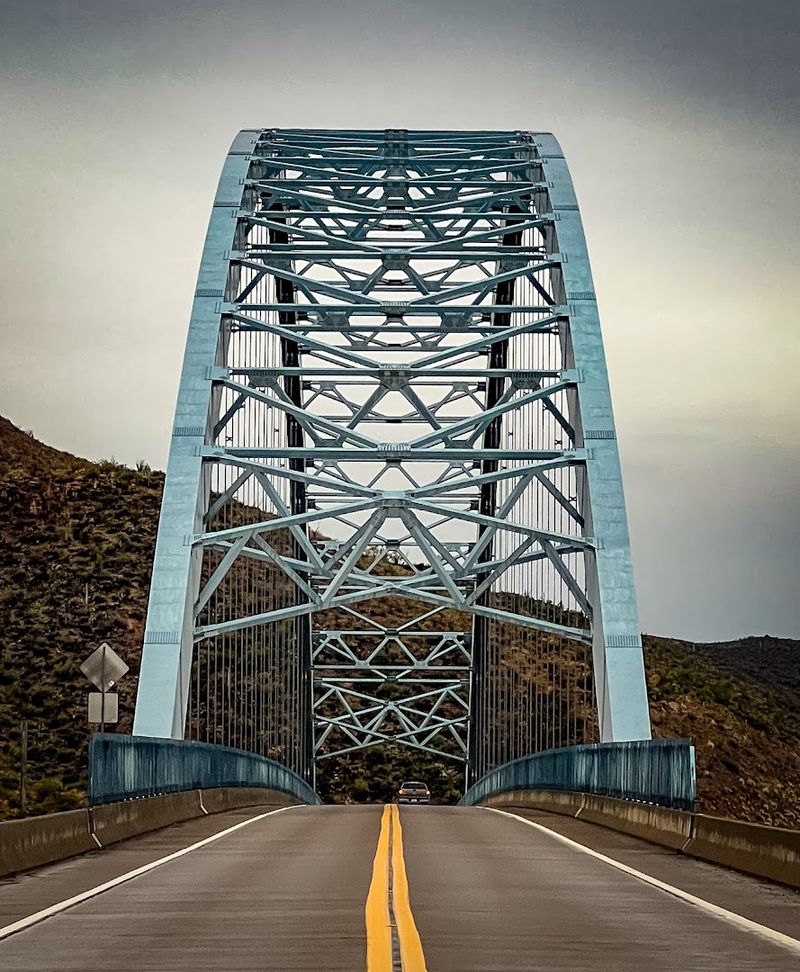
The two lanes feel perfectly adequate when you are sitting still looking at a photo, but at highway speed above a lake, they suddenly feel like a tightrope. Wind can add another layer of sensation, especially when you are in a taller vehicle.
The steel arch rises above the roadway on both sides, framing the sky like a dramatic movie set. By the time you reach the other side, you will likely want to turn around and do it again just to prove you can.
The History That Came Before The Bridge

Before this bridge existed, drivers crossed Theodore Roosevelt Lake by going directly over the dam itself. The original roadway on top of the dam was built to accommodate two Ford Model T automobiles passing side by side, which tells you everything you need to know about how old that design was.
As vehicles grew wider and heavier over the decades, the dam road was reduced to a single lane with traffic signals controlling the flow. The arrangement worked, but barely, and it became a genuine bottleneck for anyone trying to connect the two counties.
The push for a proper bridge gained momentum as traffic volumes increased and the limitations of the dam crossing became harder to ignore. Construction on the new bridge began in the late 1980s and wrapped up in 1990, finally giving drivers a modern, two-lane connection across the lake.
The dam still stands as a historic landmark nearby, and visitors can appreciate just how dramatically transportation in this corner of Arizona has changed over the past century. Progress rarely looks this scenic.
The Views That Make Every Nerve Worth It
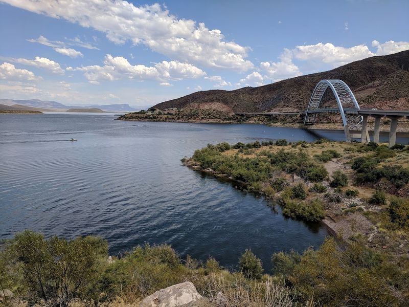
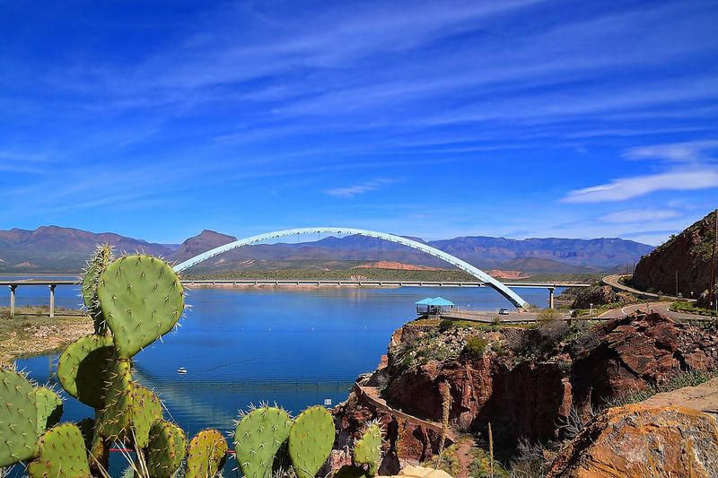
Few bridges in the American Southwest offer scenery this rewarding. From the middle of the span, you can see Theodore Roosevelt Lake stretching out in both directions, its water shifting between deep blue and green depending on the time of day and the season.
The surrounding Tonto National Forest fills the hillsides with saguaro cacti, palo verde trees, and rugged rock formations that glow amber and copper in the afternoon sun. It is the kind of view that makes you want to pull over, except there is nowhere to stop on the bridge itself.
Sunrise and sunset are the most dramatic times to cross. The light hits the water at low angles and turns everything golden, and the desert mountains in the background take on a painterly quality that no filter could improve.
Many photographers position themselves on the shoreline below to capture the bridge with the lake and landscape behind it. Whether you are behind the wheel or standing at the water’s edge, the visual reward here is genuinely hard to overstate.
Wildlife And Nature Around The Lake
The area surrounding Theodore Roosevelt Lake is part of Tonto National Forest, and that means the wildlife is as much a part of the experience as the bridge itself. Bald eagles have been spotted hunting over the lake, which always stops traffic in the most delightful way.
Great blue herons wade along the shoreline with their slow, deliberate patience, and osprey dive for fish in the shallower coves. If you time your visit between November and March, the chances of spotting a bald eagle increase significantly, since the lake is a known wintering ground for them.
Mule deer are common in the surrounding hills, and javelinas sometimes wander close to the road in the early morning hours. The lake itself supports largemouth bass, crappie, and catfish, making it a popular destination for anglers who set up along the banks.
The combination of desert terrain, open water, and diverse wildlife gives this area a layered richness that rewards slow exploration. Crossing the bridge is the headline act, but nature provides a full supporting cast.
Best Times To Visit And Practical Tips
Spring and fall are the sweet spots for visiting the Theodore Roosevelt Lake Bridge area. Temperatures in March, April, October, and November hover in the comfortable range that makes outdoor exploration genuinely pleasant rather than a test of endurance.
Summer in this part of Arizona can push well past 100 degrees Fahrenheit, which makes the drive less enjoyable and limits how long you can spend outside the car. If a summer visit is your only option, early morning crossings are the way to go before the heat takes full control of the day.
State Route 188 is well-maintained and easy to navigate from both the north and south. The town of Roosevelt sits nearby, and the broader Globe and Miami area to the south offers lodging, restaurants, and fuel.
Cell service can be spotty in the canyon stretches leading up to the bridge, so downloading offline maps before you leave is a smart move. Bring water, sunscreen, and a camera, because this is one of those drives that deserves to be remembered properly.
Why This Bridge Deserves A Spot On Your Arizona Road Trip
Arizona is full of spectacular roads, but the Theodore Roosevelt Lake Bridge earns its place among the most memorable for reasons that go beyond just being tall and long.
It connects history, engineering achievement, natural beauty, and that particular kind of road-trip thrill that reminds you why people love driving through the American West in the first place.
The bridge is not just a way to get from one county to another. It is a destination in its own right, and treating it that way changes how you experience the whole journey.
Adding this crossing to an Arizona road trip that already includes the Apache Trail Scenic Byway, Tonto Natural Bridge State Park, or even a detour toward Payson creates a route that feels genuinely curated rather than random.
The bridge sits at the intersection of adventure and awe, and that combination is rare. Once you have crossed it, turned around, and crossed it one more time just to be sure, you will understand exactly why drivers keep coming back to this particular stretch of central Arizona.