This 43 Mile Drive In Arizona Is A Nature Lover’s Scenic Dream
Sometimes you just need to roll down the windows, blast that playlist you’re embarrassed about, and let Arizona do the heavy lifting. This 43-mile stretch of pure, unfiltered joy winds through forests so green and cliffs so dramatic that you’ll forget you’re technically just driving, not starring in your own National Geographic special.
It’s the kind of route where you stop every five minutes for “just one more photo” until your phone begs for mercy.
Bring snacks, fill the tank, and clear your schedule, because once you hit that first overlook, you’ll realize you’ve accidentally planned the best unplanned day of your life. Your group chat is about to get very jealous of your Arizona adventure.
I was absolutely the person pulling over again even after promising myself the last stop was truly the last one. By the end of it, I headed home dusty, happy, and already plotting an excuse to do the whole drive again.
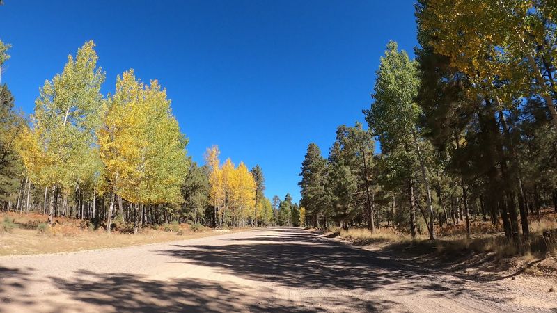
The Mogollon Rim Road Overview
Forest Road 300 is the kind of road that makes you slow down on purpose. Stretching 43 miles along the top of the Mogollon Rim near Payson, Arizona, this route is one of the most rewarding scenic drives in the entire Southwest.
The road sits at elevations ranging from about 7,000 to 8,000 feet, so the air feels noticeably cooler and fresher than down in the valley.
The drive runs east to west, connecting Arizona Highway 87 near Payson to the Show Low area, passing through the Tonto National Forest. Most of the road is unpaved and can get bumpy, especially after rain or snow.
A high-clearance vehicle is strongly recommended, though many standard SUVs handle it just fine in dry conditions.
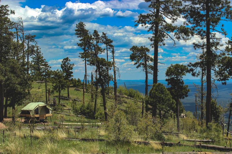
Plan to spend at least half a day, but honestly a full day is better. There are so many pull-offs, lakes, and trailheads along the way that rushing through would feel like reading only the first chapter of a really great book.
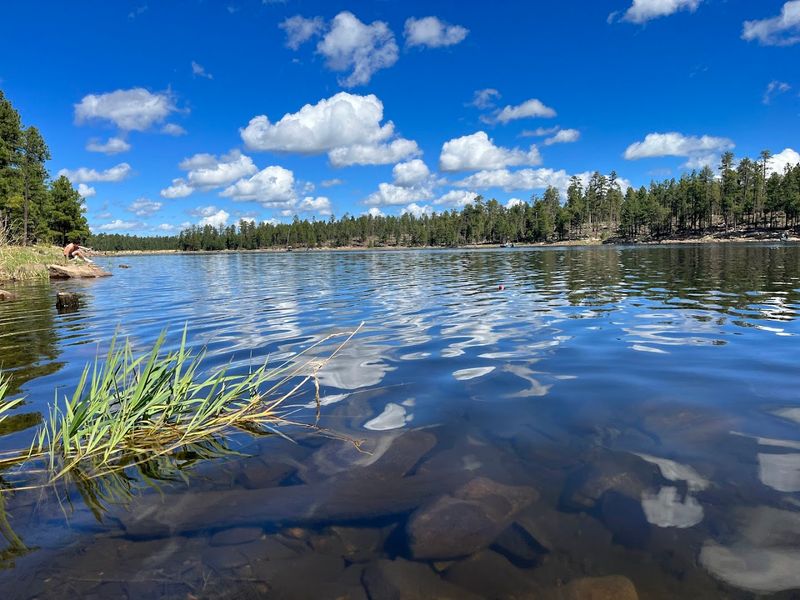
Woods Canyon Lake
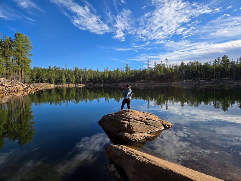
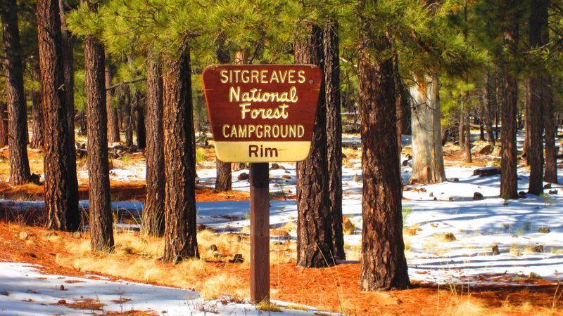
Woods Canyon Lake is arguably the crown jewel of the Mogollon Rim Road experience. Sitting at about 7,500 feet in elevation, this beautiful reservoir is nestled inside the Sitgreaves National Forest and is one of the most visited spots along the entire drive.
The lake has a calm, almost mirror-like surface that reflects the surrounding pines in a way that looks almost too perfect to be real. Fishing here is a genuine highlight.
The lake is regularly stocked with rainbow trout, catfish, and largemouth bass, making it a popular destination for anglers of all skill levels. A paved boat launch and rental facility make it easy to get out on the water even if you did not pack your own gear.
There is also a campground nearby with over 100 sites, a small store, and easy access to hiking trails. The Woods Canyon Lake Trail loops around the entire lake and offers consistently lovely views at every step of the roughly 2.5-mile path.
Bear Canyon Lake
If Woods Canyon Lake feels a little too busy for your taste, Bear Canyon Lake is the quieter sibling just a short drive away. This smaller reservoir sits off a dirt spur road and attracts visitors who prefer a more peaceful, off-the-beaten-path kind of afternoon.
The surrounding landscape is rugged and raw, with rocky outcroppings mixing in among the pine trees in a way that feels wonderfully untamed. Bear Canyon Lake is open to non-motorized boats only, which keeps the water calm and the atmosphere serene.
Kayakers and canoeists love this spot for that exact reason. Fishing is also popular here, with the lake stocked with trout and offering a genuinely satisfying catch-and-release experience.
The lack of a big campground or store nearby actually adds to its charm. You get the feeling you have found something that most people drove right past, and that quiet sense of discovery is exactly the kind of reward that makes a long scenic drive feel completely worth it.
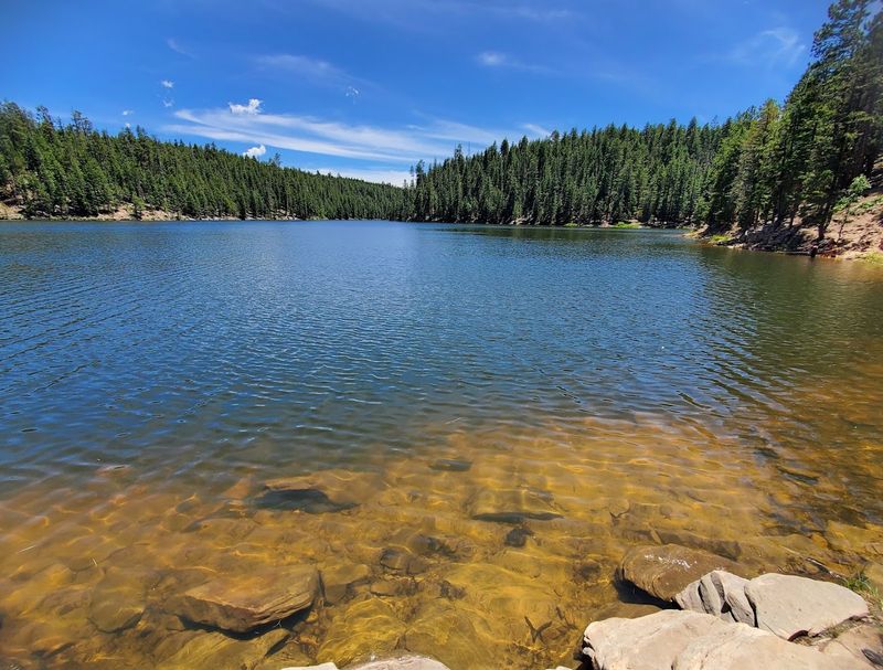
Willow Springs Lake
Tucked away along the eastern stretch of Forest Road 300, Willow Springs Lake is a favorite among locals who know the Rim Road well.
At roughly 7,500 feet in elevation, the lake stays cool even during Arizona’s famously hot summers, making it a refreshing escape from the scorching desert temperatures just a few thousand feet below.
The lake is stocked regularly with rainbow trout and is open to boats with electric motors, which keeps things peaceful without eliminating the fun of getting out on the water. A small campground sits nearby, and the surrounding area offers easy walking paths that are suitable for families with younger kids.
One thing that sets Willow Springs apart is how photogenic it is at sunrise. The early morning light filters through the pines and hits the water at an angle that turns the whole scene golden.
Serious photographers and casual smartphone snappers alike tend to linger here much longer than they originally planned, and nobody ever seems to mind.
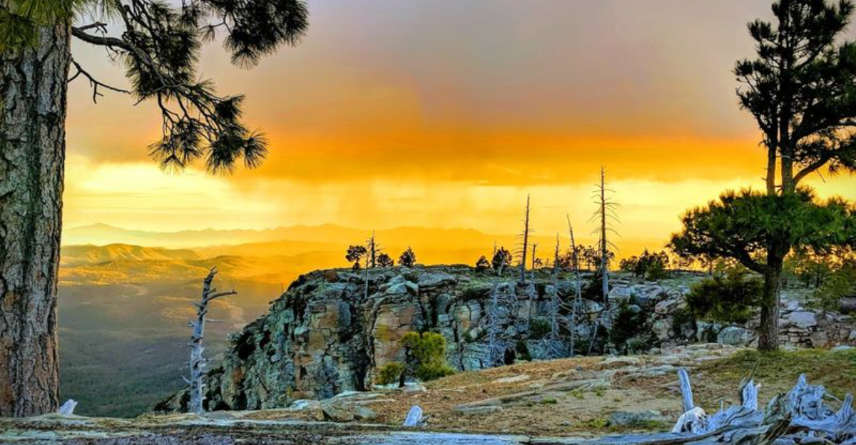
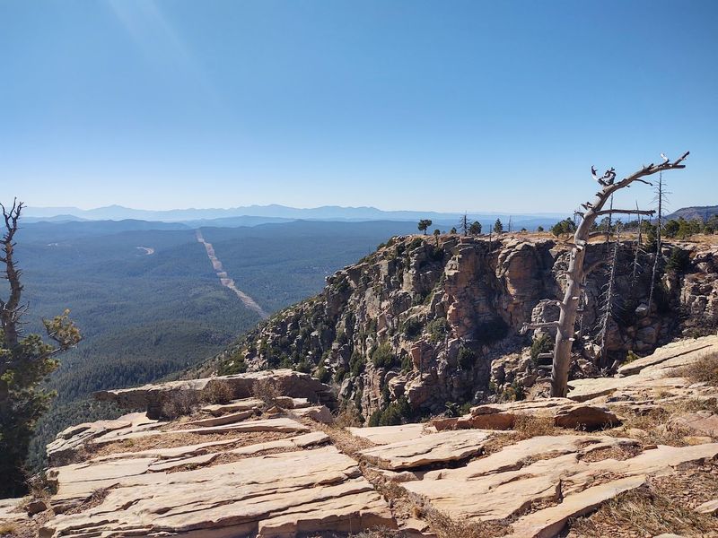
Scenic Overlooks Along The Rim
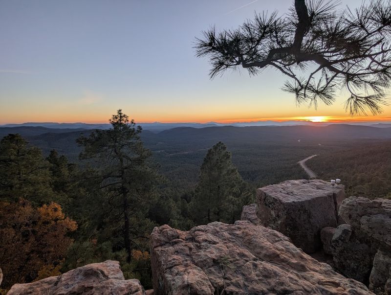
Standing at the edge of the Mogollon Rim feels like the earth just dropped away beneath you. The rim itself is an escarpment that drops nearly 2,000 feet in some places, and the views from the overlooks along Forest Road 300 are genuinely breathtaking.
You can see ridgeline after ridgeline fading into the hazy blue distance, covered in an unbroken blanket of forest. Several pullouts along the road give you easy access to these viewpoints, and most of them require nothing more than parking and walking a few steps to the edge.
Sunrise and sunset are particularly stunning from these spots, when the light turns the canyon walls shades of orange and pink that no filter could improve on.
Photographers, hikers, and casual visitors all tend to gravitate toward these overlooks as the emotional highlight of the drive.
There is something about standing at the rim’s edge, looking out over that enormous sweep of wild Arizona landscape, that puts everyday life in a very different and refreshing perspective.
Wildlife Watching Opportunities
The Mogollon Rim corridor is one of the best places in Arizona to spot wildlife in a natural, undisturbed setting. Elk are the showstoppers here, and large herds are commonly seen grazing in the meadows that open up along Forest Road 300, especially in the early morning and late evening hours.
Mule deer are equally common and often seem completely unbothered by passing vehicles. Birdwatchers will find plenty to get excited about as well.
The dense ponderosa pine forest supports a rich variety of species, including Steller’s jays, red-tailed hawks, wild turkeys, and the occasional bald eagle soaring above the rim’s edge. Bring a good pair of binoculars and a field guide if birds are your thing.
Black bears also live in this area, though sightings are less frequent. Keeping a respectful distance from any wildlife you encounter is essential, both for your own safety and for the well-being of the animals. The Mogollon Rim rewards patience, and patient observers are almost always rewarded in return.
Hiking Trails Along The Drive
Forest Road 300 is not just a drive you sit through passively. It is a jumping-off point for some genuinely excellent hiking in the Tonto and Sitgreaves National Forests.
The General Crook Trail, a historic route that follows portions of the Rim, intersects with Forest Road 300 in several places and offers a fascinating mix of history and natural scenery for hikers of moderate fitness.
Shorter walks near the lakes and overlooks are perfect for families or anyone who wants to stretch their legs without committing to a full-day trek. Trails near Woods Canyon Lake are especially well-marked and easy to follow, making them a reliable choice for first-time visitors to the area.
For more experienced hikers, the rugged terrain below the rim offers off-trail exploration that feels genuinely wild. Topo maps and a solid understanding of navigation are useful tools down there.
No matter your fitness level, the Mogollon Rim has a trail that fits, and every single one of them feels like a reward.
Tips For Visiting The Mogollon Rim Road
A little preparation goes a long way on Forest Road 300. The road is mostly unpaved and can develop deep ruts or muddy patches after rain, so checking current conditions before you head out is genuinely smart.
The Mogollon Rim Visitor Center, located near the junction of Highway 87 and Forest Road 300, is a great first stop for maps, trail information, and up-to-date road reports.
Bring more water than you think you need. The elevation and dry air can be deceptively dehydrating, especially if you plan to hike.
Cell service is spotty to nonexistent along most of the route, so downloading offline maps before you leave Payson is a practical move that will save you from any unnecessary confusion.
The best time to visit is late spring through early fall, when the road is most accessible and the wildflowers are often blooming along the roadside. Summer afternoons can bring afternoon thunderstorms, so starting early in the day keeps you ahead of the weather and gives you the best light for photos and wildlife spotting.