This 7-Mile Drive In Arizona Takes You Past Spectacular Canyons And Red Rocks
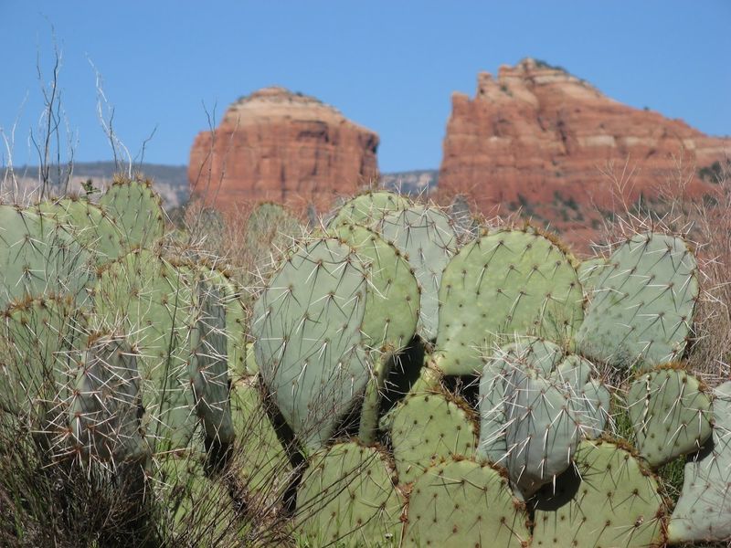
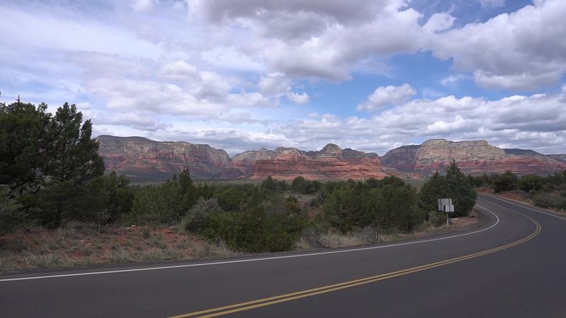
We’ve all been on those road trips where you’re staring at nothing but flat pavement for hours, but this little seven-mile adventure is the exact opposite. Every inch of this winding path is packed with those massive, fiery red rock formations that Arizona is so famous for.
It’s almost unfair how much scenery is crammed into such a short drive, like the earth decided to show off all its best features in one spot.
Honestly, my neck usually ends up a little sore from trying to look at the canyons on both sides at once, but it’s a small price to pay for views this dramatic. If you’re looking for a quick escape that feels like a massive grand tour, this little stretch of Arizona is calling your name.
The Start Of The Journey: West Sedona Entry Point
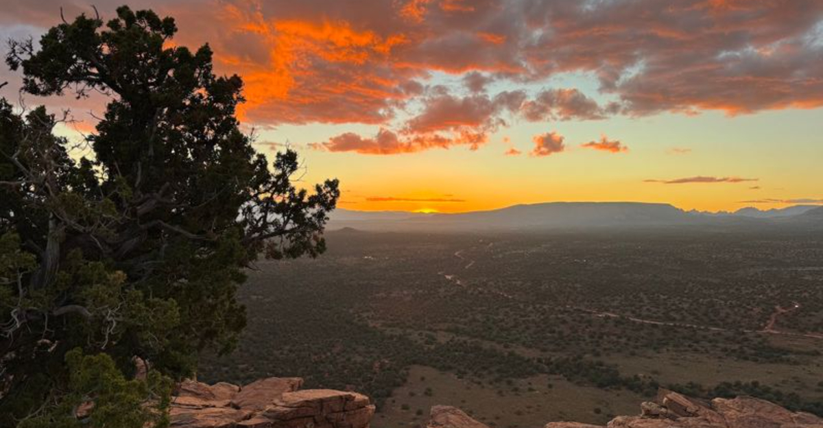
Before you even leave the pavement behind, the drive announces itself with a bold visual welcome. The journey begins at the intersection of State Route 89A and Dry Creek Road in West Sedona, Arizona, where the landscape immediately shifts from roadside shops to raw desert beauty.
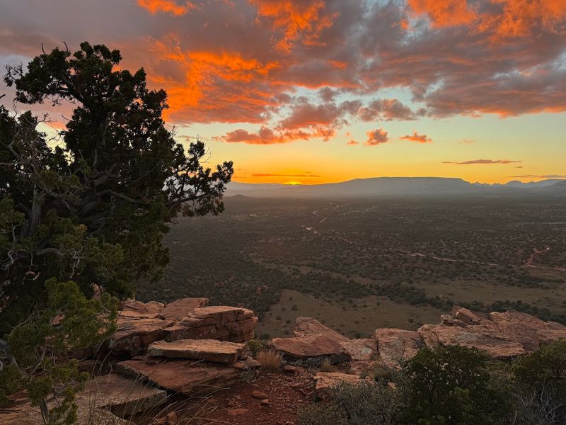
Red rock buttes rise on the horizon like ancient sentinels, and the air carries that unmistakable high-desert warmth.
The first stretch of Dry Creek Road is paved, making it accessible for most vehicles. This is a great spot to roll down the windows, slow your pace, and let the scenery take over. Many visitors stop here for a quick photo before heading deeper into the route.
Starting early in the morning gives you softer light and fewer crowds, which makes the colors of the rock formations look even more vivid. A full tank of gas and a good playlist are your best companions for what comes next on this unforgettable 7-mile stretch.
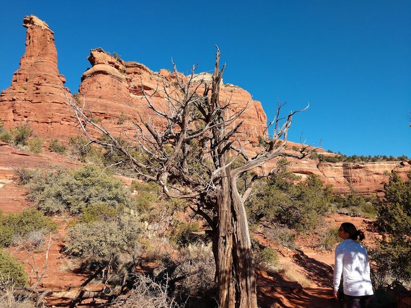
Vultee Arch Trail: A Sandstone Surprise
Tucked along the Dry Creek Road corridor, the Vultee Arch Trail is the kind of side trip that turns a scenic drive into a full-on adventure. This moderate 3-mile round-trip hike leads through a narrow canyon shaded by canyon walls before opening up to reveal a stunning natural sandstone arch overhead.
The arch itself is named after Gerard Vultee, an aviation pioneer whose plane went down near this area in 1938.
The trail winds through Oak Creek’s tributary terrain, and hikers are rewarded with panoramic views of the surrounding red rock landscape near the top. Wearing sturdy shoes and carrying water is strongly recommended, especially during warmer months when temperatures climb quickly.
Most hikers complete the trail in about one and a half to two hours at a relaxed pace. The moment you spot the arch framing the bright Arizona sky above you, every step of the climb feels completely worth it. This trail is a true highlight of the Dry Creek Road experience.
Boynton Canyon Vortex: Where Energy Meets The Earth
Few spots along Dry Creek Road carry as much mystique as the Boynton Canyon Vortex, a site that draws both spiritual seekers and curious travelers from all over the world. Sedona is famous for its vortex sites, and Boynton Canyon is considered one of the most powerful among them. Visitors often describe a tingling sensation or a deep sense of calm when standing near the vortex location.
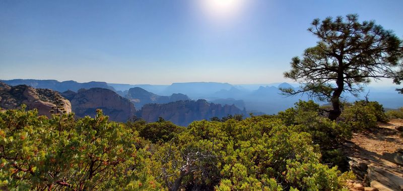
The Boynton Canyon Trail itself is a rewarding 6-mile round-trip hike that passes through towering red canyon walls, lush riparian vegetation, and ancient Sinagua cliff dwellings.
Even if the energy vortex concept is new to you, the sheer beauty of the canyon makes every step deeply satisfying. Arriving early is key here, as the trailhead parking fills up fast, especially on weekends.
The canyon feels almost cathedral-like in the morning light, with golden rays bouncing off the rust-colored walls in ways that make you stop and simply stare. It is a moment that stays with you long after you leave.
Doe Mountain Trail: Big Views, Easy Effort
Not every great hike needs to be a grueling all-day commitment, and Doe Mountain Trail is proof of that. This relatively easy 1.5-mile round-trip trail ascends the mesa-like summit of Doe Mountain, and what waits at the top is a 360-degree panorama of Sedona’s most iconic red rock scenery.
The climb itself is short but steep in sections, so trekking poles can be helpful for those who want extra stability.
Once you reach the flat summit plateau, the views stretch out in every direction across canyons, buttes, and the distant Verde Valley. It feels like standing on the roof of the desert, with the wind picking up and the silence broken only by the occasional hawk circling overhead.
Families with older kids tend to love this trail because the payoff is massive relative to the effort. Sunset hikes here are particularly popular, turning the entire landscape into shades of deep orange and rose. Pack a snack, find a flat rock, and soak it all in without any rush.
Bear Mountain Trail: The Summit That Earns Its Reputation
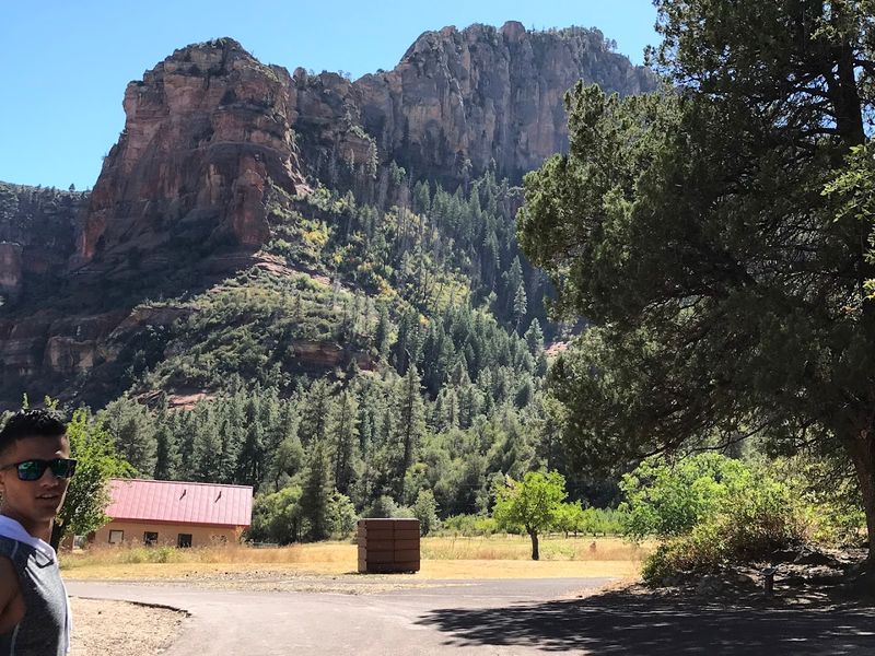
Bear Mountain Trail is not for the faint of heart, and it wears that reputation proudly. This challenging 5.5-mile round-trip hike gains about 2,000 feet in elevation as it climbs to the summit of Bear Mountain, one of the most rewarding peaks accessible from Dry Creek Road.
The trail involves scrambling over rocky ledges and navigating steep switchbacks that demand full attention and solid hiking footwear.
What makes the effort worthwhile is the summit view, which stretches across the entire Sedona basin and beyond. On a clear day, you can see for miles in every direction, with the red rock formations below looking almost miniature from that height.
Hikers should start early, carry at least two liters of water per person, and avoid the trail during extreme heat. The route is well-marked but physically demanding, so building in extra time is a smart move. Reaching that summit feels like a genuine personal achievement, the kind you talk about for weeks after getting home.
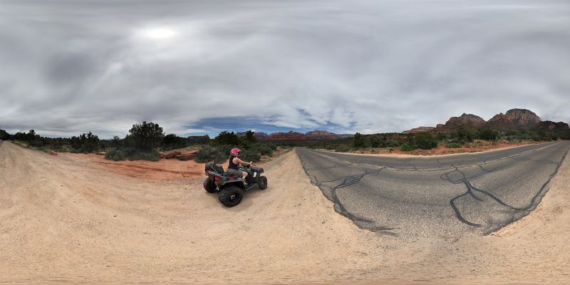
Road Conditions And What to Expect Off The Pavement
One thing that surprises many first-time visitors is how quickly Dry Creek Road transitions from smooth pavement to rugged unpaved terrain.
The initial stretch leaving West Sedona is paved and perfectly comfortable for any vehicle, but the road eventually turns to packed dirt and loose gravel as it pushes deeper into the canyon country.
After rainfall, the unpaved sections can become slippery and muddy, making a high-clearance vehicle or an AWD SUV the smarter choice for exploring the full route. Passenger cars can still enjoy a significant portion of the drive, but knowing your vehicle’s limits before heading out is always wise.
Checking weather forecasts ahead of your visit helps avoid getting caught on wet unpaved roads, which can be tricky to navigate safely. Dry Creek Road lives up to its name best during the drier months of spring and fall, when the surface is firm and the temperatures are pleasant.
Carry a paper map or download an offline version since cell service can be inconsistent along the route.
Permits, Passes, And Planning Your Visit
Planning ahead makes a real difference when visiting Dry Creek Road, and the permit situation is one detail that catches unprepared visitors off guard. Parking along the road at trailheads requires a Red Rock Pass or an America the Beautiful annual pass, and rangers do check vehicles regularly.
Day-use passes can be purchased online through the Coconino National Forest website or at local visitor centers in Sedona. The America the Beautiful pass is a fantastic investment for anyone planning multiple national forest or park visits in a single year, covering the fee for this area and hundreds of others across the country.
Single-day passes are also available if this is a one-time trip. Weekends between March and May are the busiest periods, so arriving before 8 a.m. helps secure trailhead parking before the lots fill up.
Bringing cash as a backup is useful since some self-service kiosks can have technical issues. A little preparation upfront means more time enjoying the views and less time stressing over logistics once you arrive.
Wildlife And Desert Life: What To Watch For Along The Way
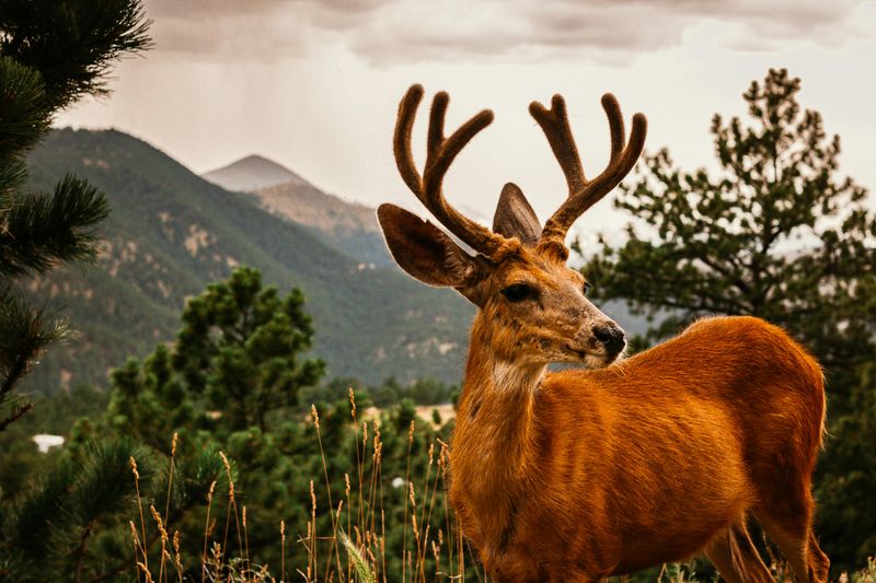
Most people keep their eyes on the canyon walls during this drive, but the living desert around you is just as worth watching. Mule deer often graze near the roadside in the early morning hours, and red-tailed hawks circle overhead scanning the rocky terrain below.
Collared lizards dart across sun-warmed boulders, and if you stop and listen, you might catch the call of a canyon wren echoing off the cliffs.
Spotting wildlife here feels effortless, almost like the animals know they own the place. Bring binoculars if you have them, and move slowly through the area to avoid startling animals or missing those quiet, easy-to-overlook moments that make a desert drive truly memorable.
The changing light also makes a big difference, especially in the softer hours near sunrise and sunset. Shadows stretch across the rock formations, colors deepen, and even familiar views start to feel more dramatic.
It is the kind of place where pulling over for one quick look can easily turn into a much longer stop. Between the wildlife, the silence, and the sheer beauty of the landscape, this drive leaves an impression that lingers long after the road ends.