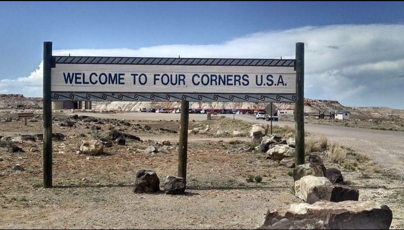
This Famous Landmark In Arizona Lets You Stand In Four States At Once
I stepped onto that little pink‑and‑white disc, and for a fleeting instant I felt like a walking, breathing, multistate GPS glitch. Arizona on my left foot, Utah on my right, New Mexico behind me, and Colorado stretching out ahead.
It’s a weird, wonderful kind of geography‑themed magic trick that turns an ordinary road trip into a story you can’t help but retell at every dinner party.
This place makes this geographic oddity not just possible but downright fun. Arizona lets you hop between states faster than you can say “road trip.”
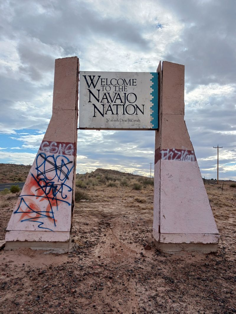
I visited this high desert landmark expecting a quick photo op and left with a deeper appreciation for how borders work and how the Navajo Nation has transformed this intersection into a celebration of culture and geography.
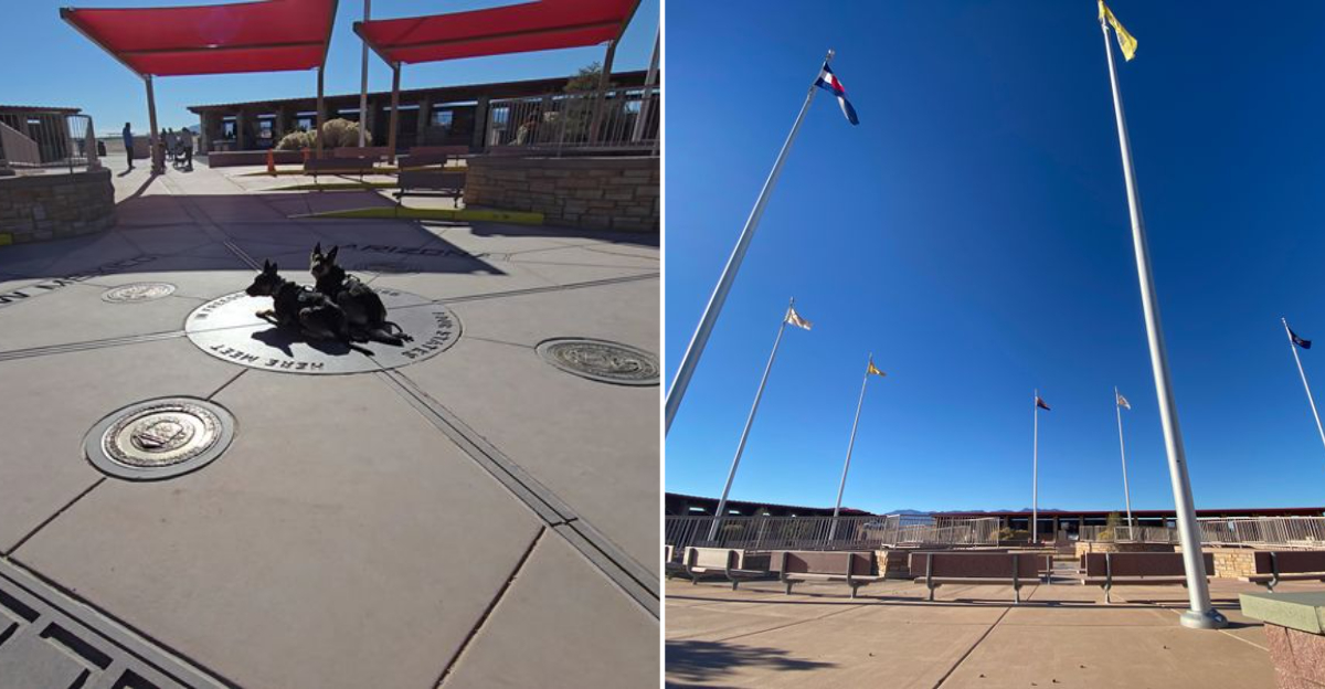
Standing On The Quadripoint
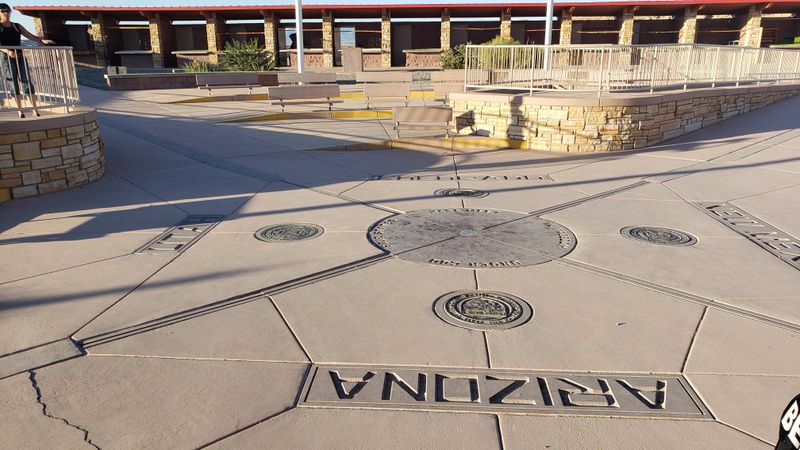
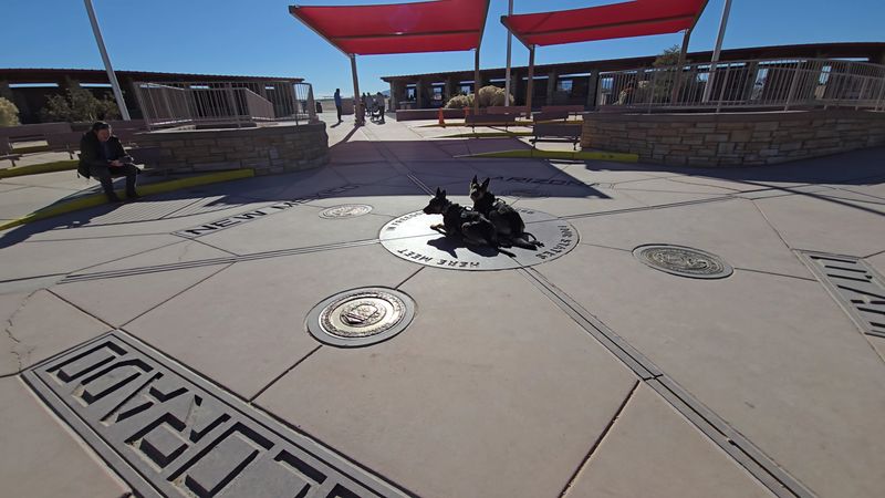
Walking up to that granite disk embedded with bronze feels oddly ceremonial, like approaching a stage where geography becomes performance art. The monument itself sits as the only quadripoint in the United States, meaning four states touch at exactly one coordinate rather than forming separate border lines.
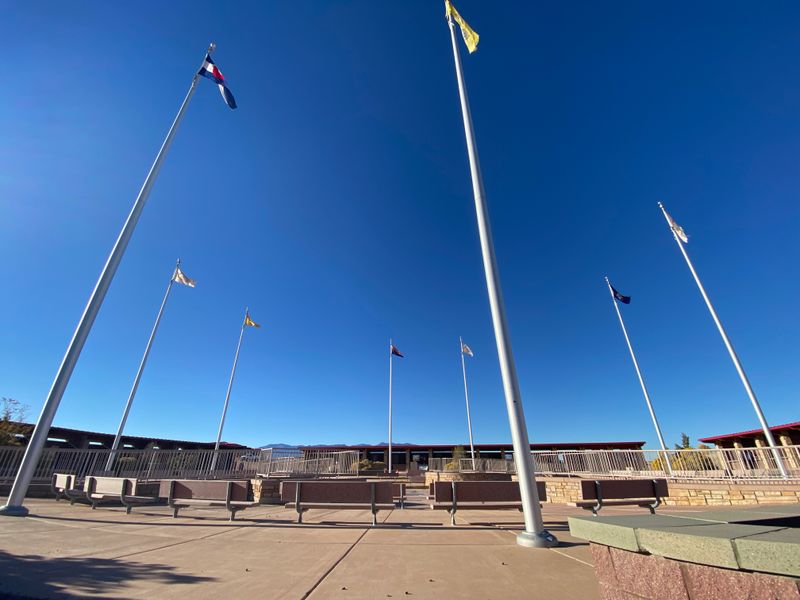
I crouched down and placed one hand in Arizona, another in Colorado, a foot in New Mexico, and my remaining foot in Utah, feeling simultaneously ridiculous and delighted. Flags representing each state and the original tribal nations flutter above the marker, adding color and movement to the otherwise stark desert setting.
The disk itself has been reconstructed multiple times since 1912, evolving from a simple cement pad to the current polished granite and brass design that withstands thousands of tourists annually.
Photos here become instant conversation starters because nobody else back home can claim they occupied four states in a single snapshot.
Visiting Four Corners Monument during early morning or late afternoon provides softer light and smaller crowds, making your quadripoint moment feel more personal and less like waiting in line at an amusement park.
Navajo Artisan Market Experience
Surrounding the monument, Navajo vendors set up stalls that transform this geographic curiosity into a genuine cultural exchange. Silver catches sunlight as artisans shape turquoise into earrings, necklaces, and rings using techniques passed down through generations of skilled craftspeople.
I spent nearly an hour chatting with one vendor about the symbolism in her basket weaving patterns, learning how each design tells stories about water, mountains, or spiritual journeys.
Hand-woven rugs hang from booth frames, their geometric patterns so precise they look machine-made until you realize every thread was positioned by human hands working traditional looms.
Managed by the Navajo Nation Parks and Recreation Department and located at 597 NM-597, Teec Nos Pos, this spot attracts curious travelers who want to literally straddle state lines while surrounded by stunning plateau landscapes and local artisans sharing their crafts.
Prices here often beat what you’d pay in Santa Fe or Sedona galleries because you’re buying directly from makers rather than through retail markups. Ceremonial baskets, pottery, and beadwork fill tables alongside more affordable souvenirs like keychains and magnets for budget-conscious visitors.
Purchasing here supports families who maintain traditional arts in an increasingly modern economy, making your souvenir meaningful beyond just remembering where four states meet on a map.
Frybread And Traditional Foods
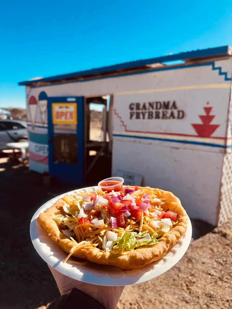
Hunger hit me about twenty minutes into my visit, and the aroma of frybread frying in hot oil made waiting impossible. Food vendors near the monument serve Navajo tacos, which pile seasoned meat, lettuce, cheese, and salsa onto pillowy frybread that’s crispy outside and tender within.
Frybread itself carries complex history as a food born from hardship during the Long Walk period, yet it has become a beloved staple that connects modern Navajo families to their resilience and adaptability.
I watched vendors expertly stretch dough into circles before dropping them into sizzling oil, each piece puffing up like edible clouds.
Beyond tacos, you’ll find mutton stew, blue corn mush, and other traditional dishes that taste nothing like standard roadside fare. Eating here becomes part of the experience rather than just fuel for your journey, offering flavors shaped by high desert ingredients and centuries of culinary knowledge.
Bringing cash helps since not all vendors accept cards in this remote location where cell service and payment infrastructure remain limited compared to urban tourist destinations.
Remote Desert Location And Planning
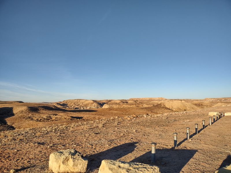
Getting here requires commitment since the monument sits approximately 40 miles southwest of Cortez, Colorado, reached via U.S. Highway 160 through landscape that feels more Mars than mainland America.
Limited services within a 30-mile radius mean you can’t just wing it and hope to find a convenience store when you need water or snacks.
I learned this lesson when my water bottle ran dry faster than expected under the high desert sun, which beats down with intensity amplified by elevation and lack of shade.
The nearest towns offering full services are Cortez, Farmington, and Shiprock, each requiring significant driving time that eats into your day.
Cell phone coverage here ranges from weak to nonexistent depending on your carrier, so downloading maps beforehand prevents frustration when GPS signals vanish mid-navigation.
Self-service gas stations exist within reasonable distance, but fuel prices run higher than urban areas due to transportation costs.
Packing extra water, sunscreen, hats, and snacks transforms your visit from potentially uncomfortable to genuinely enjoyable, letting you focus on the experience rather than basic survival needs in this beautiful but unforgiving environment.
Bringing a first-aid kit and knowing basic desert safety tips adds another layer of preparedness that can save a lot of stress. Timing your visit for early morning or late afternoon not only avoids the peak sun but also offers the best lighting for photography and a more serene experience.
Photography And Social Media Moments
Everyone arrives with the same mission: capture that perfect shot proving they simultaneously occupied four states without quantum physics. The bronze disk’s design makes positioning easy since each state name is clearly marked, guiding your limbs to their proper geographic zones.
I watched visitors get creative with yoga poses, handstands, and elaborate formations when families tried fitting everyone into the frame at once.
The monument’s circular design and surrounding plaza provide enough space that photographers can step back for wider angles without bumping into other tourists.
Midday sun creates harsh shadows that flatten features and wash out colors, while golden hour lighting adds warmth and dimension that makes photos pop on Instagram feeds. Bringing a small tripod or asking fellow visitors to snap your photo works better than selfie attempts that rarely capture the full monument context.
Beyond the obvious quadripoint shot, the surrounding landscape offers dramatic backdrops with mesas, sagebrush, and endless sky that photograph beautifully when you tire of the standard tourist pose everyone else is attempting.
Taking the extra effort to plan your route, stops, and supplies allows you to fully immerse yourself in the stark, otherworldly beauty of the high desert without distraction.
Historical Evolution Of The Marker
Originally established in 1912, the first marker was nothing fancy, just a basic cement pad marking where surveyors determined four territories met before Arizona and New Mexico even achieved statehood.
Over decades, weather, foot traffic, and the desire for something more permanent led to multiple reconstructions using increasingly durable materials.
The current granite and brass design feels substantial enough to withstand another century of tourists while looking polished enough to photograph well for modern visitors expecting Instagram-worthy landmarks.
Maintained by the Navajo Nation Parks and Recreation Department, the monument receives regular upkeep that preserves both its accuracy and appearance.
Controversy occasionally surfaces about whether the marker sits at the exact surveyed point, with some claiming it’s slightly off due to 19th-century surveying limitations.
Regardless of whether it’s precisely accurate to modern GPS standards, the legal boundary remains wherever the monument stands, making arguments about placement more academic than practical.
This evolution reflects how we’ve transformed geographic curiosities into managed attractions that balance preservation, access, and cultural significance while generating revenue for the communities maintaining them.
Practical Visiting Information
The monument operates daily from 8:00 AM to 5:00 PM, with admission set at $8.00 per person while children under seven enter free, making it reasonably affordable for families. Cash works best since payment systems in remote locations sometimes fail when technology decides to take an unscheduled vacation.
I arrived mid-morning on a Wednesday and found moderate crowds that allowed for photos without excessive waiting, though summer weekends apparently pack the plaza with tour buses and road-trippers.
Facilities remain basic with portable restrooms and vendor stalls rather than elaborate visitor centers found at more developed national parks.
The high desert climate means temperatures swing dramatically between seasons, with summer heat reaching uncomfortable levels while winter can bring surprisingly cold conditions and occasional snow. Spring and fall offer the most pleasant weather for standing on hot granite while attempting creative photography poses.
Planning your visit as part of a larger Southwest road trip makes the most sense since the monument’s remote location means you’re already committed to serious driving through spectacular but sparsely populated territory that rewards those who appreciate wide-open spaces and geographic oddities.