
This Illinois Coal Town Vanished So Completely That Only a Marker Shows Where It Stood
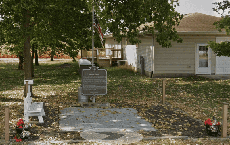
Somewhere in northeastern Livingston County, Illinois, a coal town called Cardiff once hummed with miners, merchants, and the constant noise of underground work. By 1912, the mines had closed, and the settlement faded so thoroughly that fields and farmland swallowed nearly every trace of it.
No preserved streets wait for curious visitors, no row of abandoned storefronts lines a crumbling road. What remains is a historical marker, a memorial, and a story worth knowing before you ever point your car in that direction.
Cardiff vanished instead of becoming a walkable ghost town
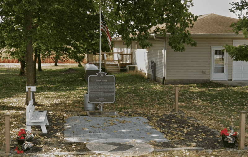
Travelers who arrive in northeastern Livingston County expecting to stroll through Cardiff’s original streets will find something far quieter: open farmland, a historical marker, and the faint outline of a community that time erased. According to the University of Illinois Mythic Mississippi Project, Cardiff’s former homes, businesses, yards, and street corridors have largely disappeared or reverted to farmland, leaving a marker to indicate where the settlement once stood.
That distinction matters enormously for anyone planning a visit. Cardiff is not an intact ghost town with creaking storefronts and rutted lanes you can photograph from every angle.
The site qualifies as a former, or lost, coal town, one whose physical presence was so thoroughly dismantled or reclaimed that the land itself gives little away.
The article you are reading describes a historical location, not a maintained attraction. The marker may serve as a reference point for understanding what once existed here, but the surrounding parcels are not a public archaeological preserve, and nothing in the documented record supports the idea that original coal-mining streets are available for recreational walking.
Cardiff’s real value lies in its history, and that history is worth understanding fully before you decide whether the drive is right for you.
A coal settlement took shape in 1899

Cardiff, Illinois, came into existence in 1899, built from scratch around a promising underground coal deposit in northeastern Livingston County. The settlement sat between the small communities of Campus and Reddick, tucked into a part of the state where coal-bearing rock lay close enough to the surface to make extraction commercially attractive.
Its founders named the town after Cardiff, Wales, one of the most famous coal-exporting cities in the world at the time, a choice that signaled the settlers’ ambitions and their familiarity with the mining trade.
The Herscher Area Historical Society places Cardiff squarely between Campus and Reddick and connects the community’s entire existence to the fortunes of its mines. When the coal came out of the ground, Cardiff had a reason to exist.
When it stopped, the town had none. That straightforward dependency shaped every aspect of life there, from the speed with which the settlement grew to the completeness with which it later disappeared.
The coal itself was geologically unusual. Illinois State Geological Survey records describing the Cardiff coal bed identify the deposit as a channel-fill formation, meaning the coal occupied an ancient river channel rather than spreading across a wide, predictable seam.
In places, the deposit reportedly reached approximately twelve feet in thickness, a figure that would have made the find look very attractive to early investors. That same localized character, however, also set a ceiling on how long the resource could sustain a full community.
Two underground mines drove Cardiff’s brief boom
Cardiff’s coal economy ran on two separate underground operations, and their histories diverged sharply. Illinois State Geological Survey mine records for the Campus quadrangle document the Cardiff Coal Company’s No. 1 mine as operating from 1899 to 1903, and the No. 2 mine as continuing through 1912.
Those dates bracket the entire lifespan of the settlement: the town was born when the first shaft opened and effectively died when the second one closed.
The No. 1 mine was the original operation, sunk at the start of Cardiff’s existence and put to work extracting coal from the channel-fill deposit that had attracted investors in the first place. Production records and shaft location data survive in the ISGS files, offering researchers a surprisingly detailed picture of where the underground workings extended and how much coal came out during active years.
Those records are historical documents, not route guides, and the shaft locations they describe are sealed or abandoned workings rather than features visitors should seek out.
The No. 2 mine picked up where the first left off, sustaining the community through Cardiff’s middle years and into the early twentieth century. The Cardiff coal bed’s channel-fill character meant that the deposit, however thick in spots, was also limited in extent.
Miners could follow a rich seam for a while, but the geology set a hard boundary on how far the resource could carry the town. By 1912, that boundary had been reached, and Cardiff’s reason for existing disappeared along with the last productive coal.
Explosions and mine closure ended Cardiff’s momentum
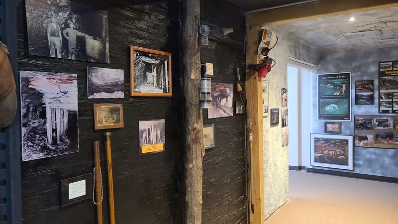
Before the No. 2 mine quietly ran its course, Cardiff’s No. 1 mine ended with a series of violent incidents that left a permanent mark on the settlement’s history. ISGS mine records for the Campus quadrangle document three separate explosions at the No. 1 mine in 1903, attributing them to gas ignitions in old workings.
The mine was abandoned after those events, a decision that reflected both the physical destruction underground and the practical impossibility of safely continuing operations in a gas-prone environment.
Gas explosions in underground coal mines were not rare in the early twentieth century, but three in a single year at one operation represented a serious and concentrated disaster. The records treat these as documented industrial incidents rather than mysterious occurrences, and that framing is the right one.
Cardiff’s miners faced the same occupational dangers that coal workers across Illinois confronted during that era, and the 1903 explosions belong in the category of industrial history rather than legend.
The No. 2 mine avoided a similarly dramatic end but closed in 1912 for reasons that were equally final. Historical accounts of Cardiff’s decline point to coal quality as a contributing factor, with some sources specifically citing the Wabash Railroad’s reported refusal to purchase Cardiff coal as a blow the community could not absorb.
Whether that refusal reflected the coal’s characteristics, market conditions, or both, the Herscher Area Historical Society confirms that the closure led directly to Cardiff’s demise. With no rail buyer and no working mine, there was simply nothing left to hold the town together.
A marker and memorial preserve Cardiff’s memory
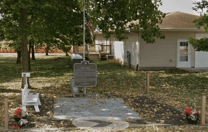
Physical evidence of Cardiff today comes down to two commemorative features rather than a townscape. The University of Illinois Mythic Mississippi Project notes that a historical marker indicates where Cardiff once stood and suggests the location has potential as a historical-archaeology site, largely because historical maps and photographs of the settlement survive.
Those surviving records are the closest thing Cardiff has to a preserved presence: paper images and mapped coordinates that allow researchers and curious visitors to reconstruct, at least in their minds, what once occupied the land.
The Herscher Area Historical Society references a Cardiff Memorial as the principal commemorative feature associated with the former community. A memorial, by definition, marks absence rather than presence.
It acknowledges that something meaningful existed here without pretending that the original fabric of the town survived intact. Former streets, house lots, business blocks, and the infrastructure of daily mining life have disappeared, replaced by the farmland and open fields that characterize the surrounding area today.
Historic maps and photographs of Cardiff are research tools, not visitor guides. They can help a reader imagine where the main street ran, where the mine shafts opened, or where workers’ housing clustered around the operation.
But they do not establish that those locations are publicly accessible, archaeologically visible, or safe to approach on foot. The marker and memorial, if confirmed as currently accessible, represent the appropriate stopping point for anyone who wants to connect with Cardiff’s history without crossing into private land or disturbing the ground above abandoned mine workings.
Current access requires verification before any visit

No documented public walking route exists through Cardiff’s former streets. Sources describe the site as a location identified by a marker and a memorial, surrounded by farmland and rural parcels that belong to private landowners.
Before making the drive, anyone interested in visiting should contact the Herscher Area Historical Society, local county authorities, or relevant landowners to confirm whether the marker or memorial is currently accessible, where legal parking exists, and whether any signage directs visitors to a confirmed public viewing point.
The Mythic Mississippi Project’s Cardiff page frames the site as a historical reference location rather than a maintained attraction. That framing carries a practical implication: the surrounding fields, farm lanes, and rural roads near the marker are not automatically public property simply because a historical feature stands nearby.
Illinois DNR guidance on cemetery access makes a related point explicit, stating that there is no general right of access across private land to reach a historical feature, even one of recognized significance.
Treating a gravel lane as a public trail, or assuming that an unmarked path through a field is an invitation to walk, can put visitors in legal jeopardy and damage relationships between the public and the landowners who steward the land around historical sites. The Herscher Area Historical Society is the most practical starting point for anyone who wants current, accurate information about what is accessible and how to approach the site respectfully.
Calling ahead costs nothing and avoids the risk of an uncomfortable encounter on someone’s private property.
Abandoned mine features can remain dangerous
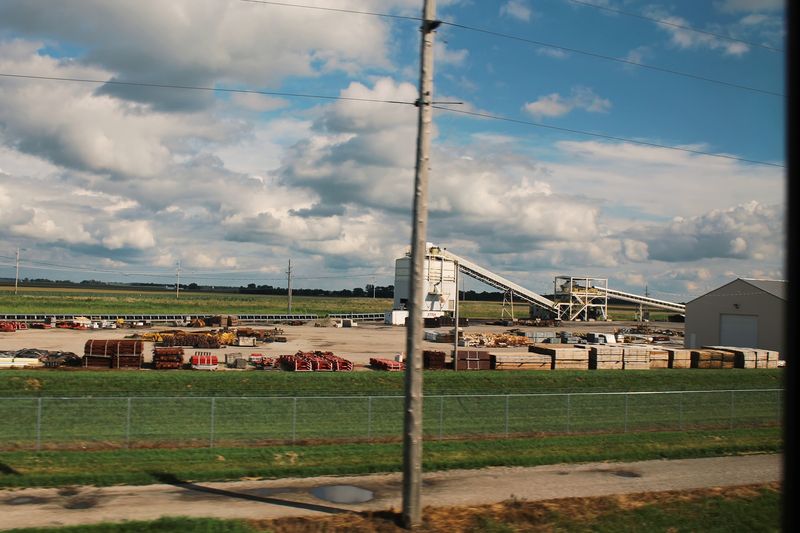
The ground around a former coal mine does not become safe simply because the mine stopped operating a century ago. Illinois DNR’s Abandoned Mine Lands program identifies a range of hazards that can persist on former mining landscapes: open or inadequately sealed shafts, mine gases, underground fires, flooding in old workings, refuse piles, spoil ridges, and unstable ground that may look solid from the surface but is not.
Cardiff’s No. 1 and No. 2 mines operated underground, which means their legacy includes subsurface voids that have had more than a hundred years to shift, settle, or partially collapse in ways that are not always visible from above.
Illinois DNR’s guidance on mine subsidence explains that underground voids can collapse anywhere from immediately after extraction to more than a century later. The surface expression of that collapse ranges from broad, shallow depressions to sudden pits.
Neither type announces itself in advance, and neither type is safe to approach, probe, or stand near without professional assessment. Spoil piles and refuse banks left over from processing operations can also be chemically unstable or physically prone to slumping.
ISGS records documenting Cardiff’s shaft locations and underground extents are geological research documents, not recreational guides. Knowing where a shaft was sunk in 1899 does not mean the shaft is safely sealed, clearly marked, or located on public land.
Visitors should stay on public roads or clearly authorized land, avoid any structure or surface feature that might be associated with former mine workings, and treat every overgrown depression, mound, or pit in the vicinity as a potential hazard until a qualified professional says otherwise. Historic maps showing underground workings are a reason for caution, not curiosity.
Experience Cardiff through verified access and historical imagination
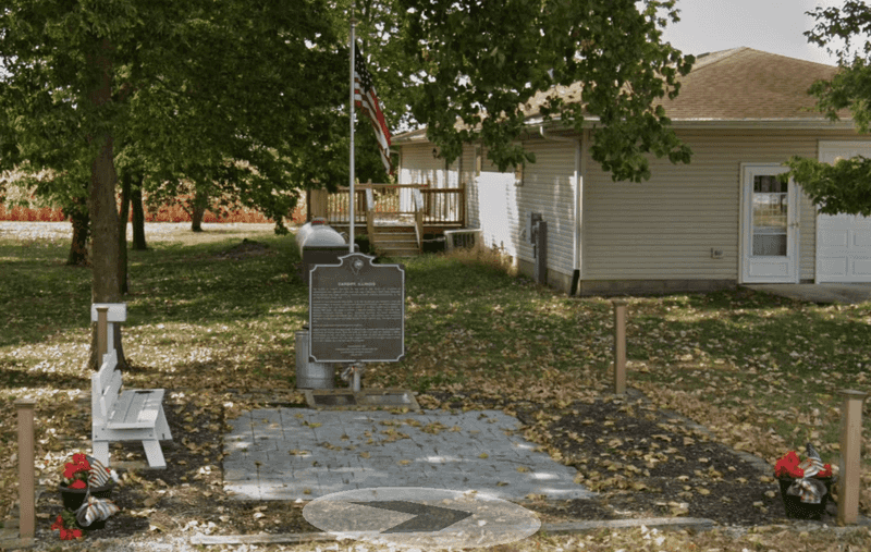
Cardiff’s real offering is not a street to walk but a story to reconstruct. If current public access to the marker or memorial is confirmed through the Herscher Area Historical Society or local authorities, that feature becomes a place to stand and think rather than a trailhead.
Bring ISGS mine records or historical photographs downloaded before your visit, and use them to orient yourself to a settlement that no longer has a physical presence.
The Mythic Mississippi Project’s Cardiff entry suggests the site’s value lies in historical archaeology and memory rather than preserved infrastructure. Workers once lived, ate, argued, and descended into the earth here every morning.
Their community rose in under a decade and was gone in little more than another. Cardiff’s meaning comes from that compressed, human story.
A vanished town remembered honestly is more affecting than a ghost town dressed up for tourism. Standing near a marker in an Illinois field, knowing what the ground once held, is its own kind of encounter with history.