
This Illinois Rail Trail Takes You Past Limestone Bluffs And Old Depot Towns On An Easy Ride
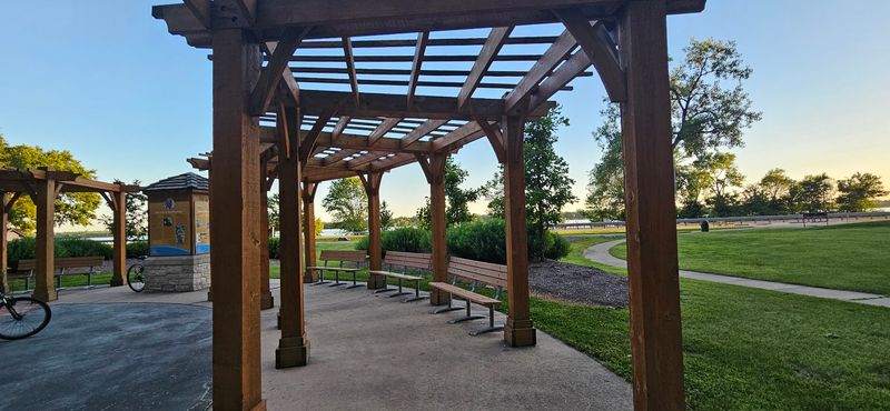
A paved path hugging the Mississippi and Illinois Rivers gives cyclists, walkers, and families a front-row seat to some of southwestern Illinois’s most dramatic scenery. The Sam Vadalabene Bike Trail stretches roughly 20 miles through limestone bluff country, passing historic river towns along the way.
Before you load the car, though, a few things about the route are worth knowing so you can plan a trip that actually matches your pace and energy.
The Sam Vadalabene Trail follows Illinois’s river corridor
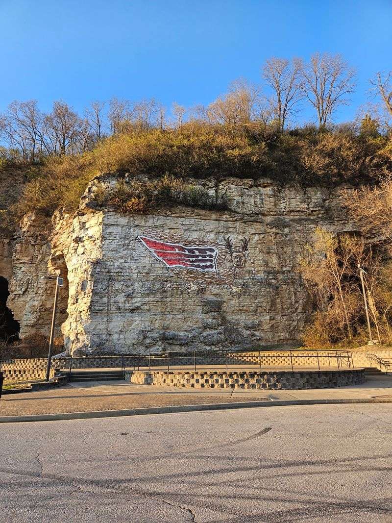
Running along one of the most scenic stretches of the American Midwest, the Sam Vadalabene Bike Trail – also known as the Sam Vadalabene Great River Road Trail – links the Alton and Piasa Park area with Pere Marquette State Park near Grafton. The regional tourism authority places the trail at approximately 20 miles end to end, though older Illinois DNR documents describe a shorter 14.5-mile Alton-to-Grafton segment with an extension that was still being developed at the time of writing.
For current planning purposes, the park page and regional trail authority are the stronger sources for the trail’s present-day reach.
The entire surface is paved, and Illinois DNR confirms that the trail welcomes biking, hiking, jogging, and strollers. Horse riding is not permitted on the trail.
That combination of a smooth surface and multiple permitted uses makes it accessible to a wide range of visitors, from road cyclists looking for a river-view ride to parents pushing strollers through bluff scenery.
The route parallels the Great River Road, also designated as part of the Meeting of the Great Rivers National Scenic Byway, beside the Mississippi and Illinois Rivers. That byway designation reflects the corridor’s recognized scenic and cultural value.
Readers should keep in mind, however, that paralleling a scenic highway is not the same as riding on a fully separated, traffic-free path – a distinction covered in more detail later in this guide.
Limestone bluffs define the scenery
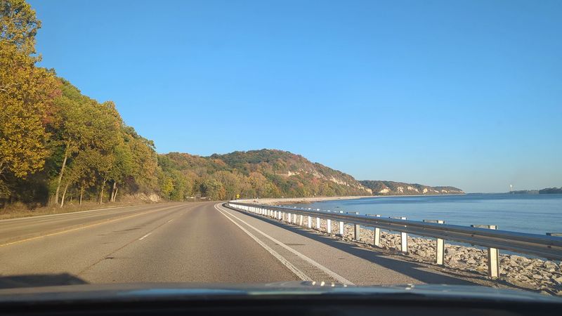
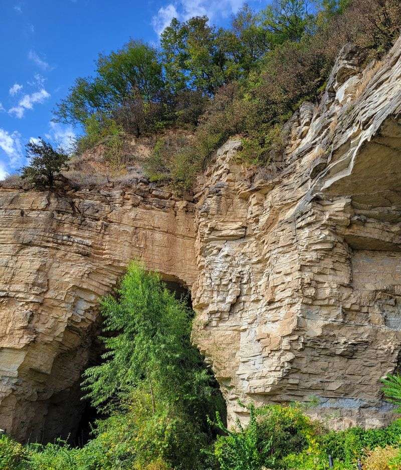
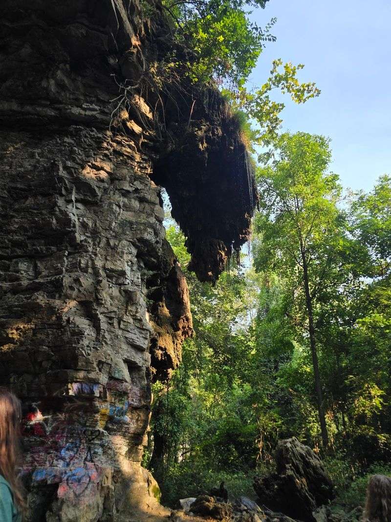
Few things make a bike ride feel more rewarding than a wall of ancient rock rising beside the water, and the corridor between Alton and Grafton delivers exactly that. Illinois DNR identifies limestone as the dominant bedrock beneath the region and notes that it is often exposed and visible in the cliffs along river bluffs – particularly along the stretch between Alton and Grafton that the Sam Vadalabene Trail follows.
Those bluffs are not just a geological footnote. They shape the entire feel of the ride.
In some places the rock face rises steeply close to the trail, creating a sense of being tucked between the bluff and the river. The regional trail authority highlights river views and bluff scenery as central draws for visitors choosing this corridor over a more typical bike path.
What you will not find in the verified sources are specific named overlooks with guaranteed unobstructed water views at predictable intervals. The scenery is real and well documented, but individual vantage points can shift depending on foliage, trail alignment, and where you stop.
Plan to slow down and look around rather than expecting a curated sequence of picture-perfect spots. The bluffs between Alton and Grafton are one of the most honest selling points of this entire route, and they hold up on their own without embellishment.
Historic river towns replace the depot-town claim
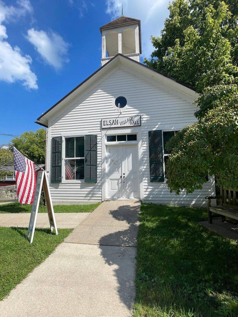
Elsah and Grafton are genuine highlights along this corridor, but calling them “old depot towns” overstates what the sources actually show. Both are historic river towns with well-documented pasts.
Elsah, in particular, carries official recognition: Illinois DNR identifies it as a historic stop along the biking route, and the Elsah Historic District has been listed on the National Register of Historic Places since 1973. Walking into Elsah feels like stepping back into a 19th-century river village, with stone and brick buildings that have survived largely intact.
Grafton sits at the confluence of the Illinois and Mississippi Rivers and brings its own character to the outing. It has restaurants, shops, and a waterfront that give riders a natural place to rest, refuel, and take in the view before heading back or continuing.
Neither town, however, is confirmed by available sources as a former railroad depot town in the sense that a surviving historic station or depot structure anchors the visit.
The railroad connection to this trail is real but applies to the corridor itself, not to the towns as depot stops. TrailLink’s trail-history page reports that roughly 20 miles of the route follow the former Illinois Terminal railroad corridor between Alton and Grafton.
That history supports describing the trail as a rail-trail in origin, but it does not confirm that either Elsah or Grafton retains a depot structure or that the present-day path is free from roadway adjacency because it once carried trains. Treat the towns as worthwhile cultural pauses on a scenic river outing, which is exactly what the evidence supports.
Choose a segment instead of assuming the full route is easy
Twenty miles is a meaningful distance for anyone who does not ride regularly, and the full Sam Vadalabene Trail is not formally rated easy by any standardized trail-rating system. The good news is that multiple access points along the route let you design a shorter outing that fits your group’s ability and energy.
The regional tourism authority lists comfort stations at Piasa Park, Clifton Terrace Park, Elsah, the Grafton Visitors Center, Grafton Harbor, and Pere Marquette State Park – each of which can serve as a logical start or turnaround point.
A shorter out-and-back from Piasa Park to Elsah, or from Grafton to Pere Marquette State Park, gives casual riders and families a taste of the bluffs and river scenery without committing to the full distance. Pavement throughout the trail removes one common barrier for riders on road bikes or families with trailers, and the proximity of Elsah and Grafton means you have towns nearby if you need water, food, or a place to sit down mid-ride.
Keep in mind that the presence of listed restrooms and nearby towns makes planning more manageable, but it does not guarantee a stress-free trip. Hours change, facilities close for maintenance, and seasonal conditions affect access.
Matching your turnaround point to your group’s realistic pace – and building in extra time rather than rushing – will do more to make the day enjoyable than any single amenity along the route.
Illinois DNR’s park page is a practical first stop for confirming current access at the Pere Marquette end before you set out. For the Alton and Piasa Park end, check with local trail authorities or the regional tourism organization for the most current information on parking and access conditions.
Expect hills and roadway-adjacent sections
Flat is a word that fits parts of this trail but not all of it. Short hills are reported near the Pere Marquette end of the route, and riders who start from Alton with the assumption of a level path all the way to the park may find themselves working harder than expected in the final miles.
The regional trail authority describes the route as running parallel to the Great River Road, which signals that the trail is corridor-adjacent to a highway rather than set apart from traffic on a fully isolated greenway.
Sections of the trail run beside or near Illinois Route 100, and riders should expect road crossings, roadside riding, or stretches where traffic is close enough to notice. TrailLink’s trail-history page notes the former Illinois Terminal corridor as the basis for the route, but a historical railroad right-of-way does not automatically translate into a vehicle-separated path today.
Portions of the trail have been developed with a paved surface set back from the road, while other sections are closer to the roadway.
None of this makes the trail unpleasant or unsafe for a prepared rider, but it does mean that treating it like a park greenway where cars are entirely absent would be a mistake. Riders with young children or those who are newer to cycling should scout the sections they plan to use and assess comfort with roadway proximity before committing to a specific segment.
TrailLink’s main trail page includes user reviews and recent condition notes that can help you get a clearer picture of what to expect on a specific section before you arrive.
Use Pere Marquette’s park resources correctly
Reaching the Pere Marquette end of the trail opens up additional options, but a few rules apply that cyclists should know before locking up their bikes and wandering off. Illinois DNR is clear that bicycles are permitted on the Sam Vadalabene Bike Trail but are not allowed on the park’s designated hiking trails.
If you want to explore the park’s interior trails on foot after your ride, that is a great way to extend the day – just leave the bike secured at a designated spot and switch to walking shoes.
Dogs are welcome in the park but must remain on a leash at all times, and owners are required to remove waste. Those rules apply across the park grounds, not just on the trail.
If you are traveling with a dog, factor in the leash requirement when planning how you will manage the bike and the animal at the same time.
Bald-eagle watching is one of the more memorable reasons to time a visit to this end of the trail, but it is a seasonal experience rather than a year-round guarantee. The main eagle-viewing season runs from December through March, when birds concentrate near the river confluence.
Arriving outside that window does not mean the park lacks wildlife, but the dramatic gatherings of eagles that draw photographers and birders happen specifically in winter. If eagle watching is your primary motivation, plan accordingly and check current sighting reports before making the drive.
Verify conditions before setting out
A few quick checks before leaving home can prevent the kind of surprises that turn a scenic river outing into a frustrating drive. Start with the Illinois DNR park page for Pere Marquette to confirm current access, parking availability, and any closures at the trail’s western end.
For the Alton and Piasa Park end, contact the relevant local authority or consult the Great Rivers and Routes tourism site for current information on restroom availability and access-point conditions.
Restroom locations are listed at Piasa Park, Clifton Terrace Park, Elsah, the Grafton Visitors Center, Grafton Harbor, and Pere Marquette State Park, but listed locations are not the same as confirmed open facilities. Hours change seasonally, maintenance closures happen, and a comfort station that appears on a map may be locked when you arrive.
Knowing which segment you plan to ride – and roughly how long it will take at your pace – helps you identify which facilities matter most and gives you a backup plan if one is unavailable.
For additional routing detail, Illinois DNR advises bicycle-tour planners to contact the Illinois Department of Transportation for county maps and low-volume local-road information. That resource is especially useful if you are combining the trail with road riding to reach a different starting point or extend your distance beyond the main corridor.
At its best, the Sam Vadalabene Trail is a flexible, scenic river outing with real bluff scenery, two worthwhile historic towns, and enough access points to suit a wide range of riders – as long as you arrive knowing it is not a guaranteed flat, traffic-free cruise past verified depot towns. The river does the rest.