
This Illinois River Town Blends A Historic Downtown With Bluff-Top Views And Riverside Trails
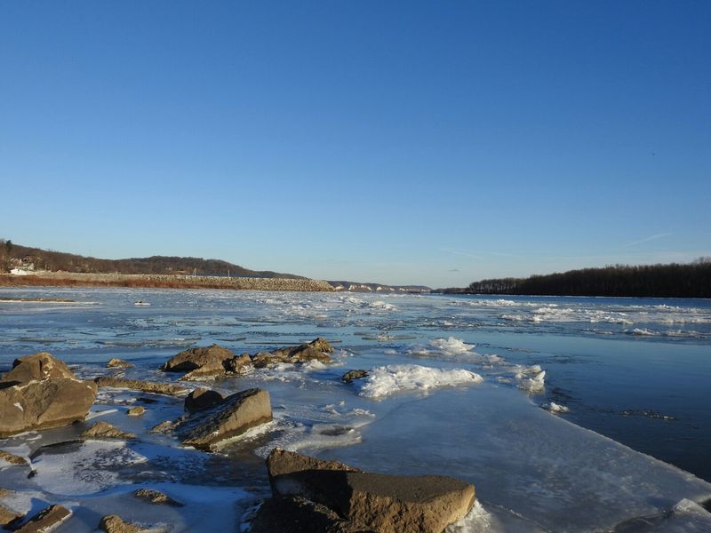
Grafton, Illinois, is a small Mississippi River town that packs a surprising amount of history, scenery, and outdoor adventure into a single day trip. Sitting near where the Illinois River meets the Mississippi, it offers a compact historic Main Street alongside bluff-top views and regional trails that stretch well beyond the town center.
Whether you want to browse century-old storefronts, ride a gondola to a hilltop overlook, or pedal a paved trail through river bottomlands, Grafton gives you real choices without requiring a long drive between stops.
Grafton sits near two rivers, but it is a Mississippi River town
Grafton occupies a narrow strip of land where the bluffs crowd the river’s edge, and its geographic identity is more precise than most travel headlines suggest. The town sits on the Mississippi River near the point where the Illinois River flows in from the northeast, making it a Mississippi River community first, with the Illinois River confluence serving as a powerful regional anchor rather than a downtown feature you can point to from Main Street.
Both the Illinois State Water Survey’s lower Illinois region overview and U.S. Geological Survey water-quality research for the lower Illinois River basin identify this confluence as a significant geographic marker in the region.
That distinction matters for trip planning because the confluence itself is not a walkable downtown attraction. Visitors who arrive expecting to stand on a street corner and watch two rivers merge will need to adjust their expectations.
What Grafton does offer is a compact historic core that you can cover on foot, paired with separate outdoor destinations that require a short drive or a bike ride to reach. Pere Marquette State Park, roughly 6 miles from town, holds the area’s strongest bluff hiking and natural overlooks.
The SkyTour gondola ride and the Sam Vadalabene Bike Trail add additional choices, each at a different distance and requiring its own logistics.
Understanding that layout before you arrive is the most useful thing this article can do for you. Grafton is not one continuous walking circuit from river to bluff.
It is a river town with a walkable center and a handful of nearby but separate outdoor experiences, each worth choosing deliberately rather than stumbling into unprepared.
Main Street offers the walkable historic part of the visit
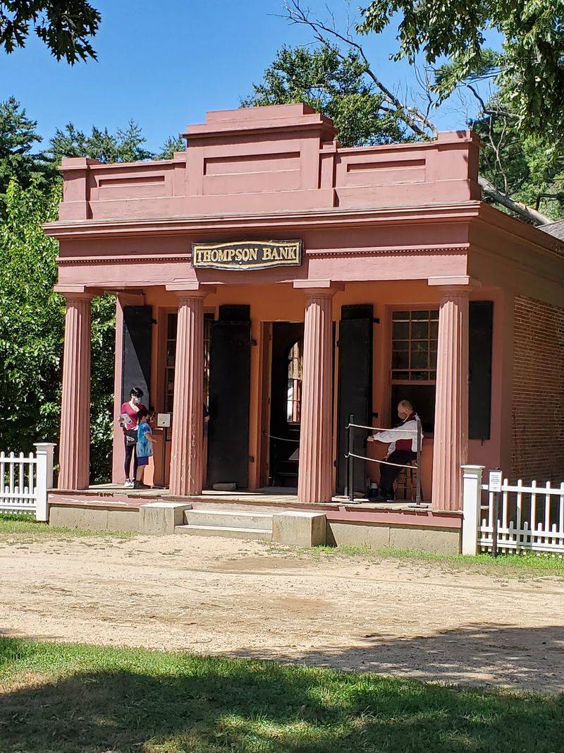
Walking Grafton’s Main Street, which runs along Illinois Route 100, gives you the clearest sense of what this town looked like when river commerce was its lifeblood. Many of the historic commercial buildings still front the street in their original positions, and their scale, brick facades, and continuous block faces create the kind of streetscape that encourages slow walking rather than a quick drive-through glance.
The National Park Service’s Illinois National Register listings include the Grafton Historic District, which documents the town’s significance as an intact commercial area. The Grafton Comprehensive Plan describes most historic buildings as remaining intact and street-facing, while also noting that fires, driveways, and other alterations have interrupted portions of the streetscape.
That honest assessment is worth keeping in mind: the district is genuinely historic, but not uniformly preserved from end to end.
A practical first stop is the Edward Amburg History Museum and Visitor’s Center at 950 E. Main Street.
The City of Grafton’s official website and the Grafton visitor center listing both describe it as open 10 a.m. to 4 p.m. daily, offering historical exhibits, maps, and current guidance on dining, lodging, shopping, and recreation. Hours are subject to change, so a quick call or website check before you go is worth the two minutes it takes.
Starting here sets you up well for the rest of the day. Staff can point you toward current trail conditions, active restaurants, and any local events that might affect parking or access.
From the visitor center, the rest of Main Street unfolds naturally on foot, with the river visible at the end of nearly every cross street as a constant reminder of where you are.
Choose between a commercial ride and a natural bluff overlook
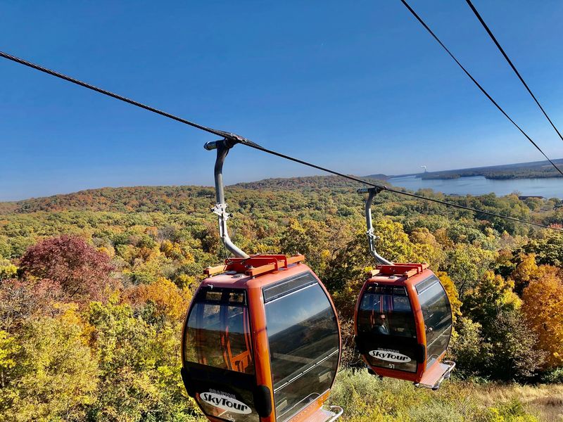
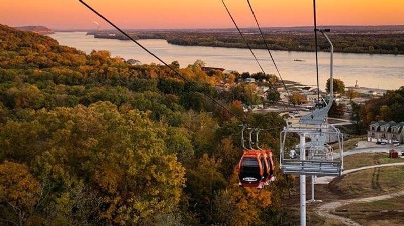
Before committing to an afternoon outdoor plan, it helps to understand that Grafton’s elevated views come from two very different sources. The Grafton SkyTour, operated by Aerie’s Resort, is a commercial gondola that carries visitors up the bluff face to a hilltop setting with river panoramas.
Pere Marquette State Park, about 6 miles from downtown, provides the area’s natural bluff terrain, marked hiking trails, and wooded overlooks without the ticket-booth experience.
The SkyTour operator’s current schedule lists hours of 10:45 a.m. to 6:30 p.m. on Fridays and Saturdays, and 10:45 a.m. to 5:30 p.m. Sunday through Thursday, with the last ticket sold at closing.
Those are commercial hours tied to a private business, and they can shift with seasons, staffing, or weather. Confirming the schedule the day before your visit is a reasonable precaution, not an overabundance of caution.
The SkyTour suits visitors who want bluff-top scenery without a hike, or who are traveling with young children or older adults who prefer a seated ride to a trail climb. It is a distinct experience from anything available inside the downtown walking area, so you will need a car to reach it even though it is close to town.
Pere Marquette State Park and its associated nature preserve offer the most clearly documented natural bluff experience in the area, with marked trails, wooded ridges, and views toward the Illinois River valley and its backwaters. The IDNR activities page for Pere Marquette describes approximately 12 miles of hiking trails across a range of difficulty levels.
Choosing between the SkyTour and Pere Marquette comes down to whether you want a managed, accessible bluff experience or a more physically engaged one on natural terrain.
Pere Marquette supplies the area’s main hiking experience
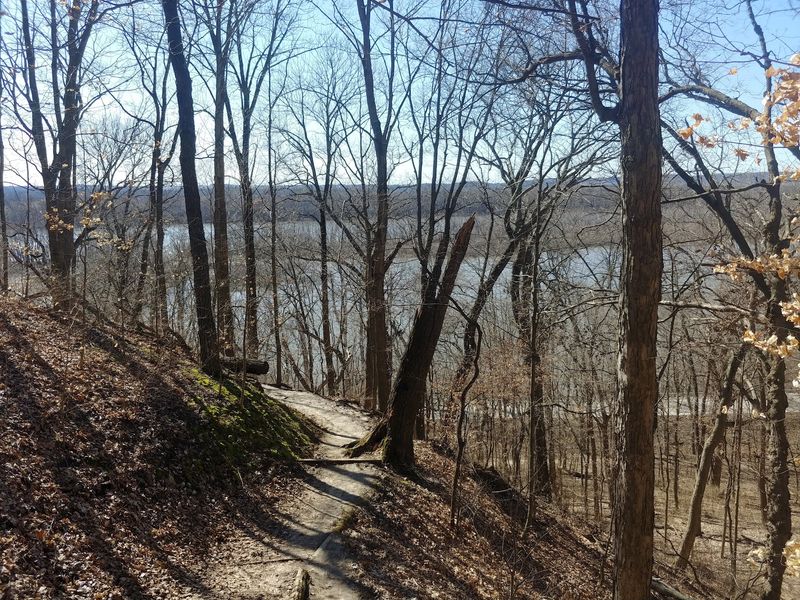
Pere Marquette State Park is the most substantial natural addition available to a Grafton day trip, and it earns that designation through sheer variety. The park’s trail network covers approximately 12 miles of marked routes across wooded bluffs, with named trails including Dogwood, Hickory, Fern Hollow, Ravine, Ridge, Rattlesnake, Oak, and others.
Difficulty ranges from easy walks to genuinely demanding climbs, so the park works for a wide range of fitness levels as long as hikers choose their route honestly.
For a day-trip visitor with limited time, the Goat Cliff Trail is a reasonable starting point. The official IDNR Pere Marquette hiking trail map describes it as a moderate route of approximately 1.5 to 2 miles round trip, with a rewarding overlook at the top.
Use those figures as approximations rather than precise measurements, because different IDNR materials give slightly different numbers depending on the measured endpoints.
IDNR’s Pere Marquette activities page establishes the basic ground rules: trails are open from sunrise to sunset, dogs must be kept on a leash, and bicycling is not permitted on the hiking trails. Those rules apply across the entire trail network, not just on the easier routes.
Bluff terrain also calls for appropriate footwear with traction, attention to posted closures, and staying on marked paths throughout your hike.
The park’s main IDNR page notes that climbing and rappelling are restricted to designated areas only, per IDNR’s statewide rock climbing regulations. Attempting unauthorized climbing on the bluff faces is both unsafe and against park rules.
For most day visitors, the marked trail overlooks provide more than enough drama without approaching any cliff edge outside a designated area.
The Vadalabene Trail expands the trip beyond downtown
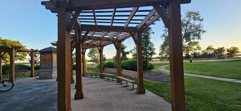
The Sam Vadalabene Bike Trail adds a regional dimension to a Grafton visit that no downtown stroll can replicate. Paved and running through the Grafton and Elsah area between Pere Marquette State Park and Alton, it follows the general corridor of the Great River Road and gives cyclists a way to connect the town’s riverfront setting with the park and the wider region in a single outing.
IDNR’s Pere Marquette activities page describes the full route as approximately 20 miles from the park to Alton, while IDNR’s national recreation trails document places it closer to 22 miles. The difference likely reflects different measured endpoints, so planning materials should treat the full route as roughly 20 to 22 miles rather than a single fixed number.
Completing the entire route is not a requirement or even a reasonable expectation for most day-trippers who also plan to spend time in town and at the park. Selecting a manageable segment, perhaps the stretch nearest Grafton or a short out-and-back toward Elsah, gives you the riverside scenery without committing to a half-day ride before you have seen anything else.
One important clarification: the trail is not a continuous, separated riverfront promenade. IDNR’s Mississippi River Trail user guide describes portions of the route as off-road paved trail and portions as paved shoulders along Illinois Route 100.
Riders should expect some sections to run alongside highway traffic rather than on a dedicated separated path, and should plan accordingly with appropriate gear and awareness of road conditions.
Build the day around one outdoor choice
A workable Grafton day trip follows a natural sequence without requiring military-level scheduling. Start on Main Street in the morning, beginning at the Edward Amburg History Museum and Visitor’s Center to pick up a trail map, check current conditions, and get a feel for the historic district before the midday crowd arrives.
The City of Grafton’s official website lists current dining, lodging, and event information that can help you decide where to pause for lunch.
After a meal or a riverfront break, commit to one outdoor experience for the afternoon rather than trying to squeeze in all three options. If you prefer a relaxed approach with guaranteed bluff scenery and no trail exertion, the SkyTour gondola is the most accessible choice, provided you confirm hours before heading over.
Hikers with a few hours and appropriate footwear will get more natural immersion from a short outing at Pere Marquette, where the IDNR Visitor Center at Pere Marquette can provide current trail recommendations and help you choose a route that fits your group’s fitness level. Cyclists who want to extend the day can pick up the Vadalabene Trail for a segment ride in either direction before returning to town.
The Brussels Ferry, located about 1 mile west of Grafton, offers an optional extension into Calhoun County across the Illinois River. IDOT’s ferry services page identifies the state-operated Brussels Ferry as running 24 hours a day, seven days a week under normal conditions, but weather, river levels, and maintenance can interrupt service without much advance notice.
Build the ferry into your plan only after you have confirmed it is running, and treat it as a bonus rather than a centerpiece.
IDNR’s Pere Marquette activities guidance reinforces that the park’s trails close at sunset, so afternoon timing matters if you plan to hike. Arriving at the park by 2 p.m. on a summer day leaves comfortable time for a moderate trail and a return drive to town before evening.
Check conditions before crossing the river or heading for the bluffs
River towns are beautiful partly because they sit close to the water, and that same proximity creates real planning considerations. At Grafton, the National Weather Service river forecast for the Grafton gauge identifies major flood stage at 29 feet, and the NWS Illinois flooding safety page documents how quickly conditions can change along the state’s river corridors.
After heavy rain or during high-water periods, riverfront roads, businesses, and low-lying access routes can be affected well before bluff-top areas see any impact.
That distinction matters practically. The USGS streamflow data for the Grafton station provides current gauge readings that you can check from home before your trip.
Do not assume that because the bluffs are elevated, the entire visit is unaffected by high water. Road closures, ferry interruptions, and parking-area flooding can reshape the day even when Pere Marquette’s trails remain open.
Equally, do not assume that bluff access is guaranteed just because the river is behaving normally; trail closures for maintenance, storm damage, or seasonal conditions can occur independently.
Before any visit, confirm the SkyTour’s current hours, check the Brussels Ferry’s operating status, review current road conditions, and look up any park closure notices. Five minutes of pre-trip checking can prevent a two-hour drive to a closed gate.
Grafton rewards visitors who arrive with a flexible plan and the information to adapt it. The town’s combination of a walkable historic core and nearby but separate outdoor destinations is what makes it genuinely worth the trip, not the idea that everything connects in one unbroken loop.