
This Illinois State Park Has A Waterfall Canyon That Looks Nothing Like The Midwest
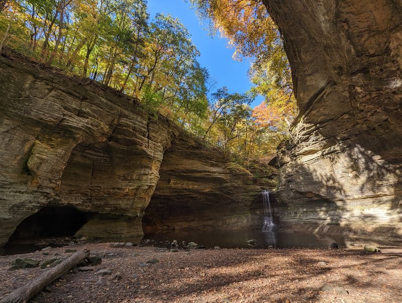
Most people picture flat cornfields when they think of Illinois, so finding a narrow sandstone canyon with waterfalls tucked into the state’s north-central region feels genuinely startling. Matthiessen State Park, near the small towns of Utica and Oglesby, hides a compact canyon system called the Dells where mossy walls, mineral-stained rock, and cascading water create a scene that stops first-time visitors in their tracks.
The park is real, the waterfalls are real, and the surprise is absolutely worth the drive.
Matthiessen Is the Illinois Park Behind the Surprise
Sandwiched between the Illinois River valley and the broad farm country of LaSalle County, Matthiessen State Park sits roughly four miles south of Utica and three miles east of Oglesby. That address alone sounds unremarkable, but the ground beneath it tells a very different story.
A roughly one-mile sandstone canyon, known as the Dells, cuts through the park and divides into an Upper Dell and a Lower Dell, each offering a progressively deeper look at walls that rise steeply above a creek-fed canyon floor.
Many Illinois travelers head straight to nearby Starved Rock State Park, which is larger, more famous, and home to 18 canyons. Starved Rock earns every visitor it gets.
But if the goal is a concentrated waterfall-canyon experience with a more intimate feel, the Illinois DNR’s Matthiessen overview makes clear that the Dells are the park’s defining feature, and they deliver something the bigger neighbor does not: a compact, canyon-within-a-canyon layout where the walls close in and the scale feels almost personal.
The visual impression can be genuinely disorienting for anyone expecting the flat Midwest. Narrow passages, shaded rock faces, and the sound of moving water combine to create a setting that reads as rugged and wild even though marked trails, bridges, and park facilities are part of the experience.
Calling it a Hawaii lookalike overstates the case, since this is firmly a temperate Illinois ecosystem, but the canyon’s drama is real and entirely unexpected at this latitude.
The Dells Create an Unexpected Illinois Landscape
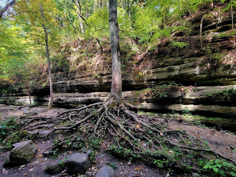
Walk down into the Upper Dell and the light changes almost immediately. The sandstone walls narrow, shade deepens, and the air feels cooler and damper than the bluff above.
Mosses and ferns cling to the rock wherever moisture collects, and groundwater seeps steadily through the porous sandstone, feeding small pools and keeping sections of the canyon floor wet even in dry spells.
The colors on those walls are worth stopping to study. Dissolved minerals, especially iron, travel with groundwater through the sandstone and leave streaks and patches of yellow, orange, brown, and rust across the stone.
According to the Illinois DNR’s park description, this mineral staining is part of what gives the Dells their distinctive palette, a layered mix of earth tones that shifts with the angle of light and the season.
It is easy to understand why visitors reach for the Hawaii comparison when they first see photographs of the canyon. Lush vegetation, flowing water, and stained canyon walls do share a surface resemblance with certain tropical gorge photos.
The honest picture is more nuanced: the Illinois Natural Areas Inventory for the Matthiessen Dells Nature Preserve identifies northern-climate plant species in the sandstone cliff community, including white pine, northern white cedar, Canada yew, and Canada mayflower. The ecosystem is cool, shaded, and distinctly northern Illinois, not tropical, but that does not make it any less striking on a clear morning after a good rain.
Stream Erosion Shaped the Sandstone Canyon
Spend a few minutes looking at the canyon walls and a question forms naturally: how did something this dramatic end up in the middle of Illinois? The short answer involves water, time, and the particular weakness of one specific rock layer.
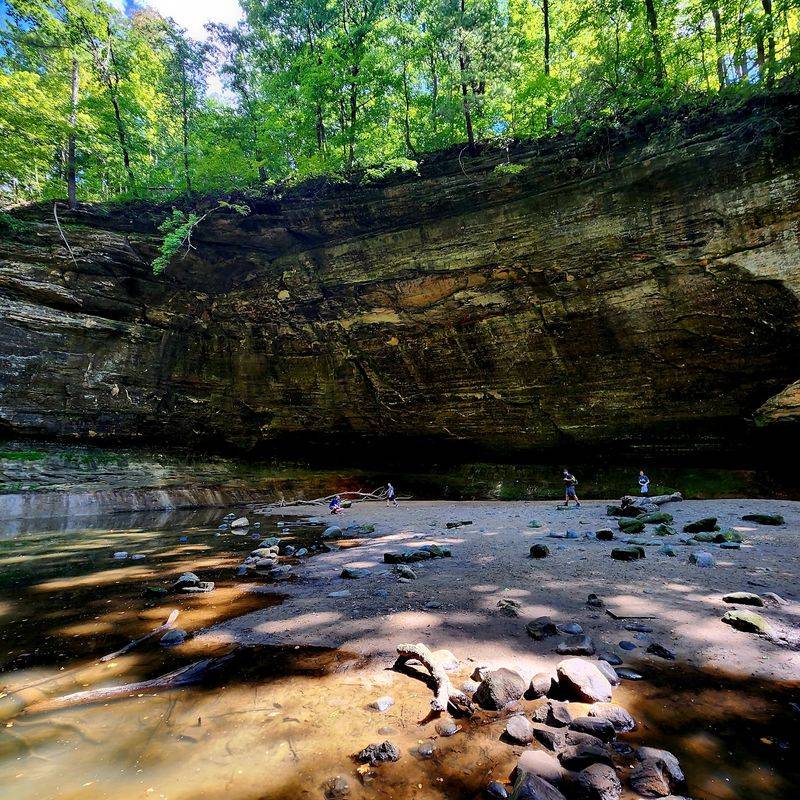
The canyon formed in Ordovician St. Peter Sandstone, a formation that is relatively soft and permeable compared with the harder limestone and dolomite layers that sit above it. The Illinois DNR’s geology and ecology information packet for the parks explains that this difference in resistance between rock layers helped maintain the canyon’s steep walls as erosion worked downward and inward over thousands of years.
Streams did the heavy lifting. Water flowing across the landscape found the softer sandstone and began cutting into it.
As waterfalls formed, they did not stay in one place; they migrated upstream through a process called headward erosion, where the plunge of falling water undercuts rock at the base of a fall and the brink retreats gradually uphill. That mechanism is why the canyon extends inland as a long, branching system rather than a simple notch at the river’s edge.
Swirling water also carved some of the canyon’s most unusual shapes. When cobbles and pebbles become trapped in depressions on the streambed, the current spins them in circles, grinding smooth, bowl-shaped holes into the rock called potholes.
Giant’s Bathtub, one of the named features in the Dells, is a documented example of this process at work, a large pothole scoured by centuries of abrasive sediment spinning in the current. The canyon is not a glacier’s creation, though glacial meltwater and postglacial drainage shaped the broader regional landscape.
The Dells themselves owe their form to streams, differential weathering, and the slow retreat of waterfalls through vulnerable sandstone.
Several Falls Highlight the Dells
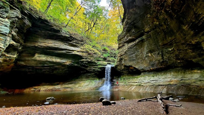
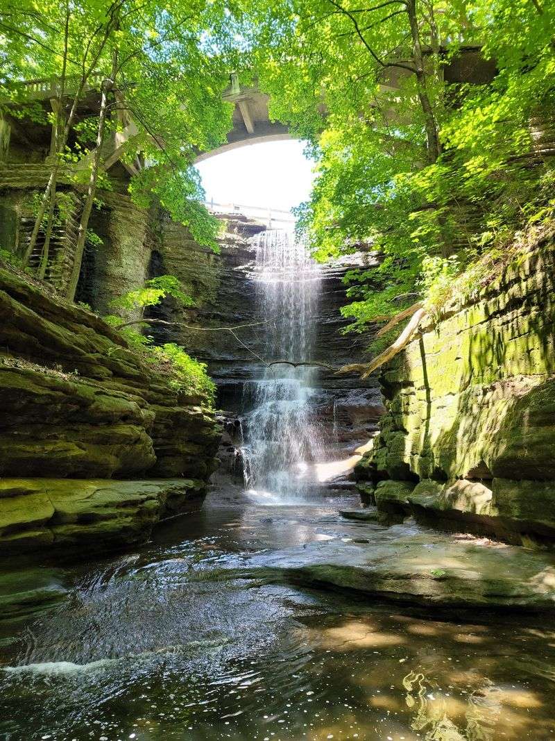
Water is the reason most people make the trip, and the Dells deliver more than one place to find it. The Illinois DNR identifies several named water features within the canyon, including Lake Falls, Giant’s Bathtub, and Cascade Falls.
Each occupies a different part of the Dells and offers a different visual character, from the relatively open upper reaches to the tighter, deeper passages toward the Vermilion River end of the canyon.
Cascade Falls is the standout. The canyon drops 45 feet at that point, sending water over a sandstone ledge into a shaded pool below.
Enjoy Illinois describes the park’s waterfall route as a sequence that includes Lake Falls, Giant’s Bathtub, and Cascade Falls, though the exact spatial relationships between every feature along that route should be confirmed with a current park map rather than assumed from a description. Middle Falls is sometimes mentioned in connection with the canyon as well, but its precise position within the Dells is best verified on-site.
One thing every visitor should understand before packing the camera: the falls are fed by small creeks, not permanent rivers, so flow can vary significantly with recent rain, snowmelt, and seasonal conditions. Illinois DNR guidance for nearby Starved Rock notes explicitly that canyon waterfalls in this region are rain-dependent and can dry out by late June depending on rainfall, and that same caution applies at Matthiessen.
A photograph taken after a spring storm will not guarantee the same rushing water during a dry August visit. Checking recent weather and current park notices before the drive is the most reliable way to set realistic expectations.
The Interior Trails Require Careful Hiking
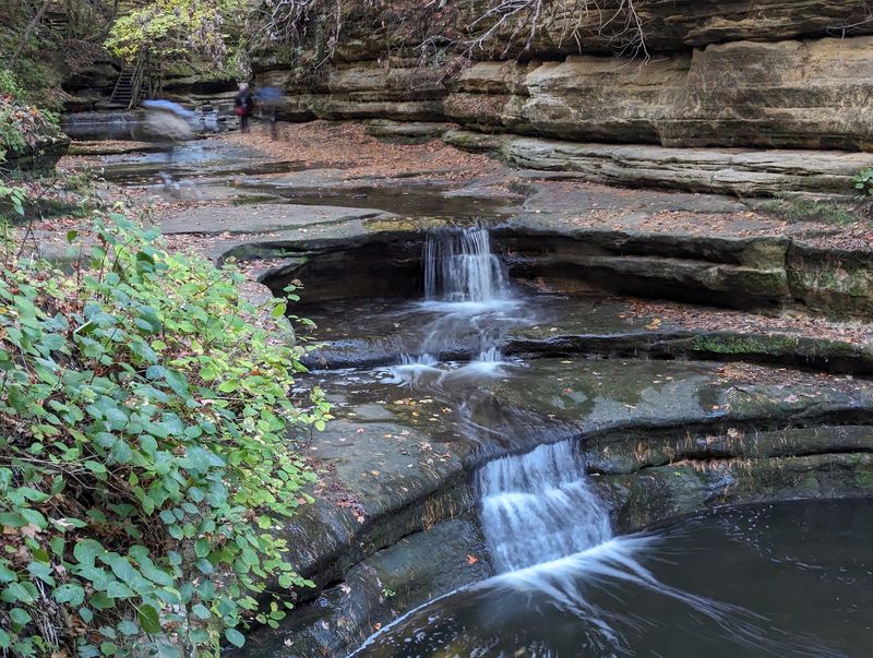
Getting to the waterfalls takes more effort than a casual stroll, and knowing that ahead of time makes the experience far more enjoyable. The Illinois DNR’s Matthiessen trails page notes that the park has five miles of marked, surfaced hiking trails total.
The bluff-top and upper trails are generally easier, offering views of the canyon from above without requiring descent into the narrow passages below. Those routes work well for visitors who want the scenery without the technical demands of the canyon floor.
Trails into the Dells are a different proposition. Steps cut into the terrain, steep canyon walls, uneven rock surfaces, and sections that stay wet long after rain all combine to make the interior more physically demanding, particularly in spring and early summer when water levels are higher and surfaces are slick.
Trekking poles, sturdy footwear with grip, and a willingness to move slowly through tight passages make a real difference.
The park’s official accessibility information does not describe the interior waterfall canyon as wheelchair-accessible, and visitors with limited mobility should plan accordingly. Some parking areas, shelter facilities, and shorter paths near the park entrance have accessibility features, so there are ways to enjoy parts of the park even without descending into the canyon.
For everyone else, the interior trails reward patience and preparation. Staying on marked paths is both a safety rule and practical advice: the canyon walls can look climbable in spots, but the rock weathers unpredictably and off-trail scrambling creates real fall risk on surfaces that are often damp.
Check Water, Crowds, and Access Before You Go
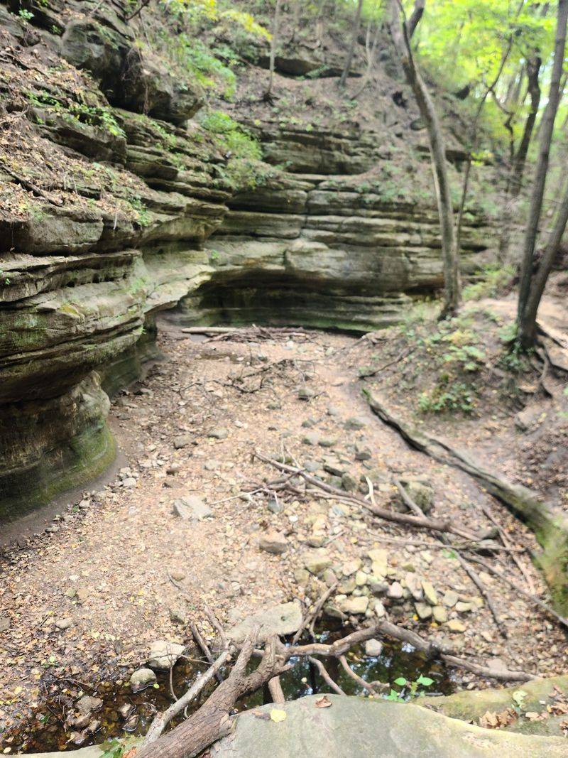
A little planning before the drive saves a lot of frustration at the trailhead. The official Matthiessen park page lists hours as 7 a.m. to sunset, so early arrivals have the best chance of both parking and a quieter canyon experience.
The same page warns that the Dells and Vermilion River areas may reach capacity on weekends from May through October, sometimes as early as 11 a.m., with the park reopening only when parking becomes available again. Arriving at or just after opening on a weekend is the most reliable strategy for avoiding a turnaround.
Water conditions at the falls change with the weather, and access to the canyon itself can change even faster. Storms, rising river levels, bridge damage, and trail work can close sections of the park with little advance notice.
A notice dated July 5, 2026, on the official park page reported that the Lake Falls bridge and trail were closed, and that access to interior waterfall areas including Lake Falls, Middle Falls, and Cascade Falls was closed because of storm water and a rising Vermilion River. That notice is cited here as a historical example of how quickly conditions shift, not as a description of current park status.
Before any visit, check two sources directly: the live Matthiessen park page for the most recent access notices, and the IDNR statewide current closures page, which tracks bridge, trail, and area closures across all state parks. Neither page should be skipped.
Conditions at the park and conditions listed on the statewide page do not always match in detail, so reading both gives the clearest picture of what is actually open. Waterfall flow, trail surfaces, and canyon access at Matthiessen are all weather-dependent and changeable; planning around current information rather than past trip reports is the only way to avoid a wasted drive.
Enjoy the Canyon Without Treating It Like a Playground
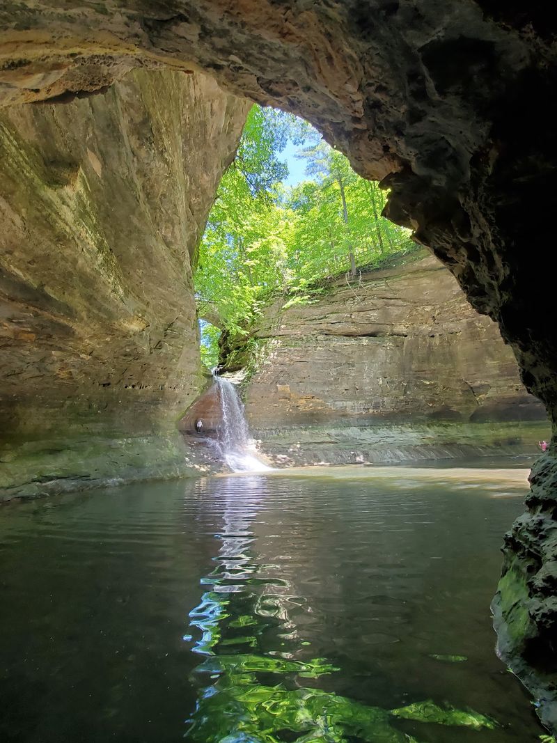
Matthiessen delivers something genuinely rare for a Midwest weekend trip: a sandstone canyon with real waterfalls, mineral-stained walls, lush vegetation, and a scale that feels nothing like the open farmland surrounding it. None of that requires exaggeration or a tropical comparison to be impressive.
The park earns its surprise on its own terms, through geology, water, and the particular beauty of a shaded Illinois canyon on a good day.
Keeping that experience available for future visits means following the rules that protect both the canyon and the people in it. IDNR’s park rules are clear: stay on marked trails, do not swim in the waterfalls, creeks, or the Vermilion River, and do not climb or rappel on the canyon walls.
Closed areas exist for real reasons, whether storm damage, unstable rock, or high water, and entering them puts both visitors and rescue personnel at risk.
The Dells are a documented natural area with a long history of managed access, and that management is part of why the canyon still looks as striking as it does. Check conditions before you go, wear shoes with grip, and let the canyon be exactly what it is: one of Illinois’s most unexpected landscapes, hiding in plain sight about 90 miles southwest of Chicago.