
This Illinois State Park Hides A Fern-Draped Canyon Where Waterfalls Freeze Into Ice Columns
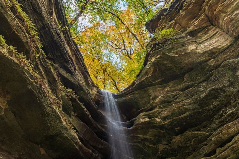
Tucked inside Starved Rock State Park in north-central Illinois, St. Louis Canyon offers one of the more surprising hikes in the state. Its enclosed sandstone walls stay cool and damp year-round, supporting mosses, ferns, and other moisture-loving plants that cling to the rock.
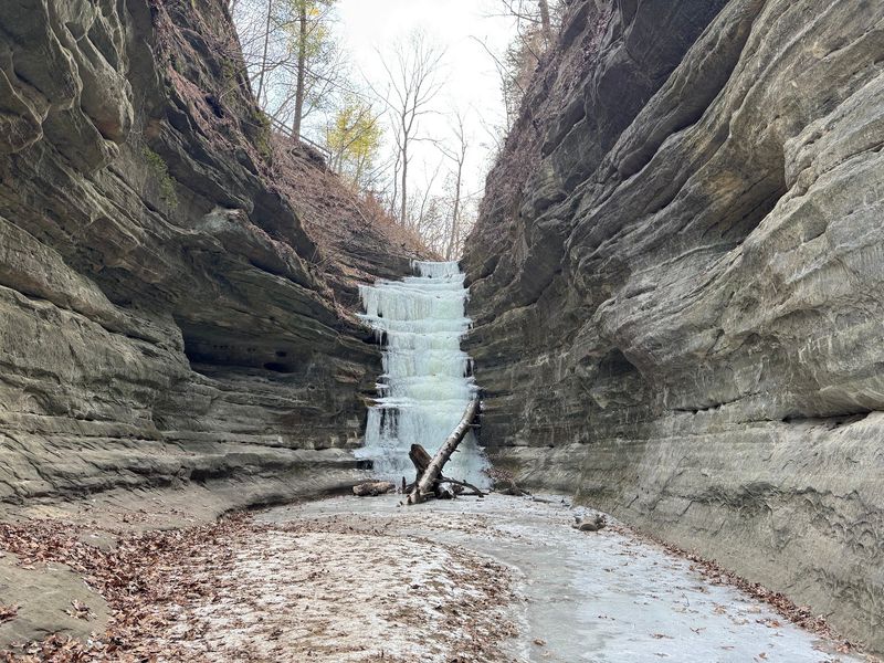
In winter, the canyon’s spring-fed waterfall can develop dramatic ice formations, though what you actually find depends entirely on recent weather. If you’re planning a visit, a little preparation goes a long way toward making the trip worthwhile.
The canyon is at Starved Rock, not Starkville
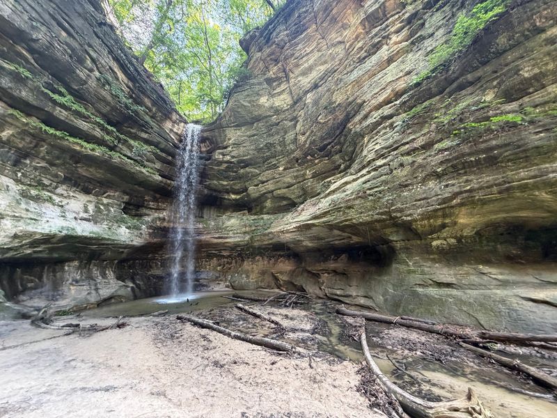
Starved Rock State Park sits along the Illinois River in north-central Illinois, roughly 100 miles southwest of Chicago, and it holds more than a dozen accessible canyons carved into ancient sandstone. St. Louis Canyon is one of them, reached by a separate trailhead along Route 178 rather than the park’s main lodge entrance.
Any reference to a place called “Starkville” in connection with this destination appears to be a name error. The park is Starved Rock, and the canyon is St. Louis.
IDNR’s Starved Rock park page lists St. Louis Canyon and Aurora Canyon together as a roughly 3-mile round-trip trail suggestion. That figure reflects a combined route, not a fixed distance for every possible variation of the St. Louis Canyon hike alone.
Depending on where you park, which connector trails are open, and how far into the canyon you walk, your actual mileage may differ.
The canyon’s waterfall is spring-fed, which means it draws on groundwater rather than relying solely on rainfall. That steady source can supply water for ice formation during cold stretches, but it does not guarantee a frozen feature on any particular visit.
The Starved Rock Foundation’s canyon guide describes the park’s seasonal character honestly, and conditions at any individual canyon shift with precipitation, temperature swings, and snowmelt.
Framing the hike as a guaranteed winter spectacle sets up disappointment. St. Louis Canyon is worth visiting in any season for its sandstone setting and plant life alone, with the possibility of ice formations serving as a welcome but uncertain bonus rather than a fixed attraction.
The route descends between sandstone walls
Getting to St. Louis Canyon requires more effort than a casual stroll. The trail from the Route 178 parking area leads hikers through mixed forest before the terrain drops noticeably, and the descent into the canyon involves stairs, uneven footing, and surfaces that stay damp even when the air above is dry.
Wet sandstone can be slippery under any conditions, and a dusting of snow or a thin film of ice makes each step demand more attention.
IDNR’s winter trail guidance for Starved Rock is direct about what hikers should expect: major staircases, narrow passages, and sections where the ground shifts between packed dirt, exposed root, and bare rock. None of the park’s canyon trails are ADA-accessible by car or wheelchair, and the descent into St. Louis Canyon is not an exception to that rule.
Once you reach the canyon floor, the walls rise on either side and the light changes. Sound dampens, the air feels cooler and more humid, and the scale of the sandstone becomes easier to appreciate up close.
Brown directional signs and trail maps at parking areas and intersections help keep hikers oriented, and the park recommends staying on marked trails throughout the route.
The spring-fed waterfall sits at the canyon’s far end, visible once you’ve worked your way through the enclosed passage. Reaching it is the payoff, but the hike itself earns your attention before you ever see a drop of water or a sliver of ice.
Why the canyon supports moisture-loving plants
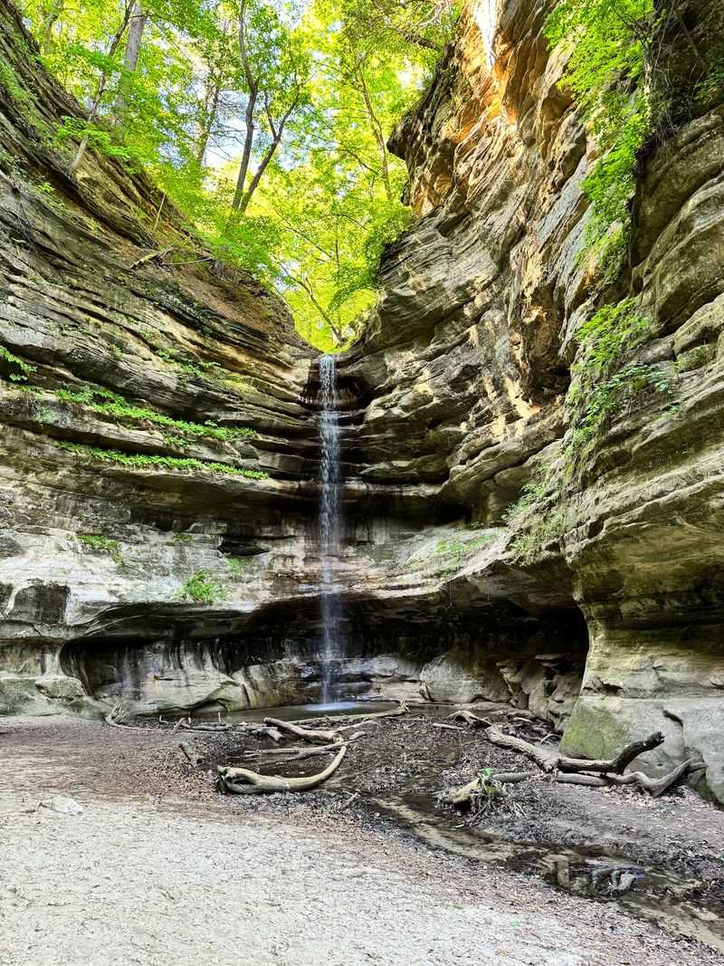
St. Louis Canyon’s geology explains its plant life more directly than any other factor. The walls are composed of St. Peter Sandstone, a porous, fine-grained rock that formed from ancient dunes roughly 450 million years ago.
Water seeps through it slowly and continuously, keeping the canyon walls damp even during dry spells on the surface above.
IDNR’s park ecology and geology packet attributes the canyon’s formation to water erosion, including the Kankakee Torrent, a massive glacial flood event that reshaped the regional landscape roughly 16,000 years ago. That torrent and centuries of subsequent erosion cut the canyons deep into the sandstone, creating enclosed, shaded spaces where temperatures stay lower and moisture lingers longer than in the surrounding forest.
Those conditions favor plants that struggle in drier, sunnier environments. Mosses carpet the lower walls and pool edges.
Liverworts, flat and ribbon-like, spread across surfaces where water trickles or seeps. Lichens crust onto exposed faces where even mosses can’t get a firm hold.
Ferns grow in crevices and along ledges where soil accumulates and moisture is reliable, though their presence varies by season and location within the canyon.
Calling the canyon “fern-draped” captures something real about its character during the warmer months, but it overstates the case as a year-round or wall-to-wall description. What you’re more likely to see is a layered community of moisture-dependent plants distributed unevenly across the walls, concentrated wherever the rock stays wettest and the light stays lowest.
That patchwork is worth examining closely, especially in sections where the walls narrow and the plant coverage becomes densest.
How the waterfall can become a temporary icefall
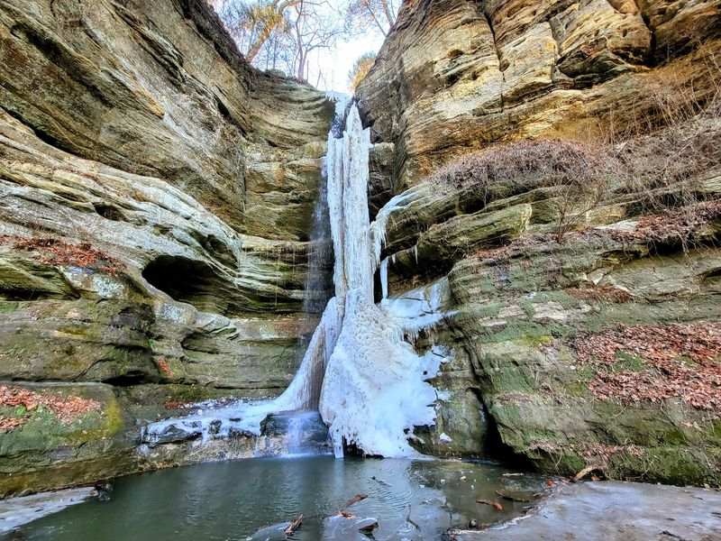
Water and cold rock interact in ways that produce some of the most visually striking winter features in the Midwest, and St. Louis Canyon’s spring-fed waterfall is capable of joining that category under the right conditions. When temperatures drop and stay low, the water flowing over and seeping through the sandstone begins to freeze on contact with the cold rock surface.
What builds up can take several forms: curtains of translucent ice, clusters of icicles, rounded mounds where water pools and refreezes, or column-like structures where ice grows upward from a frozen base while water continues to flow behind or beneath it.
Research published in the Journal of Glaciology on waterfall ice formation describes these structures as ephemeral, meaning they grow, change shape, weaken, and can collapse as weather fluctuates. A formation that looked solid on Saturday may have cracked or partially melted by Monday.
The ice is never as stable as it looks from a distance, and its appearance on any given day reflects a running negotiation between water flow, air temperature, rock temperature, humidity, and exposure to direct sunlight.
The spring-fed source at St. Louis Canyon provides a steadier water supply than purely rain-dependent falls, which gives the waterfall a better chance of producing ice during cold stretches. IDNR’s common park Q&A identifies January as a historically favorable period for icefalls along the park’s green-marked canyon trails, though the agency is careful not to promise any specific formation.
Precipitation leading up to your visit, recent snowmelt, groundwater levels, and the specific cold pattern all shape what you find. Some years produce a dramatic column that fills the canyon’s back wall.
Other years bring only partial formations or a thin glaze over wet rock. IDNR notes directly that it cannot guarantee current waterfall or icefall conditions, so what you see is genuinely a product of the season’s weather rather than a scheduled attraction.
Check access and conditions before you leave
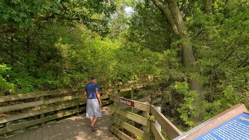
A few quick checks before you drive to the park can save a wasted trip. Starved Rock’s trails are officially open from 7 a.m. until sunset, and the St. Louis Canyon trailhead is located along Route 178 rather than at the main lodge.
IDNR’s Starved Rock Trail Improvement Project page notes that as of its July 23, 2026 update, the outlying Route 178 parking lot serving St. Louis Canyon remained available while other areas of the park were affected by construction. That status can change, so checking the closure page immediately before your visit is a practical necessity, not an optional step.
Construction work, trail closures, and parking restrictions at the park are time-sensitive. What was accessible last month may be blocked this week, and connector trails that link St. Louis Canyon to other parts of the park have been affected by ongoing improvements.
The official park page is the most reliable source for current hours, access points, and any new restrictions that have been posted since this article was written.
For icefall conditions specifically, IDNR is straightforward: the park office cannot provide frequent updates on whether a formation exists at any given canyon. Recent visitor reports on hiking forums and social media tend to be more current than any official source for that kind of detail.
January is historically the most favorable month for finding ice at St. Louis Canyon, but a warm spell, a dry stretch, or an early thaw can reset conditions quickly.
IDNR’s park Q&A confirms that waterfalls across the park depend on precipitation, snowmelt, and groundwater, and that many canyon waterfalls can diminish significantly during dry periods. Combining the official closure page, the park’s main activity page, and recent visitor accounts gives you the clearest picture of what to expect on any specific winter day.
Prepare for winter footing and changing trail hazards
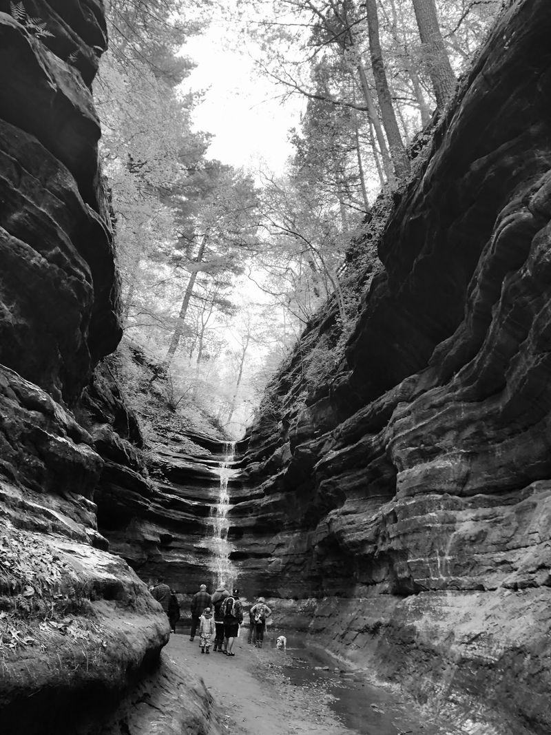
Winter hiking at Starved Rock is genuinely different from a warm-weather visit, and St. Louis Canyon’s enclosed setting amplifies that difference. The canyon floor stays in shadow for most of the day during short winter days, which means ice and snow that melt on south-facing slopes above may persist on the stairs and canyon floor well into the afternoon.
IDNR’s winter hiking guidance recommends dressing in layers, carrying extra insulation, bringing water, and building in extra time for delays or unexpected conditions.
Traction devices such as microspikes or Yaktrax can make a significant difference on icy stairs and canyon approaches. IDNR’s Q&A specifically mentions traction devices as appropriate for some winter canyon trails, including French and LaSalle canyons.
Whether you need them at St. Louis Canyon depends on current conditions, so check recent reports and bring them when there’s any reasonable chance of ice on the trail.
Marked trails and brown directional signs are your navigation tools throughout the park. Trail maps are posted at parking areas and major intersections.
If you need emergency help on the trail, call 911 and use the red QR-code location markers posted near trail maps to communicate your position to responders. IDNR emphasizes staying on marked trails at all times, both for your safety and for the protection of the canyon environment.
Specific behaviors create serious risks at the icefall and should be avoided without exception: never climb the ice formation, never walk on frozen pools, never position yourself behind or beneath unstable ice, and never scramble off-trail for a closer view. Separately, IDNR’s safety enforcement guidance explicitly prohibits off-trail hiking, rock-wall climbing, wading, swimming, and using the canyons as waterslides.
Sandstone crumbles when wet and undercut ice can fall without warning, so the marked viewing area is the right place to stop and take in whatever formation the season has produced.
Treat the icefall as a possibility, not a promise
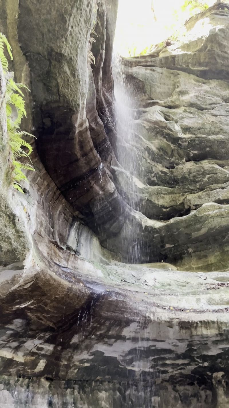
St. Louis Canyon earns a visit on its own terms before any ice appears. The enclosed sandstone walls, the damp plant communities clinging to the rock, and the quiet at the canyon floor offer a genuinely different experience from the park’s more trafficked overlooks and bluffs.
In winter, that setting gets a potential addition: a temporary ice formation that builds, shifts, and eventually disappears as temperatures rise and fall.
The practical decision rule is straightforward. Verify that the Route 178 trailhead is currently open using IDNR’s official park page and the current closure notices.
Check recent visitor reports for any word on ice conditions. Prepare your footing for stairs, wet sandstone, and possible ice on the trail.
Stay on the marked route when you arrive, keep a safe distance from any ice formation you find, and resist the urge to move closer for a better photo.
As glaciological research on waterfall ice makes clear, these formations are ephemeral by nature, shaped by forces that continue working while you’re standing in front of them. The canyon that shelters ice in January may show only a trickle of water in March and a lush green wall by June.
Catching it in its frozen state is a matter of timing, preparation, and a willingness to accept whatever the season offers.