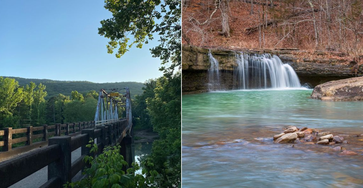
This Scenic Arkansas Hike Takes You To Three Hidden Waterfalls
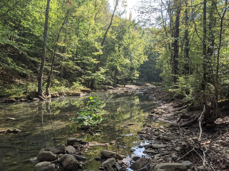
The sound of rushing water pulled me down this trail long before I saw the first waterfall. Within minutes, the forest closed in and the noise of the road disappeared behind me.
I remember thinking right away that this hike felt different from most short walks I take in Arkansas. The path itself isn’t long, yet it delivers far more than you’d expect.
Three waterfalls appear along the way, and none of them look alike. One spreads wide across the creek like a natural staircase.
Another trickles through mossy rock and shaded trees. The last one drops from a tall bluff and fills the whole hollow with sound.
I found this route by chance on a cool fall morning while wandering through the Ozarks. By the time I reached the third waterfall, I was already thinking about when I could come back again.
Discover One of Arkansas’ Most Scenic Hidden Waterfall Hikes
Arkansas has a quiet habit of hiding its best scenery behind gravel roads and tree lines that most drivers pass without a second glance.
I’ve noticed that some of the most rewarding hikes begin exactly this way, with a turn off the highway that barely looks like the start of anything memorable.
The trail I’m thinking of strings together three completely different waterfalls through one of the most beautiful sections of the Ozarks.
I first heard about it while chatting with a ranger at another trailhead, and the description sounded modest enough that I wasn’t sure what to expect.
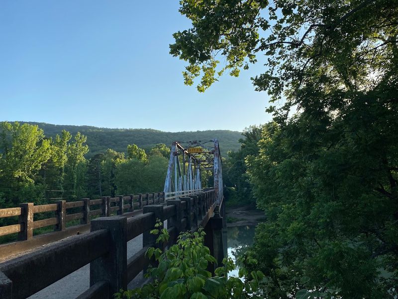
The drive through the rolling hills of Johnson County doesn’t give much away either.
Then the forest closes in, the sound of water grows louder, and suddenly the scenery feels far removed from the rest of the world.
Even better, hikers of almost any experience level can enjoy parts of the route, which makes it a great outing for families and solo wanderers alike.
You’ll find this trail at Haw Creek Falls Recreation Area, Haw Creek Falls Rd, Hagarville, AR 72839.
Where This Waterfall Hike Is Located
Finding Hagarville on a map takes a little patience, and that is part of its charm.
This census-designated place in Johnson County, Arkansas had a population of just 142 people as of the 2020 census, which means the surrounding forest feels refreshingly uncrowded even on weekends.
From Hagarville, the drive north on Arkansas Highway 123 covers roughly 14 miles before the recreation area comes into view, and the road itself winds through some of the most photogenic hill country in the state.
Coming from the other direction, travelers from Pelsor head west on Highway 123 for about 12 miles to reach the same trailhead.
The Ozark National Forest wraps around this entire area, giving the landscape a depth and scale that genuinely surprises first-time visitors.
Johnson County sits in the Arkansas River Valley region, where the Ozark Plateau begins its dramatic rise from the flatlands below.
Knowing the geography ahead of time helps you appreciate why the waterfalls here are so powerful, because the terrain practically funnels water toward these creek beds with every rainfall that rolls through the region.
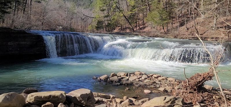
Start Your Adventure At Haw Creek Falls
Right at the edge of the campground, Haw Creek Falls greets you before you have even started the main trail, which feels like the forest offering a warm handshake.
The falls drop about six feet over a wide ledge of layered rock, creating a curtain of white water that catches the light beautifully in the late morning hours.
Because of its position so close to the parking area, this waterfall is accessible to virtually everyone, including visitors who may not be up for a longer hike.
I spent a good twenty minutes here just watching the water move over the rock shelf, noticing how the sound changed depending on where I stood along the bank.
The campground nearby offers nine primitive family campsites with fire rings and picnic tables, making it easy to turn a day hike into an overnight stay.
Camping trailers are permitted at the site, though there are no electrical hookups or water hookups available, so self-sufficiency is the order of the day.
Starting at Haw Creek Falls sets a satisfying tone for the rest of the hike, because the trail only gets more dramatic from this point forward.
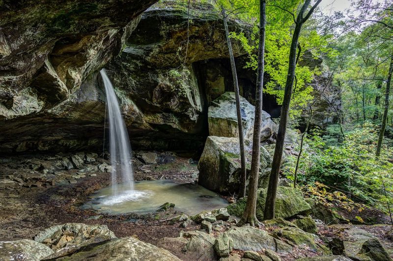
Follow The Trail To The Hidden Pack Rat Falls
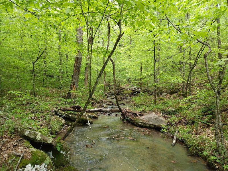
About a quarter mile past the campground, the trail narrows and the forest thickens, signaling that you are moving into territory that rewards the curious hiker.
Pack Rat Falls arrives with little fanfare but makes an immediate impression, tumbling down a taller and more dramatic cascade than the first waterfall back at the trailhead.
The surrounding rock formations here have a rougher, more rugged character, with boulders stacked at angles that suggest the land has been rearranging itself for centuries.
I remember pausing on a flat rock just downstream and noticing how the mist from the falls drifted through the ferns and moss in slow, lazy spirals.
The trail to reach Pack Rat Falls is more uneven than the short path to Haw Creek Falls, so sturdy footwear makes a real difference on this stretch.
Despite being a short but uneven hike, the route is well worth every step, and the payoff of standing in front of this cascade is the kind of moment that makes you glad you pushed a little further.
Pack Rat Falls sits in a natural pocket of the forest that amplifies the sound of the water, filling the whole hollow with a steady, meditative roar.
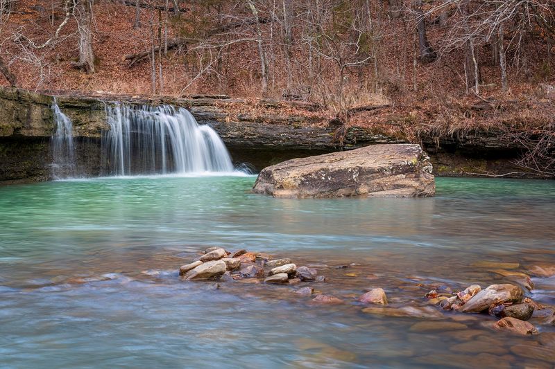
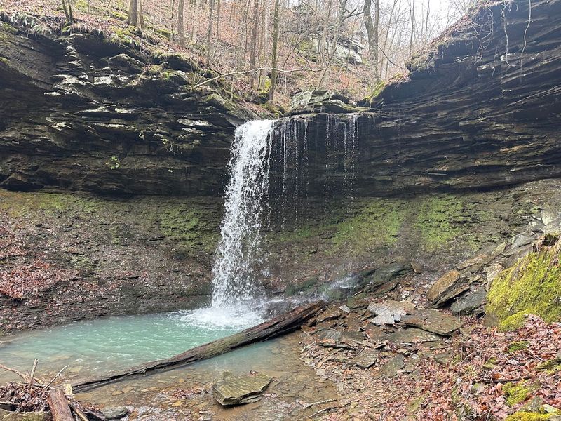
Don’t Miss The Tall Waterfall At Pam’s Grotto
Pam’s Grotto is the showstopper of this three-waterfall route, and nothing on the approach quite prepares you for the moment it comes into full view. The short trail to reach it begins just across Highway 123 from the Haw Creek Falls campground.
Standing 37 feet tall, the waterfall drops into a rocky grotto framed by massive boulders draped in thick green moss, creating a scene that looks more like a painting than a real place.
The scale of the surrounding rock walls gives Pam’s Grotto a cathedral quality, and I found myself lowering my voice instinctively when I arrived, the way you do in places that feel genuinely ancient.
Reaching this waterfall requires the most effort of the three stops on the route, with a more rugged trail section that involves some careful footing over uneven terrain.
The payoff is so dramatically out of proportion to the effort that first-time visitors almost always stand in silence for a moment before reaching for their cameras.
Moss-covered rocks line the base of the falls, and in wet seasons the entire grotto glistens with a soft green luminescence that photographers absolutely love.
Pam’s Grotto alone would justify driving to the Ozarks, but the fact that it sits at the end of a route that already includes two other waterfalls makes it feel like a bonus prize.
Best Time Of Year To See These Arkansas Waterfalls
Timing a visit to Haw Creek Falls Recreation Area can dramatically change the experience, and every season brings something genuinely different to the trail.
Spring delivers the most powerful water flow, as snowmelt and seasonal rainfall push the creek to its most dramatic levels, turning all three waterfalls into roaring, spray-filled spectacles.
Autumn is my personal favorite season here, when the Ozark hardwoods shift into golds, oranges, and deep reds that frame every waterfall with a natural color palette that no filter can replicate.
Summer visits are popular with families, and the cool mist from the falls provides welcome relief from the Arkansas heat, especially on the approach to Pam’s Grotto.
Winter brings a quieter, more solitary experience, and on cold mornings ice formations sometimes appear along the rock edges near Haw Creek Falls, adding an unexpected sculptural element to the landscape.
The recreation area is open year-round, but visitors should always check weather forecasts before heading out, because the area is subject to flash flooding during heavy rain events.
Whatever season you choose, arriving early in the morning gives you the best light for photography and the best chance of having the trail mostly to yourself.
Tips For Hiking This Three-Waterfall Route
A little preparation goes a long way on this route, and the hikers who enjoy it most are almost always the ones who came ready for the terrain.
Waterproof or water-resistant trail shoes are a smart choice here, because creek crossings and wet rocks are part of the experience, especially on the way to Pack Rat Falls and Pam’s Grotto.
Trekking poles are not strictly necessary, but they add stability on the more uneven sections of the trail and take pressure off your knees on the return descent.
Bring more water than you think you need, because the hike through the Ozark heat in summer can be more demanding than the modest trail distance suggests.
Cell signal in this area is limited to nonexistent, so downloading an offline map before you leave home is a genuinely useful step rather than just a suggestion.
The Ozark Highlands Trail passes through the recreation area, connecting this route to a broader network of trails for hikers who want to extend their adventure beyond the three waterfalls.
Pack out everything you bring in, keep noise levels respectful of other visitors, and leave the mossy rocks exactly where you find them so the next hiker gets the same unspoiled experience you did.