This Short Drive In Arizona Packs More Beauty Per Mile Than Anywhere Else
Sometimes I feel like I have accidentally driven onto another planet. There is a specific route I take whenever I need to remember that the world is still a wild, breathtaking place.
It isn’t a long trek through the desert; in fact, it’s one of the shortest drives I’ve ever taken. Yet, it packs a heavier punch than any thousand-mile journey could.
The earth here is a shade of burnt sugar I didn’t think existed in nature, and the rocks rise up like ancient guardians against a sky that looks painted on. This little slice of Arizona is proof that you don’t need a massive fuel tank to see something life-changing.
It is a dense, dizzying masterpiece of geology that makes every single mile feel like a victory lap for the senses. Every single mile of this route feels like someone turned up the color saturation on the whole world.
The All-American Road That Started It All
Back in 2005, the Federal Highway Administration handed the Red Rock Scenic Byway a title that very few roads in the entire country ever receive: All-American Road. That designation is not handed out casually.
A road must have qualities so rare and irreplaceable that the road itself becomes the destination, not just the route to one.
State Route 179 earned that honor by threading through one of the most visually dramatic landscapes on the continent.
The drive connects Interstate 17 to the town of Sedona, passing through the Village of Oak Creek along the way, and sits about 110 miles north of Phoenix and 40 miles south of Flagstaff.
Officials and travel writers often call it a museum without walls, and that phrase is honestly one of the more accurate descriptions I have ever heard applied to a stretch of highway.
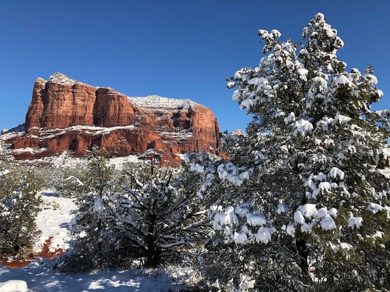
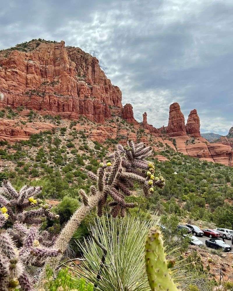
The red rock formations lining the route are 300 million years old, and every bend in the road reveals a new composition that no gallery could ever frame properly.
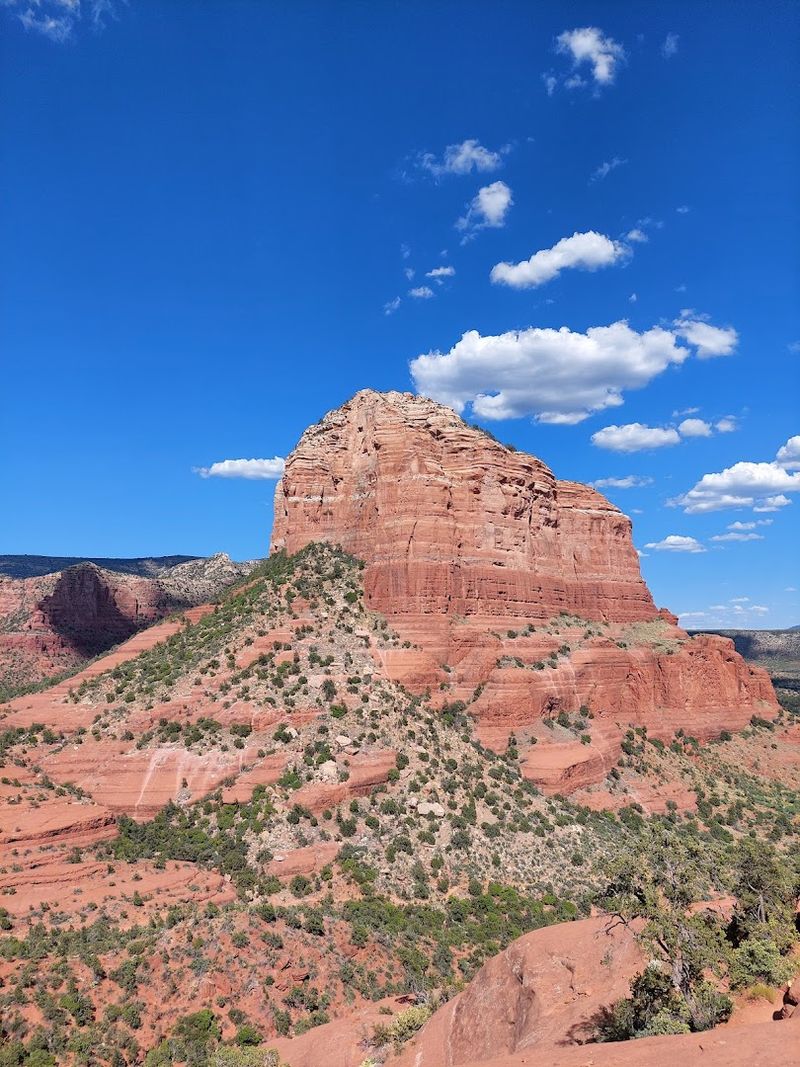
Bell Rock And Courthouse Butte: The Byway’s Most Famous Faces
There is a moment driving north on SR 179 when Bell Rock appears on your right and you instinctively slow down. It rises from the desert floor in a near-perfect dome shape, and its symmetry feels almost too deliberate for something that formed without any human help.
Courthouse Butte stands right beside it, taller and more angular, like a companion that chose a completely different personality.
Together, these two formations are arguably the most photographed landmarks along the entire byway. Bell Rock also carries a reputation as an energy vortex site, a concept deeply tied to Sedona’s spiritual culture, and visitors come from around the world specifically to sit near its base and soak in whatever the place is offering that day.
The Bell Rock Pathway is an easy, well-marked trail that loops around both formations and rewards hikers with close-up textures and colors that no windshield view can replicate. Sunrise and sunset light the rocks in shades of deep amber and rust that make every photograph look professionally edited.
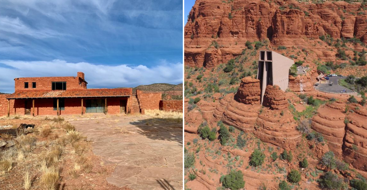
Chapel Of The Holy Cross: Architecture Meets The Sacred Landscape
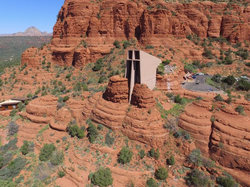
Somewhere between bold architecture and quiet reverence, the Chapel of the Holy Cross manages to occupy both spaces at once.
Built directly into a butte above Sedona, this Roman Catholic chapel was completed in 1956 and was designed by sculptor Marguerite Brunswig Staude, who wanted to honor both faith and the natural world in a single structure.
The chapel’s defining feature is a massive concrete cross that rises from the face of the building and frames the red rock canyon behind it. From the road below, the structure looks like it grew out of the cliff rather than being constructed on top of it.
Inside, floor-to-ceiling windows replace traditional stained glass, letting the red rock landscape serve as the sanctuary’s backdrop.
The views from the chapel’s outdoor terraces stretch across the Verde Valley in every direction, and even visitors who are not religious tend to stand quietly for a while before moving on. The short but steep road leading up to it is worth every twist and turn it takes to get there.
The Red Rock Ranger District Visitor Center: Your Best First Stop
Pulling over at the Red Rock Ranger District Visitor Center before heading up the byway is one of those decisions that pays off for the rest of the day. Positioned near the southern start of SR 179, the center offers maps, trail condition updates, exhibits about the region’s geology and ecology, and staff who genuinely enjoy talking about the area they work in.
This is also where you can sort out your Red Rock Pass, which is required for parking at many trailheads and pullouts on National Forest land along the route. Skipping this step and assuming you can pay later tends to result in a parking ticket that costs considerably more than the pass itself.
The exhibits inside give a solid grounding in what you are about to see, explaining the layered geology that produced those vivid red formations and the plant communities that somehow thrive in the dry, rocky soil.
Walking in without that context is fine, but walking in with it makes the landscape feel even more layered and alive.
Tlaquepaque Arts And Shopping Village: Culture Woven Into The Landscape
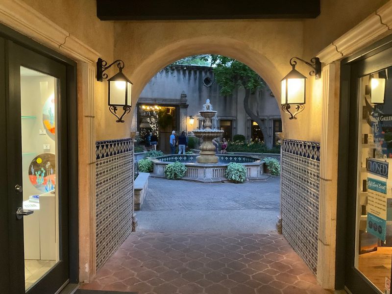
The name Tlaquepaque (pronounced T-lah-keh-PAH-keh) trips up almost every first-time visitor, but the place itself is impossible to forget once you have wandered through it.
Modeled after a traditional Mexican village and built with genuine Spanish Colonial architectural details, the complex sits along Oak Creek and houses art galleries, boutique shops, and restaurants within a series of shaded courtyards and covered walkways.
Unlike a typical shopping plaza, Tlaquepaque was designed to feel like a living community rather than a commercial space. Sycamore trees grow up through openings in the tile rooftops, fountains anchor the central courtyards, and handcrafted ironwork decorates nearly every doorway and window frame.
The overall effect is one of texture and warmth that makes browsing feel genuinely leisurely rather than transactional.
Many of the galleries represent local and regional artists working in ceramics, painting, jewelry, and sculpture, so what you find here tends to reflect the actual landscape and culture surrounding it.
Stopping for lunch at one of the courtyard restaurants while watching the light shift across the adobe walls is a perfectly reasonable way to spend two hours of your day.
Wildlife And Desert Flora Along The Route
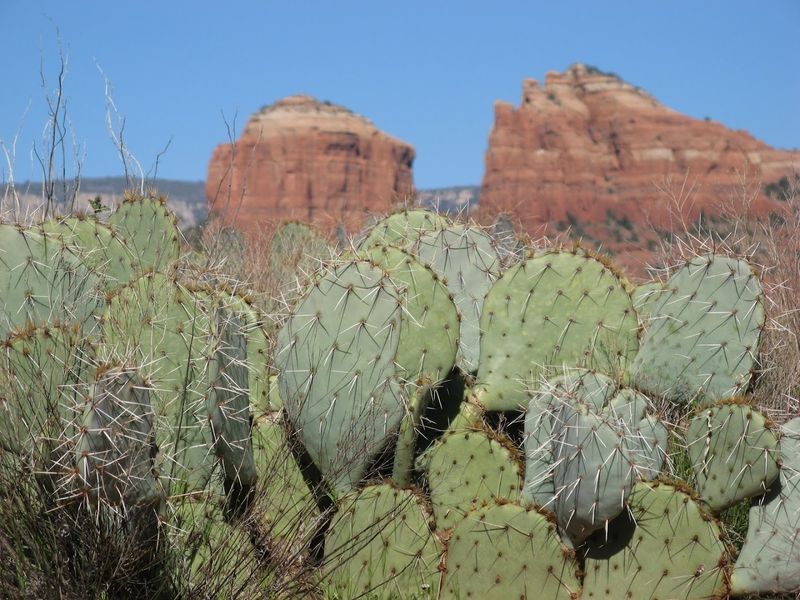
Most people come to the Red Rock Scenic Byway for the formations, but the living landscape running along the base of those rocks is worth just as much attention. Scrub oak, juniper, pinon pine, cacti, and yucca cover the rolling terrain in a mosaic of deep greens and grays that contrast sharply against the red soil.
In spring, wildflowers push up between the rocks and add unexpected bursts of yellow and purple to the scene.
Wildlife moves through this corridor with impressive regularity. Deer and elk are spotted near dawn and dusk, coyotes trot across the road with casual confidence, and hawks ride thermals overhead in wide, lazy circles.
Quail dart between shrubs in small groups, and if you are patient and quiet near Oak Creek, you have a reasonable chance of spotting a great blue heron standing motionless in the shallows.
The diversity of species here reflects how well-preserved the surrounding Coconino National Forest remains. Pulling over at one of the designated scenic pullouts and simply sitting still for ten minutes often produces more wildlife sightings than an entire hike at a busier park.
Planning Your Visit: Practical Tips For Getting The Most Out Of SR 179
The drive itself takes about 20 minutes if you keep moving, but treating it that way is genuinely a waste of a road this remarkable. Most experienced visitors block out at least half a day, and a full day is not an overcommitment if you plan to hike, photograph, and stop at the cultural sites along the route.
Spring and fall are the strongest seasons for a visit. Spring brings wildflowers and comfortable temperatures, while fall layers cooler air and occasional autumn color against the red rocks in a combination that photographs beautifully.
Summer brings heat that can make midday hiking genuinely uncomfortable, so early morning starts are essential if you visit between June and August.
Weekdays and shoulder seasons keep the crowds manageable, especially at Bell Rock and the Chapel of the Holy Cross, where parking fills quickly on busy weekends.
Grab your Red Rock Pass at the visitor center before heading up, wear sun protection regardless of the season, and carry more water than you think you need because the desert here has a way of reminding you that it is still very much a desert.