
This Thrilling Hiking Trail Is Arizona’s Answer To The Bridge Of Khazad-Dûm, But With Breathtaking Views
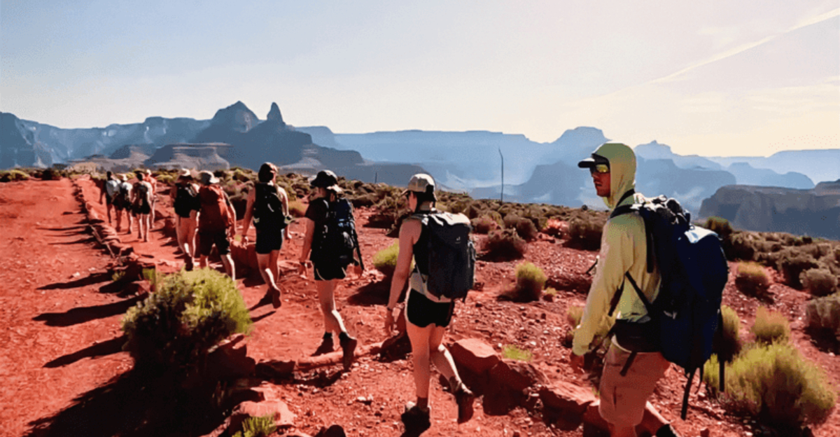
My therapist told me I needed to face my fears, and I told her I’d consider skydiving or maybe public speaking. What I didn’t anticipate was her handing me a map to a trail so ruthlessly vertical that ancient civilizations probably used it as an entrance to the underworld—which, given what I saw, tracks.
There I was, a perfectly reasonable person who’d rather take elevators than stairs, staring down a path carved into sheer rock face while the canyon whispered seductive promises about how beautiful the view would be if I survived.
The drama? The sheer 7,000-foot plunge into geological time, where every switchback mocked my existence and every stunning panorama felt like nature’s cruel reward for pushing through existential terror.
Arizona’s monuments might inspire patriotism, but this place?
This place inspires a primal survival instinct I didn’t know I possessed. No trees blocking your sightlines, no side canyons hiding the drama, just raw canyon walls, layered red rock, and the silver ribbon of the Colorado River waiting far below.
The Ridgeline Route That Changes Everything
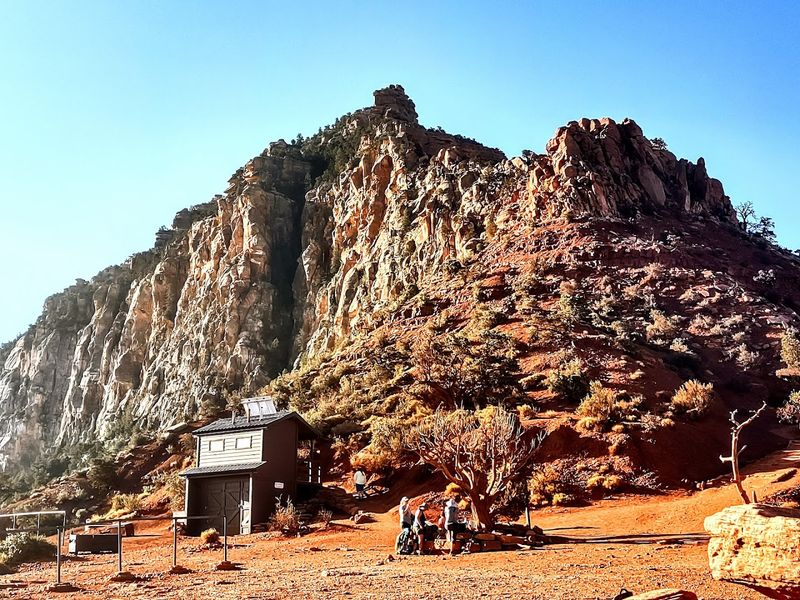
Most Grand Canyon trails sneak along side canyons, giving you glimpses of the big picture. The South Kaibab Trail throws that approach out entirely. It descends directly along an open ridgeline, meaning there is almost nothing between you and one of the most jaw-dropping landscapes on the planet.
Every step forward reveals a new angle, a deeper layer, a wider sweep of canyon that makes your brain work overtime just processing it all.
This design choice is what separates the South Kaibab from trails like the Bright Angel. You are not tucked away in a corridor of rock. You are perched on top of the world, exposed and exhilarated.
The tradeoff is real though, because with no trees and very little shade, the sun hits you directly. Starting early in the morning is not just a suggestion here, it is genuinely smart planning.
I loved how every turn felt completely exposed to the canyon’s enormous beauty, with nowhere for the views to hide.
That same openness is exactly why I would plan this hike carefully and be moving well before the sun takes over the ridge.
Ooh-Aah Point And The First Big Payoff
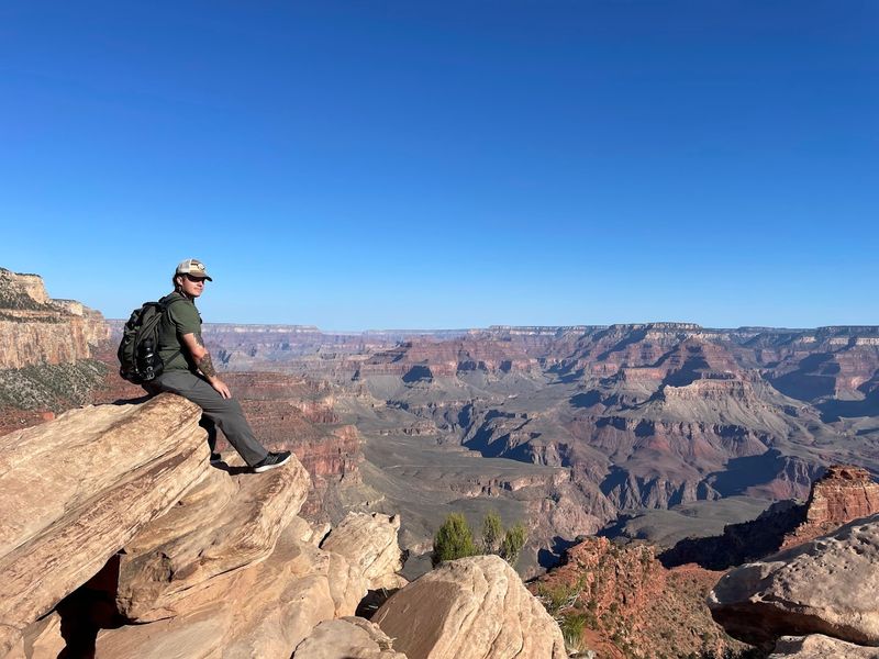
About 0.9 miles from the trailhead, you reach a spot that earned its name entirely through honest visitor reactions. Ooh-Aah Point sits at a natural bend in the ridgeline where the canyon opens up in a way that genuinely stops people mid-sentence.
I watched a group of four hikers arrive there in total silence, phones already raised, completely speechless for a solid thirty seconds.
The elevation at this point still keeps you high enough to see enormous sweeping distances across the canyon, while the descent has already begun to pull you into the drama below.
Canyon walls glow amber and rust in the morning light, and the scale of what you are looking at slowly starts to register. For families or casual hikers, Ooh-Aah Point works beautifully as a turnaround destination that still delivers a full sensory experience worth every uphill step back.
Cedar Ridge And The Comfortable Middle Ground
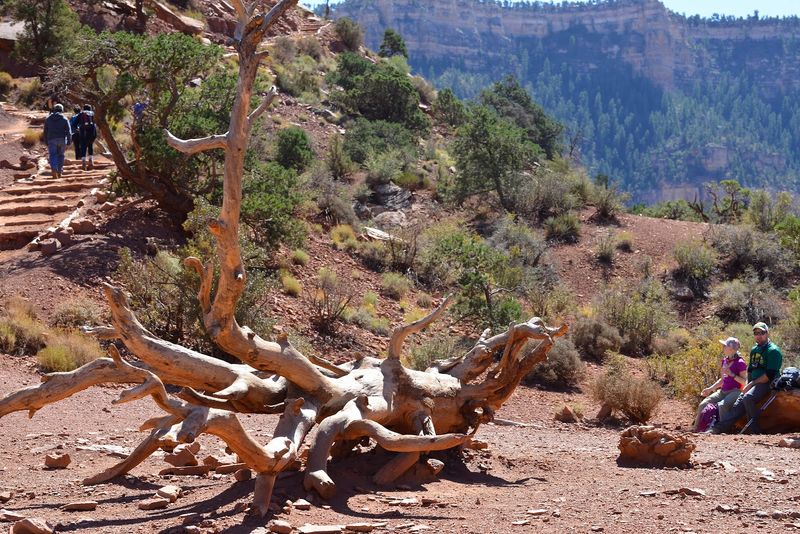
Cedar Ridge sits 1.5 miles down the trail, and it functions as the trail’s unofficial social hub. There is a composting toilet facility here, a relatively flat resting area, and enough open space that groups spread out, eat snacks, and stare at the canyon like it owes them something.
On busy mornings, Cedar Ridge feels almost lively, with hikers coming and going in a steady rhythm.
The views from here are already extraordinary, and the elevation change so far is noticeable but manageable for most reasonably fit hikers. Many park rangers recommend Cedar Ridge as the ideal turnaround point for day hikers who want a satisfying challenge without overcommitting.
The return climb back to the rim from here takes most people between 45 minutes and an hour and a half, depending on pace and the heat pressing down on your shoulders.
Skeleton Point And The First Sight Of The River
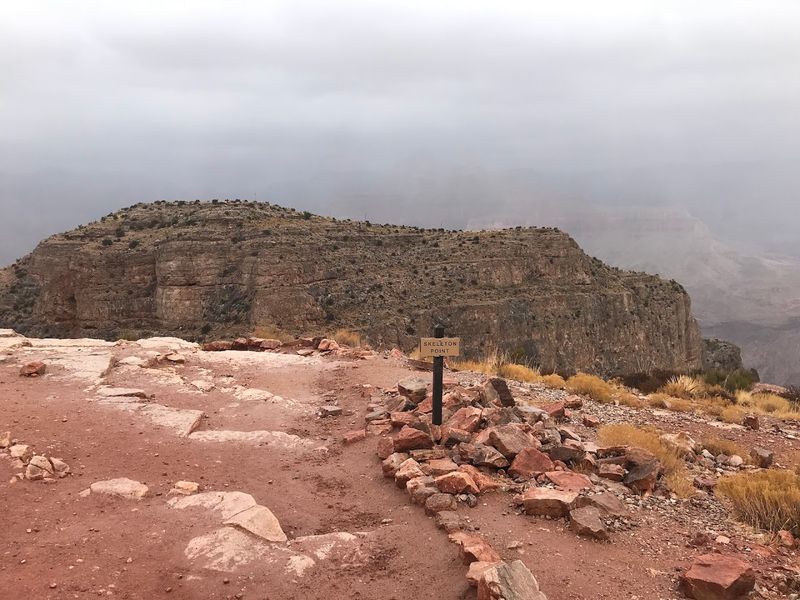
At 2.8 miles down, Skeleton Point delivers the moment many hikers have been working toward since the trailhead. This is where the Colorado River first appears, a thin, glittering line threading through the canyon floor so far below that it looks almost unreal.
Your legs are already feeling the steep and steady descent by this point, and your knees are beginning to have quiet opinions about the whole adventure.
Skeleton Point is the farthest recommended turnaround for day hikers, and that recommendation comes from real experience, not just cautious signage.
The terrain below becomes significantly more demanding, and the return ascent from this point is a serious physical commitment. Still, reaching Skeleton Point feels like cracking open the canyon’s secret.
The river that carved all of this over millions of years finally reveals itself, and the scale of everything you have been walking through suddenly makes perfect sense.
The Black Suspension Bridge At The Bottom
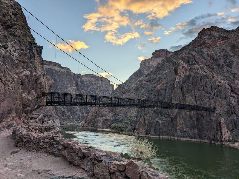
If Ooh-Aah Point is where you first gasp, the Black Suspension Bridge is where your inner adventurer quietly pumps a fist.
Spanning the Colorado River at the canyon’s floor, this narrow bridge connects the South Kaibab Trail to Bright Angel Campground, and crossing it is one of those genuinely memorable travel moments that sticks with you long after the sore muscles fade.
The bridge sways gently underfoot, the river churns green and cold below, and towering canyon walls rise on both sides in every direction. It feels cinematic in the best possible way.Reaching this point means you have descended roughly 4,780 feet from the South Rim, and the full weight of that achievement lands somewhere around the middle of the bridge.
Bright Angel Campground sits just beyond, offering a rest point for those with backcountry permits secured well in advance through the park lottery system.
Practical Tips For Tackling The Trail Safely
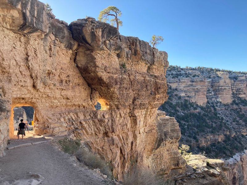
The National Park Service is refreshingly blunt about this trail: hiking rim to river and back in a single day is not recommended for most people. The South Kaibab Trail has no water sources along its length, so carrying at least four liters per person is essential, not optional.
A water spigot near the trailhead bus stop operates roughly from early May through mid-October, but do not count on it as your only source.
Private vehicles are not allowed at the trailhead. You reach it via the Kaibab/Orange Route shuttle or the Hiker Express shuttle from the South Rim Visitor Center area.
Timing matters enormously here. Between May and September, starting before dawn is genuinely critical, since temperatures between 10 a.m. and 4 p.m. can turn a thrilling hike into a dangerous one. Spring and fall offer the most forgiving conditions for a longer descent.
I would rather carry extra water and start in the dark than underestimate a trail this beautiful and unforgiving.
Why This Trail Earns Its Legendary Status
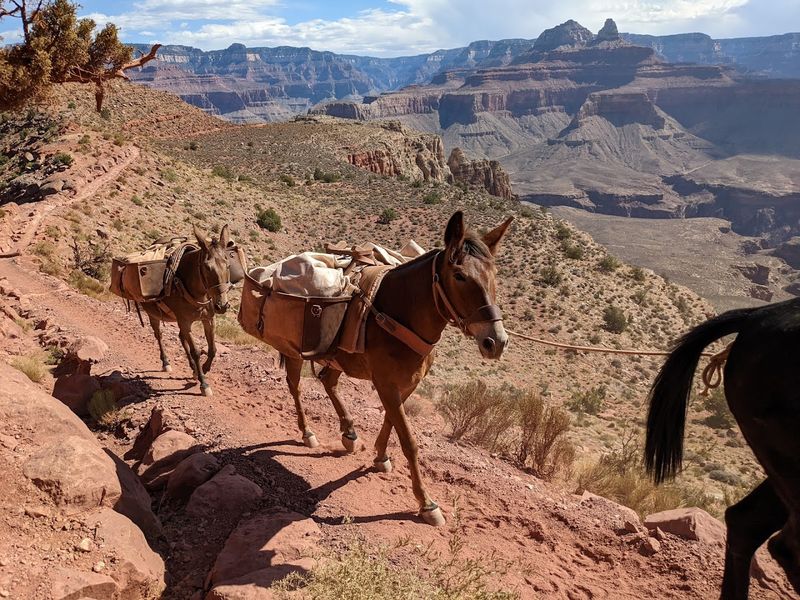
Some trails are beautiful. Some are challenging. The South Kaibab Trail manages to be both at the same time, which is a rare combination that keeps hikers talking about it for years.
The ridgeline route means there is no hiding from the canyon’s full scale, and that relentless exposure to the landscape is exactly what makes every mile feel earned and unforgettable.
The trail is well-maintained and clearly marked, which helps given how disorienting the sheer size of the canyon can feel on the way down. Seasonal hikers return to it year after year, finding something new in the light, the color of the rock, or the stillness of an early morning descent before the crowds arrive.
The South Kaibab Trail sits inside Grand Canyon National Park, South Rim, Arizona, and it rewards every hiker willing to respect its demands with a perspective on this world that very few places can match.
I left with tired legs and the feeling that every exposed mile had been completely worth it.
Few hikes make the landscape feel this enormous while still making you grateful to be walking straight through it.
The Tonto Trail Junction And The Crossroads Below
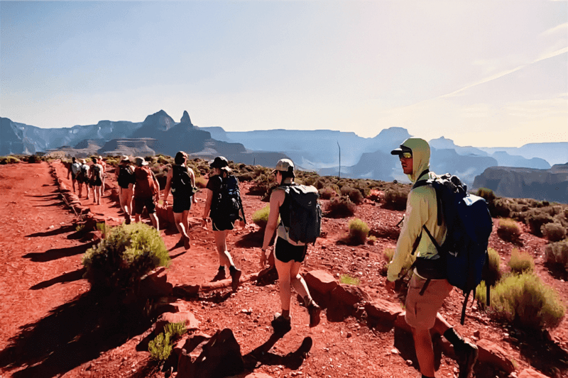
Few moments on the South Kaibab Trail carry as much quiet drama as reaching the Tonto Trail junction. By this point, your legs have been working hard, the canyon walls tower above you, and the sheer scale of where you are finally sinks in completely.
This junction marks a real decision point. You can push forward toward the river or loop onto the Tonto Trail for a longer backcountry experience. Either way, stopping here to catch your breath and take in the surrounding plateau feels almost mandatory.
The Tonto platform stretches wide and eerily flat compared to the steep descent behind you. It is one of those rare trail moments that rewards every step of the effort. I found myself pausing longer than expected, partly to rest and partly because the view made moving on feel almost rude.
From here, the canyon opens in layers of rock and distance that make the trail behind you look impossibly small. It is the kind of stop that reminds you the Grand Canyon does not reveal itself all at once, but step by demanding step.