This Unique Colorado Drive Is Packed With History, Legends, And Scenic Payoff
Some road trips demand color coded plans, backup snacks, and a fully charged group chat. This one simply asks you to get in the car and go.
In Colorado, that kind of easy magic feels extra rare, which is exactly why this drive stands out. The road twists through dramatic rock formations, climbs into crisp mountain air, and rolls past the kind of small town scenes that make you want to slow down just to take it all in.
Families can turn it into a full day of laughs and overlooks, couples will find plenty of scenery worth pulling over for, and solo travelers may discover that the best company is a great playlist and a wide open view. Colorado’s quieter adventures often end up being the most memorable, and this route proves it with every turn.
Bring a jacket, clear some space on your camera roll, and prepare for a drive that feels wonderfully underappreciated.
Where The Road Begins: The Walsenburg Entrance
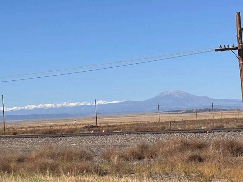
There is something quietly satisfying about a road trip that starts with a sign you almost miss. Its entrance sits along US-160 near Walsenburg, Colorado 81089, a small but determined town that serves as the official gateway to one of the state’s most storied drives.
Pull over, take a breath, and let the moment register.
Walsenburg itself has the kind of Main Street energy that feels like a handshake from a stranger who turns out to be excellent company. It is the kind of place where the gas station attendant will tell you exactly which overlooks are worth slowing down for, and they will be right every single time.
Starting here grounds the trip in something real. You are not just entering a scenic route; you are stepping into a corridor of history, geology, and local legend that stretches far beyond what any highway sign can summarize.
Quick Tip: Top off your tank in Walsenburg before heading out, since services along the byway are spaced out and part of its charm is that it does not feel like a highway at all.
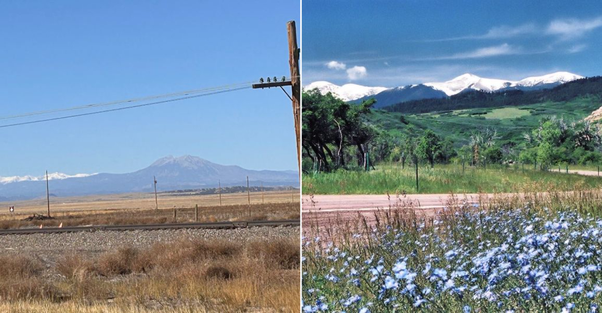
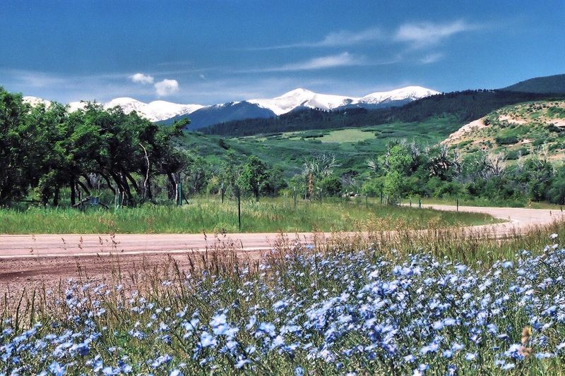
The Spanish Peaks: Two Giants That Anchor Every View
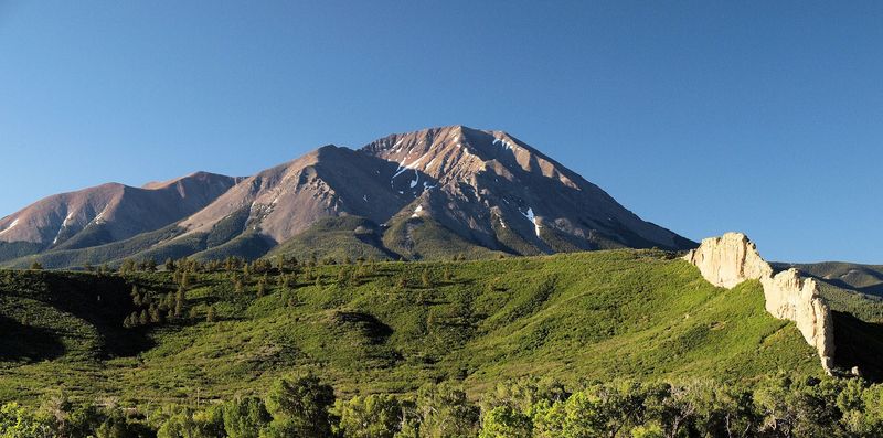
Few landmarks in Colorado command attention quite like the Spanish Peaks. These twin volcanic mountains rise dramatically from the surrounding plains, and they are visible for miles before you ever get close.
Indigenous peoples, Spanish explorers, and later settlers all used them as navigational anchors, which means these peaks have been doing their job for a very long time.
The mountains are part of the broader Spanish Peaks State Wildlife Area, and their presence shapes the entire visual identity of the byway. Every curve in the road seems choreographed to reveal a new angle of these giants, which is exactly the kind of scenery that makes passengers stop looking at their phones.
Geologically, the peaks are the result of igneous intrusions that pushed through sedimentary rock millions of years ago. That scientific backstory somehow makes them feel even more dramatic in person.
Why It Matters: The Spanish Peaks are not just pretty backdrops. They are a federally designated National Natural Landmark, which means the landscape you are driving through carries genuine scientific and cultural significance worth appreciating at every mile marker.
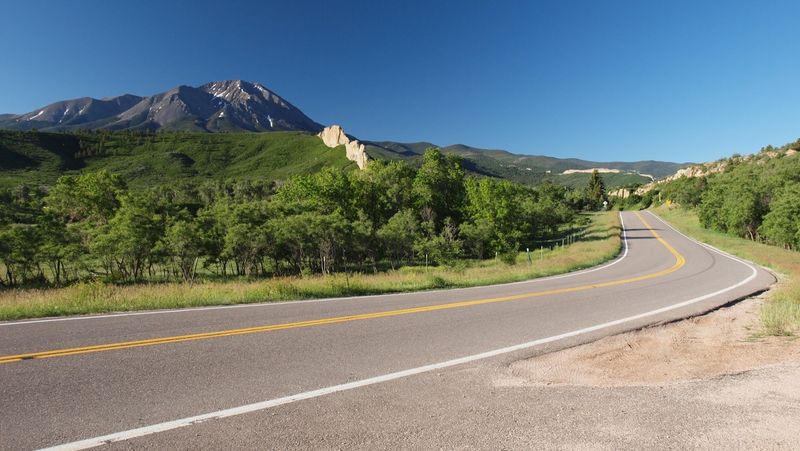
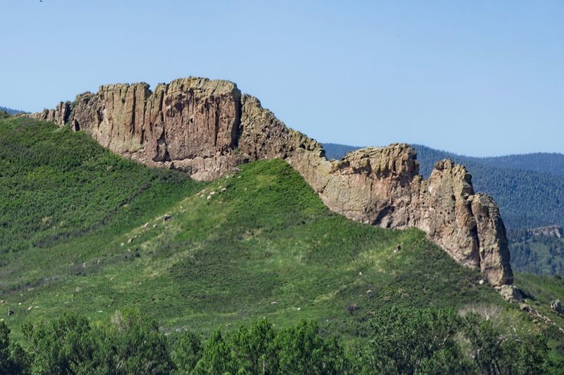
The Devil’s Staircase: Lava Walls That Defy Explanation
Imagine driving along a perfectly reasonable mountain road and suddenly encountering a wall of ancient lava rock jutting out of the earth like nature forgot to clean up after itself. That is the Devil’s Staircase, a series of volcanic dikes that runs along the east side of the highway for roughly 43 miles.
It is one of the most visually arresting geological features in the entire state.
These dikes formed when molten rock forced its way through cracks in the earth and then cooled into vertical walls. Over millions of years, the softer rock around them eroded away, leaving these dramatic ridges standing like sentinels along the road.
The effect is somewhere between a science museum exhibit and a fantasy novel illustration.
Visitors who know to look for it tend to slow down considerably, which is exactly the right response. Insider Tip: The dikes are most visually striking in the morning light when shadows play across the rock faces.
If your drive takes you eastbound in the early hours, keep your eyes on the right side of the road for the full dramatic effect of this 43-mile geological gallery.
Fall Color Season: When The Byway Becomes Something Else Entirely
There is a window in autumn when the Highway of Legends transforms into something that feels almost too good to be real. Aspen groves along the route shift to gold and amber, and the contrast against the dark volcanic rock formations creates a color palette that photographers chase for hours.
Visitors who time their drive for peak fall season tend to use words like “unreal” and “overwhelming” in the best possible way.
Peak color typically arrives in late September through mid-October, though the exact timing shifts year to year depending on temperature and precipitation patterns. The Spanish Peaks area and the hillsides around La Veta and Cuchara are particularly spectacular during this window, with golden aspen stands appearing around almost every bend.
Planning around fall color does require a bit of flexibility, but the payoff is substantial enough to justify the scheduling effort. Planning Advice: Check Colorado’s fall foliage forecast through the Colorado Department of Transportation before you go.
Timing even one week off from peak can mean the difference between a good drive and a genuinely jaw-dropping one, so a quick check before departure is well worth the two minutes it takes.
The Road Conditions Reality Check: What To Know Before You Go

Here is the part of the trip planning that most travel features skip over in favor of more dramatic content. Road conditions along the Highway of Legends vary significantly by season and by specific segment.
Visitors heading westbound from Aguilar toward the arch tend to report smooth, well-maintained pavement, while the stretch eastbound from Cuchara has been noted as rougher in sections. Knowing this in advance saves you the mild irritation of being surprised by it mid-trip.
The Colorado Department of Transportation manages the byway and provides road condition updates that are genuinely useful rather than just bureaucratic formality. Checking the CDOT website or calling their travel information line before departure is a low-effort habit that pays off consistently, especially if you are traveling with a vehicle that has lower clearance or if you are towing anything.
Winter travel on this route requires winter driving readiness, full stop. The mountain passes along the corridor are serious terrain even in good conditions.
Who This Is For: Drivers who have some comfort with mountain roads and are willing to do a quick pre-trip conditions check. The byway is genuinely accessible to most visitors in summer and fall, but it rewards a small amount of preparation with a much smoother and more enjoyable experience overall.
The Byway’s Rating And Why It Holds Up
A 4.9-star rating from visitors is the kind of number that makes you wonder whether the remaining 0.1 is just statistical humility. The Highway of Legends Scenic Byway has earned that near-perfect score through consistent delivery of exactly what it promises: dramatic scenery, genuine geological interest, and a driving experience that feels rewarding rather than merely functional.
That kind of consistency across different seasons and different types of visitors is not accidental.
The reviews that accompany that rating point to specific features repeatedly: the views at La Veta Pass, the spectacle of the Devil’s Staircase, the fall color season, and the overall sense that this is a road worth driving more than once. That last point matters more than it might seem, because a route that people want to repeat is one that has depth beyond the first impression.
The Colorado Department of Transportation’s designation of this corridor as a scenic byway reflects the same assessment in official terms. Quick Verdict: The Highway of Legends Scenic Byway is one of southern Colorado’s most reliably rewarding drives, delivering volcanic geology, mountain passes, and small-town character in a single route that works for virtually every type of traveler who gives it a chance.
Final Verdict: The Drive That Pays You Back Every Mile
Some road trips are about the destination. The Highway of Legends Scenic Byway is about every mile in between, which is a rarer and more satisfying kind of travel.
From the entrance near Walsenburg to the mountain crossings at La Veta and Wolf Creek passes, this route delivers the kind of layered experience that holds up under repeat visits and rewards anyone who takes the time to look out the window instead of just passing through.
The geological drama of the Devil’s Staircase, the cultural weight of the Spanish Peaks, the character of the small towns, and the sheer visual variety of the landscape across seasons combine into something that justifies the detour every single time. This is not a hidden gem in the sense of being difficult to find.
It is simply a route that has not been oversold, which in the current travel landscape is practically a compliment in itself.
If someone texts you asking for a Colorado road trip recommendation that actually delivers, this is the answer you send back with full confidence. Key Takeaways: Start in Walsenburg, download the GPS app before you leave, plan for at least one unscheduled stop, check road conditions for the pass sections, and go in fall if you can possibly manage it.
The byway will handle everything else.