
This Winding Arizona Canyon Drive Takes You Past Hoodoos And Sweeping Desert Views
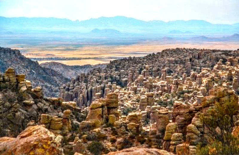
Picture stone columns taller than houses, standing shoulder to shoulder like a crowd frozen in place. That is what waits at the end of an eight-mile paved road in southeastern Arizona, where grassland slowly gives way to pine and rock.
The drive climbs nearly a mile into the sky, opening one jaw-dropping view after another. Best of all, getting in costs nothing, making it one of the most rewarding day trips the state has to offer.
Where the Road Begins in Southeastern Arizona
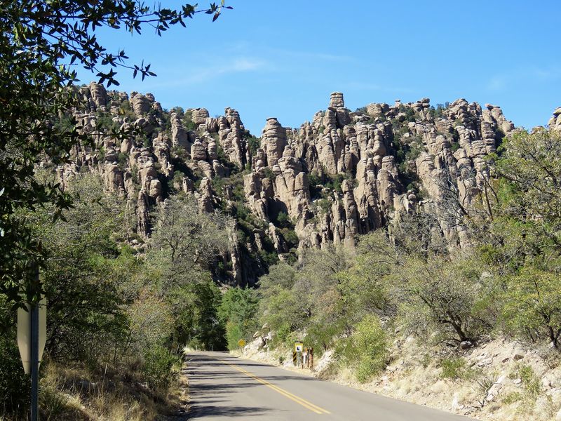
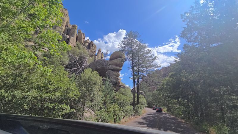
Roughly 35 miles southeast of Willcox, this eight-mile paved road threads through Chiricahua National Monument, a rugged pocket of southeastern Arizona that many travelers zip right past. The route is the only motorized drive inside the park, so it carries the full weight of showing off what makes this place special.
Willcox and Sunizona are the closest towns for fuel and basic supplies, so it pays to top off the tank before pointing your car toward the hills. Once you turn onto the road, civilization fades quickly and the landscape takes over.
Visitors describe it as a magical desert drive tucked back in the hills, and that captures the feeling of leaving the everyday behind. The road runs in and out, meaning you travel the same route both directions, which is a gift because you catch different angles on the return trip.
Grasslands roll into forest, forest climbs into rock, and the whole thing unfolds slowly enough to soak in.
Standing-Up Rocks Born From an Ancient Eruption
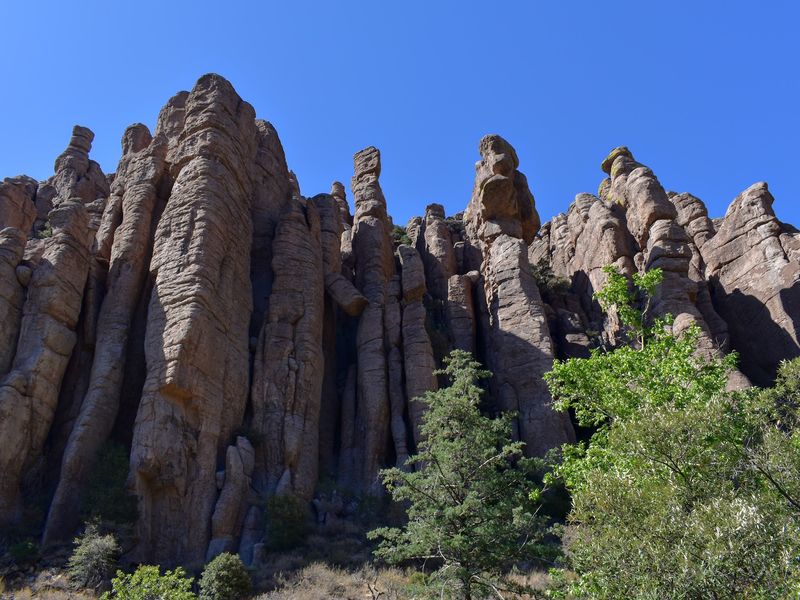
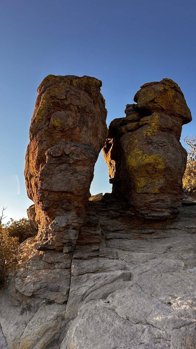
Long before roads or towns, a colossal volcanic eruption from the Turkey Creek Caldera about 27 million years ago blanketed the region in a thick layer of rhyolite tuff. As that hot ash cooled and shrank, it cracked into vertical joints, setting the stage for everything you see today.
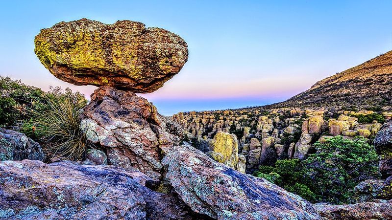
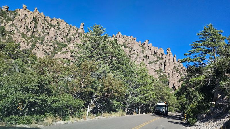
Ice and water went to work over the ages, prying those cracks wider and wider. Bit by bit, the erosion carved out the towering columns, spires, and gravity-defying balanced rocks that crown the monument.
The Chiricahua Apache had a fitting name for these formations, calling them standing-up rocks. Once you spot them clustered along the ridgelines, that description feels perfect, like a gathering of stone figures keeping watch over the canyon.
Geologists group these shapes under one word: hoodoos. Knowing the fiery, patient story behind them adds a whole layer of wonder to the drive.
What looks like a jumble of odd rocks is really the slow handiwork of fire, frost, and time working together across millions of years.
A Sky Island That Changes as You Climb
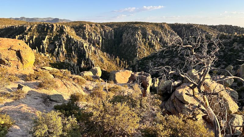
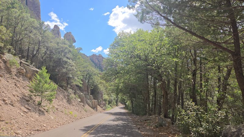
Few drives let you pass through several worlds in a single afternoon, but this one manages exactly that. Because the road climbs so steeply, it moves you through what scientists call a sky island, an isolated mountain range that stacks different life zones on top of each other.
You start among regular mountains dotted with light desert plants, the kind of scenery you might expect anywhere in the region. Then things shift.
Visitors love pointing out how the greenery thickens near the visitor center, where oak, cypress, and shady forest take hold. Keep climbing and pines appear, and higher still the famous hoodoos begin poking above the treetops.
One traveler put it simply, describing a beautiful drive that carries you through different biomes without ever leaving your car. That layering is part of the fun, since each mile brings a fresh backdrop.
The gradual change also means the temperature drops as you rise, so the top can feel noticeably cooler than the base. Packing a light layer is a smart move even on a warm day.
The Organ Pipe Formation Along the Route
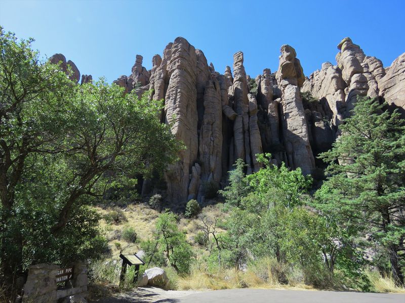
Music lovers get a treat partway up the drive, though this instrument is made entirely of stone. The Organ Pipe Formation is one of the standout features you can spot from the road, and its name gives away exactly what it looks like.
Erosion has weathered a sloping cliff face into a row of tall, narrow rocky columns lined up side by side. Squint a little and the resemblance to a giant pipe organ becomes obvious.
What makes it so satisfying is that you do not have to hike anywhere to enjoy it. The formation is visible right along Bonita Canyon Drive, rewarding folks who prefer to admire the scenery from a comfortable seat.
Regulars mention how the road delivers great views of the park’s features even for those who are not hikers, and the Organ Pipe is a prime example. It is the kind of landmark that makes you slow the car and reach for a camera.
Catch it in the right light and the columns seem to glow, each pipe casting its own long shadow across the slope.
Massai Point and Its 360-Degree Panorama
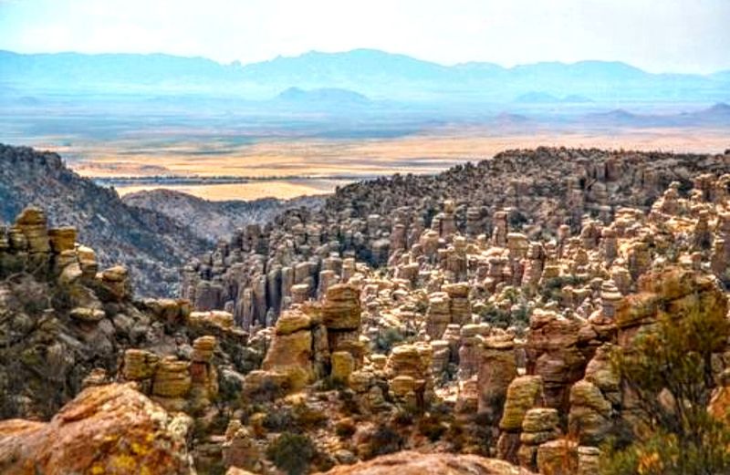
Everything on this drive builds toward one grand finale, and it does not disappoint. Massai Point sits at a lofty 6,870 feet and marks the end of the road, rewarding the climb with a full circle of scenery.
From here the view sweeps a complete 360 degrees, taking in fields of rhyolite hoodoos, Rhyolite Canyon, and far-off mountain ranges. On a clear day you can pick out Cochise Head and the Cochise Stronghold in the distant Dragoon Mountains.
A short paved trail of about half a mile leads to the long-distance viewpoint at the very end. Visitors especially appreciate that this path is wheelchair accessible, so the big payoff is open to nearly everyone.
Along the way, exhibits explain the geology and history that shaped these formations. It turns a simple overlook into a small outdoor classroom.
Restrooms are available right at Massai Point, a welcome convenience after the drive up. Many travelers call this the highlight of the whole trip, and standing among the sweeping vistas, it is easy to understand why.
Pullouts Made for Slowing Down
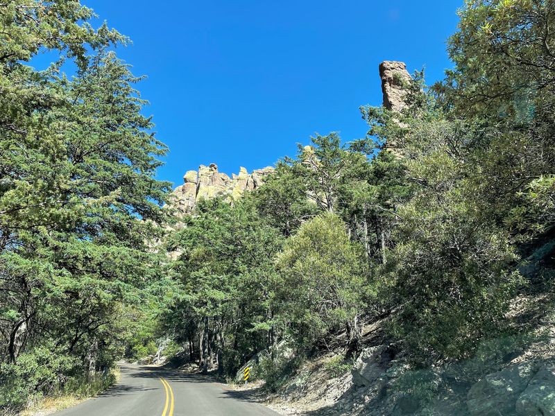
Rushing this drive would be a mistake, and the road practically begs you to take it easy. Scattered along the route are several pullouts, most of them on the left-hand side as you head into the park, each offering a fresh place to stop and stare.
Visitors repeatedly advise traveling slowly so you do not miss the turnouts to the many viewpoints. That advice is worth following, because each pullout frames the scenery a little differently.
One reviewer counted about four pull outs on the way in and praised how ample they are for admiring the wonderful views. They give you room to park safely, step out, and breathe in the quiet.
Because the road winds through narrow passages with blind curves, these stops double as safe spots to let faster traffic pass. Watching for wildlife is part of the routine here too.
Treating the pullouts as mini destinations rather than afterthoughts turns a short eight-mile road into a leisurely, memorable outing. There is no prize for finishing fast, only for what you notice on the way.
Sugarloaf Mountain and Its Hidden Tunnel
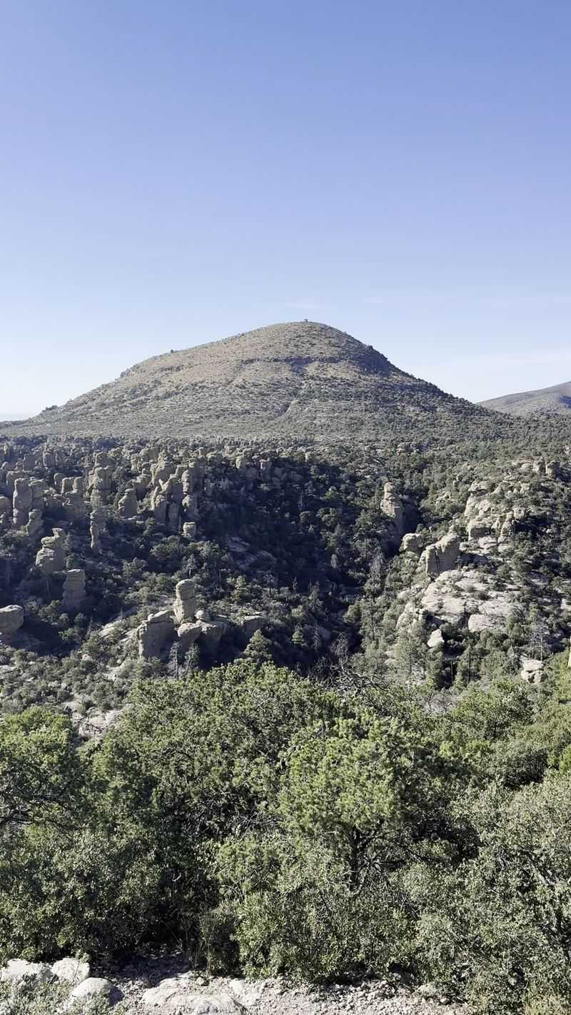
For those willing to stretch their legs a bit, an extra reward waits near the top of the drive. The Sugarloaf Mountain Trail is a moderate 1.8-mile roundtrip hike that begins at a parking area close to Massai Point.
The path climbs to a 7,310-foot summit, which happens to be one of the highest reachable points in the monument. The effort buys you exceptional views in every direction.
What makes this route memorable is a surprise along the way: a tunnel carved by the Civilian Conservation Corps back in the day. Walking through that cool stone passage feels like stepping into a piece of history.
The CCC left its fingerprints all over the monument, and this hand-built tunnel is one of the more charming reminders. Kids especially seem to get a kick out of it.
Since it is a moderate hike, comfortable shoes and a bottle of water go a long way. Reach the summit and the whole tangled world of hoodoos and canyons spreads out below, a fitting reward for a modest climb.
Seventeen Miles of Trails Branching Off the Drive
Beyond the pavement lies a whole network of adventure for anyone eager to explore on foot. The monument holds 17 miles of hiking trails, and many of them branch directly off Bonita Canyon Drive.
Options range from gentle strolls to strenuous treks, so there is something for casual walkers and serious hikers alike. You can dip in for a quick loop or plan a full day of trekking.
The Echo Canyon Loop is a favorite, weaving hikers straight into the heart of the standing-up rocks. Reviewers mention parking at Echo Canyon or Massai Point to get a birds-eye view of the hoodoos.
For the truly unique formations, the Heart of Rocks Loop delivers some of the monument’s most fantastical shapes. It is longer and tougher, but the payoff is a wonderland of balanced boulders and spires.
Travelers who love trails describe beautiful views paired with great paths, a combination that keeps hikers coming back. Even if you only walk a short stretch, stepping among the rocks up close is an entirely different thrill than viewing them from the road.
Faraway Ranch and a Glimpse of the Past
History buffs have a reason to pause before the main climb even begins. Near the start of the drive sits Faraway Ranch, a former homestead that grew into a guest ranch, with roots stretching back to 1888.
Wandering the grounds offers a window into what frontier life looked like in this remote corner of Arizona. The old buildings still carry the character of an earlier era.
Close by is the historical Erickson Cemetery, a quiet spot tied to the family that once called this canyon home. Together these sites tell the human story layered on top of the geological one.
It is a nice contrast to the wild rock formations up the road, grounding the visit in the lives of real people who settled here. You get nature and heritage in a single stop.
Because it comes early on the route, Faraway Ranch makes a natural first stop before you head toward the higher elevations. Spend a little time here and the rest of the drive feels richer, colored by a sense of who came before and what drew them to such a striking place.
Dark Skies and Golden Hour Magic
When the sun dips low, this drive reveals a second personality that is every bit as stunning as the daytime one. The monument is recognized as a Dark Sky Park, which means the nights here stay wonderfully free of city glow.
Massai Point turns into a prime perch for watching the stars come out, with the Milky Way stretching overhead on clear nights. Stargazers treasure spots like this, where the sky feels close enough to touch.
The same viewpoint shines at sunrise and sunset too. One visitor drove up in late afternoon specifically to catch a breathtaking sunset, and that timing is a well-kept secret worth borrowing.
As golden light spills across the hoodoos, the rock columns glow warm and cast dramatic shadows. It is a completely different show than the midday version.
Because the road stays open around the clock, you have the flexibility to plan for these magical hours. Bundle up, since higher elevations cool off fast after dark.
Whether you chase the first light of dawn or a blanket of stars, the payoff is pure Arizona wonder.
Who This Peaceful Drive Suits Best
Not every outing needs a strenuous hike to feel rewarding, and that is exactly the charm here. This road is a dream for travelers who want big scenery without big effort, since the views come right to your car window.
Folks who are not hikers get the same sweeping vistas as everyone else, simply by rolling down the windows and pulling over at the turnouts. That makes it welcoming for older visitors and anyone taking it easy.
Families find plenty to enjoy, from the tunnel on Sugarloaf to the odd shapes of the hoodoos that spark a child’s imagination. One traveler even brought their pups along and had a wonderful time.
Peace and quiet rank high on the list of what people love. Reviewers describe it as very beautiful and peaceful, the kind of place where you can hear the wind more than anything else.
Photographers, retirees on a budget, and curious day-trippers all find their groove here. The wheelchair-accessible trail at Massai Point widens the welcome even further, so nearly everyone can share in the wonder.
Free Entry, Open Hours, and Getting There
Here is the detail that makes budget-minded explorers grin: there is no entrance fee to visit. That free access, celebrated by visitors who happily note that park entry costs nothing, turns this into one of Arizona’s best-value day trips.
The road stays open 24 hours a day, seven days a week, giving you total freedom to plan around sunrise, sunset, or a starry night. Just keep in mind it can be subject to flooding, so it is wise to check conditions at the Visitor’s Center before heading up.
Getting there means driving to southeastern Arizona, roughly 35 miles southeast of Willcox. Fuel and basic supplies are easiest to grab in Willcox or Sunizona, so plan accordingly since services thin out near the park.
Restrooms are available at both the Visitor’s Center and Massai Point, a handy comfort on a longer visit. There is also a paved road in good shape the whole way, making the drive smooth and stress-free.
With no ticket booth and no rush, the only real cost is your time and gas.
Vehicle Rules Worth Knowing Before You Go
Before you load up and head out, a few vehicle rules can save you a headache at the gate. Larger rigs face limits, so this is one drive where a smaller car actually works in your favor.
Vehicles over 29 feet or day-use trailers are not permitted beyond Faraway Ranch. Push farther up past the campground and only standard-size vehicles up to 24 feet can continue.
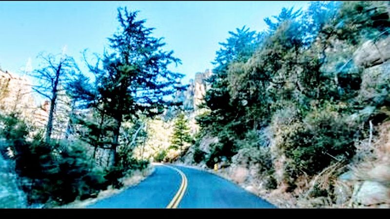
Those restrictions exist because the road is genuinely winding, with narrow passages and plenty of blind curves. One visitor cheerfully called the experience scary but very cool, which sums up the thrill of the tight mountain turns.
Driving slowly is not just about the views, it is about safety too, since wildlife often wanders across the pavement. Keeping your speed gentle gives you time to react and to soak in the scenery.
Given all it offers, from ancient hoodoos to a full circle of desert vistas, this free and easygoing drive earns its glowing reputation. Pack your patience, bring a camera, and let the road unwind.
It is a small effort for a genuinely big payoff.