Top 11 Outdoor Adventures In Arkansas You Should Try In 2026
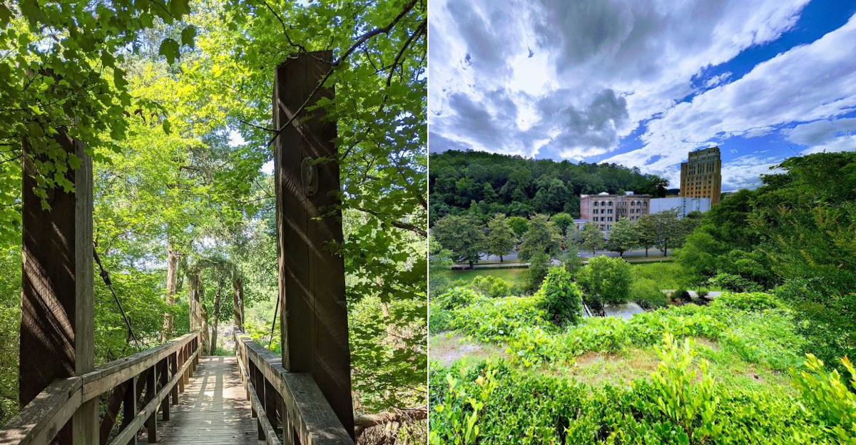
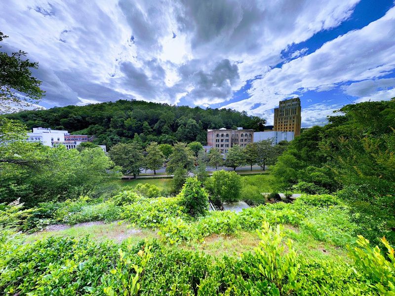
Arkansas never gets old for me, no matter how many weekends I spend outside. Living here means I don’t have to go far to find rocky trails, clear rivers, and ridgelines that seem to stretch forever.
I’ve wandered all over the state over the years, and I still end up discovering places that surprise me. Some days I’m floating a familiar stretch of river, and other times I’m climbing to a viewpoint I somehow missed before.
The Ozarks offer steep bluffs and waterfalls, while the Ouachitas feel quieter and more spread out. Planning a few outdoor trips in 2026 is as good an excuse as any to explore even more.
These adventures go beyond a casual walk and show why Arkansas is such an easy place to love if you enjoy being outside.
1. Buffalo National River Canoeing & Kayaking
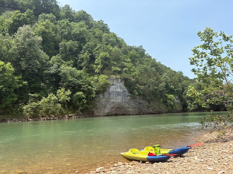
There is something almost surreal about floating down a river where the water is so clear you can watch the gravel shift beneath your hull while 200-foot bluffs rise on either side of you.
The Buffalo National River, headquartered near 402 N Walnut St Suite 136, Harrison, AR 72601, holds the distinction of being the first national river in the United States, protected by Congress in 1972 to preserve its wild, undammed character.
Canoeing and kayaking here is not just an activity. It is a full sensory experience where the only sounds are paddle strokes, birdsong, and the occasional splash of a startled great blue heron taking flight.
I typically put in at the Steel Creek or Woolum access points, depending on how much river I want to cover in a single day, and I always recommend at least two days on the water to truly settle into the rhythm of the river.
Spring runoff from April through early June gives paddlers the most reliable water levels and the most dramatic scenery, with wildflowers coating the bluff bases and the canopy still fresh and bright green.
Outfitters near Harrison offer canoe and kayak rentals along with shuttle services, which makes logistics much easier if you are planning a multi-day float without a second vehicle at the takeout.
The Buffalo rewards patience, and the paddlers who linger longest are always the ones who leave with the best stories to tell around the campfire that night.
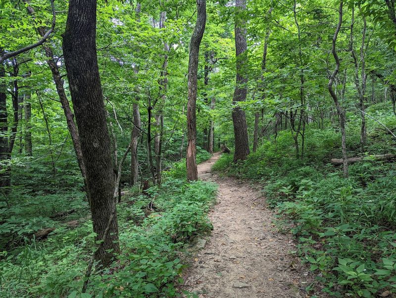
2. Hemmed-In Hollow Falls Trailhead
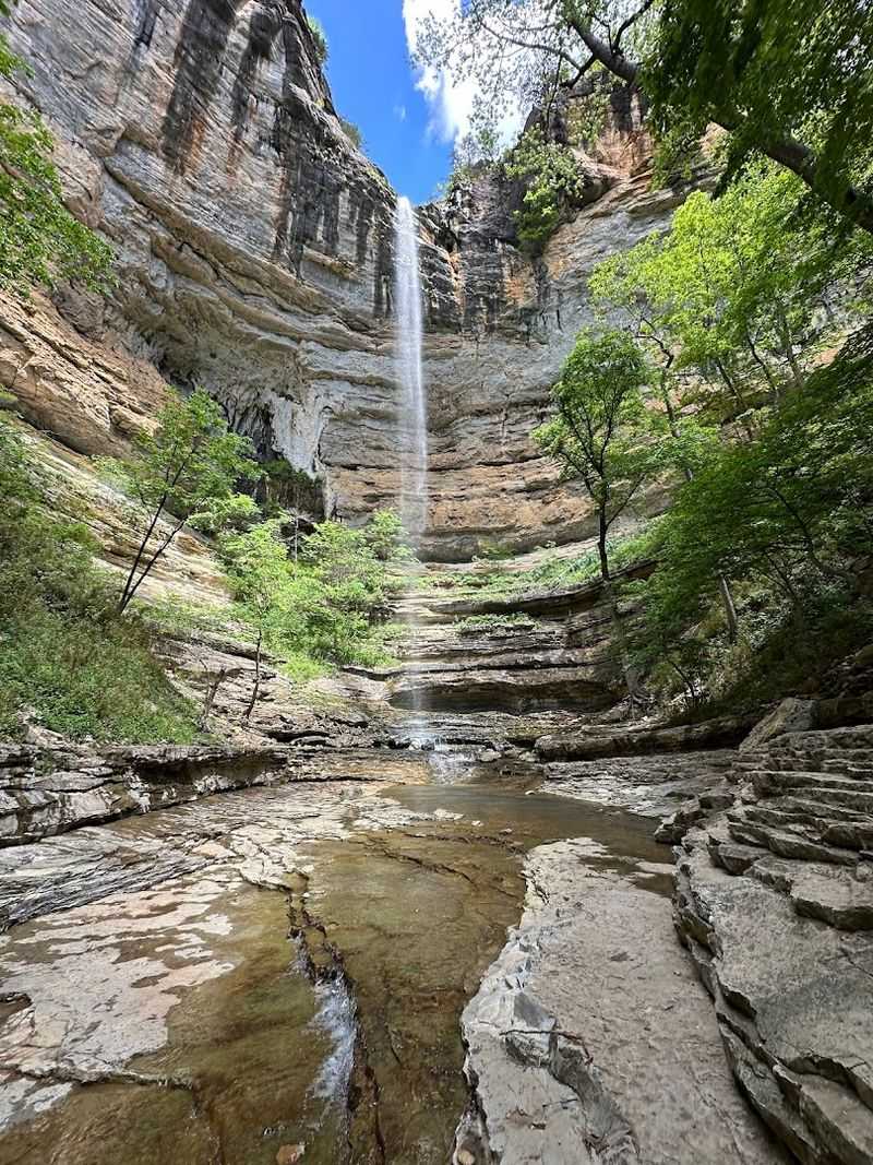
Tucked into the Ozark National Forest near 594 AR-43, Compton, AR 72624, Hemmed-In Hollow Falls drops approximately 209 feet, making it the tallest waterfall between the Rocky Mountains and the Appalachians, which is a title that earns every step of the hike to reach it.
The trail from the Compton Trailhead runs about 6.5 miles round trip with elevation changes that will remind your legs they have a job to do, but the payoff at the end redefines what the word “waterfall” means in your personal vocabulary.
I remember standing at the base for the first time, feeling the cold mist hit my face and looking straight up at the cliff, genuinely wondering how something this dramatic had stayed off my radar for so long.
The route passes through hardwood forest, crosses seasonal streams, and offers peek-a-boo views of the Buffalo River valley that are worth stopping for even before the main attraction comes into sight.
After spring rains, the falls thunder with enough force to create a permanent rainbow in the mist, and the amphitheater-shaped sandstone bowl surrounding the pool amplifies the roar in a way that feels almost theatrical.
Wear sturdy hiking boots with ankle support because the descent to the falls involves rocky, sometimes slippery terrain that punishes overconfident footwear choices.
Plan to arrive early on weekends because this trail draws serious crowds in spring, and the hollow feels completely different when you have it mostly to yourself in the early morning quiet.
3. Crater Of Diamonds State Park
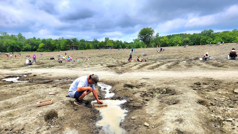
Most state parks ask you to look but not touch; Crater of Diamonds State Park at 209 State Park Rd, Murfreesboro, AR 71958, hands you a bucket and tells you to start digging, which is a policy I fully support.
This 37-acre plowed field sits on top of an ancient volcanic crater and is the only diamond-producing site in the world where the public can search and keep whatever they find, a fact that makes even the most casual visitor suddenly feel like a prospector with something to prove.
Over 35,000 diamonds have been found here since the park opened, including the 15.33-carat white diamond called the Amarillo Starlight, discovered in 1975 and still one of the largest ever unearthed by a park visitor.
I spent an entire morning working a section of the field after a heavy rain, which is actually the smartest time to search because water washes surface soil away and exposes heavier stones that have worked their way up.
The park provides free identification services, so if you find something that looks promising, rangers will examine it on the spot and tell you exactly what you have in your hand.
Beyond the diamond field, the park offers hiking trails, a water park, and a visitor center with exhibits on diamond formation and the volcanic geology beneath your feet.
Even if you leave empty-handed, the sheer novelty of legally mining for diamonds in Arkansas makes this one of the most genuinely unique outdoor stops in the entire country.
4. Hot Springs National Park Hiking Trails
Hot Springs National Park, centered around 369 Central Ave, Hot Springs, AR 71901, often gets recognized for its historic bathhouses and thermal springs, but the network of hiking trails winding through the surrounding forested mountains deserves far more credit than it typically receives.
The park contains over 26 miles of trails ranging from short paved promenades to rugged forested climbs, and the variety means you can tailor a hiking day to exactly the energy level and scenery you are after on any given morning.
Hot Springs Mountain Trail is one of my personal favorites, climbing through a canopy of oak and hickory to the Hot Springs Mountain Tower, where the view across the Ouachita foothills on a clear day stretches far enough to feel genuinely earned.
The Gulley Park Trail and the Sunset Trail are both excellent options for longer outings, with the Sunset Trail offering about 10 miles of ridgeline walking through second-growth forest that feels nothing like the busy downtown area just a short drive below.
The thermal springs along some trail sections steam visibly in cooler weather, creating an atmospheric detail that reminds you this park sits on top of something geologically unusual and endlessly fascinating.
5. Northwoods Trails Mountain Biking
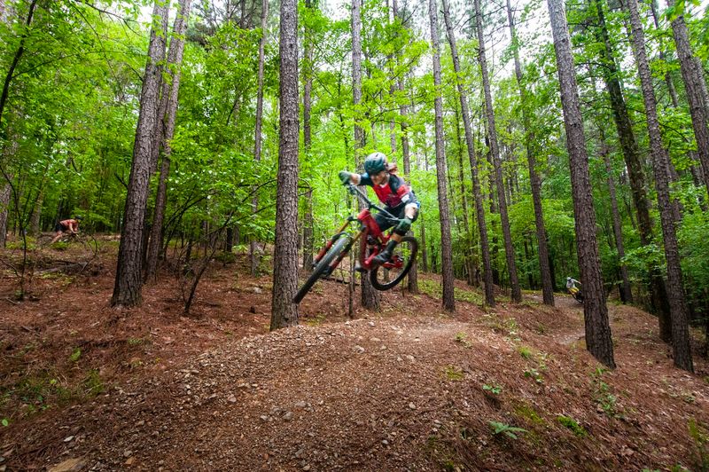
Riders who think Arkansas is flyover territory for mountain biking have clearly never pointed their front wheel down a Northwoods singletrack and let the trail do the talking.
Located at 300 Pineland Dr, Hot Springs, AR 71901, Northwoods Trails sits within the Ouachita National Forest. It offers a trail system that has quietly built a national reputation among serious mountain bikers looking for technically satisfying riding in a beautiful natural setting.
The network includes roughly 22 miles of maintained singletrack with trails rated for beginner through expert riders, so the system welcomes first-timers without boring anyone who has been riding technical terrain for years.
The Northwoods Loop is a great introduction, flowing through pine and hardwood forest with enough root sections and small drops to keep things interesting without demanding expert-level bike handling skills.
More advanced riders tend to gravitate toward the upper sections of the system, where the trail designers clearly had a sense of humor about what a reasonable line through a rocky descent might look like.
I rode here on a weekday in October and had long stretches of trail entirely to myself, which is a luxury that is increasingly hard to find at well-known riding destinations anywhere in the country.
The trailhead parking area has basic amenities, and the proximity to downtown Hot Springs means a post-ride meal or coffee is never more than a few minutes away when your legs finally wave the white flag.
Bring a trail map, charge your GPS device, and give yourself at least half a day to explore without feeling like you are racing through something worth savoring.
6. Horseshoe Canyon Ranch Rock Climbing
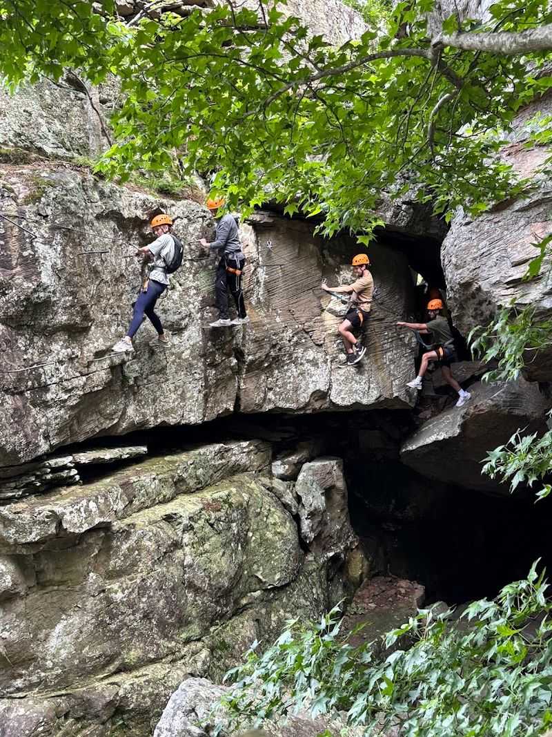
Horseshoe Canyon Ranch near Jasper, Arkansas, sitting at 14683 AR-43, Jasper, AR 72641, is the kind of place that makes experienced climbers widen their eyes a little when they first see the scale of the sandstone canyon stretching out in front of them.
The ranch features over 200 established sport climbing routes spread across multiple canyon walls, with grades ranging from beginner-friendly 5.6s to demanding 5.13s that will test even seasoned climbers who think they have seen every type of rock face the country has to offer.
The sandstone here has a distinctive orange and tan coloring that looks almost painted at golden hour, and the texture provides excellent friction for foot placements on routes that might look intimidating from the ground but reward committed movement beautifully.
I spent three days here on my first visit and still did not tick every route I had circled on the guidebook, which is exactly the kind of problem you want to have at a climbing destination.
The ranch operates as a working dude ranch and offers on-site lodging, camping, horseback riding, and guided climbing instruction, making it a legitimate multi-day destination rather than just a single-afternoon stop.
Guided climbing packages are available for beginners who want to learn the basics in a safe, structured setting before attempting routes on their own.
The Ozark setting surrounding the canyon adds a layer of natural beauty that makes rest days between climbing sessions feel like their own kind of reward, with trails and river access just minutes from the main canyon walls.
7. Mount Magazine State Park Hiking
Standing at 2,753 feet above sea level, Mount Magazine is the highest point in Arkansas, and the trails that wind through Mount Magazine State Park near 16878 AR-309, Paris, AR 72855, give hikers access to views that genuinely stop conversations mid-sentence.
The park trail system covers several distinct routes, and the Signal Hill Trail is the one most visitors make a beeline for, leading to the true summit with sweeping panoramic views of the Arkansas River valley and the Ouachita Mountains layered in the distance like a painted backdrop.
Cameron Bluff Trail is another standout, following the cliff edge along the south face of the mountain with exposure that rewards careful footing and punishes anyone scrolling their phone while walking near the edge.
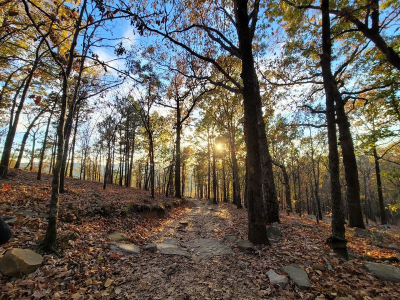
I hiked here on a crisp November morning when the hardwood forest below the summit had turned every shade from gold to deep rust, and the view from the bluff trail felt like watching autumn perform its absolute best work.
Trails here range from easy paved walks near the lodge to moderately strenuous routes, so the mountain genuinely has something worth lacing up for regardless of your fitness level.
8. Mount Magazine Hang Gliding Launch Area
Mount Magazine is not just for hikers with panoramic views. It is also one of the most celebrated hang gliding destinations in the southeastern United States, and the launch area at 16878 AR-309, Paris, AR 72855, sits right at the edge of a view that makes you very aware of how high 2,753 feet actually feels.
Mount Magazine draws pilots from across the country because the mountain’s elevation, consistent ridge lift conditions, and the wide open valley below create a combination that is genuinely rare to find at a single site east of the Rockies.
Experienced hang glider pilots can launch from the dedicated ramp on the south face and ride thermals for extended flights over the Arkansas River valley, with some pilots logging flights of an hour or more when conditions cooperate.
I watched a group of pilots launch on a clear afternoon with a steady south wind, and the sight of them banking out over the valley and climbing effortlessly in the rising air was one of those moments that makes you immediately start researching beginner hang gliding lessons.
Even if you never plan to strap into a glider yourself, watching pilots soar out over that valley from the summit is a free spectator experience that earns its place on any Arkansas itinerary.
9. Lake Ouachita State Park Kayaking & Camping
Lake Ouachita is the largest lake entirely within Arkansas, covering over 40,000 acres with water so clear in its upper reaches that you can see submerged rocks and logs from the surface of your kayak, which sounds like marketing copy until you actually see it yourself.
Lake Ouachita State Park, located at 5451 Mountain Pine Rd, Mountain Pine, AR 71956, provides direct water access, well-maintained launch ramps, and a campground that positions you perfectly for early morning paddles before the afternoon wind picks up on the open water.
The lake’s irregular shoreline creates dozens of quiet coves and inlets that reward exploratory paddlers, and the lack of heavy boat traffic in the upper arms of the lake means you can find genuine solitude even on busy summer weekends if you know which direction to point your bow.
I camped here for three nights on a late September trip and spent each morning paddling a different section of shoreline, watching osprey dive for fish and great blue herons stand motionless in the shallows with the patience I have never personally managed to develop.
The park also offers scuba diving, which is unusual for a freshwater state park but completely logical given the water clarity and the interesting submerged terrain created when the lake was filled decades ago.
Fishing for bass, crappie, and striped bass is popular throughout the year, and the park’s location within the Ouachita National Forest means the surrounding landscape stays green and forested in every direction.
Bring a dry bag for your gear, slather on the sunscreen, and let Lake Ouachita remind you why some of the best paddling in the South has been hiding in the Arkansas hills all along.
10. Cossatot River State Park-Natural Area Hiking
Cossatot River State Park-Natural Area, located at 1980 AR-278 W, Wickes, AR 71973, protects one of the most geologically dramatic river corridors in the Ouachita Mountains. Ancient novaculite rock formations have been carved by the river into a series of cascades, drops, and pools that look like something from a landscape painting.
The Cossatot Falls Trail follows the river through the most dramatic section of the canyon, covering about 1.5 miles of trail that requires scrambling over rocks, hopping between boulders, and occasionally wading through shallow crossings when the route demands it.
I hiked this trail in late spring when the river was running strong, and the combination of roaring white water, ancient rock formations, and the dense hardwood canopy overhead created an atmosphere that felt more Pacific Northwest than Arkansas in the best possible way.
The park is also a destination for advanced kayakers and canoeists who come specifically to run the Cossatot’s challenging rapids during appropriate water levels, and watching skilled paddlers navigate these drops from the hiking trail adds an unexpected entertainment element to the experience.
The remoteness of the Wickes location means crowds are rarely an issue, and the park feels like a genuine discovery every time I visit rather than a well-worn tourist destination.
11. Ouachita National Recreation Trail (Pinnacle Mountain Access)
Just west of downtown Little Rock, Pinnacle Mountain rises abruptly from the flat river bottom like it missed the memo about the surrounding terrain, and the trail to its summit via the Ouachita National Recreation Trail access at 11901 Pinnacle Valley Rd, Little Rock, AR 72223, is one of the most rewarding short climbs in the entire state.
The Ouachita National Recreation Trail stretches over 220 miles from Pinnacle Mountain State Park west into Oklahoma, and the eastern terminus here gives hikers a genuinely iconic starting point with a summit scramble that delivers views stretching across the Arkansas River valley in multiple directions.
The West Summit Trail is the main route up, covering about 1.5 miles each way with a final stretch that requires hands-and-feet scrambling over exposed quartzite boulders, a section that earns the trail its “strenuous” rating and filters out anyone who underestimated the mountain based on its modest 1,011-foot elevation.
I have hiked this summit in every season, and the winter view, with bare trees exposing the river corridor and the Little Rock skyline visible to the east, is my personal favorite version of a trail I never get tired of revisiting.
For anyone visiting Little Rock who wants to squeeze a legitimate outdoor adventure into a city trip, Pinnacle Mountain is the answer that requires no long drive and delivers far more than its proximity to the highway would suggest.