
12 Unforgettable Arkansas Bucket List Fall Hikes Ranked From Breezy To Bold
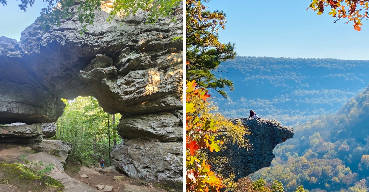
Some bald cypress trees along one Arkansas river trail are estimated to be 500 to 600 years old. That means they were already growing long before anyone mapped these hills.
I love that a short fall walk can put you next to something that ancient.
The surprises keep stacking up. One trail ends at a waterfall pouring out of a cave mouth.
Another leads to a rock ledge that ranks among the most photographed spots in the state.
I like how this list climbs slowly, starting with paved paths and ending with a hike that tests your legs. Fall is the sweet spot for it, with cooler air and color on the ridges.
So which kind of hiker are you, breezy or bold?
1. Kingfisher Trail
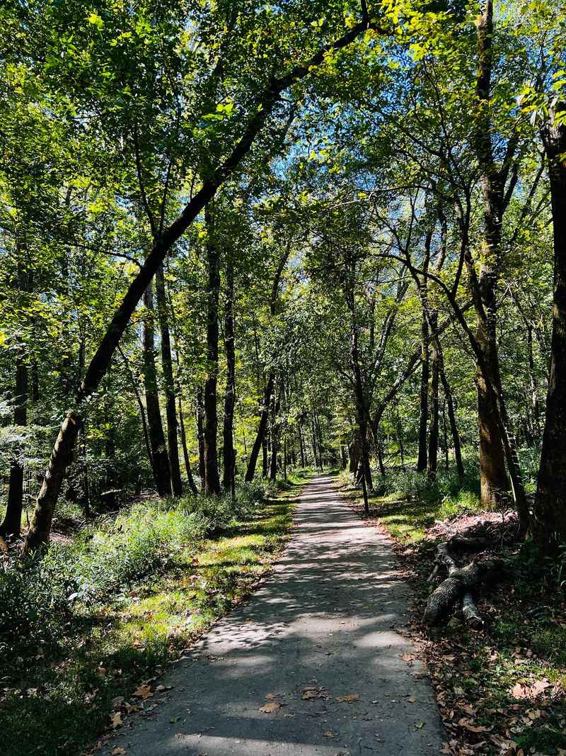
Trees older than the printing press line this little loop, and you barely have to break a sweat to meet them. Some of the bald cypress here are estimated at 500 to 600 years old.
The Kingfisher Trail sits inside Pinnacle Mountain State Park and runs about half a mile. It’s paved and barrier-free, so strollers and wheelchairs can roll along without trouble.
The path follows the floodplain of the Little Maumelle River through bottomland forest. Sunlight filters through those giant cypress trees, giving the woods a shady, quiet feel.
Bird lovers, this one’s for you. Mornings are the best time to spot warblers, vireos, woodpeckers, and the belted kingfisher that gave the trail its name.
Bring binoculars if you own a pair. A small field guide or a bird app on your phone can turn a short stroll into a fun scavenger hunt.
You’ll find only one small incline, right near the end. That makes it a smart pick for grandparents, little kids, or anyone easing back into hiking.
Restrooms are nearby in the park, which is always a win. The visitor center also has exhibits, native plant gardens, and an education pond worth a peek afterward.
Address: 9600 Highway 300, Roland, AR 72135
2. Bear Cave Trail
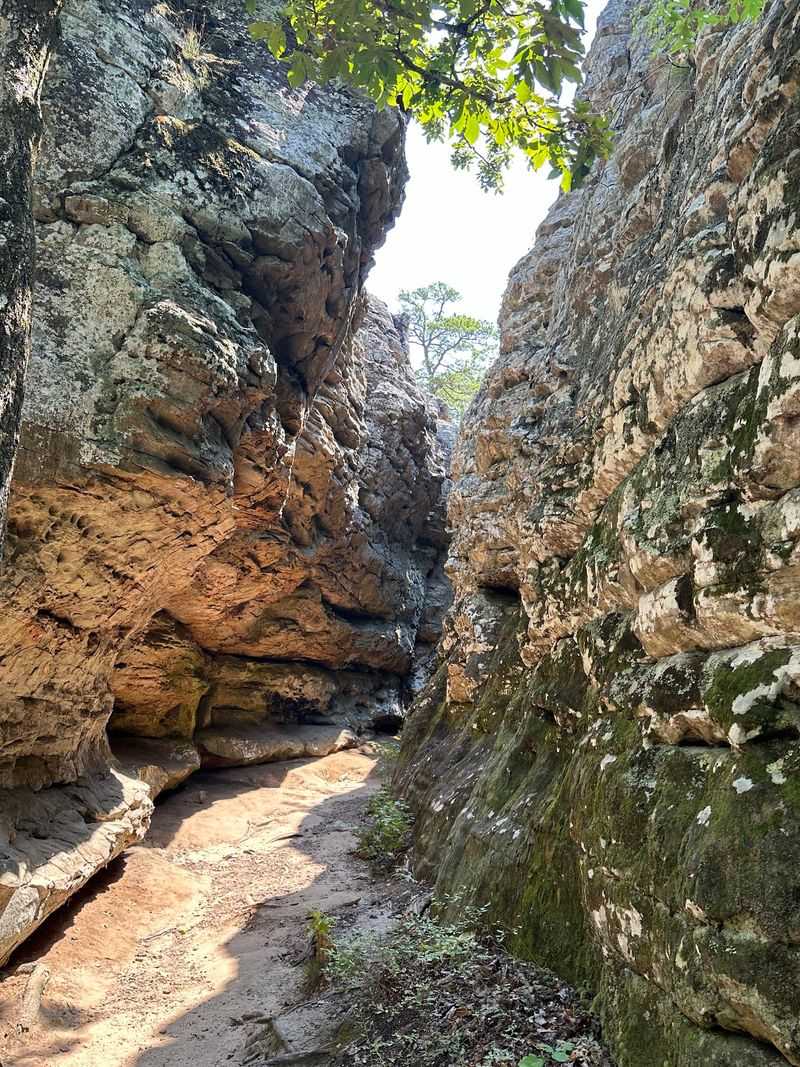
Giant sandstone boulders turn this short walk into a natural maze. Kids tend to treat it like a playground built by the planet itself.
Bear Cave Trail is one of the shortest hikes at Petit Jean State Park, Arkansas’s first state park. The out-and-back trail is roughly a quarter mile, so you can finish it fast and still feel like an explorer.
The big draw is the rock. Massive slabs and boulders create narrow passages, overhangs, and shaded corners to poke around in.
Don’t expect a deep cave with a real bear inside. The name points to a rock shelter, and the fun comes from weaving through the formations.
Fall adds color to the scene. Bright leaves pile up against gray stone, making for great photos with very little effort.
Sturdy shoes still help, since the ground can be uneven around the rocks. Keep a close eye on young climbers near ledges.
Pair this one with a scenic drive across Petit Jean Mountain. You can easily stack it with other trails in the park for a full day outdoors.
It’s a quick win for families or anyone short on time. Sometimes the best adventures fit inside a single lunch break.
Address: 1285 Petit Jean Mountain Road, Morrilton, AR 72110
3. Benefield East Loop Trail
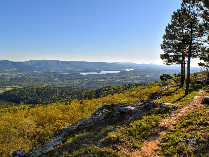
A peaceful forest walk with scenic overlooks makes this short trail a great choice for an easy fall adventure. You don’t have to tackle a steep summit to enjoy Mount Magazine’s beauty.
Benefield East Loop Trail sits inside Mount Magazine State Park, home to Arkansas’s highest mountain. The loop runs about 1.1 miles and offers a gentler alternative to the park’s more demanding hikes.
The path winds through hardwood forest, where autumn leaves turn the surroundings into a colorful display. Cooler temperatures make the walk especially pleasant.
Along the way, you’ll find interesting rock formations and reminders of the mountain’s history. The changing scenery keeps this little loop from feeling ordinary.
Fall is a wonderful time to explore. Red and golden leaves brighten the woods, while the mountain air feels refreshingly crisp.
Bring comfortable walking shoes and a camera. Uneven ground can still appear along an easy trail, especially where roots and rocks cross the path.
Families and casual hikers will appreciate the manageable distance. There’s plenty of time afterward to visit the park’s scenic overlooks and enjoy sweeping views of the Arkansas River Valley.
Address: 16878 AR-309, Paris, AR 72855
4. Lost Valley Trail
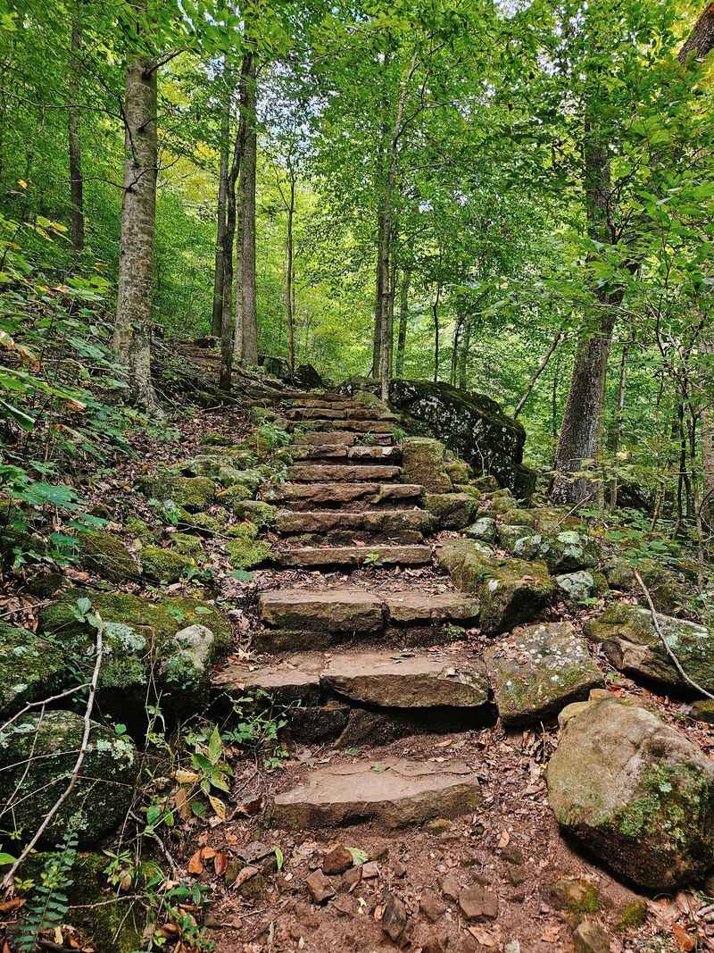
A waterfall pouring out of a cave sounds like something from a fantasy movie. On this trail, it’s the grand finale.
Lost Valley Trail sits along the Buffalo National River near Ponca. The out-and-back hike runs about 2.3 miles round trip and follows Clark Creek through a narrow valley.
Along the way, you’ll pass a natural bridge carved into the rock. Tall bluffs and big boulders keep your eyes busy the whole time.
Eden Falls is the star. The main waterfall tumbles 53 feet down a rocky cliff, while a separate waterfall waits inside Eden Falls Cave farther up the trail.
The climb toward the cave gets steep and rocky. Anyone planning to explore inside should bring at least three light sources and appropriate protective gear, and watch their footing on wet rock.
Waterfall flow depends on rain, so check recent conditions. A rainy fall week can make a big difference.
The last stretch gets steeper and rockier near the falls. That’s why this one lands right in the middle of our breezy to bold scale.
Address: Lost Valley Trailhead, Highway 43, Ponca, AR 72670
5. Yellow Rock Trail
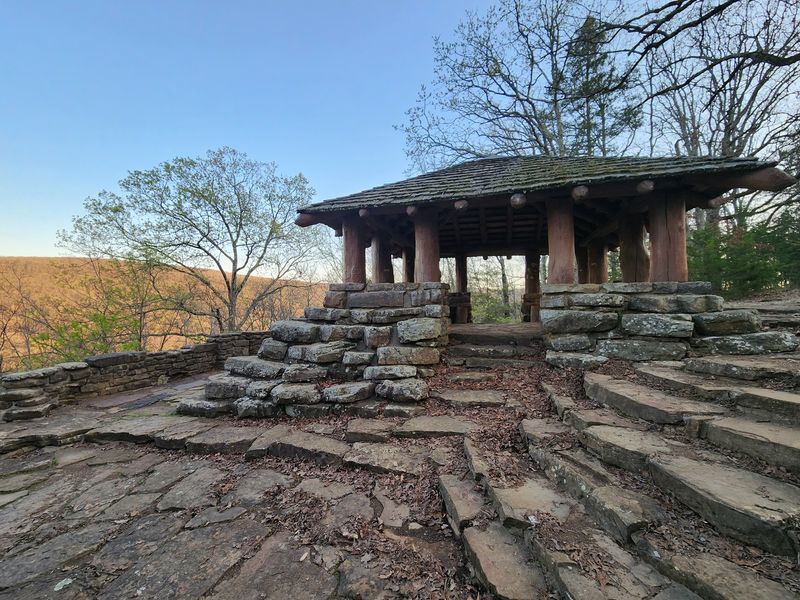
Sometimes the name tells you exactly what you’ll get. A big, yellowish sandstone bluff waits at the top, and the view steals the show.
Yellow Rock Trail is part of Devil’s Den State Park in the Ozark Mountains. The loop is about three miles, with some climbing to reach the overlook.
Once there, you get a wide look over the Lee Creek valley. In fall, those rolling hills light up in shades of red, orange, and gold.
The rock ledge is open and dramatic. Keep pets leashed and kids close, because the edges drop off sharply.
Plan for a moderate workout. The uphill parts will get your heart pumping, but the payoff comes quickly.
Devil’s Den is known for its stonework built by the Civilian Conservation Corps in the 1930s. Look for those rustic touches around the park when you’re done hiking.
Pack water and a snack for the overlook. It’s a great spot to sit, catch your breath, and soak in some of the best fall color in Arkansas.
Address: 11333 West Arkansas Highway 74, West Fork, AR 72774
6. Rim Trail
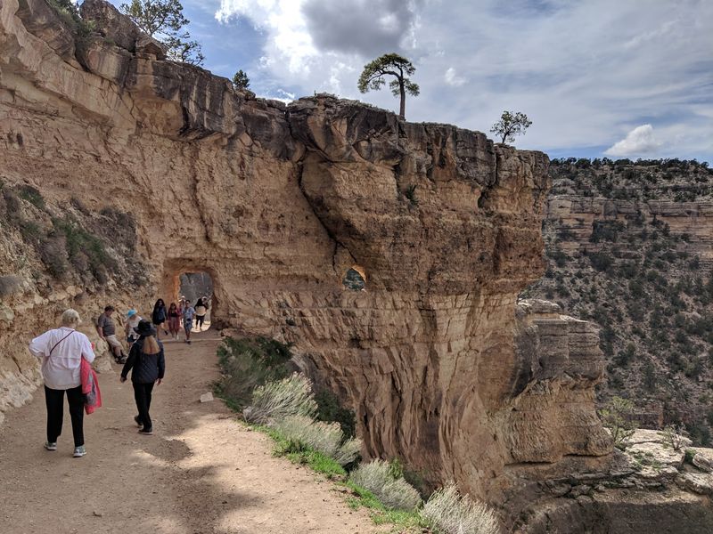
Mountain views usually come after a long climb, but this path hands them out right along the edge. You walk the rim, and the valley spreads out below.
The Rim Trail circles the top of Mount Nebo at Mount Nebo State Park. It’s roughly 3.5 miles around, with some rocky and uneven spots.
Look out over the Arkansas River Valley as you go. On clear days, the views stretch toward Lake Dardanelle and surrounding farmland.
The trail passes springs, bluffs, and old stonework from the Civilian Conservation Corps. Those little surprises help the miles slip by.
Fall is a terrific time to go. The hardwood forest changes color, and cooler air makes the rocky sections much more pleasant.
Getting to the top is an adventure in itself. The road up Mount Nebo has steep switchbacks, so large trailers aren’t a good idea.
Sunset Point and Sunrise Point are nearby overlooks. Time your hike right, and you can catch the sky putting on its own show.
Address: 16728 West State Highway 155, Dardanelle, AR 72834
7. Whitaker Point Trail
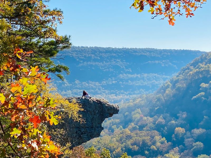
One famous ledge has graced more Arkansas calendars and postcards than most celebrities. Hawksbill Crag pokes out over the valley like a stone beak.
Whitaker Point Trail leads to that iconic perch in the Upper Buffalo Wilderness. The out-and-back hike runs about three miles round trip.
The trip in is mostly downhill, which feels easy. Save some energy, because the walk back climbs the whole way out.
Along the trail, you may spot a seasonal waterfall after rain. The forest blazes with color in mid to late fall.
The crag itself has steep drops and no railings. Stay well back from the edge, and skip it entirely on wet or windy days.
Getting there means driving gravel county roads. A vehicle with decent clearance makes the trip smoother.
Weekends in peak foliage season can get busy. Arrive early for the best shot at parking and quieter moments on the ledge.
Sunrise here can be stunning. Bring a headlamp if you want to catch the first light warming up the hills.
Address: Whitaker Point Trailhead, County Road 5, Kingston, AR 72742
8. West Summit Trail
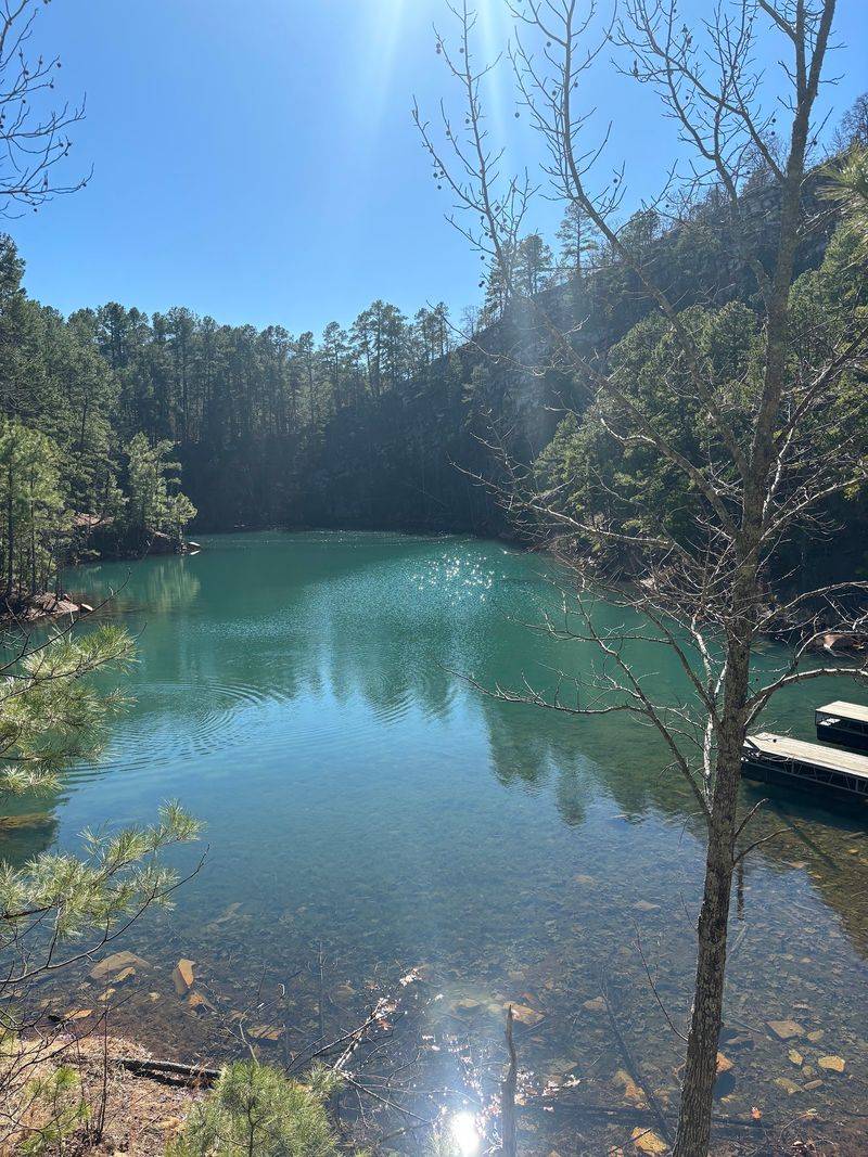
Pinnacle Mountain looks like a kid drew a mountain, a perfect pointy cone. Climbing it is a lot less cartoonish.
The West Summit Trail heads straight up the mountain in Pinnacle Mountain State Park. It’s about three quarters of a mile one way, and much of it is a rocky scramble.
Expect to use your hands in spots. Large boulders make up big sections near the top, so this one feels more like climbing stairs built by giants.
The summit rewards that effort. You’ll see the Arkansas River, Lake Maumelle, and miles of fall color.
Short doesn’t mean easy. The park advises good shoes, plenty of water, and extra care on the descent.
Fall temperatures make the climb much friendlier than summer heat. Go early, since this is a popular trail near Little Rock.
Want a loop? Some hikers go up one side and down the East Summit Trail, then use the base trail to return.
Afterward, the gentle Kingfisher Trail nearby makes a nice cooldown. Same park, totally different mood.
Address: 9600 Highway 300, Roland, AR 72135
9. Seven Hollows Trail
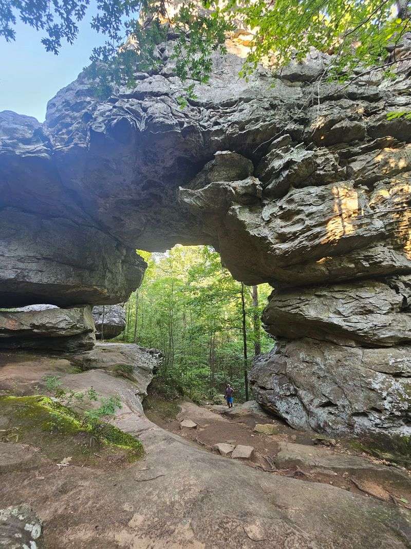
Rocks shaped like turtle shells, a natural bridge, and a hidden grotto all share one trail. Talk about a packed schedule.
Seven Hollows Trail is a loop of about 4.5 miles at Petit Jean State Park. It dips in and out of several small canyons, or hollows, which keeps the scenery changing.
Watch for the turtle rocks early on. These rounded, patterned sandstone formations really do look like a group of giant turtles napping.
A natural bridge stands along the route, carved by wind and water over a very long time. Further on, a side spur leads to a grotto with a seasonal waterfall.
The ups and downs add up. You’ll climb out of hollows more than once, so pace yourself.
Fall brings bright leaves and cooler air to the canyons. The shady hollows feel extra peaceful this time of year.
Bring more water than you think you need. The trail is longer than many in the park and takes a few hours for most hikers.
Address: 1285 Petit Jean Mountain Road, Morrilton, AR 72110
10. Cedar Falls Trail
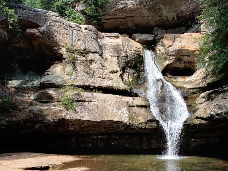
A 90-foot waterfall crashing into a box canyon sounds like a postcard. Earning that view involves some serious stairs.
Cedar Falls Trail at Petit Jean State Park is about two miles round trip. It drops down into Cedar Creek Canyon, then follows the creek to the falls.
Going down feels breezy. Coming back up is where your legs start filing complaints.
Rocky steps, roots, and creek crossings make for uneven footing. Good shoes with grip are a must, especially after rain.
The waterfall is the big payoff. Flow is strongest after rainy spells, and it can slow to a trickle in dry weather.
Fall color frames the canyon walls nicely. Even with lighter flow, the canyon itself is worth the trip.
Not up for the climb? The Cedar Falls Overlook near Mather Lodge offers a view from above with almost no effort.
Many visitors call this the most famous hike in Arkansas state parks. Go early on autumn weekends to enjoy it with more elbow room.
Address: 1285 Petit Jean Mountain Road, Morrilton, AR 72110
11. Big Bluff via Centerpoint Trail
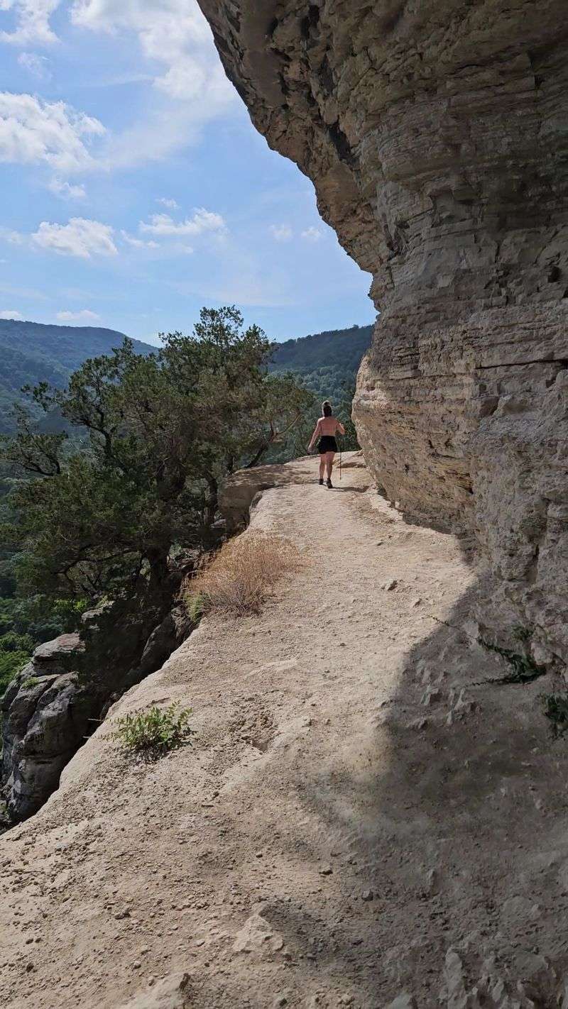
Walking a narrow ledge hundreds of feet above a river is not for the faint of heart. Big Bluff hands you exactly that.
The route starts at the Centerpoint Trailhead near Ponca. You follow Centerpoint Trail downhill, then branch onto the famous Goat Trail along Big Bluff.
Big Bluff rises about 550 feet above the Buffalo National River. It’s often called the tallest bluff face between the Rockies and the Appalachians.
The Goat Trail is a slim rock shelf with no railings. Steady feet and a calm head are essential.
Round trip, expect around six miles with a big climb out. The return hike is steep and long, so save energy.
Fall views from the ledge are jaw-dropping. The river bends below while colorful ridges roll toward the horizon.
Skip the Goat Trail in rain, ice, or strong wind. Leave young kids and nervous pups at home for this one.
Pack plenty of water and snacks. This is a true Arkansas bucket list moment, but it asks for respect.
Address: Centerpoint Trailhead, Highway 43, Ponca, AR 72670
12. Hemmed-in Hollow Trail
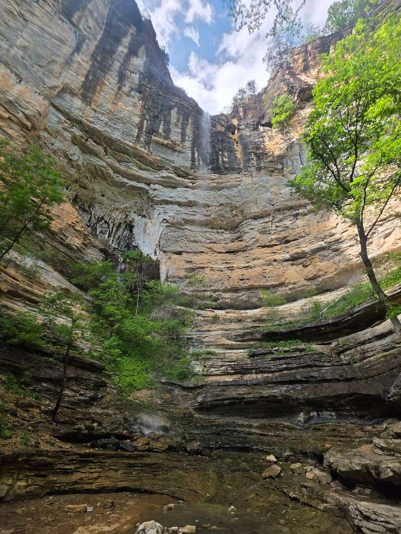
The tallest waterfall between the Rockies and the Appalachians hides at the bottom of a very steep hill. Getting back up is the real final exam.
Hemmed-In Hollow Falls drops about 209 feet in the Ponca Wilderness. The National Park Service lists it as a highlight of the Buffalo National River.
From the Compton Trailhead, the hike is about five miles round trip. The trail loses roughly 1,200 feet on the way down.
Every one of those feet comes back on the climb out. Many hikers rate this as one of the toughest day hikes in the region.
The falls sit inside a box canyon with tall stone walls. Water spills over the rim and drifts as spray when flow is light.
Like most Ozark waterfalls, it shines brightest after rain. Dry spells shrink it to a thin ribbon.
Start early, carry lots of water, and give yourself plenty of daylight. Fall’s shorter days sneak up fast.
Earn this one, and you can call yourself bold. Your legs will remind you for days.
Address: Compton Trailhead, Compton-Erbie Road, Compton, AR 72624