12 Winter Road Trips Across California’s Coastal Highways
California’s coastline stretches over 800 miles, offering some of the most breathtaking winter drives in the country.
Cold months transform the Pacific edge into something quieter and more dramatic, with gray whales passing offshore, elephant seals crowding beaches, and storm swells crashing against ancient rocks.
Highway 1 and its coastal cousins wind through redwood groves, past historic lighthouses, and alongside cliffs that drop straight into the surf.
Winter brings fewer crowds, better wildlife viewing, and that moody light photographers crave, making it the perfect season to explore these legendary routes at your own pace.
1. Bodega Bay to Sea Ranch along the Sonoma Coast
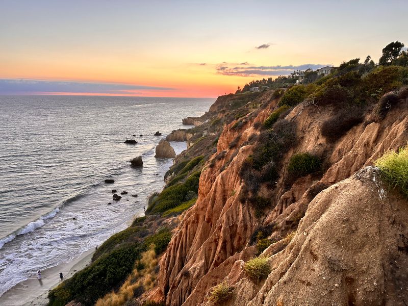
On days when I want cliffs, waves, and very little schedule, I aim the car toward Bodega Bay and let Highway 1 steer the plan north.
The route winds past the harbor, climbs to bluffs above Salmon Creek, then snakes through tiny Jenner, where the Russian River slips into the ocean, and pelicans patrol the mouth.
Beyond that, the pavement clings to raw headlands with pullouts that feel tailor-made for storm watching in winter when big swells pound the rocks.
I keep rolling through Fort Ross and Timber Cove, trading long views for quiet forested stretches where the road hides under redwoods for a few moments at a time.
Eventually, Sea Ranch’s low-slung homes appear along the bluffs, and I usually park for a bundled-up walk on one of the public access trails.
Driving back in the dark with the heater working overtime, it always feels as if the Sonoma Coast has delivered a full season of mood in a single afternoon.
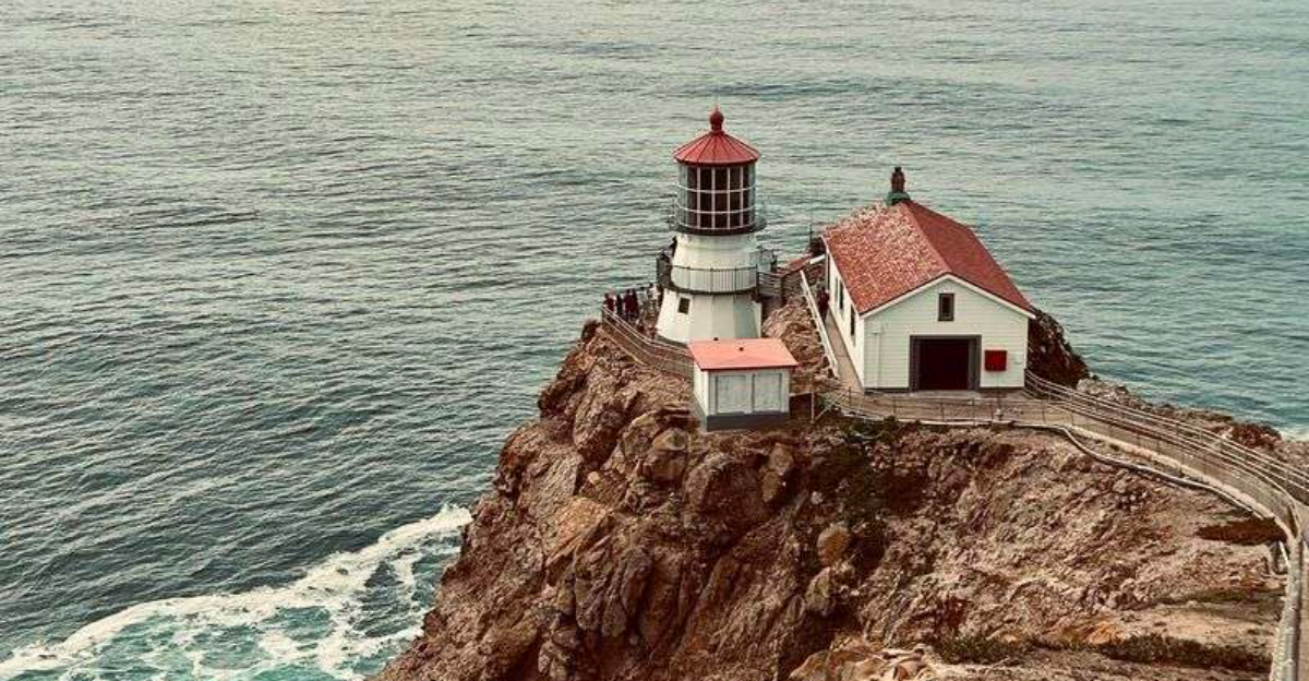
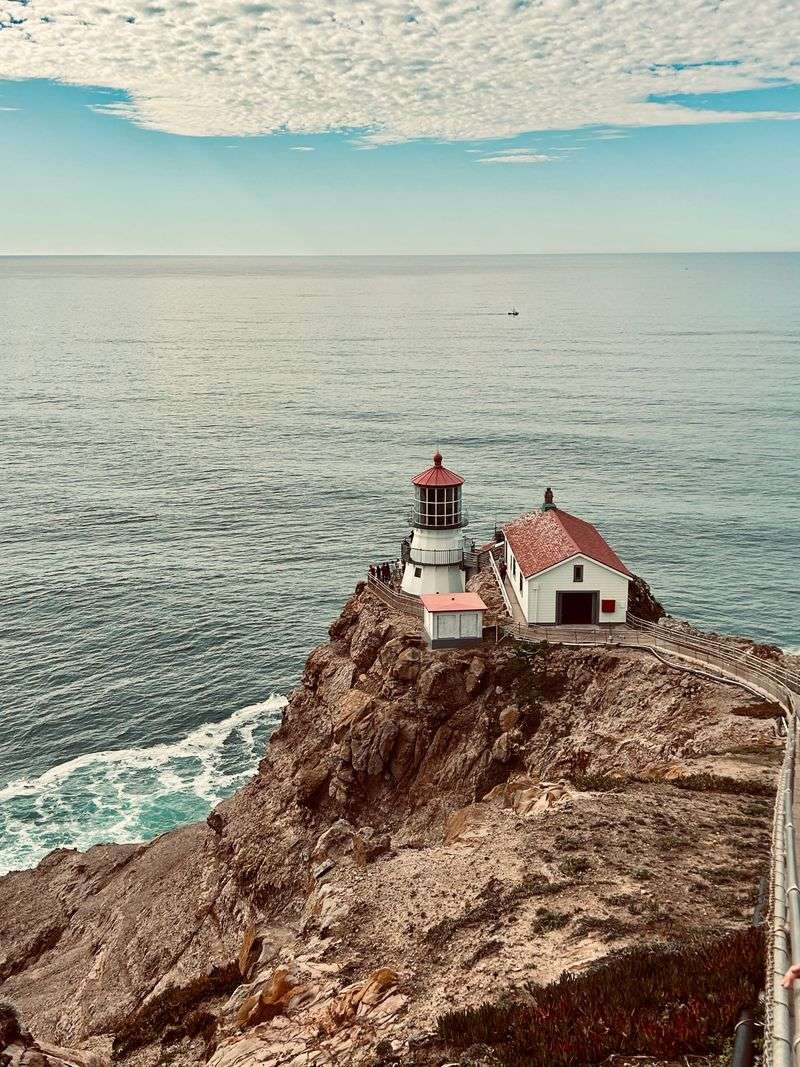
2. Marin Headlands to Point Reyes Lighthouse
Some winter mornings, I start this drive right after crossing the Golden Gate Bridge, ducking off 101 into the Marin Headlands for a slow roll past foggy overlooks and hawks hovering over the cliffs.
From there, I drop down to Highway 1, curl past Muir Beach and Stinson Beach, then aim for Olema where Sir Francis Drake Boulevard begins its 20-mile run out to the Point Reyes Lighthouse.
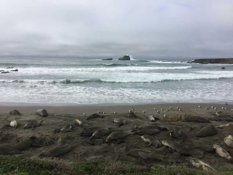
That last stretch is narrow, twisty, and worth every careful mile, especially in midwinter when gray whales migrate right past the headlands and elephant seals crowd nearby beaches.
I always stop at Chimney Rock or the Elephant Seal Overlook to watch the noisy colonies arguing over prime sand.
Wind can be fierce, and storms sometimes limit access, so I keep an eye on park alerts before committing to the lighthouse spur.
By the time I loop back through Point Reyes Station for warm food, it usually feels as if the whole peninsula has been on weather duty just for my little road trip.
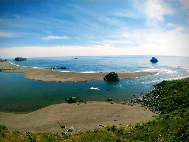
3. Mendocino Headlands and the Fort Bragg Coast

Whenever I need a winter reset, I start in Mendocino village, grab a coffee near the historic water towers, and point the hood north on Highway 1.
The road hugs the Mendocino Headlands first, then opens to wide ocean views as it tracks toward Jug Handle State Natural Reserve and its layered coastal terraces.
Fort Bragg arrives with its working harbor, sea-sprayed piers, and the easy walking stretch of the coastal trail skirting MacKerricher State Park.
In winter, the bluffs feel especially wild, and I keep an eye on the horizon for spouts from migrating gray whales slipping quietly past the headlands.
If rain moves in, I retreat into town for chowder and a stroll through the old lumber buildings that now house galleries and shops.
By the time I retrace Highway 1 back to Mendocino under early darkness, my camera roll is full of cold blue water, and my head feels pleasantly salt-rinsed.
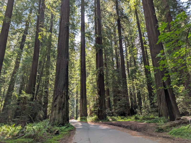
4. Humboldt Coast and Redwood Detours on Highway 101
For a road trip that mixes waves with towering trees, I like starting around Eureka and using Highway 101 as a loose spine for the day.
Northbound, the route skirts Humboldt Bay, then reaches Trinidad’s sea stacks before slipping into Redwood National and State Parks, where elk sometimes wander near the shoulder.
I always detour onto the Newton B Drury Scenic Parkway, a slow, quiet parallel road that dives straight into old-growth redwoods and feels perfectly matched to winter mist.
Farther north, the highway closes in on the Pacific again and eventually approaches Del Norte County’s notorious Last Chance Grade, a cliff-hugging section that has a reputation for slides and repairs.
Any time I head that way, I check conditions in advance since the weather can shuffle lane closures or cause short delays.
Ending the day with a sunset stop near Trinidad, watching offshore rocks catch the last light, always feels like a well-earned bonus round after so many curves.
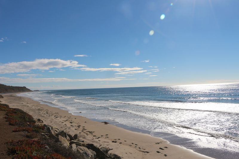
5. Santa Cruz to Monterey and Carmel-by-the-Sea
On shorter winter days, I like making Santa Cruz my starting line and lazily tracing Highway 1 south toward Monterey Bay.
First, I ease past Capitola’s colorful waterfront, then Seacliff State Beach, where the concrete ship’s broken hull still lies just offshore at the old pier site in all kinds of weather.
The road straightens past strawberry fields toward Moss Landing, where fishing boats crowd the harbor and sea otters often float in the calmer channels beside them.
Monterey arrives with the aquarium, Cannery Row, and the coastal recreation trail, all quieter in winter and much easier to explore between rain showers.
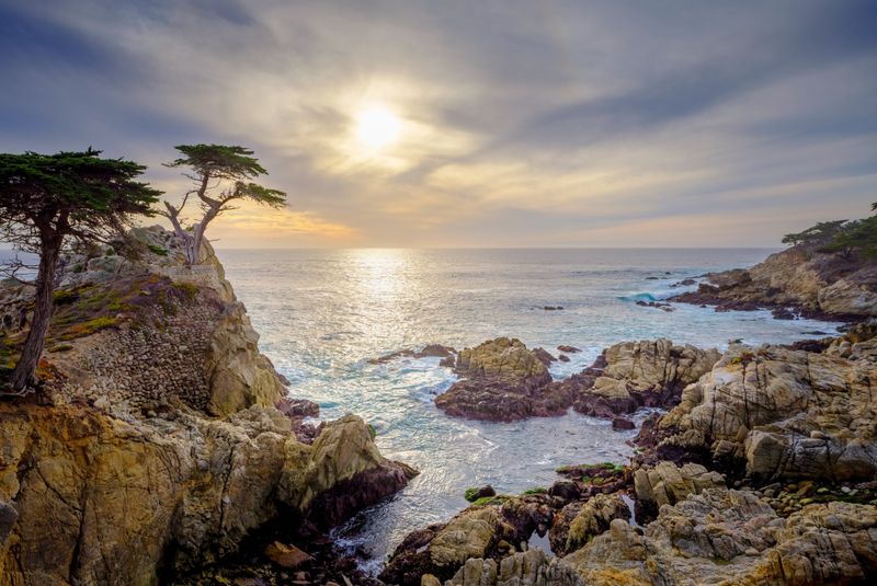
From there, I keep rolling into Pacific Grove and Carmel-by-the-Sea, sometimes splurging on 17 Mile Drive for windblown cypress trees and broad sweeps of ocean.
By the time dusk drops over Carmel Beach, it usually feels as if I have squeezed an entire vacation into a loop small enough to fit between storms.
6. Carmel to Big Sur’s Northern Reaches
When I want the drama of Big Sur without committing to a through crossing, I start in Carmel and simply follow Highway 1 south until the road tells me to turn back.
Point Lobos makes an early stop, with short trails that deliver harbor seal coves and tangled Monterey cypress groves in very little time.
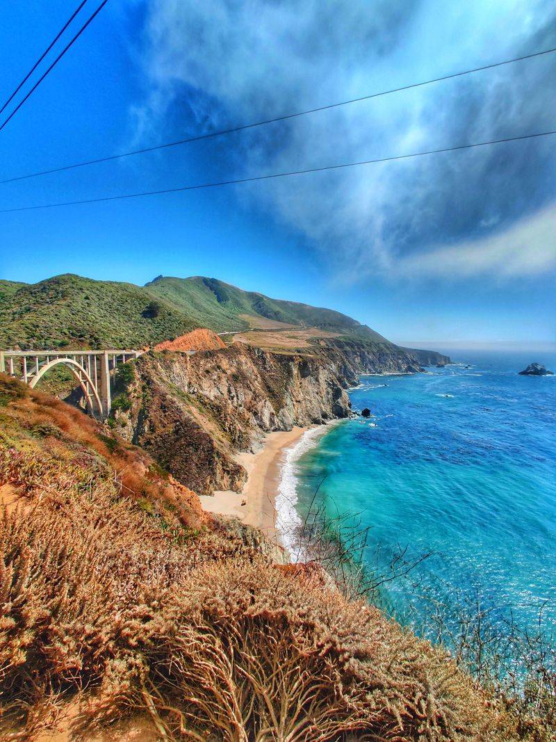
Beyond that, the highway climbs to the overlooks above Bixby Creek Bridge, a spot that stays popular year-round for its sweeping views of the cliffs and arching span.
I keep going past Garrapata and Pfeiffer Big Sur State Park, enjoying the slower pace created by new reduced speed limits through the area.
Since closures and construction sometimes affect the highway farther south, I usually plan this as an out-and-back trip that turns around near Big Sur village.
Returning north as the light shifts, watching the coastline unfold in reverse, makes the drive feel like two different trips sharing the same ribbon of pavement.
7. Cambria to Morro Bay along the Central Coast
Whenever Highway 1 south of Big Sur is calling, I like basing myself in Cambria and letting the day drift down the coast to Morro Bay.
Moonstone Beach sets the tone with its boardwalk and winter surf, and just north of town, the elephant seals near Piedras Blancas pile onto the sand in impressive numbers.
Heading south, the road slides past San Simeon’s bluffs, the tiny town of Harmony, and the relaxed pier at Cayucos, where shorebirds poke around even in chilly wind.
Morro Rock eventually rises ahead, anchoring the harbor while fishing boats and kayakers shuffle around its base.
I like to end the day wandering the Embarcadero, watching sea otters in the channel, and steam rising from takeaway cups in people’s hands.
Driving back to Cambria under a sky full of stars, with the silhouette of the rock behind me, always makes the Central Coast feel comfortably small and easy to revisit.
8. Pismo Beach to Santa Barbara via Highway 101 and Coastal Spurs
On days when I want a mix of beaches and classic California towns, I hop on Highway 101 near Pismo Beach and aim south toward Santa Barbara.
The route parallels the ocean in stretches, then veers inland past rolling hills before returning to the water near Gaviota, where the state park and trestle bridge mark a good picnic stop.
I sometimes detour toward Grover Beach or Oceano’s wide sands first, then rejoin 101 and keep an eye out for surfers around Shell Beach and Avila.
Occasional construction projects around interchanges have shuffled access here and there, so a quick check of current conditions can save a surprise detour.
Closer to Santa Barbara, palm trees line the waterfront, and the highway slips into a slower rhythm as it approaches the city’s beaches and harbor.
By the time I roll onto Cabrillo Boulevard for a sunset walk, the earlier freeway stretches feel far away, and the whole trip feels nicely condensed into one tidy winter loop.
9. Ventura to Malibu and Santa Monica on the Pacific Coast Highway
For a straightforward winter day with a lot of scenery packed into a short distance, I start in Ventura and follow Highway 1 toward Malibu.
The road cuts through Oxnard and then squeezes between the Santa Monica Mountains and the ocean at Point Mugu, a section where cliffs tower on one side and waves work on the other.
I like to stop at the small pullouts near Mugu Rock or Leo Carrillo State Beach, where tide pools and long sand stretches reward slower wandering.
From there, Malibu’s sequence of beaches unfolds, from El Matador’s photogenic coves to Zuma’s wide open shoreline, each quieter in winter but still buzzing with local walkers and surfers.
Continuing east, the highway glides into Santa Monica, where the pier and bike path offer plenty of reasons to stretch legs before thinking about the return trip.
Finishing the drive under the Ferris wheel lights and then cruising back along the darkened coast makes the whole route feel generous despite its modest mileage.
10. Santa Monica to Dana Point through Los Angeles and Orange County
There are days when I treat Highway 1 itself as the destination, starting in Santa Monica and drifting south through a string of famous beaches toward Dana Point.
The road runs through Venice, Marina del Rey, and the South Bay piers first, then works past the ports before joining the Orange County shoreline around Seal Beach and Huntington Beach.
From there, the Pacific Coast Highway tips through Newport Beach and Laguna Beach, with short detours to coves and cliffside parks always tempting from the main drag.
Between Huntington and Dana Point, the distance is only a few dozen miles, which makes it easy to slow down and lean into frequent stops rather than chasing progress.
I like to time things so the final stretch into Dana Point happens near sunset, when the harbor and headlands pick up soft winter light.
Ending the day with the car pointed inland toward the freeway again, it usually feels as if I just stitched together a highlight reel of half the Southern California coast.
11. Dana Point to Oceanside along Coast Highway 101
When I want something shorter but still packed with variety, I roll out of Dana Point and keep close to the water as the route trends south toward Oceanside.
Through San Clemente, the frontage roads shadow the freeway, then Coast Highway 101 picks up the story near the edge of Camp Pendleton and pulls the drive back to the shoreline.
Oceanside’s long pier, working harbor, and classic beach motels feel especially relaxed in winter, with easier parking and cooler air that makes long walks comfortable.
I usually stop for a harbor stroll, watch surfers near the pier, and check out whatever seasonal events are happening along the promenade.
Because this stretch uses surface streets more than freeway ramps, it feels easy to improvise side trips without worrying about complicated interchanges.
Gliding back north under streetlights, with storefronts reflecting off the windshield, always reminds me how nicely the old highway still connects these towns.
12. Oceanside to San Diego on Historic Highway 101
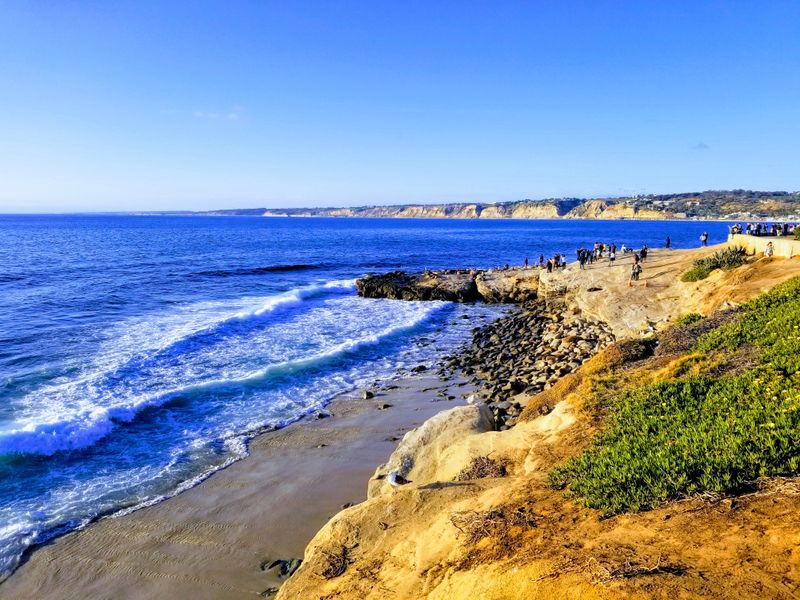
For a final coastal run that links multiple beach towns into one smooth line, I like starting in Oceanside and following Historic Highway 101 all the way toward San Diego.
Southbound, the road passes through Carlsbad’s village and beach bluff parks, then reaches Encinitas, where surfers cluster at Swami’s and Cardiff’s shoreline feels especially spacious in winter.
Solana Beach and Del Mar come next, sharing bluffs, lagoons, and a quieter off-season pace that makes parking easier near the sand.
Approaching La Jolla, cliffs grow taller, and coves deepen, and I often stop around La Jolla Shores or the village to watch seals and sea lions sprawled on the rocks.
From there, surface streets feed directly into San Diego’s coastal neighborhoods, where Mission Beach and Pacific Beach offer long boardwalks and wide sand for evening walks.
Rolling into the city with salt on my jacket and a half-finished bag of road snacks, I always feel grateful that this older highway still traces such a satisfying winter line along the edge of the Pacific.