This Historic Arkansas Valley Is Where Pioneer Legacies And Wild Elk Herds Roam
You might miss it if you are not paying attention. Driving through the Ozark Mountains of northwest Arkansas, the valley opens up in a way that feels almost quiet at first.
Then it settles in. Rolling fields stretch out, broken by timber cabins and old fences that have clearly been here for generations.
Near the edge of the woods, a herd of wild elk grazes without much concern for anything else. It feels steady and real.
The history of the place shows in small details, from stone foundations to land still worked today. Nothing feels preserved or staged.
It all continues as part of everyday life, shaped by seasons and routine. The light shifts, the scene changes, and it never quite looks the same twice.
Stay a little longer and more details begin to stand out. Read on for key facts that show why this Arkansas valley is worth your time.
Early Homesteads With Timber Cabins And Stone Foundations
A visit to the James A. Villines Homestead feels less like sightseeing and more like stepping through a door that history forgot to close behind it.
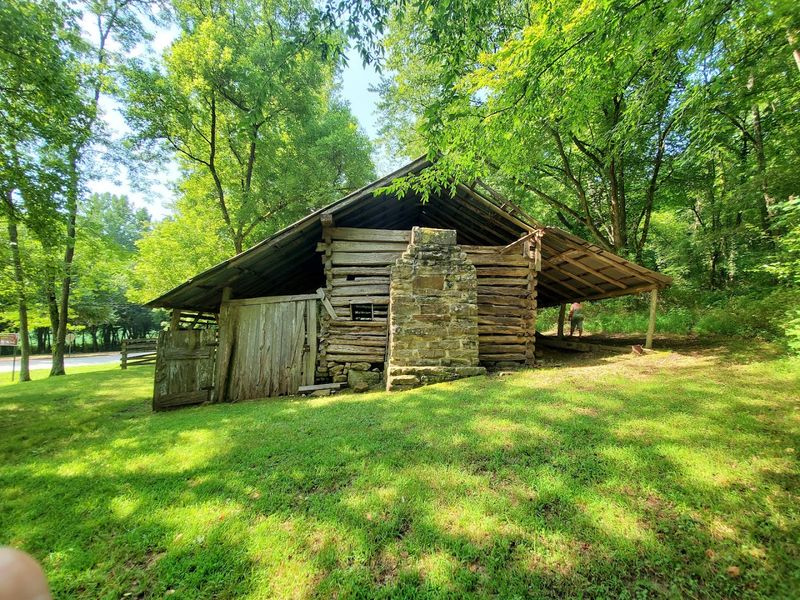
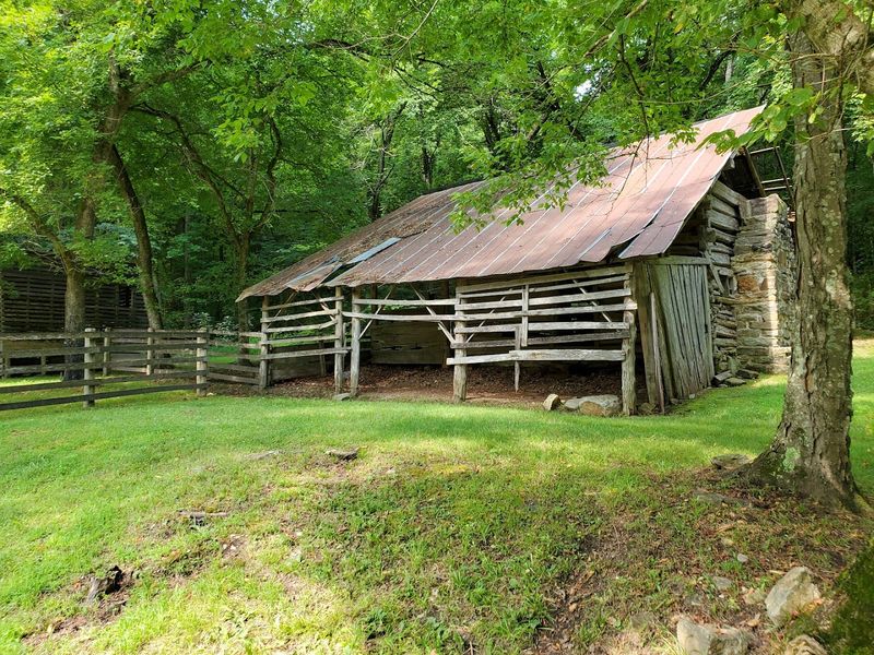
The structures standing in Boxley Valley today trace their roots to the mid-1800s, when the first families pushed into this narrow Ozark corridor and began carving out permanent lives from the land.
Timber cabins were the first shelters these settlers built, using whatever hardwood the surrounding hills could offer, and the stone foundations they laid have outlasted generations of Arkansas winters without complaint.
The Ponca low-water bridge provides a quiet approach to the Villines property, offering time to appreciate how deliberate every building choice once was.
Each notched log and stacked fieldstone tells a story about resourcefulness that no museum exhibit can fully replicate.
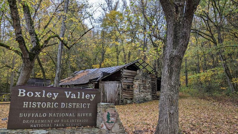
The Boxley Valley Historic District stretches along Highway 43 near Ponca, where these original homestead structures still stand as powerful reminders of the families who shaped this corner of Arkansas.
Buffalo River Lowlands Supporting Generations Of Farming
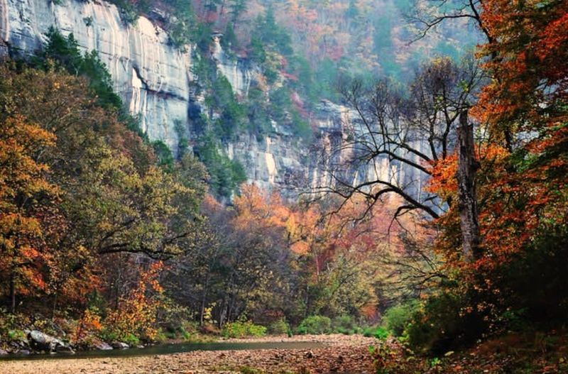
Few rivers in the American South have shaped human settlement as quietly and consistently as the Buffalo River, and the lowland fields stretching along its banks in Boxley Valley are living proof of that relationship.
Families who arrived here in the 1800s quickly recognized that the flat bottomlands near the river held some of the most productive soil in the Ozarks, fed by seasonal floods that deposited rich sediment across the valley floor year after year.
Corn, hay, and vegetable crops kept these farms running through decades of boom and hardship, with each generation passing down the knowledge of when to plant and when to expect the river to reclaim its banks.
Today, active farms still operate within the protected cultural landscape, maintaining a visual and agricultural continuity that stretches back nearly two centuries.
Standing at the edge of one of those open fields with the river murmuring nearby, it is easy to understand why settlers chose this spot and why their descendants stayed.
The Buffalo River lowlands remain one of the most quietly compelling agricultural stories in all of Arkansas.
Free Roaming Elk Herds In Open Pastures At Dawn
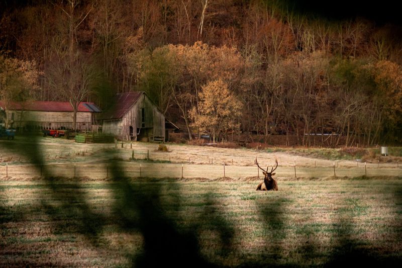
A bend along Highway 43 at first light can reveal a dozen elk standing calmly in a frost-covered pasture, completely unbothered by your presence.
The Arkansas Game and Fish Commission reintroduced 112 Rocky Mountain elk into this region in the 1980s, and that founding population has since grown to roughly 450 to 500 animals roaming the valley and surrounding hills.
Dawn remains the best time to spot them, when the pastures are quiet and the elk move freely between the tree line and the open fields without the distraction of midday traffic.
October and November mark the rutting season, when bulls bugle loudly across the valley and spar with rivals in displays that draw wildlife photographers from across the country.
Visitors consistently report seeing herds along Highway 43, though the elk have a well-documented habit of appearing wherever they choose rather than in designated viewing areas.
Keeping a respectful distance is both a safety requirement and a personal favor to yourself, because the experience of watching them move undisturbed is far more rewarding than any forced close-up.
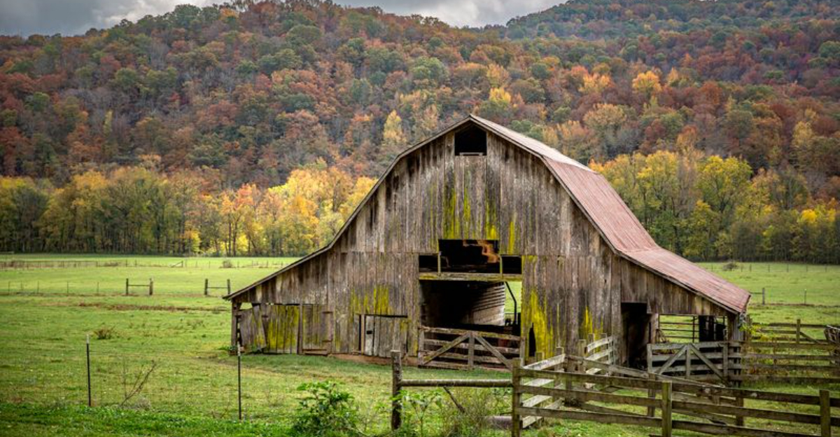
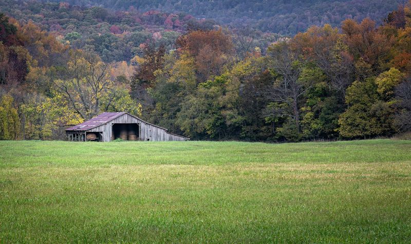
Weathered Barns And Corncribs From Nineteenth Century Life
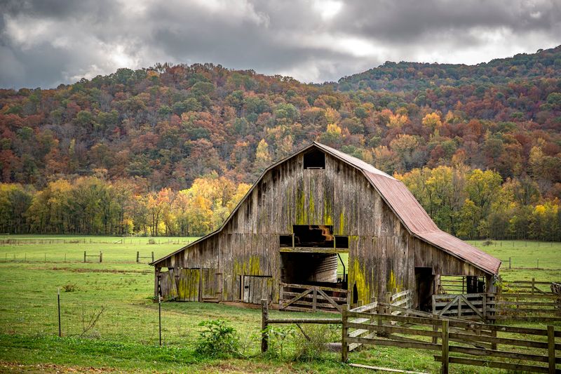
Historic barns and corncribs scattered across the valley immediately catch the eye, standing as quiet markers of long-standing agricultural traditions.
Barns and corncribs from the late nineteenth and early twentieth centuries are scattered throughout the valley, each one a functional relic of an agricultural system that relied on animal power, hand tools, and community labor to survive.
Corncribs in particular tell a specific story about how these families stored their most critical crop, using slatted wood construction to allow airflow while keeping moisture and pests at bay through the long winter months.
Many of these structures have never been fully restored, which is actually part of their appeal, because the weathered wood and sagging rooflines communicate authenticity that a fresh coat of paint would only undermine.
The National Park Service has worked carefully to document and preserve these buildings as part of the valley’s designated cultural landscape.
Photographers and history enthusiasts alike tend to linger here longer than they planned, pulled in by the texture and quiet dignity of structures that have simply refused to disappear.
Settler Stories Of Isolation And Endurance Passed Down
Life in Boxley Valley demanded resilience, and the families who settled here learned quickly how to rely on themselves in ways that still shape the area’s identity.
Surrounded by steep forested ridges with limited access and few nearby communities, early settlers developed a self-sufficiency that touched every part of daily life, from milling their own grain at the Boxley Grist Mill to preserving food through methods passed down from parents and grandparents.
The Villines family name appears repeatedly in the valley’s historical record, representing one of the most enduring lineages in the region and a direct human thread connecting the 1850s to the present day.
Stories of harsh winters, river crossings gone wrong, and harvests that barely stretched through spring were carried forward through oral tradition and community memory, keeping the human cost of pioneer life from fading into abstraction.
The Ponca Nature Center offers a practical starting point for anyone who wants to understand these stories in context, with exhibits that ground the history in specific names and real events.
Every conversation with a long-time local here feels like a small act of historical preservation happening in real time.
Seasonal Flooding Shaping Fertile Valley Fields
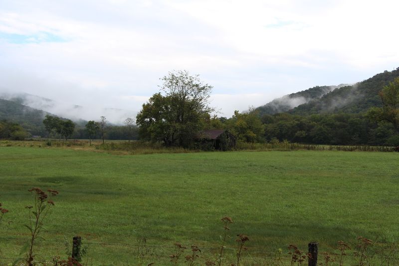
Seasonal flooding has long shaped the character of Boxley Valley, influencing both its fertile fields and the way people have lived on the land.
When the river rises after heavy rains, it carries fine sediment from the surrounding hills and deposits it across the low-lying fields, recharging the soil with nutrients that synthetic fertilizers can only approximate.
Generations of farming families learned to read the river’s patterns carefully, timing their planting schedules around the predictable rhythms of high water in spring and lower, calmer flows through summer.
This relationship between flood and farm shaped the physical layout of the valley, pushing homesteads toward higher ground while leaving the richest bottomland open for crops that could tolerate wet conditions.
These flooding patterns also helped sustain the open meadow character of the valley floor, which continues to support both agriculture and grazing wildlife today.
What looks like flat, unremarkable farmland from a car window is actually the product of a centuries-long conversation between the river and the people who chose to live alongside it.
Gravel Roads Following Historic Valley Routes
Backroads winding through Boxley Valley offer a slower way to experience the landscape beyond the main highway.
Some of these routes reflect older paths once used by settlers moving between homesteads, transporting goods, and connecting with small community hubs in this remote part of the Ozarks.
Driving them today at a steady pace gives a clearer sense of the valley’s geography, with the crunch of gravel underfoot and the occasional creek crossing reminding you that this landscape was never designed for convenience.
These roads also lead to lesser-known spots beyond the main corridor, including small cemeteries, creek-side clearings, and remnants of outbuildings that have settled quietly into the hillsides over time.
Exploring beyond the primary route adds depth to the visit, revealing details that are easy to miss when staying on the main road.
There is a specific kind of unhurried clarity that comes from navigating a narrow lane with no particular deadline, and Boxley Valley delivers it generously.
Protected Landscape Preserving Heritage And Wildlife
Recognition of Boxley Valley as a cultural landscape within the Buffalo National River system reflects its long-standing importance rather than a simple administrative label.
The National Park Service oversees a landscape that balances active farming, historic preservation, and wildlife management in a way that few protected areas in the country manage to pull off successfully.
Elk share the valley with cattle, historic barns stand alongside functioning pastures, and hiking trails pass within view of structures that date back to the 1800s, all within a framework designed to keep the whole picture intact.
The Boxley Grist Mill, which operated from the 1870s until the 1950s, has been opened for special tours in some years, giving visitors a closer look at the valley’s milling history.
Wildlife beyond elk also thrives here, with deer, wild turkey, and wood ducks regularly spotted by visitors who take the time to move slowly through the valley.
Protecting a place like this means accepting that its value lies not in any single feature but in the layered relationship between its land, its history, and the living things that continue to call it home.