12 Michigan Islands That Make The Great Lakes Feel Stranger Than Expected
Mainland logic is a fragile thing that completely evaporates the moment you step onto a ferry. These islands are like glitches in the 21st century: pockets of limestone and timber where the Great Lakes suddenly feel massive, predatory, and infinitely more interesting than a postcard suggests.
Whether you’re navigating a bustling shipping lane or a silent wildlife refuge that hasn’t changed since the 1800s, there is a distinct, unpolished grit to these places. The air is sharper, the local memories are longer, and every arrival feels like a minor miracle of navigation.
Ditch the predictable beach resorts and find your own private horizon among the most rugged, remote, and historic islands scattered across Michigan.
To find the true character of these offshore outposts, you have to embrace the fog and the unpredictable transit schedules. This is a world of improbable landings and rusted history, proving that the best way to understand the water is to leave the shore behind.
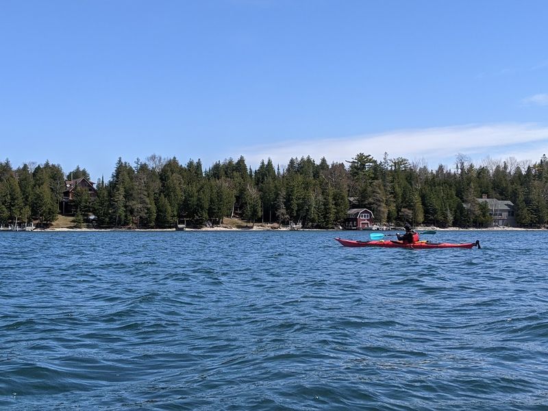
1. Mackinac Island
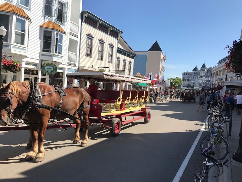
The first oddity on Mackinac Island is silence with hoofbeats in it. Cars have been banned since the late 1800s, so the soundtrack is bicycles, carriage wheels, gulls, and the faint clatter of tourists carrying pink fudge boxes down Main Street.
That alone makes the island feel less like a resort than a beautifully preserved social experiment. Then the layers keep stacking up. Fort Mackinac predates the American Revolution, more than 80 percent of the island is protected parkland, and limestone landmarks like Arch Rock and Skull Cave give the place a slightly theatrical geology.
The Grand Hotel’s famously long porch anchors the human side of the spectacle. What lingers most is how quickly the island shifts once you pedal away from downtown. A few minutes inland, the crowds thin, the forest closes in, and Lake Huron looks almost unreal.
2. Isle Royale
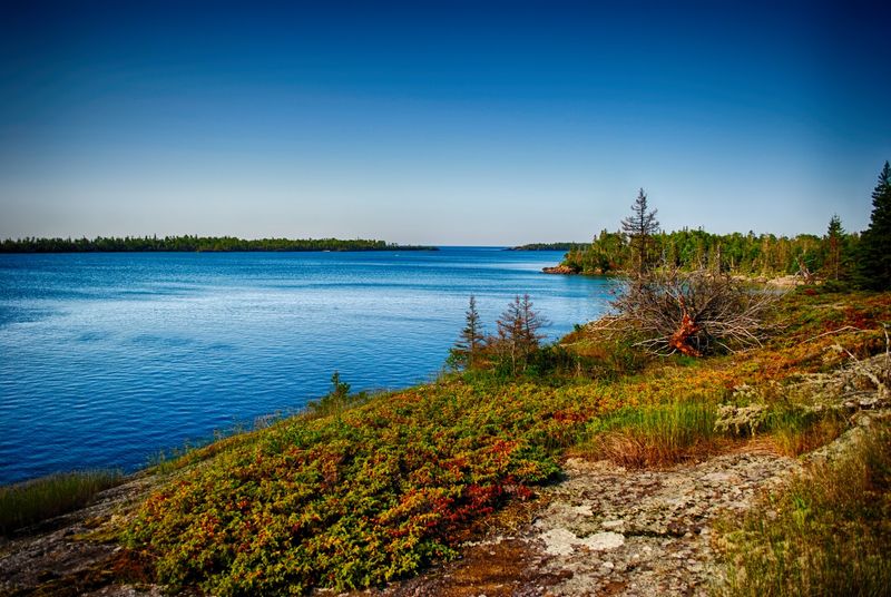
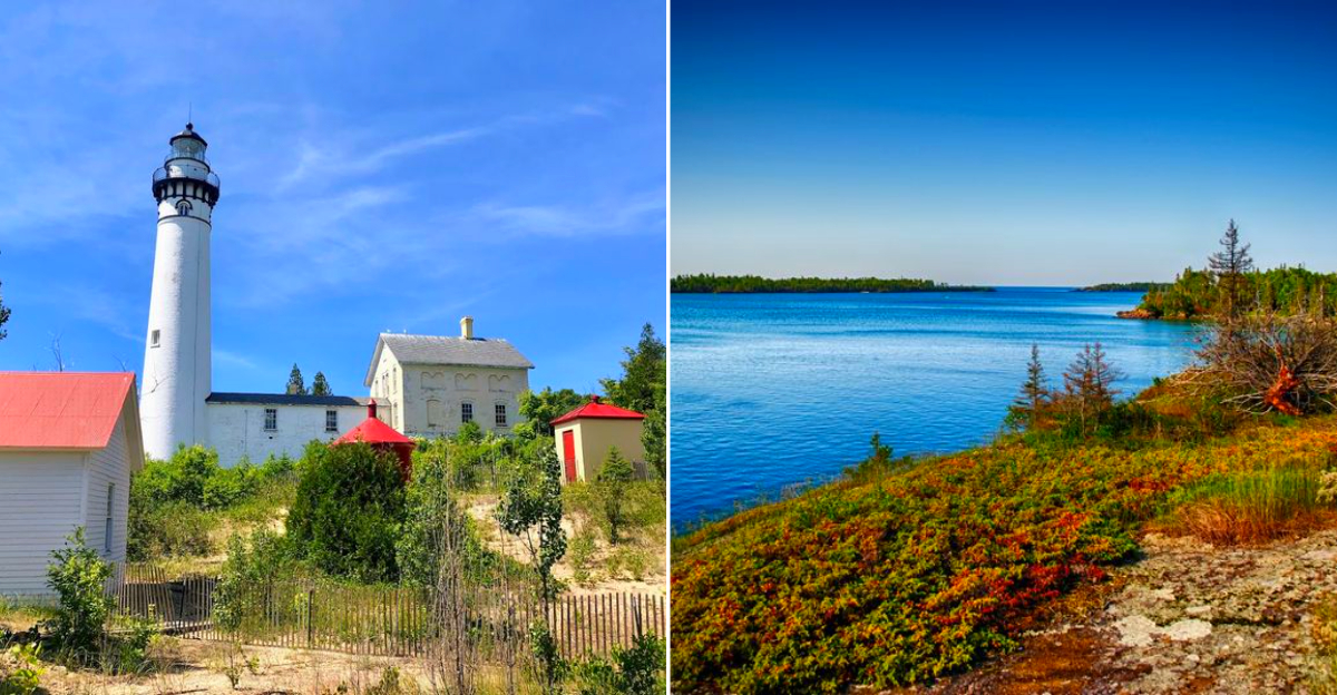
Reaching Isle Royale already feels like agreeing to a different set of rules. This remote national park sits in Lake Superior and is accessible only by boat or float plane, which means arrival comes with a built-in sense of separation from ordinary time.
Even before the hiking starts, the scale feels unusual: wilderness and water spread across 850 square miles, including more than 450 surrounding islands. Its strangeness is not decorative. Wolves and moose have been studied here for decades in one of the world’s best known predator-prey research projects, and the park fully closes in winter, the only U.S. national park to do so.
Trails, campgrounds, lighthouses, shipwrecks, and ancient copper mining sites are scattered across a place that remains lightly visited. That rarity changes the mood. Lake Superior stops feeling scenic and starts feeling immense, cold, and sovereign.
3. Beaver Island
Beaver Island carries one of the most improbable political histories in the Great Lakes. In the mid-1800s, James Jesse Strang built a Mormon kingdom here, declared himself king, and even served in the Michigan Legislature before his assassination in 1856.
That story alone gives the island a charged, slightly off-center feeling long before its beaches and forests come into view. Today, Beaver Island is the largest island in Lake Michigan and the only inhabited island in its archipelago. Later Irish Catholic fishing families shaped much of the year-round culture, while the landscape holds dunes, wetlands, woodlands, and streams where the endangered Michigan monkey-flower grows.
The island lies about 32 miles from Charlevoix, reached by a roughly two-hour ferry or short flight. The result is a place that feels both settled and remote. History, ecology, and weather seem to share equal authority here.
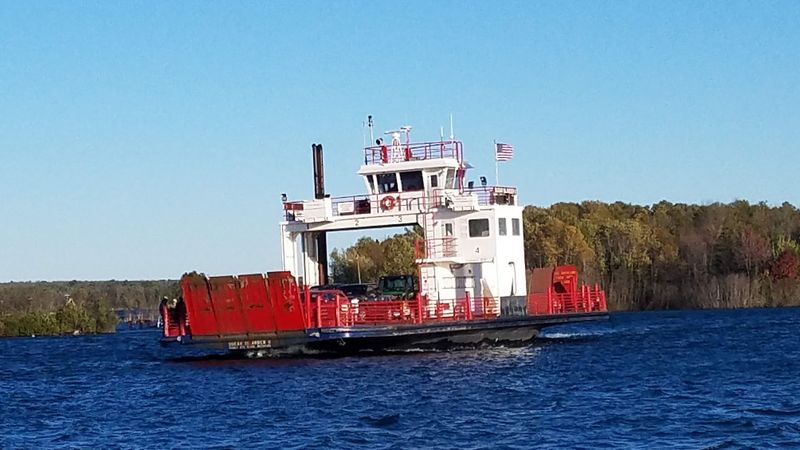
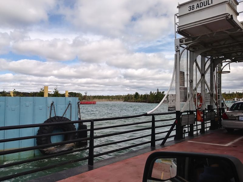
4. Drummond Island
Drummond Island feels geologically restless, as if the land never settled on one identity. It is the second largest freshwater island in the United States, with about 87,000 acres and 150 miles of shoreline, yet much of its character comes from rarer details: globally uncommon alvars, broad limestone plains where thin soil, grass, and wildflowers create a landscape that looks almost borrowed from somewhere else.
Even before you name what you are seeing, the island gives off a feeling of exposure, openness, and ecological oddity. Two-thirds of the island is state-owned land, so the sense of open space is real rather than promotional. At the same time, Drummond is known for more than 100 miles of closed-loop ORV trails, giving it an energy that contrasts sharply with its fragile ecosystems.
The island is reached by a year-round car ferry, and in severe winters an ice road can form. That mix is what makes it memorable. It feels wild, worked, ancient, and slightly provisional all at once, a place where recreation, remoteness, and rare habitat all press against one another without fully resolving.
5. Bois Blanc Island
Bois Blanc Island, often shortened locally to Boblo, has the kind of quiet that makes every practical detail seem important. The island sits in the Straits of Mackinac, and once there, miles of unpaved roads, a tiny year-round population, and long stretches of solitude create an atmosphere that feels less like tourism and more like temporary residency in a place apart.
The name means white wood, likely referring to basswood or paper birch used by Native people and French traders. History lingers in stranger forms too: lime kiln ruins on the northwest end helped produce mortar for Fort Mackinac, and local legend says John Dillinger hid here after plastic surgery in 1934.
Bois Blanc is also the only part of Michigan’s Upper Peninsula where the eastern massasauga rattlesnake is found. Nothing on the island insists on itself. That restraint is exactly what makes it so uncanny.
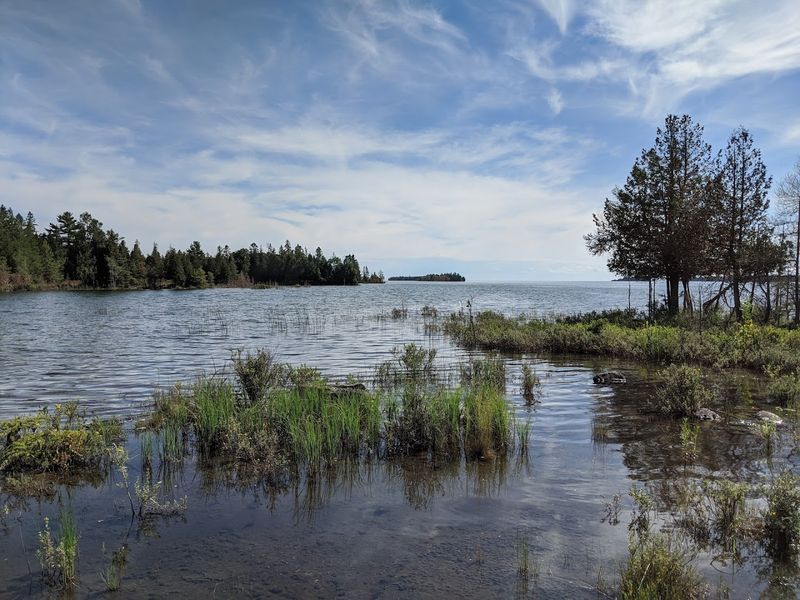
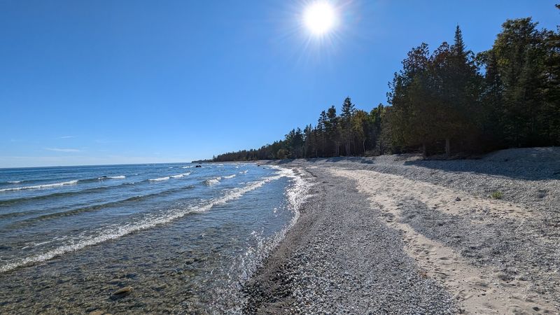
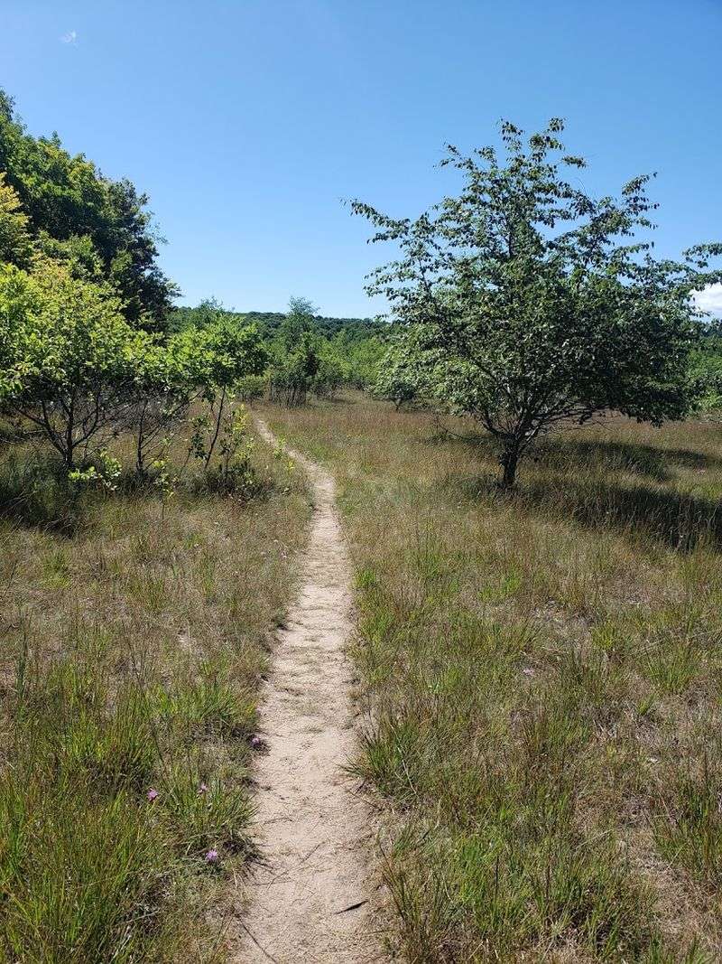
6. South Manitou Island
South Manitou Island has a neat, almost storybook outline on the map, but the place itself feels weathered and elemental. Pebble beaches ring much of the shore, dunes rise unexpectedly, and inland there is Florence Lake, the island’s only lake, a detail that somehow makes the whole landscape feel even more self-contained.
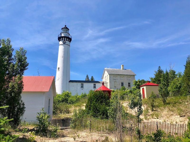
The lighthouse and harbor add order, but the island never quite stops feeling feral. That tension comes from use layered over time. In the nineteenth century, the deep-water harbor made South Manitou a crucial stop for steamships taking on wood, and the current lighthouse dates to 1872.
A Life-Saving Station opened in 1902, while farm families once grew prize-winning rye, beans, and peas in isolation. Today it is uninhabited, part of Sleeping Bear Dunes National Lakeshore. The rare old-growth white cedars are perhaps the strangest part. Some are more than 500 years old, gripping the bluff as if time hardly applies.
7. North Manitou Island
North Manitou Island does not offer the usual island promise of neat edges and easy orientation. It is managed largely as wilderness within Sleeping Bear Dunes National Lakeshore, and the island’s old farms, settlement traces, and decaying buildings often appear only after long quiet stretches of trail.
That alternation between natural beauty and human afterimage gives the place a haunted, unfinished texture. Even the silences feel layered, as if weather, abandonment, and memory have all been working on the landscape at once.
The island is about seven miles long and five miles wide, with nearly 15,000 acres and 20 miles of shoreline. People have used it for at least 3,000 years, including Native communities who hunted and stayed here seasonally, and later trappers, loggers, and farmers.
Reaching North Manitou usually means committing to overnight backcountry camping from the Leland ferry. Offshore, Manitou Passage has over 50 shipwrecks. The effort required to get there is part of the atmosphere, because distance and exposure shape your attention almost immediately.
That history is not ornamental. It makes every meadow and beach feel like something survived there.
8. Sugar Island
Sugar Island can seem almost ordinary at first glance, which is part of its peculiarity. It sits in the St. Marys River near Sault Ste. Marie, reached by ferry, with rural roads, homes, and broad undeveloped stretches that soften the international border into something less visible than expected.
Yet the island keeps revealing unusual context the longer its story unfolds. In 1945, it was even nominated as a possible site for the headquarters of the United Nations, one of those facts that instantly changes the air around a place.
The University of Michigan Biological Station manages the 3,200-acre Chase Osborn Preserve here, and both the Bay Mills Indian Community and the Sault Tribe of Chippewa Indians have interests on the island as ancestral homeland. About one-third of residents are Native American.
That combination of ferry-town routine and world-historical footnote makes Sugar Island feel quietly surreal.
9. Neebish Island
Neebish Island has one of the strangest contrasts in Michigan: a calm agricultural island beside a major industrial waterway. The name comes from an Ojibwe word meaning leaf, possibly describing its shape, and much of the island still reads as rural and residential.
Fields, trees, and modest roads set a gentle tone that would feel wholly secluded if not for the ships. That is where the dissonance arrives. The East Neebish Rock Cut, a dredged navigation channel, is an essential part of the St. Marys River shipping system, allowing large vessels to pass through this narrow corridor.
The Neebish Island Ferry connects residents and visitors to the mainland, while anglers and birders use the same waters and shorelines for much quieter purposes.
Few places balance scale this oddly. Freighters move like apartment buildings, and then a few yards away the island returns to its patient, almost pastoral rhythm.
10. Harsens Island
Water does the planning on Harsens Island. Set in the St. Clair Flats at the mouth of the St. Clair River, the island sits inside one of the world’s largest freshwater deltas, where channels, marshes, and shifting edges make the landscape feel more amphibious than fixed.
Even the arrival helps establish the mood: this is the only U.S. island in the Flats reached by automobile ferry. Its history is more complicated than the vacation-cottage scenery suggests. Jurisdiction here was disputed because of vague boundary language after the 1783 Treaty of Paris, and Walpole Island First Nation also claims Harsens as unceded territory.
Today, about 75 percent of the island is state-owned for wildlife and waterfowl habitat, while Big Muscamoot Bay becomes famous each summer for the huge Muscamoot Raft-Off.
That mix of marsh quiet, legal complexity, and floating festivity makes Harsens feel wonderfully hard to categorize.
11. Grosse Ile
Grosse Ile is the island on this list that feels least remote, and perhaps most surprising because of that. Sitting in the Detroit River, connected by bridge and folded into metropolitan life, it still carries the psychological outline of a separate place.
Shoreline neighborhoods, marinas, marshy edges, and passing freighters give it a curious split personality: suburban and riverine at once. The island is historically significant as one of the oldest European settlement areas in the region, shaped first by French colonial presence and later by farming, navigation, and transportation.
Nearby water and wetland areas remain important for birds and seasonal migration, so the natural setting still presses through the residential one. Unlike the northern islands, Grosse Ile does not depend on dramatic isolation for its effect.
Instead, the strangeness comes from proximity. It shows how an island can remain visibly distinct even while living in constant conversation with the city around it.
12. Les Cheneaux Islands
The odd charm of the Les Cheneaux Islands is that they rarely announce themselves with one grand spectacle. Instead, this Lake Huron archipelago in the eastern Upper Peninsula works by accumulation: narrow channels, cedar-framed shorelines, weathered boathouses, and water that keeps changing color between islands.
The name comes from the French for the channels, which feels exactly right once the geography starts folding in on itself. There are 36 islands and countless small transitions between open lake, protected passage, and inland-seeming water.
That complexity helped create a long tradition of boating, summer cottages, and patient local travel that values meandering over arrival. In winter, the wider area is also known for antique wooden boat culture and the famous Hessel ice shanty gathering when conditions allow.
What makes Les Cheneaux feel strange is its scale of intimacy. The Great Lakes usually read as vast, but here they become intricate, sheltered, and almost secretive.