
This Unassuming Michigan Spot Lets You Stand Halfway Between The Equator And The North Pole
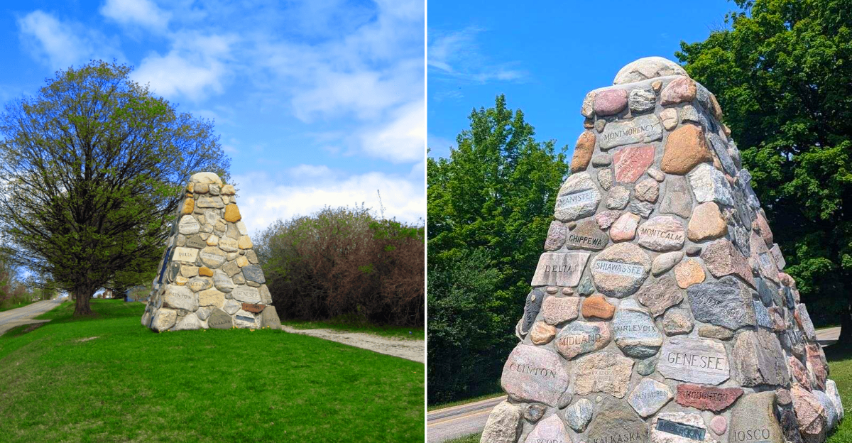
Roadside landmarks are best when they act casual about being completely strange.
You pull over expecting a quick photo, maybe a stretch of the legs, and then suddenly you are standing on the widely recognized halfway line between the Equator and the North Pole, which is not the kind of thing most Tuesday afternoons offer.
The charm here is compact but surprisingly durable. There is stone, signage, Michigan history, and that satisfying travel feeling of finding a stop that does not need noise to be memorable.
It is not a long visit, but it has the rare ability to make a map feel physical under your shoes. Northern Michigan travelers will find 45th parallel history, a quirky roadside monument, quick photo opportunities, and a small but memorable detour worth adding to the route.
Give it a few minutes. Read the marker, look around, and enjoy the odd pleasure of being exactly halfway to somewhere enormous.
Notice How Quiet The Stop Feels
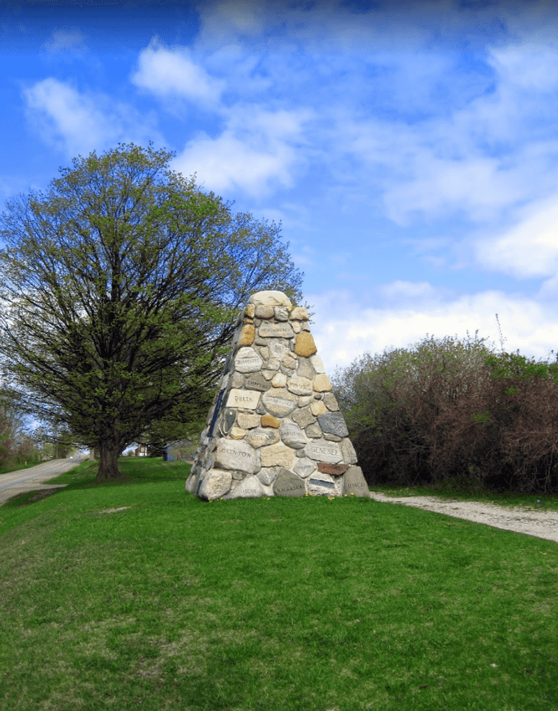
The first surprise here is not the geography but the hush. The cairn sits along Cairn Highway just north of Kewadin, in a roadside pull-off that feels more reflective than flashy.
Shade from large old maples and the open rural setting give the monument an unexpectedly settled presence.
That quiet makes the 1938 dedication easier to imagine. Hugh J.
Gray was known as the Dean of Michigan’s Tourist Activity, and the monument honors his role in promoting travel across the state. If you stop for only five minutes, spend one of them simply standing back and letting the place register, because its appeal comes from calm scale, not spectacle.
Find The Marker Where The Road Gets Quiet
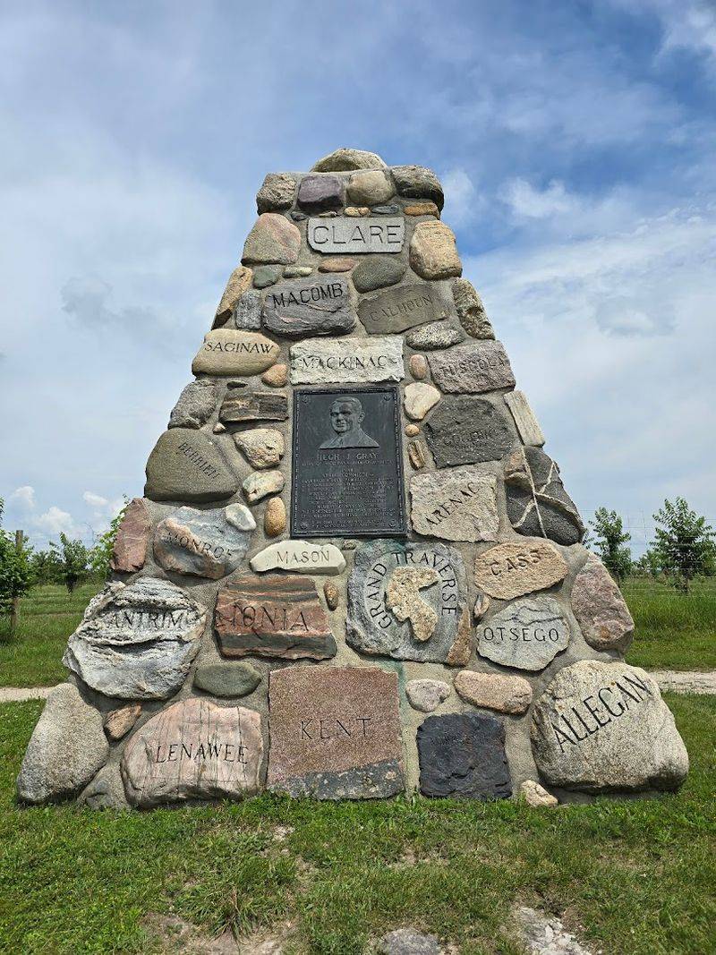
45th Parallel Marker / Hugh J. Gray Cairn, 5899 Cairn Highway, Kewadin, Michigan 49648, sits just north of Kewadin on old US-31, now Cairn Highway.
Follow the road like you are chasing a small roadside secret, not a major attraction. The closer you get, the more the drive feels made for a quick pull-off and a curious pause.
Once you arrive, park, step out, and look up at the stone cairn. The fun is simple: you came for a latitude marker, but found a strange little monument to Michigan travel itself.
Look Closely At The Cairn’s Construction
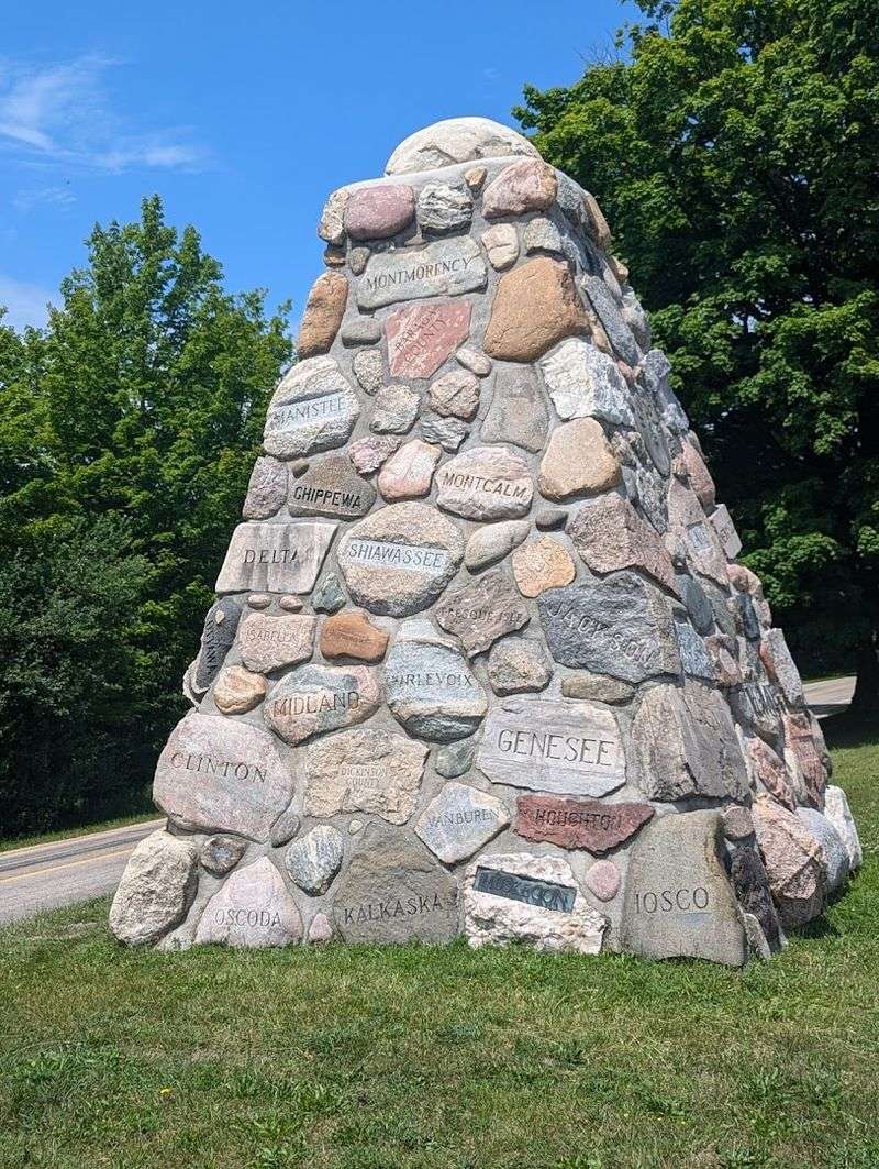
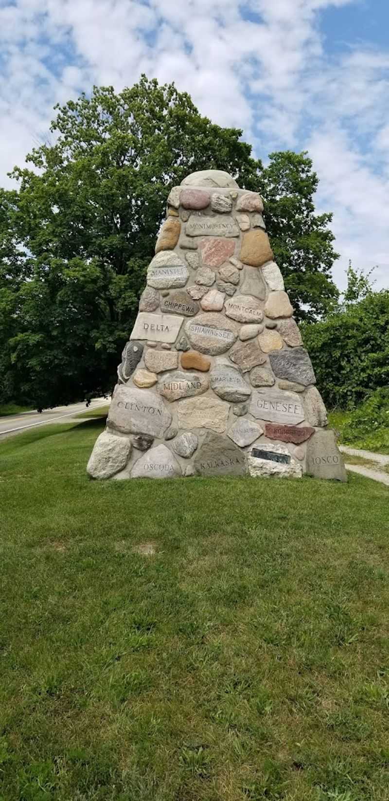
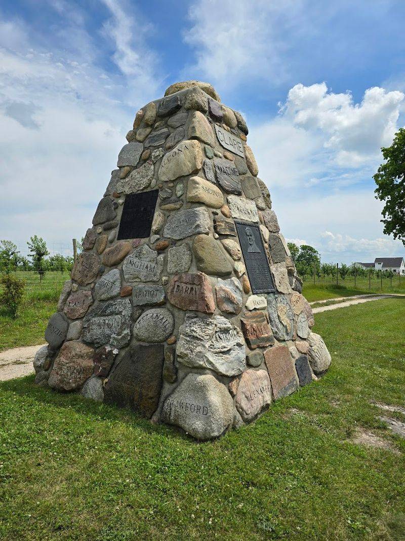
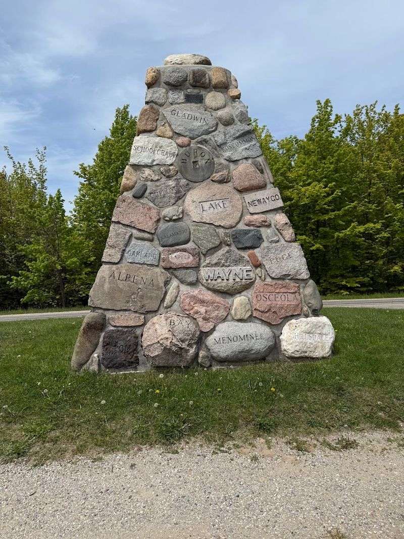
From a distance, the cairn reads as a sturdy pyramid of fieldstone and concrete. Up close, its proportions become clearer: about 12 feet square at the base and 16 feet high, with a shape that feels formal without becoming grand.
The masonry has a practical beauty that suits northern Michigan perfectly.
The structure contains 83 stones, one from each of Michigan’s 83 counties, each inscribed with its county name. That detail changes the monument from a geographic marker into a statewide collection in stone.
It is worth circling the cairn slowly, because the craftsmanship and the county-by-county idea are the real visual reward, not just the halfway headline.
Treat It As A History Stop, Not Just A Photo Stop
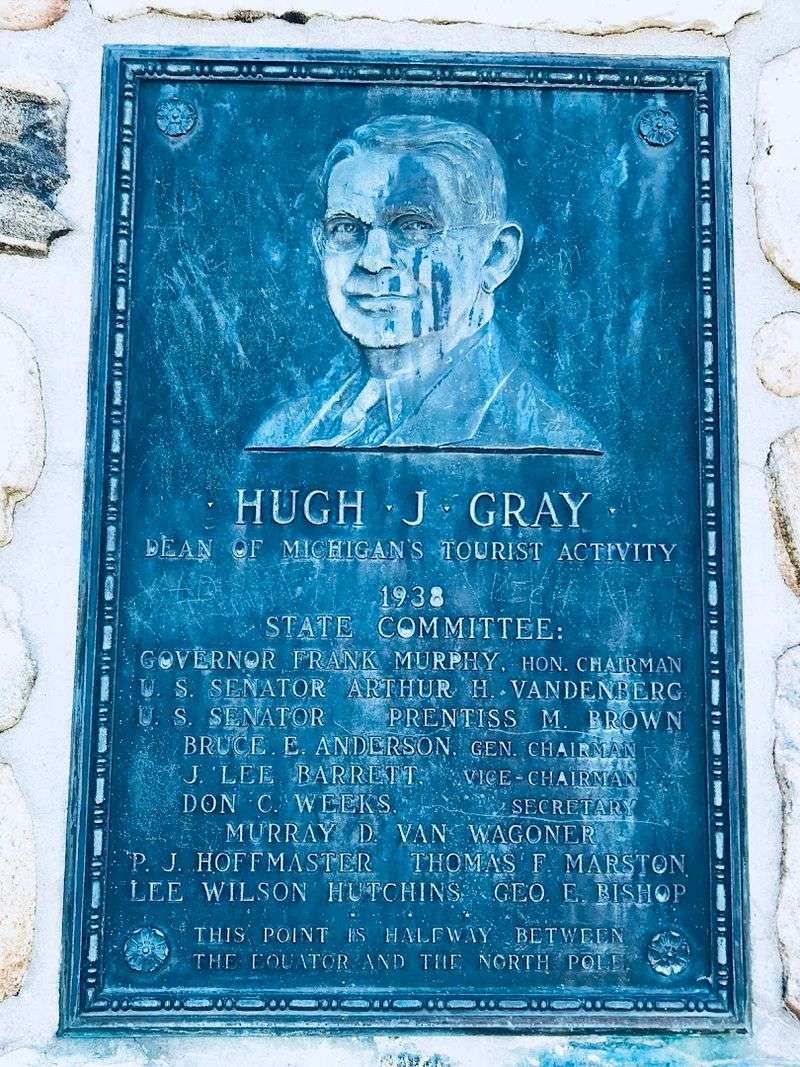
What gives this place depth is the person behind the name. The cairn was dedicated on June 28, 1938, to honor Hugh J.
Gray, whose work promoting tourism helped shape how Michigan presented itself to travelers. A bronze plaque with his likeness anchors that story in a very direct, human way.
Inside the monument, a sealed crypt reportedly holds resort booklets, brochures, and newspapers from the dedication era. That hidden cache gives the structure a time-capsule quality that lingers in the mind long after the stop is over.
I found that detail especially satisfying, because it turns a quick roadside pause into a compact piece of cultural history.
Remember That The Road Used To Matter More
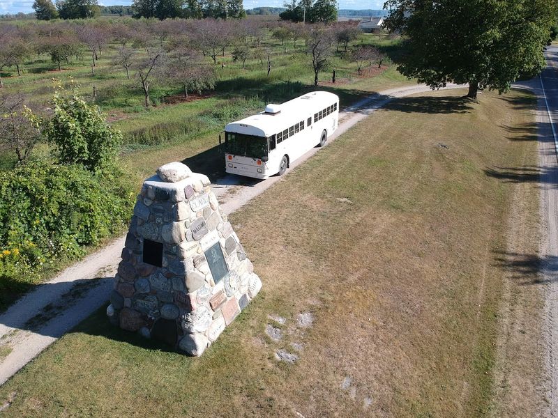
The road tells part of the story here. This monument originally stood on old US-31, when the main north-south route brought far more passing traffic by the site than today.
After US-31 was rerouted in 1955, the old alignment became Cairn Highway, and the monument settled into a quieter afterlife.
That shift helps explain the mood visitors find now. Instead of a busy roadside attraction competing for attention, the cairn feels preserved by reduced traffic and a bit of luck.
The best approach is to appreciate that altered context, because the place makes the most sense when seen as a survivor from an earlier age of Michigan motoring.
Give Yourself Time To Read The County Names
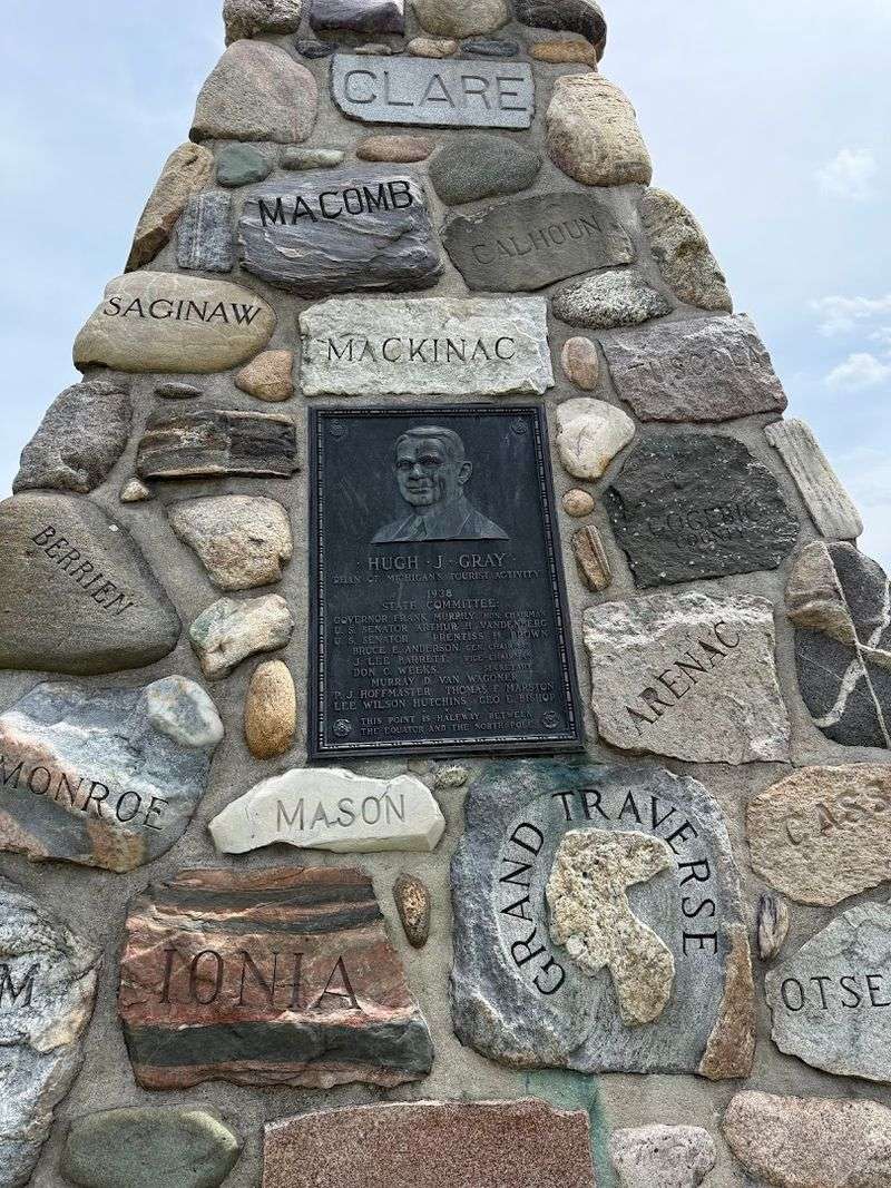
One of the most satisfying habits at the cairn is slowing down enough to read the county names built into it. Each inscribed stone ties a specific corner of Michigan to this single point in Antrim County, turning the monument into a rough-textured map of the whole state.
The idea is simple, but it works beautifully.
There is also one especially odd detail: Wexford County contributed a piece of rubber rather than stone. That small eccentric note keeps the monument from feeling too solemn and reminds you that civic projects once had room for personality.
Start on one side and work methodically around, because the pleasure comes from noticing the accumulated variety.
Use The Stop As A Lesson In Scale
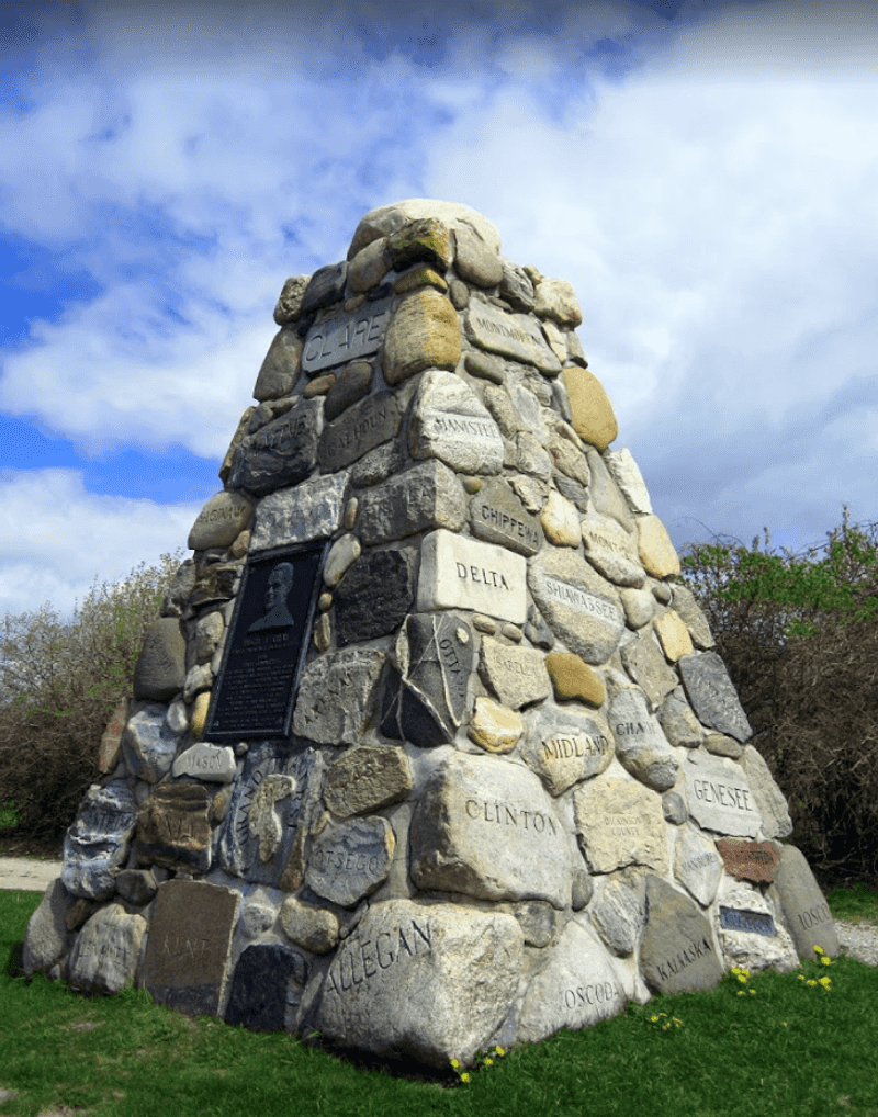
Standing here produces an oddly expansive feeling, even though the attraction itself is compact. The marker points to a global idea, the midpoint between Equator and pole, while the setting remains distinctly local: a modest roadside turnout, trees, farm country, and a breeze moving through northern Michigan.
That contrast is part of the charm.
The site does not overwhelm you with interpretation, so the imagination has room to work. I liked how the monument made huge distances feel briefly graspable without becoming abstract or preachy.
If you are traveling with children or simply enjoy maps, this is the kind of place that sparks questions better than many larger attractions do.
Know What Kind Of Stop This Is
This is not an afternoon destination, and it is better when approached honestly. The cairn is a quick roadside attraction with room for a short visit, simple parking, and easy access right off Cairn Highway.
Most people can see it well in five to ten minutes, which is part of its usefulness on a longer drive.
That brevity should not be mistaken for thinness. The monument rewards attention, but it does not demand elaborate planning, hiking gear, or a schedule carved around it.
Step out, read the marker, notice the quiet rural surroundings, and give yourself a moment to understand why the spot exists. Visit when you are already moving between places, give it a focused pause, and let the stop reset your eyes before the next stretch of road through northwestern Lower Michigan.
Notice The Interplay Of Monument And Landscape
For such a compact landmark, the cairn has a remarkably good setting. Old maples help frame the turnout, and the open air around Kewadin gives the monument breathing room instead of visual clutter.
On a warm day, the shade and occasional breeze soften the experience and make the stop feel less like a checkbox than a pause.
That natural ease matters because the cairn itself is visually dense, with county stones, inscriptions, and plaque details asking for close attention. The landscape provides the necessary balance.
Rather than rushing straight to the photo, walk the perimeter first, then step back and see how neatly the monument fits into this understated slice of Antrim County.
Appreciate How Modestly Michigan Marks This Latitude
Michigan has several markers for the 45th parallel, including examples at Old Mission Point, Gaylord, Suttons Bay, and Menominee. What makes the Kewadin site distinctive is that it combines the latitude marker with a memorial to Hugh J.
Gray and a monument built from contributions by every county. It feels less isolated than those facts might suggest.
Instead, the cairn gathers geography, state identity, and travel history into one object. That layering gives it more character than a simple signpost would ever manage.
There is also something quietly appealing about seeing the whole state represented through stone, turning a roadside latitude marker into a small civic gesture. If you have seen other 45th parallel markers, this stop is still worth making, because the county-stone concept gives the Kewadin version a richer sense of purpose.
Leave With The Right Expectation
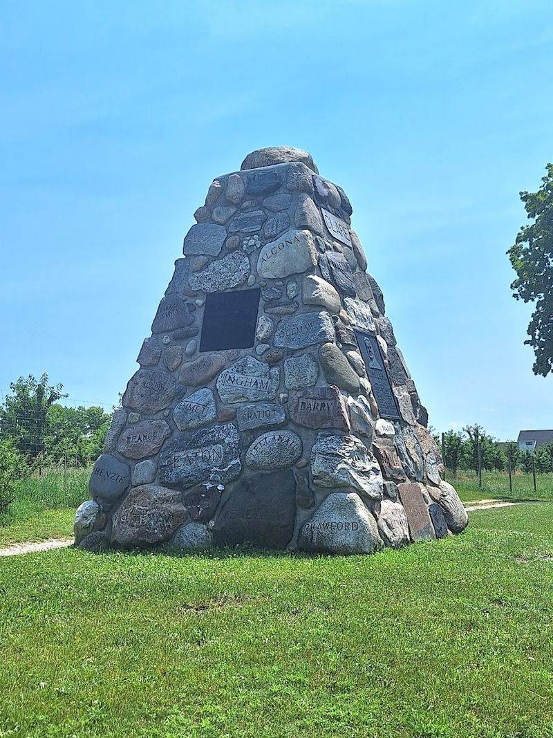
The best reason to stop here is not that the cairn is spectacular. It is that the place remains humble while carrying a surprising amount of meaning: a near-precise latitude, a 1938 tribute, a statewide collection of county materials, and a surviving fragment of old road culture.
Very few quick stops manage that combination without making the visitor feel as if they have been dragged into a forced roadside lesson.
Seen that way, the monument becomes memorable precisely because it does not try too hard. You arrive, circle it, read a few names, take your picture, and leave slightly more grounded in where you are.
Maybe you notice the stones more closely than expected, or think for a second about all the places they came from. That is a modest gift, but a real one, and it suits this quiet stretch of Cairn Highway better than any flashy reinvention ever could.