
9 Scenic Arkansas Hikes That Take You Straight Into The State’s Fascinating Past
A walk in Arkansas can change character faster than you expect. The trail may begin with birds overhead and leaves shifting underfoot, then suddenly lead straight into a story that started centuries ago.
Old mining remains stand beside the woods. Ancient markings survive beneath broad rock shelters.
Quiet fields once held soldiers, surveyors, families, or entire communities whose lives changed the state. That is the pull of these hikes.
They offer more than scenery without turning the outing into a history lesson. You simply keep walking, and the landscape begins explaining itself.
Interpretive signs help, but the strongest moments often come when you pause and picture what happened on the same ground beneath your shoes. Some routes take less than an hour.
Others reward a slower pace. All nine bring the past close in a way that feels immediate, vivid, and surprisingly personal from the first step to the last.
1. Village Creek State Park, Wynne
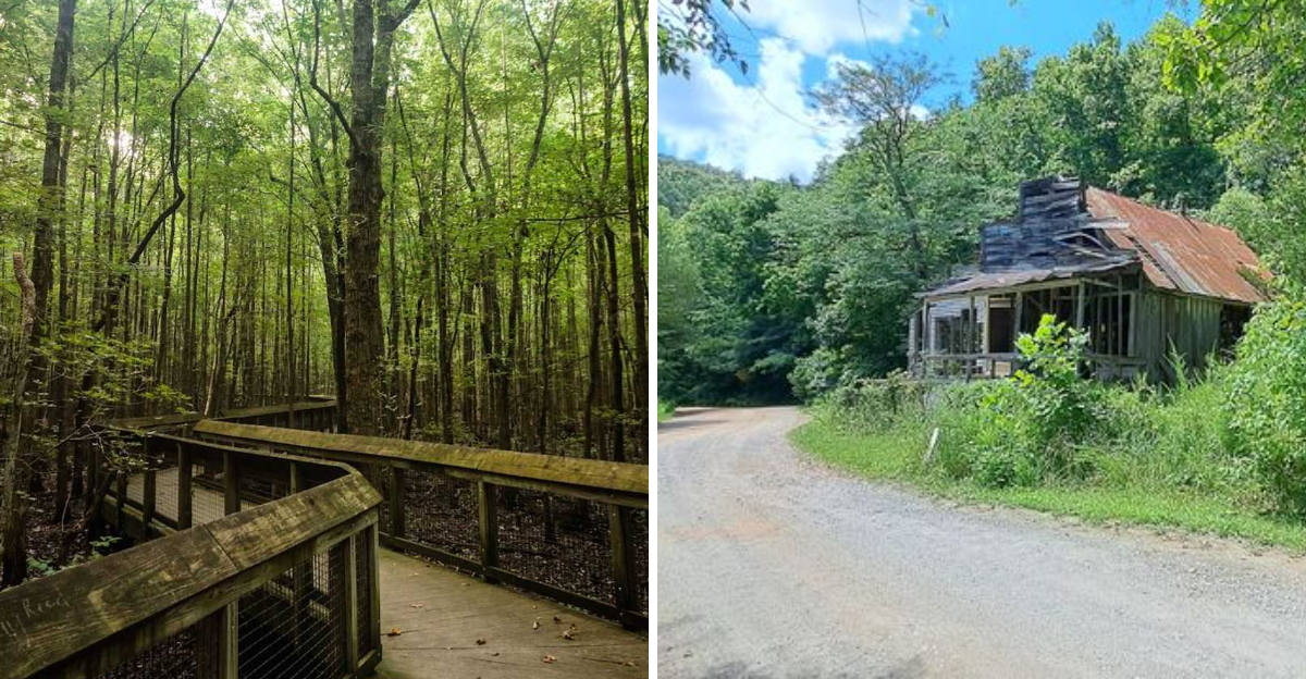
Crowley’s Ridge is one of the more geologically peculiar landforms in the American South. Village Creek State Park at 201 County Road 754, Wynne, AR 72396, sits right on top of it.
The park blends ecological curiosity with a deeply sobering piece of history, because running through its forest is a preserved section of the Old Military Road, completed in 1829 and later used as part of the Trail of Tears.
Walking the Old Military Road Trail, you can step into a sunken remnant of the original route, worn down by generations of travel into a visible groove in the earth.
The forest here feels different from many Arkansas woodlands, with a mature mix of hardwood trees growing in the unusual soils of Crowley’s Ridge.
The visitor center features interpretive displays covering the Native American nations connected to removal along this road, along with exhibits on local wildlife and the unique geology of Crowley’s Ridge.
Beyond the historic road trail, the Big Ben Nature Trail offers a closer look at the ridge’s unusual topography and the plant communities that have adapted to its soils.
Early morning hikes here carry a particular quiet, with birdsong filling the canopy and the filtered light making the old road trail feel like something from a different century.
This park connects natural surroundings with difficult human history along a single trail system.
2. Rush Historic District, Yellville
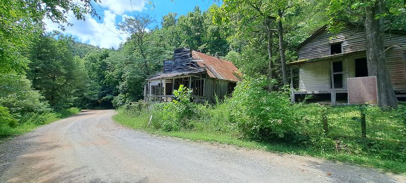
A ghost town that does not bother hiding its bones. Rush Historic District along Arkansas Highway 14 South in Yellville, AR 72687, pulls you into a world of rusted machinery and silent wooden frames.
This cluster of ruins sits inside the Buffalo National River corridor, where zinc was pulled from the earth starting in the 1880s.
The town roared back to life during World War I when demand for zinc spiked, then quietly faded as the market softened and families packed up and left for good.
What remains today is a remarkably intact collection of old mills, a general store shell, a smelter, and several historic homes, each one frozen in a different stage of slow return to the forest.
The Morning Star Interpretive Loop is the best starting point, a gravel path that loops through the heart of the mining district with signs explaining what each structure once was.
For a longer outing, the Mine Level Trail adds about 1.5 miles and passes the fenced entrances of former mine shafts, which carry a cool draft even on warm days.
Sturdy shoes are a must here because the ground shifts between gravel, roots, and uneven rock without much warning.
Wildlife has moved back in alongside the ruins, so do not be surprised if a deer steps through the frame of an old doorway just ahead of you on the path.
3. Prairie Grove Battlefield State Park, Prairie Grove
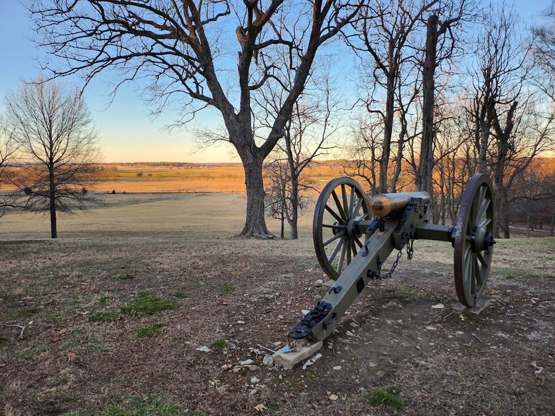
The grounds of Prairie Grove Battlefield State Park at 506 E Douglas Street, Prairie Grove, AR 72753, immediately convey the weight of the history held by this land.
The Battle of Prairie Grove took place in December 1862 and stands as one of the last major Civil War engagements fought in northwest Arkansas, a clash that shaped the fate of the region for the remainder of the war.
Historians and preservationists consider this one of the most intact Civil War battlefields in the country, which makes every step across its fields feel genuinely significant.
A one-mile paved Battlefield Trail winds past ancient oak and hickory trees, with interpretive panels stationed along the route to explain the positions of troops and the flow of the fighting.
If you want a broader view of the engagement, a five-mile driving tour connects the key points of the battle across the surrounding landscape.
Hindman Hall, the park museum and visitor center, holds interactive exhibits that bring both the soldiers and the civilians caught in the conflict to vivid life.
The park also hosts periodic battle reenactments where costumed participants re-create the chaos and strategy of the December clash, drawing crowds from across the region.
Spring and fall visits offer the most comfortable hiking temperatures, and the fall foliage adds a rich layer of color to the already striking scenery of this preserved battlefield.
4. Mirror Lake Waterfall, Fifty-Six
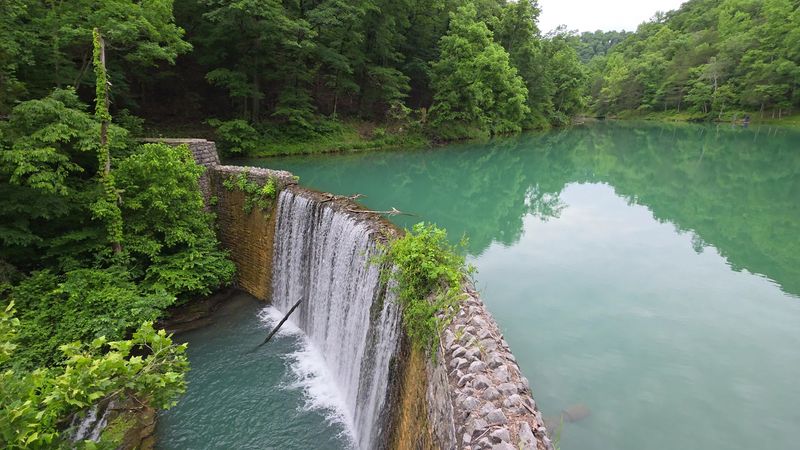
Mirror Lake Waterfall sits within the Ozark Mountains along 704 Blanchard Springs Road in Fifty-Six, AR 72533. Its still, clear pool reflects the surrounding forest so sharply that the scenery seems to double.
The lake is fed by cool water flowing from Blanchard Springs, which maintains a low temperature throughout the year.
The stone and concrete dam that creates Mirror Lake was built by the Civilian Conservation Corps around 1940, adding a layer of New Deal-era craftsmanship to an already photogenic natural scene.
An easy 1.3-mile loop follows the lake and offers views of the dam and Mirror Lake Waterfall, along with the atmospheric remains of an old mill below the falls.
Paved walkways and boardwalks make the prime viewing areas accessible without requiring any technical hiking ability, so this spot works well for a wide range of visitors.
The lake is regularly stocked with rainbow trout, and on many mornings you may find anglers casting lines from the bank with the waterfall as their backdrop.
Late spring brings wildflowers to the trail edges, while the rushing water and cool mountain air create a memorable setting.
Plan to linger here longer than you think you need to, because the view tends to hold people in place.
5. Louisiana Purchase State Park, Holly Grove
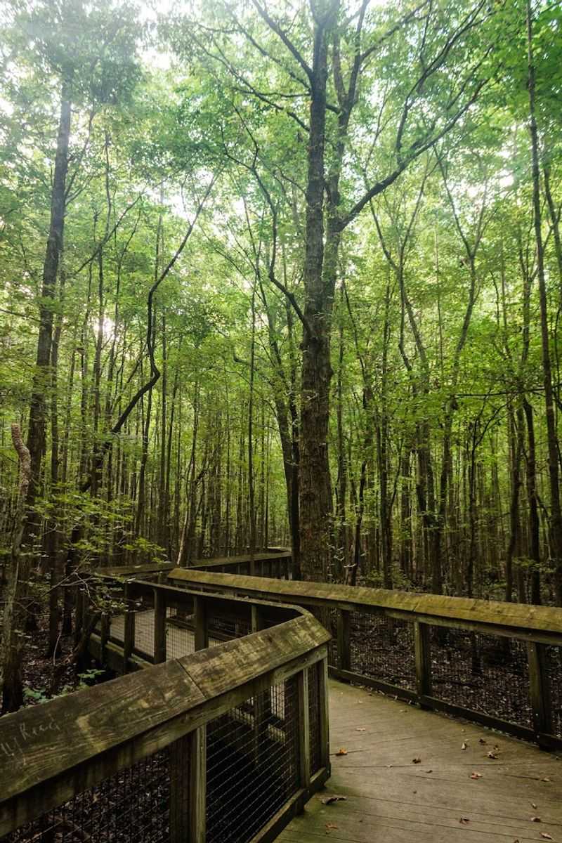
Most historical markers sit at roadsides, but the one at Louisiana Purchase State Park off Arkansas Highway 362 in Holly Grove, AR 72069, requires a boardwalk stroll through a headwater swamp to reach it.
A granite monument marks the initial point from which all land surveys of the territory acquired in the 1803 Louisiana Purchase were measured, a modest stone carrying an enormous amount of national significance.
Early surveyors, acting on an 1815 order, established this exact spot as the intersection of the fifth principal meridian and its east-west baseline, essentially the anchor for mapping a massive portion of the American West.
The 950-foot elevated boardwalk that leads to the monument passes through a rare wetland ecosystem, with interpretive signs along the way explaining both the history of the purchase and the ecology of the surrounding swamp.
Cypress trees rise from the dark water on either side of the walkway, their knobby roots creating a landscape that feels ancient and undisturbed.
This National Historic Landmark is one of those places where the gap between a quiet natural setting and the scale of what it represents is almost dizzying to think about.
The park occasionally offers guided programs that go deeper into the surveying process and the political story behind the purchase, which are worth checking the schedule for before your visit.
A short visit here punches well above its weight in terms of the historical perspective it delivers on a very short and easy walk.
6. Rock House Cave, Morrilton
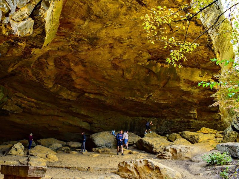
The name Rock House Cave may bring to mind a dark, narrow tunnel. Instead, visitors at 1285 Petit Jean Mountain Road, Morrilton, AR 72110, find a broad sandstone rock shelter rather than a conventional cave.
The large overhang creates a protected space that Native American people used long before European settlement reached the region.
Ancient pictographs painted with red pigment remain visible on the rock, including geometric designs and figures interpreted as animals or fishing-related images.
The short Rock House Cave Trail winds over uneven ground past rounded sandstone formations commonly called turtle rocks before reaching the shelter.
Standing inside and looking at those ancient images, knowing they were made by people who occupied this region centuries ago, carries a particular kind of quiet weight.
Petit Jean State Park surrounds the site with additional trails and overlooks, so it is easy to build a full day around the shelter visit and the broader park landscape.
The pictographs are protected, so visitors should view them without touching or disturbing the rock surfaces.
A short walk here delivers an unusually strong combination of visual and historical interest.
7. Arkansas Post National Memorial, Gillett
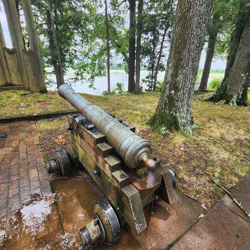
Henri de Tonti established a trading post here in 1686. Today, Arkansas Post National Memorial at 1741 Old Post Road, Gillett, AR 72055, preserves one of the oldest European settlement sites in the lower Mississippi Valley.
The location passed through French, Spanish, and American control over the following century, with each era adding its own chapter to a story that never seemed to slow down.
During the Revolutionary War period, the 1783 Colbert Raid brought the only Revolutionary War action to what would become Arkansas, a skirmish most people have never heard of but that plays out vividly in the park exhibits.
The site later served as the first capital of the Arkansas Territory before the Civil War brought Confederate Fort Hindman to the banks of the river, where it was destroyed in 1863.
Remnants of Confederate earthen trenches are still visible along the trails today, low grassy ridges that are easy to miss until a sign points them out and suddenly the landscape rearranges itself in your mind.
More than three miles of paved and unpaved trails loop through the historic town site and a beautiful hardwood forest, with the river providing a steady backdrop throughout.
The park also shelters a champion Osage orange tree, a natural landmark that adds an unexpected botanical footnote to an already layered historical experience.
The visitor center film and exhibits do an excellent job of stitching three centuries of history into a coherent and compelling story before you head out on the trail.
8. Parkin Archeological State Park, Parkin
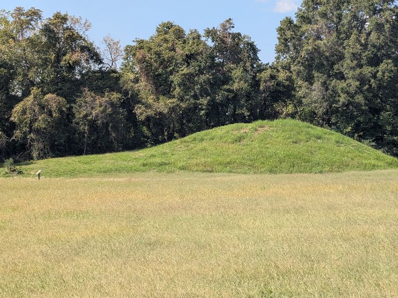
The village that once stood at 60 State Highway 184, Parkin, AR 72373, had developed over several centuries by the time a Spanish expedition reached the region in the 1540s.
Parkin Archeological State Park preserves a Mississippian-period settlement that many archaeologists associate with Casqui, the province visited by Hernando de Soto’s expedition, a connection supported by Spanish artifacts including a brass bell and a glass chevron bead found at the site.
The prehistoric village was built with defensive features, using the St. Francis River as a natural barrier on one side and a moat, likely accompanied by a wooden palisade, around other portions of the settlement.
A large platform earthen mound constructed by the village’s inhabitants still rises above the riverbank today, offering a striking visual anchor to the entire site.
The three-quarter-mile Village Trail is fully paved and accessible, winding through the site with interpretive panels that cover both the prehistoric occupation and the more recent history of the Parkin community.
Two bridges along the trail cross sections of the ancient moat, and one provides an overlook of the St. Francis River.
Archaeologists continue to study this site, and the visitor center presents artifacts and information from research conducted there.
Walking this trail, the gap between the ancient world and the present one feels surprisingly narrow.
9. Plum Bayou Mounds Archeological State Park, Scott
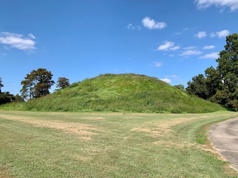
Before the word Arkansas was attached to anything, the Plum Bayou people were already building some of the most ambitious earthen monuments in the region. They built them at what is now 490 Toltec Mounds Road, Scott, AR 72142.
The park preserves an 18-mound complex featuring some of the tallest surviving prehistoric mounds in the state, constructed between roughly 650 and 1050 AD for ceremonial and community purposes.
Researchers have noted that the placement of the mounds appears to align with key solar positions, suggesting that the Plum Bayou culture used astronomical observations while planning the complex.
The park sits beside Mound Lake, an oxbow lake associated with the Arkansas River, which gives the site a reflective quality that softens the scale of what the mound builders accomplished here.
Two self-guided trails offer different ways to experience the complex. The fully paved and accessible Knapp Trail covers approximately 0.8 miles, while the 1.6-mile Plum Bayou Trail extends the journey toward a boardwalk at Mound Pond.
The boardwalk section is particularly striking, placing you above a still wetland with the mound complex nearby.
Inside the visitor center, exhibits and an audiovisual presentation provide cultural and archaeological context for the site.
This place rewards slow, thoughtful exploration, and the trail back always seems shorter than the trail in.