
This Small South Carolina Town Has More Outdoor Adventures Than Anywhere Else In The State
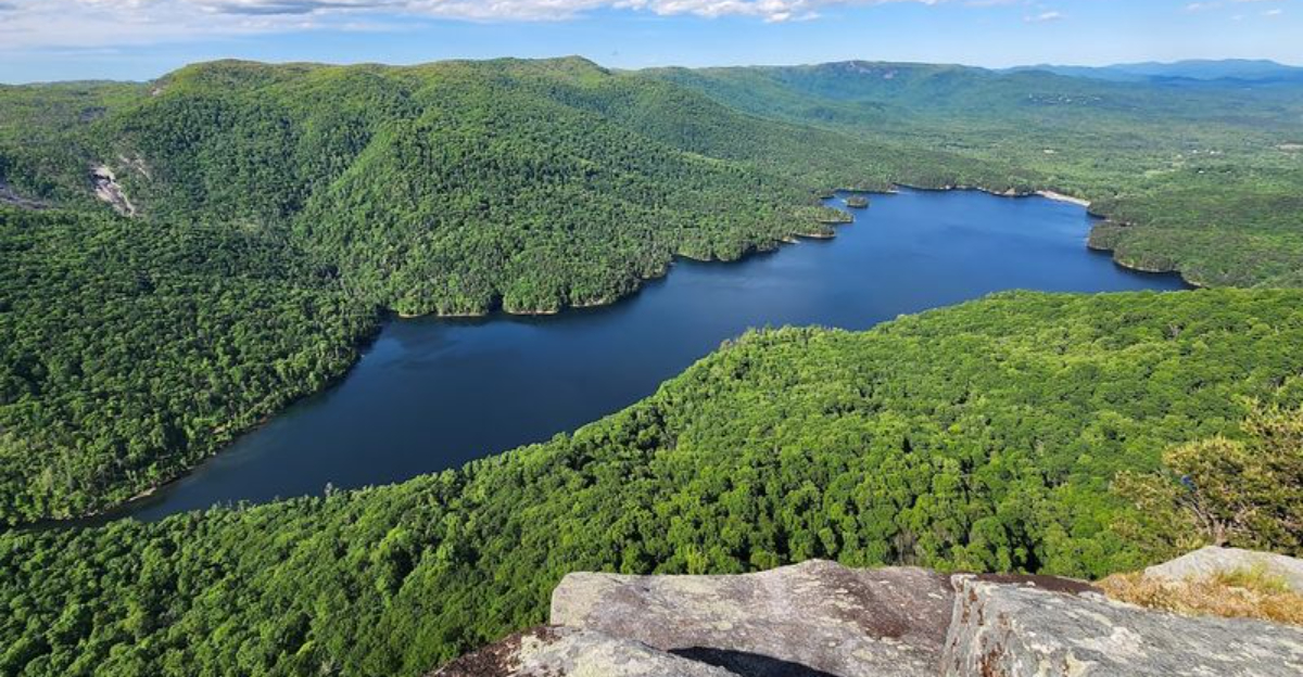
The size of a town has very little to do with the size of the adventures waiting around it. Some of the most unforgettable places fit onto a map in seconds but can keep you exploring for days.
From the moment the pavement gives way to winding mountain roads, everything begins to change. Forest trails disappear beneath towering trees, rivers rush through ancient rock formations, and peaceful lakes reflect the surrounding peaks like polished glass.
Every direction seems to lead somewhere worth stopping, whether it is a hidden waterfall, a scenic overlook, or a trail that rewards every step with an even better view.
South Carolina is filled with charming small towns, but few offer such an impressive gateway to the outdoors.
Nestled against the Blue Ridge foothills, South Carolina’s mountain landscape transforms this quiet community into the perfect base for hikers, paddlers, photographers, and anyone looking to trade busy schedules for fresh mountain air. The biggest adventures in South Carolina often begin in the places most travelers drive right past.
If you believe unforgettable weekends are measured by miles hiked instead of city skylines, this hidden gem deserves a place at the top of your travel list.
Table Rock State Park Trails
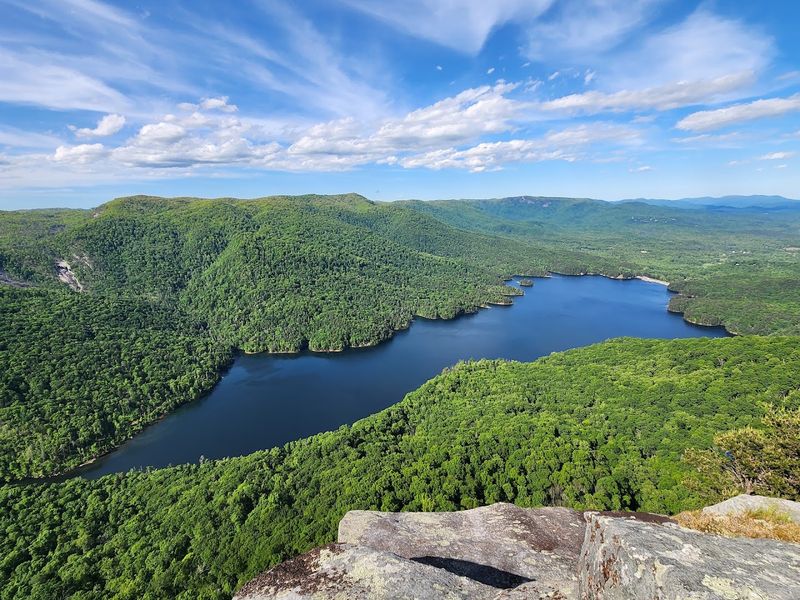
Lacing up my boots at the trailhead, I knew the climb to Table Rock summit would test my legs, but I had no idea the view from the top would practically erase the memory of every switchback.
Table Rock State Park sprawls across more than 3,000 acres just a few miles north of Pickens, and its network of trails ranges from easy lakeside loops to the lung-burning ascent of Table Rock Mountain itself. The seven-mile round trip to the summit gains nearly 2,000 feet, winding through hardwood forest, across boulder fields, and finally up a rocky scramble that rewards you with a panorama stretching across the Piedmont and into North Carolina.
I have hiked this trail in every season, and each time the forest reveals something new, whether it is spring wildflowers, summer shade, or the crimson blaze of autumn leaves.
Families with younger kids often stick to the Carrick Creek Nature Trail, a gentler path that meanders past cascades and offers plenty of spots to splash in cool water. Rangers lead guided hikes during peak season, sharing stories about the Civilian Conservation Corps crews who built the park’s stone shelters and bridges in the 1930s.
Every time I reach the top of Table Rock, I find myself scanning the horizon for landmarks I recognize, then sitting in silence for a few extra minutes before heading back down.
Jocassee Gorges Wilderness
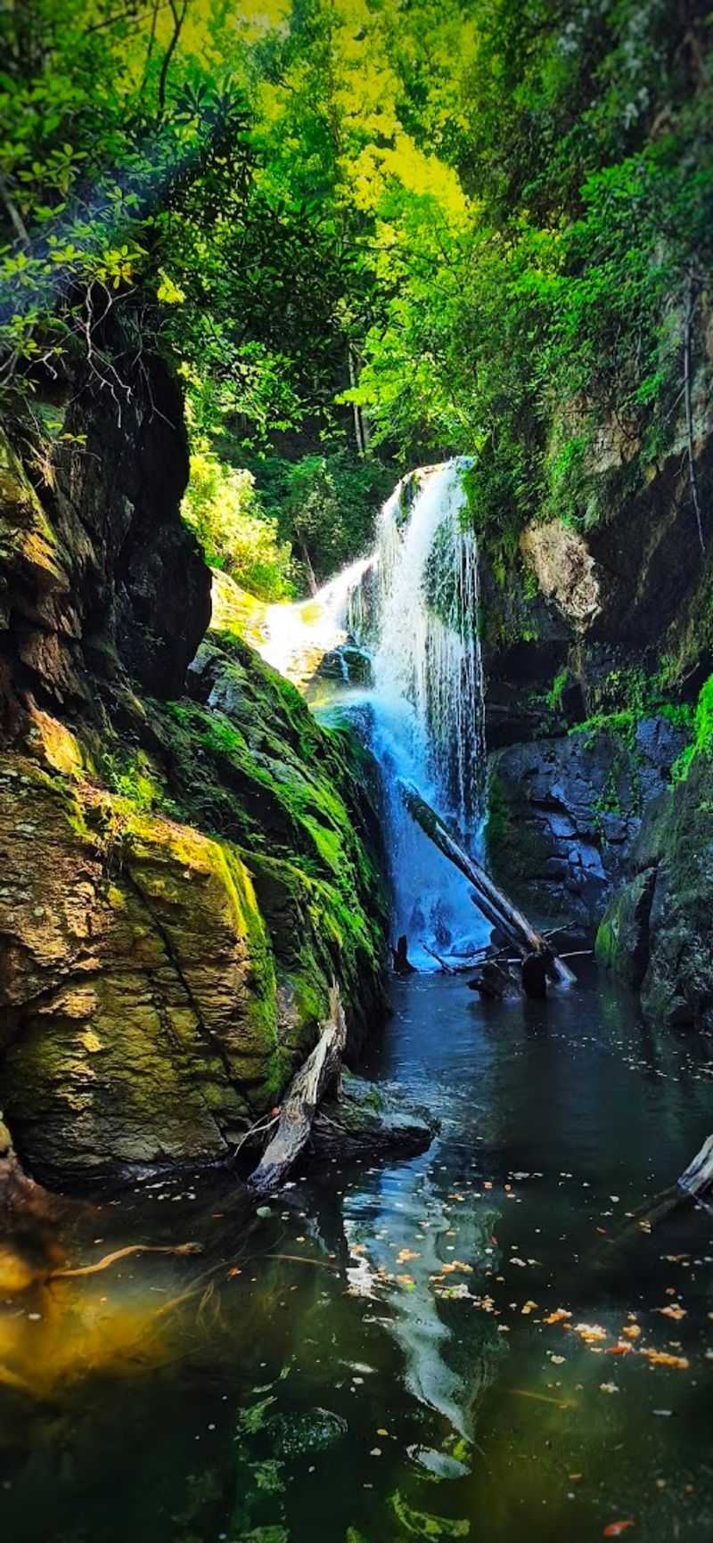
Stepping into Jocassee Gorges feels like crossing into a hidden world where waterfalls outnumber people and the only sounds are birdsong and rushing water.
This 43,000-acre wilderness area lies just west of Pickens and protects some of the most biodiverse terrain in the southern Appalachians, with steep gorges, old-growth forest, and more than a dozen named waterfalls. I have spent entire days here exploring unmarked trails that lead to cascades like Laurel Fork Falls and Wright Creek Falls, each one tumbling over moss-covered rock into pools so clear you can count the stones on the bottom.
The terrain is challenging, with rocky scrambles and creek crossings that require careful footing, but the solitude and beauty make every step worthwhile.
Backcountry camping is allowed with a permit, and I have pitched my tent on ridges where the only light after dark comes from stars and distant lightning bugs. The gorges are also home to rare plants and animals, including the Oconee bell, a delicate white flower that blooms in early spring and grows nowhere else on Earth.
Every visit reminds me that some places still guard their secrets, and Jocassee Gorges is one of them.
Lake Jocassee Kayaking
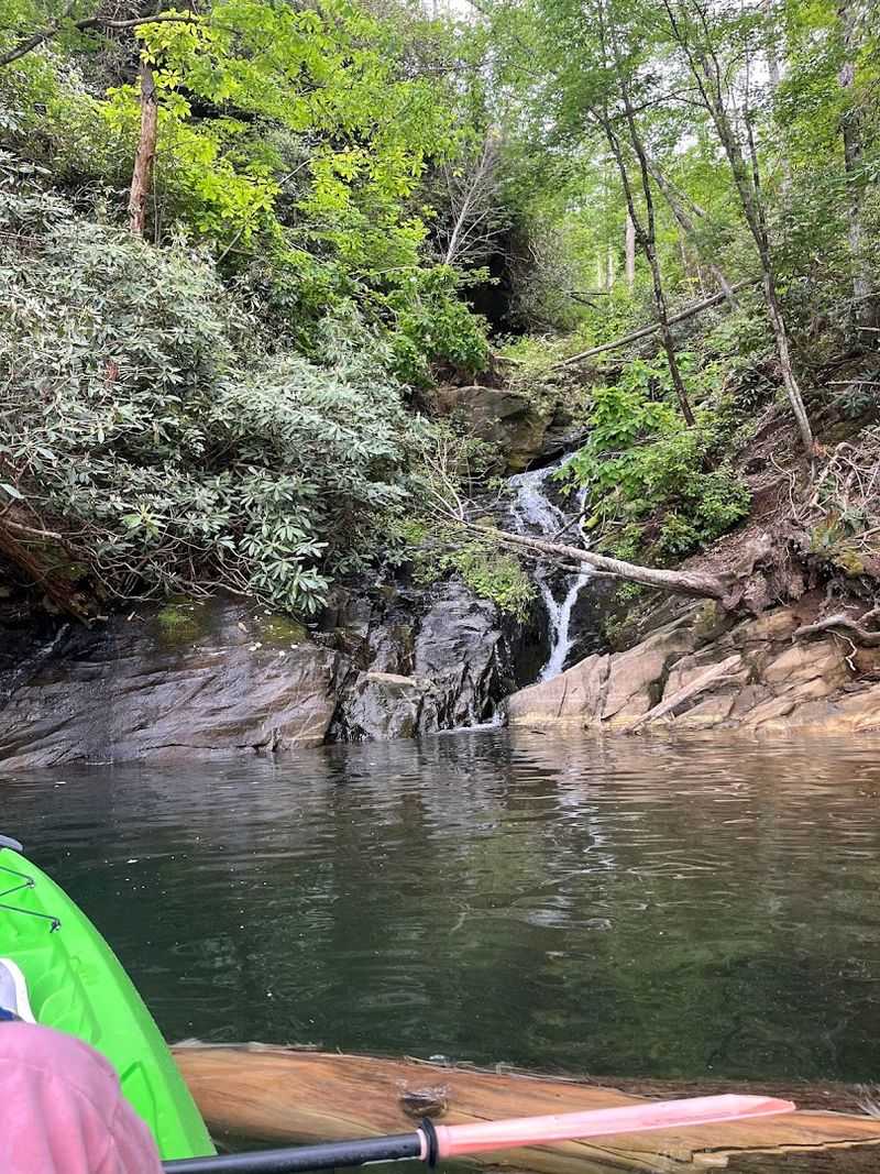
Gliding across Lake Jocassee in a kayak, I felt like I was floating on liquid glass, the kind of water so clear you can see submerged tree stumps and boulders twenty feet below.
This 7,500-acre reservoir sits at the edge of Pickens County, created in the 1970s when Duke Energy dammed the Keowee River, and it has since become one of the cleanest and most scenic lakes in the Southeast. I have launched from several access points, but my favorite is the Devil’s Fork State Park ramp, which puts you within paddling distance of secluded coves and waterfalls that tumble directly into the lake.
On calm mornings, the surface mirrors the surrounding mountains, and I have watched herons fish the shallows while ospreys circle overhead.
The lake is also a hotspot for scuba divers, who explore the remains of old homesites and a submerged lodge that disappeared when the valley flooded. Anglers chase trout and bass in the cool depths, and I have seen more than one kayaker towing a small cooler filled with their catch.
Rentals are available at the state park, and guided tours often include stops at waterfalls like Laurel Fork and Wright Creek, where you can beach your kayak and hike to the base of the falls.
Every paddle reminds me that some adventures require nothing more than a boat and a willingness to explore.
Issaqueena Falls Overlook
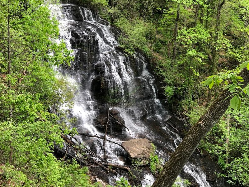
Standing at the overlook, I watched Issaqueena Falls plunge 200 feet into a narrow gorge, the mist rising like smoke and catching the afternoon sun in tiny rainbows.
Located along Highway 178 between Pickens and Walhalla, this waterfall is one of the easiest to reach in the region, with a paved parking area and a short, wheelchair-accessible walkway leading to the viewing platform. Legend has it that a Cherokee woman named Issaqueena leaped over the falls to escape pursuers, and the story has been passed down through generations, adding a layer of mystery to the already dramatic scenery.
I have visited in every season, and the falls change character with the weather, roaring after heavy rain and slowing to a delicate curtain during dry spells.
The overlook sits high above the plunge pool, so you get a bird’s-eye view of the entire cascade as it drops through layers of rock and fern-covered ledges. A steep, unofficial trail leads down to the base, but it requires careful footing and a sense of adventure.
Nearby, you will find Stumphouse Tunnel, an unfinished railroad tunnel that stays cool year-round and offers a quirky side trip after visiting the falls.
Every time I stand at the overlook, I feel the pull of the gorge below and the wild beauty that defines this corner of South Carolina.
Caesars Head State Park Overlook
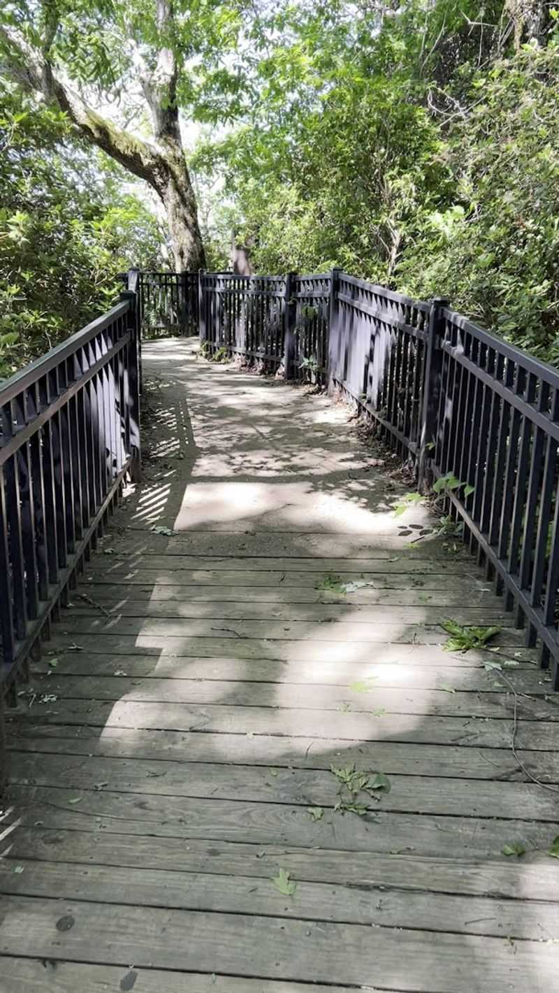
Reaching the Caesars Head overlook, I leaned against the railing and stared across a sea of ridges that rolled into the distance like frozen waves, each one softer and bluer than the last.
This state park sits on the South Carolina-North Carolina border, just a short drive north of Pickens, and its signature overlook offers one of the most iconic views in the southern Appalachians. The rock formation that gives the park its name resembles the profile of a Roman emperor, and I have spent more than one sunset here watching the light fade over the Piedmont far below.
The park also serves as a gateway to the Mountain Bridge Wilderness Area, which connects Caesars Head to Jones Gap State Park and protects more than 10,000 acres of steep terrain, waterfalls, and rare ecosystems.
Hikers can tackle the Raven Cliff Falls Trail, a moderately difficult path that leads to a suspension bridge overlooking a 420-foot cascade, one of the tallest in the state. I have seen peregrine falcons nesting on the cliffs in spring and migrating hawks riding thermals in fall, part of the annual raptor migration that draws birdwatchers from across the region.
Every visit to Caesars Head reminds me that some views are worth the drive, and this one never disappoints.
Keowee-Toxaway State Park Camping
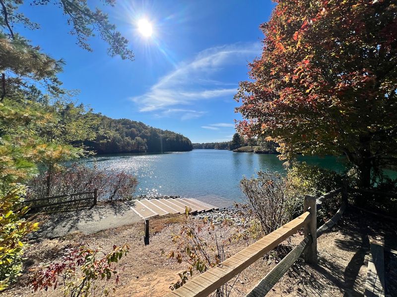
Pitching my tent at Keowee-Toxaway State Park, I could hear the lake lapping against the shore just a few steps away, and I knew I had found the perfect spot to unplug for a weekend.
This 1,000-acre park sits on the shores of Lake Keowee, a massive reservoir that straddles the Pickens County line, and it offers a quieter, less crowded alternative to some of the region’s busier parks. The campground features both tent sites and RV hookups, all tucked into a forested setting that stays cool even in summer.
I have camped here in spring when the dogwoods bloom and in fall when the maples turn gold, and each season brings its own rewards.
The park also includes a small museum dedicated to Cherokee history, with exhibits about the tribes that lived in this area before European settlement, and a nature center that offers programs on local wildlife and ecosystems. A network of trails winds through the park, connecting the campground to the lakeshore and offering easy hikes for families and casual walkers.
Fishing is popular on Lake Keowee, and I have watched anglers pull bass and catfish from the water while I sipped coffee at my campsite. Boat rentals are available nearby, and the lake’s size means you can explore for hours without running out of new coves to investigate.
Every night at Keowee-Toxaway, I fall asleep to the sound of water and wake to the smell of pine.
Foothills Trail Long-Distance Hiking
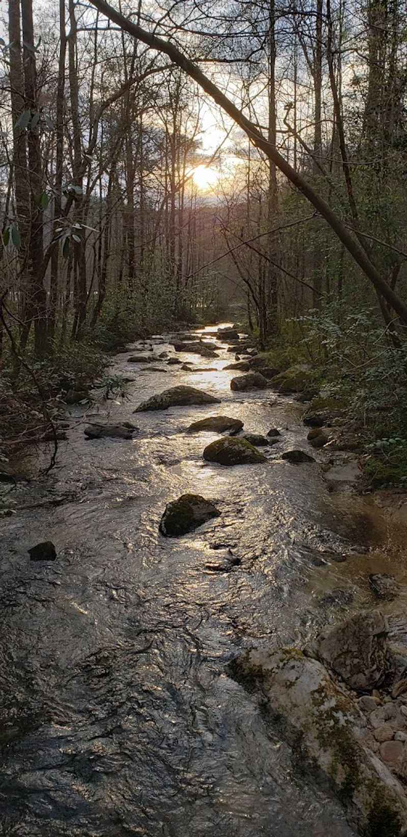
Shouldering my pack on the Foothills Trail, I felt the familiar thrill of a long hike ahead, knowing that the next 77 miles would take me through some of the wildest terrain in the Southeast.
This point-to-point trail runs from Table Rock State Park to Oconee State Park, crossing the heart of the Blue Ridge escarpment and passing through Jocassee Gorges, Caesars Head, and other protected lands along the way. I have hiked sections of it on day trips, but the real magic happens when you commit to a multi-day trek, camping at backcountry sites and waking to fog-filled valleys and the distant roar of waterfalls.
The trail is challenging, with steep climbs, rocky descents, and creek crossings that can swell after rain, but it rewards you with solitude and scenery that few people ever see.
Highlights include the Laurel Fork area, where the trail skirts a series of cascades, and the Sassafras Mountain spur, which leads to the highest point in South Carolina at 3,554 feet. I have met through-hikers from across the country who come to test themselves on this trail, and I have shared campsites with locals who return year after year.
The Foothills Trail Association maintains the route and publishes a detailed guidebook that includes maps, water sources, and camping regulations.
Every mile reminds me that the best adventures are the ones that push you a little further than you thought you could go.
Chattooga River Whitewater Rafting
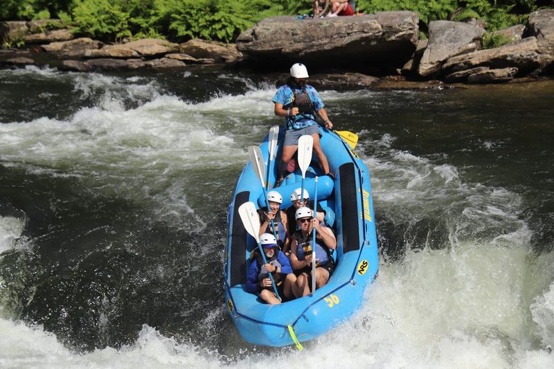
Gripping the paddle as our raft plunged into the next rapid, I felt the Chattooga River grab hold and remind me that some adventures require both skill and a healthy respect for moving water.
This National Wild and Scenic River forms the border between South Carolina and Georgia, and its upper sections flow just west of Pickens, offering some of the best whitewater rafting in the eastern United States. Section III is the most popular, with Class III and IV rapids that thrill beginners and experienced paddlers alike, while Section IV is reserved for advanced rafters who can handle technical drops and powerful hydraulics.
I have run both sections, and each time the river delivers a different experience, shaped by rainfall, water levels, and the ever-changing character of the rapids.
Outfitters based in the area provide guided trips, equipment rentals, and shuttle services, making it easy to spend a day on the water without worrying about logistics. I have also seen kayakers and canoeists tackling the river, navigating eddies and playing in waves with the kind of precision that only comes from years of practice.
The Chattooga cuts through remote forest, and between rapids you will drift past rock cliffs, rhododendron thickets, and sandbars where you can stop for lunch and a swim.
Every trip down the Chattooga leaves me soaked, smiling, and already planning the next run.
Sassafras Mountain Summit
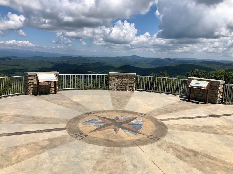
Climbing the observation tower at Sassafras Mountain, I reached the top platform and realized I was standing at the highest point in South Carolina, a fact that felt both thrilling and humbling.
At 3,554 feet, Sassafras Mountain does not compare to the towering peaks of the Rockies or the Sierra Nevada, but it offers something special: a 360-degree view that takes in parts of South Carolina, North Carolina, Georgia, and Tennessee on clear days. The summit sits along the South Carolina-North Carolina border, just northwest of Pickens, and a short, paved trail leads from the parking area to the tower.
I have visited at sunrise when the valleys below were filled with mist, and at sunset when the ridges glowed orange and purple.
The tower itself is a modern structure with interpretive signs that identify distant landmarks and explain the geology of the Blue Ridge. A spur trail connects the summit to the Foothills Trail, making it a popular stop for long-distance hikers.
The road to the summit is narrow and winding, but it is paved and well-maintained, accessible to most vehicles. I have seen families with young children, serious hikers, and photographers all sharing the platform, each one captivated by the view.
Every visit to Sassafras Mountain reminds me that elevation is not just about height, but about perspective.
Downtown Pickens And Local Outfitters

Walking down Main Street in Pickens, I passed the old courthouse square and ducked into a local outfitter to stock up on trail snacks and ask about conditions on the trails I planned to hike the next day.
The town itself may be small, with a population just over 3,000, but it serves as the gateway to all the outdoor adventures that surround it, and the downtown reflects that role with shops catering to hikers, paddlers, and campers. I have found everything here from topographic maps and guidebooks to freeze-dried meals and replacement tent stakes, and the staff always seems to know which trails are in the best shape and which waterfalls are running strong.
The town also hosts festivals and events throughout the year, including a farmers market that draws vendors from across the county.
Several restaurants and cafes line the streets, offering fuel for early-morning starts and comfort food after long days on the trail. I have grabbed breakfast sandwiches before dawn and celebrated successful hikes with burgers and milkshakes in the late afternoon.
Pickens sits at the crossroads of several major routes, making it easy to reach from Greenville, Clemson, and other Upstate cities, and it serves as a natural base camp for exploring the surrounding mountains and lakes.
Every time I pass through downtown, I am reminded that the best adventure towns are the ones that support the people who come to explore them.