
This Illinois Canal Town Lets You Bike A Towpath Past Historic Canal Remains And Former Grain-Mill Sites In One Afternoon
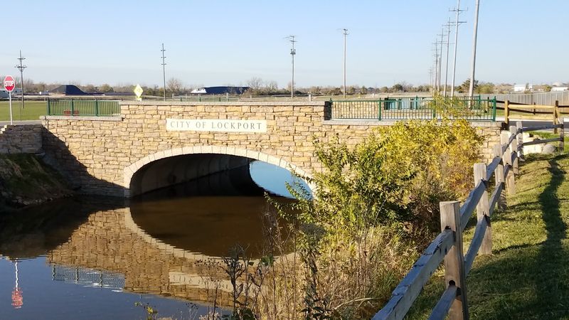
A short ride through downtown Lockport, Illinois puts you face to face with one of the Midwest’s most intact canal-era streetscapes, where stone walls, historic lock remains, and repurposed warehouses still line the old towpath. Lockport served as the headquarters of the Illinois and Michigan Canal and grew into a busy grain-processing hub during the mid-1800s.
The canal closed to commercial traffic in 1933, so what you encounter today is a historical and recreational corridor rather than a working waterway, and that distinction makes the outing all the more interesting.
Lockport is the best-supported town for this history ride
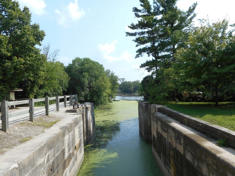
Lockport, Illinois earns its place at the center of this outing through a combination of geography, infrastructure, and industrial history that few canal towns in the state can match. The city’s own historical record documents its role as the headquarters of the Illinois and Michigan Canal and describes how that position made it a commercial magnet for grain merchants, flour millers, boat builders, and laborers throughout the mid-nineteenth century.
The downtown corridor still carries visible evidence of that era in the form of preserved canal walls, historic lock remains, interpretive markers, and repurposed commercial buildings.
Riders approaching the canal from downtown will find a route that passes the remains of historic I&M Canal Lock 1, Lincoln Landing, the Public Landing area, and a sequence of canal-era structures that have survived in various states of preservation. The city identifies the former towpath as a walking and bicycle path with historic mile markers and interpretive features, so the infrastructure for a self-guided history ride already exists.
This is a living town with modern streets, industrial neighbors, and active road crossings woven through the historic core, not a sealed-off museum landscape.
The Illinois and Michigan Canal State Trail follows the historic corridor for roughly 61.5 miles from Rockdale to LaSalle, but the premise of an afternoon outing works best when focused on the Lockport downtown section rather than any attempt at the full route. The National Park Service recognizes the corridor as an I&M Canal National Heritage Area, a designation that underscores the region’s historical weight.
Come expecting historical remains, adaptive reuse, and interpretive evidence of a grain-processing past, and the ride will reward that expectation fully.
Build the afternoon around a short downtown trail section
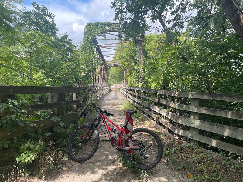
Shaping a realistic afternoon ride in Lockport starts with understanding how the trail is actually organized. The Forest Preserve District of Will County documents a 1.05-mile crushed-limestone segment running from Division Street to Second Street within the Lockport area, and that corridor sits at the heart of the town’s most historically concentrated stretch.
Adjacent sections extend south toward Joliet and north toward Romeoville, giving riders the option to lengthen the outing if time and energy allow.
An out-and-back from a downtown parking area keeps the planning simple. Ride south from Division Street to Second Street, turn around, and you have covered just over two miles on the most historically dense portion of the route.
Riders who want a slightly longer outing can continue south along the canal corridor or explore connecting streets through the historic district before looping back, though those extensions mix trail and road surfaces and require attention to traffic.
The IDNR describes the full I&M Canal State Trail as a recreational route for hiking and bicycling along the old towpath, but 61.5 miles is a multi-day commitment, not an afternoon one. Keeping the focus on downtown Lockport lets casual riders absorb the historical landscape at a pace that leaves time to stop, read interpretive signs, photograph the lock remains, and still finish before the light fades.
Treat the documented segment as your anchor, and add distance only after you have assessed the surface, weather, and your own comfort on limestone.
Read Lock 1 and the canal walls as engineering remains
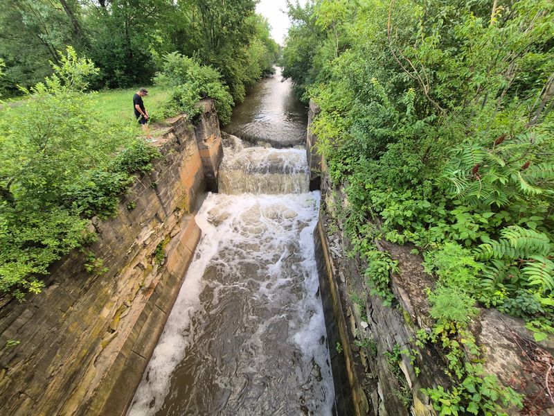
Standing beside the remains of historic I&M Canal Lock 1 in downtown Lockport, you are looking at one of the engineering anchors of a canal system that connected the Great Lakes to the Illinois River and reshaped the economic geography of northern Illinois. The city’s outdoor recreation information identifies the former towpath route as passing these lock remains along with Lincoln Landing, the Public Landing area, preserved canal walls, and historic mile markers.
Each of those features reads as a physical sentence in the story of how goods and people moved through this corridor during the canal’s commercial life.
The Library of Congress documentation of the Lockport Historic District captures the Public Landing’s north side and the surrounding canal infrastructure, showing how tightly the commercial waterfront and the engineering works were integrated. Canal walls that once guided loaded boats now frame a recreational path, and the scale of those stones gives a rider a concrete sense of what it took to move grain, lumber, and freight through a pre-railroad landscape.
Historic mile markers along the route reinforce the same lesson: every marker once told a boat captain exactly where he stood on a 96-mile commercial highway.
Viewing these remains responsibly means staying on marked paths and reading them from the designated trail or observation areas. IDNR manages the state trail corridor and expects visitors to treat the historic structures with care.
Climbing on lock walls, stepping onto canal edges, or crossing into restricted areas risks both personal safety and the preservation of irreplaceable masonry. The remains are most legible, and most impressive, when you give them a respectful distance and let the interpretive signage fill in the details that the stones alone cannot explain.
Trace the former grain industry without promising operating mills
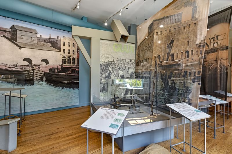
Grain was the economic engine that justified the I&M Canal’s construction, and Lockport sat at a critical point in that flow. The city’s historical documentation identifies Lockport as an agricultural-processing center with dozens of flour mills, grain warehouses, and boatyards operating during the canal’s commercial peak.
Wheat and corn moved east from the Illinois prairie toward Chicago and the Great Lakes, while finished flour and processed goods traveled back west, and the town’s hydraulic basin provided the water power that kept the mills running.
The Library of Congress Historic American Engineering Record documentation for the Lockport district describes grain and flour as major goods moved through the town and identifies water-powered milling facilities near the canal’s hydraulic basin. What a rider encounters today is not a row of intact mills grinding wheat beside the path.
The surviving evidence is a layered mixture of repurposed commercial buildings, stone foundations, preserved canal walls, historic districts, and interpretive markers that together outline where that industry once stood.
That distinction matters for setting expectations, but it does not diminish the experience. Reading a stone foundation or a converted warehouse as a former mill site requires a small imaginative step, and the payoff is a more honest connection to the landscape than any reconstructed attraction could offer.
The HAER documentation for the Lockport Historic District provides detailed architectural and industrial context that riders can review before the outing to sharpen what they notice along the route. Arrive knowing the history, and the adapted buildings and surviving walls become a far more compelling landscape than they might appear to a visitor with no background.
Use the Gaylord Building to connect construction and commerce
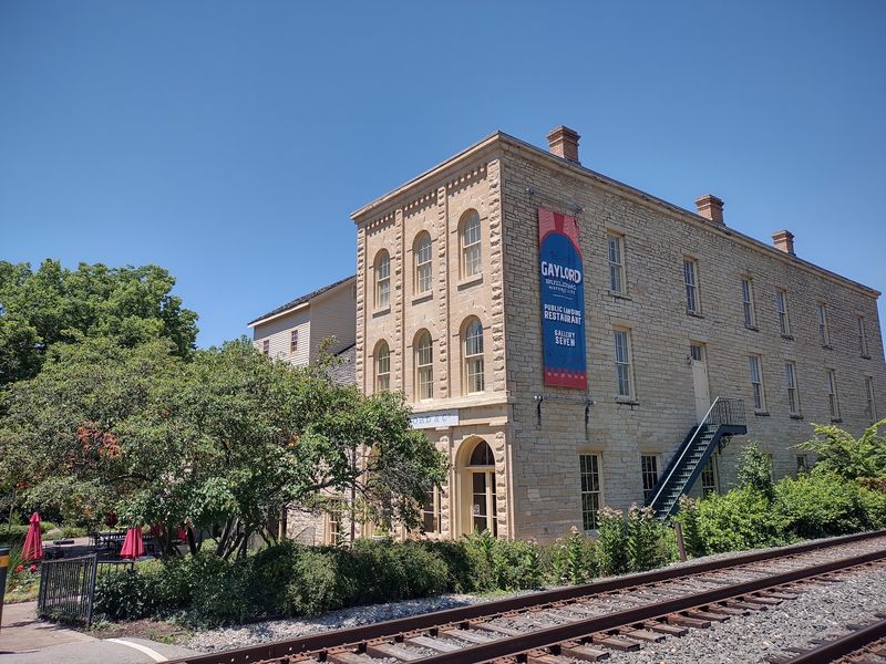
Few buildings along the entire I&M Canal corridor carry as much layered history in a single structure as the Gaylord Building in downtown Lockport. National Park Service documentation describes the Gaylord Building as a National Historic Landmark that began its life as a canal construction depot, serving the practical logistical needs of the workers and engineers who built the waterway itself.
After construction ended, the building transitioned into grain storage, which placed it directly inside Lockport’s commercial milling economy rather than on its margins.
That two-phase history makes the Gaylord Building a useful anchor for understanding how canal-era infrastructure shifted function as the waterway matured. A depot that once stored tools and supplies became a warehouse storing the very agricultural goods the canal was built to transport.
Today the building houses canal-related interpretation alongside other uses, which adds another layer to its story without erasing the earlier ones. Lockport’s historical record places the Gaylord Building within the broader context of the town’s commercial district, where construction-era and trade-era functions overlapped for decades.
Riders passing through downtown should treat the building as a complement to the outdoor canal remains rather than a substitute for them. The interpretive materials inside can clarify what the stone walls, lock chambers, and loading areas outside were actually doing during the canal’s working years.
Not every historic building along the corridor remains in its original use or open to walk-in visitors, so checking current hours before planning a stop is worth the brief effort. The Gaylord Building’s value as a stop on this outing comes from the conversation it opens between the built environment and the landscape around it.
Match the bicycle and distance to the mixed trail surface
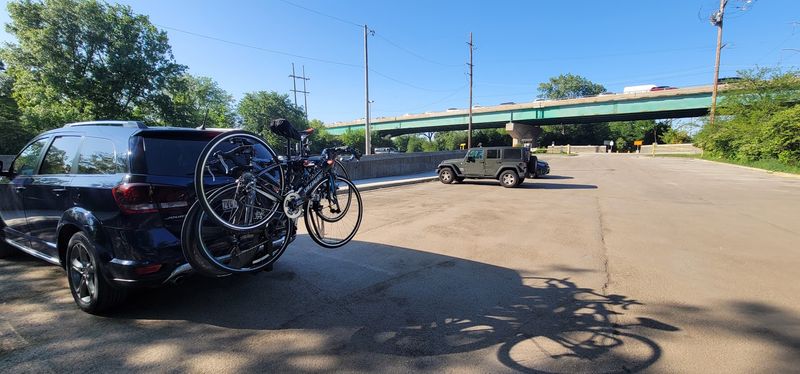
Crushed limestone feels very different under your tires than pavement does, and choosing the right bicycle before you leave home saves a lot of frustration once you are on the trail. The Forest Preserve District of Will County describes the I&M Canal Trail surface as crushed limestone with some paved sections, a combination that suits hybrid, gravel, touring, or mountain bikes considerably better than narrow-tire road bikes.
Official sources do not impose a universal bike-type rule, but the practical reality of a compacted stone surface is that wider tires roll more comfortably, handle loose patches more predictably, and give you more control at canal-edge sections where a slip has real consequences.
Distance planning deserves the same honest attention. A short out-and-back covering the documented downtown segment can be completed comfortably in an hour or two, leaving time for stops at the lock remains, the Public Landing, and the Gaylord Building.
Riders who underestimate the return leg, especially on a warm afternoon with a headwind off the canal, sometimes find themselves more fatigued than expected on a surface that looks flat and easy from a map.
Shared-use traffic is another variable worth acknowledging before you start. The downtown corridor sees walkers, dog owners, families with strollers, and other cyclists, so a bell or a clear verbal signal keeps encounters courteous.
Road crossings within the historic district require a full stop and traffic awareness, not just a slow roll. Heat, sun exposure, and the absence of shade in some canal-side sections also argue for carrying more water than you think you need.
None of these considerations make the ride difficult, but treating a flat limestone path as effortless before you have ridden it is the most reliable way to have a less enjoyable afternoon than the route deserves.
Check management, hours, conditions, and segment rules
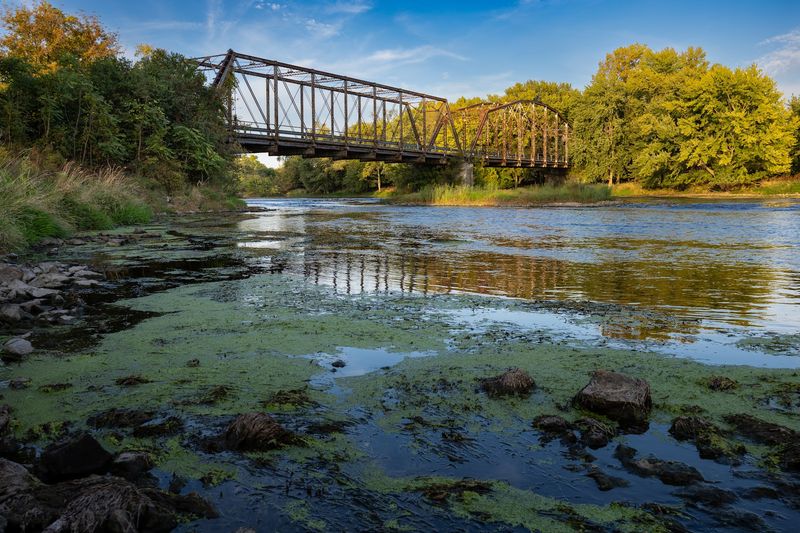
One of the practical realities of riding through the Lockport canal corridor is that different sections of the route fall under different management. The city of Lockport oversees the downtown path and its interpretive features, while the Forest Preserve District of Will County manages its own trail segment.
The city’s outdoor recreation page covers the downtown corridor, and the Forest Preserve District lists its I&M Canal Trail segment as open from sunrise to sunset, with emergencies directed to 911 and a non-emergency safety contact available through the district. Parking arrangements, maintenance schedules, and posted rules can differ between those two management areas, so reading the signage at each trailhead rather than assuming uniform rules applies throughout is good practice.
Conditions along any limestone trail change with weather, flooding, and seasonal maintenance. Before leaving home, check IDNR’s current closures page and consider calling 815-942-9501, the IDNR contact number for I&M Canal trail updates, to confirm that your planned segment is accessible.
The canal corridor runs close to the waterway in several places, and high water after heavy rain can make sections muddy, slippery, or temporarily closed without advance notice on every platform where you might look for information.
E-bike riders should note that the Forest Preserve District of Will County permits e-bikes on its segments if the motor produces less than 750 watts, the top assisted speed stays under 20 mph, the bike has functional pedals, and the rider is at least 16 years old. That rule applies specifically to Will County forest preserve land and should not be assumed to extend automatically to every municipality or state-managed segment along the broader I&M Canal State Trail corridor.
When in doubt, check the posted rules at the specific trailhead you are using before riding an e-bike onto an unfamiliar segment.
Keep historic Lock 1 separate from the later Lockport facility
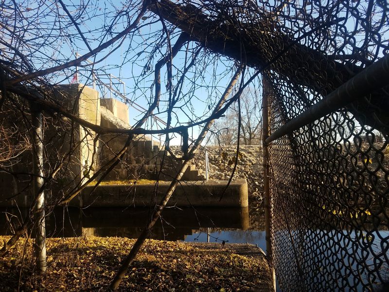
Two different waterway facilities carry the word “Lockport” in their names, and conflating them produces a genuinely misleading picture of what a rider encounters on the downtown towpath. The remains visible along the historic canal corridor in downtown Lockport belong to the original Illinois and Michigan Canal’s Lock 1, a mid-nineteenth-century masonry structure that once raised and lowered canal boats between water levels.
The city’s outdoor recreation documentation places these lock remains on the downtown towpath route alongside the Public Landing, Lincoln Landing, and preserved canal walls.
A separate facility, the Lockport Lock, Dam, and Power House, belongs to the later Illinois Waterway system and represents a different engineering era and a different waterway entirely. Those two facilities should not be described as the same structure or presented as part of the same towpath outing without clear sourcing that establishes their relationship to the trail.
Because available documentation does not definitively connect that later facility to the downtown bike route described here, this article treats it only as a distinct Lockport-area landmark rather than a stop on the afternoon ride.
The NPS confirms that the original I&M Canal closed to commercial navigation in 1933, which means the lock remains along the downtown path are historical features, not active water-control infrastructure. Riders who understand that distinction arrive with the right frame: they are reading the physical evidence of a working waterway that has been quiet for nearly a century, not observing a canal in operation.
Follow the marked trail, respect posted restrictions around canal edges and hydraulic structures, and do not climb on or enter historic lock chambers or canal walls. The engineering story those stones tell is most legible, and most safely experienced, from the path that was built to bring you close enough to understand it.