
This Short Arkansas Trail Leads To A Secret Waterfall Most Visitors Miss
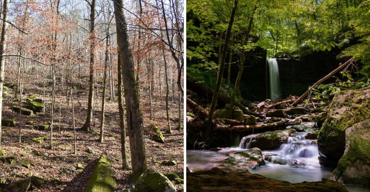
A 24-foot waterfall sits about a quarter mile from a free campground, and there’s no official trail to it. No signs.
No arrows. Just a creek, some rocks, and a little faith.
I love how the reward hides inside a narrow, moss-covered canyon. The water often splits into two streams as it pours over the ledge.
It looks especially impressive after a good rain, though the flow varies with the weather.
This corner of Arkansas sits in the Ozark National Forest, and most people stop at the famous falls by the campground. I’d say that’s a perfectly fine plan.
It just leaves the better secret upstream for the rest of us.
You’ll hop rocks and splash through a crossing or two. You might pause at small cascades along the way.
So how many people drive right past this one without a clue?
The Waterfall Everyone Overlooks Is Barely A Quarter Mile Away
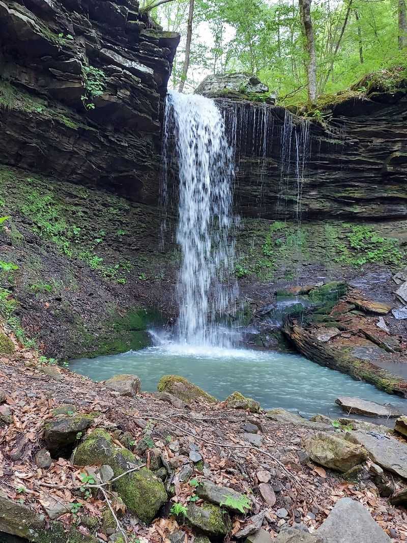
Most folks pull into Haw Creek Falls Campground, snap photos of the falls by the road, and leave. Meanwhile, Pack Rat Falls waits just upstream, roughly 0.25 miles away.
That short distance is the funny part. You could practically shout and have the waterfall hear you, yet many people never go looking.
Pack Rat Falls drops about 24 feet. It’s sometimes called Lower Pack Rat Falls, since a smaller upper falls sits farther up the hill.
The round trip clocks in near half a mile. Don’t let that number fool your legs, though, because the path is rugged.
Rocks, roots, and creek crossings slow everybody down. Plan for more time than the distance suggests, and you’ll enjoy it more.
The payoff feels oversized for such a quick walk. A narrow canyon wraps around the falls like a mossy green amphitheater.
This makes a great add-on when you’re already visiting the campground. It also works as a short adventure for families with older kids who like scrambling.
Honestly, it’s the rare outing where the bragging rights outweigh the miles. That’s a pretty good trade for one afternoon in the Ozarks.
Your Sneakers Might Want To Sit This One Out
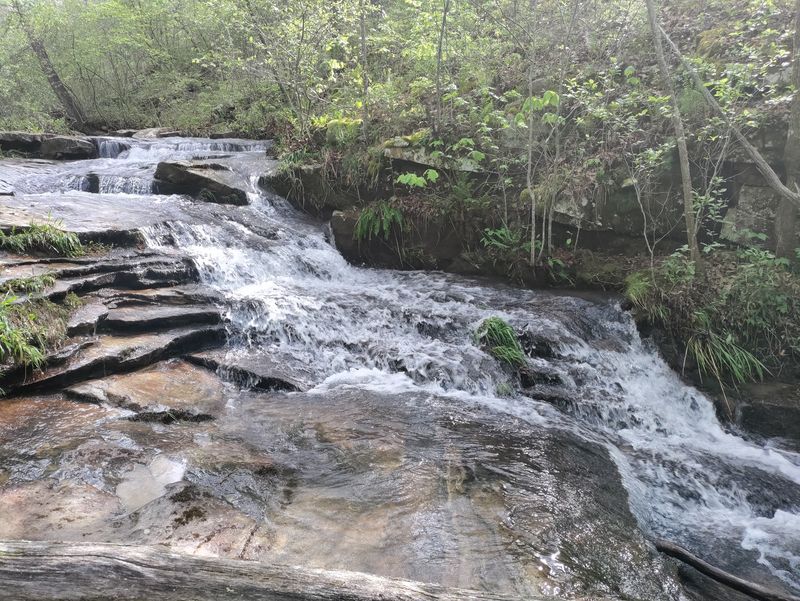
Slick rocks are the real boss of this hike. Water crossings, rock hopping, and steep little climbs show up fast.
Sturdy hiking boots with good grip make a huge difference. Waterproof ones are even better when the creek runs high.
Trekking poles help on crossings. They give you an extra point of balance when a rock wobbles.
Some hikers prefer gloves instead, since you may grab rocks and branches while scrambling. Packing both isn’t a bad idea.
Bring a small bag with water and snacks. The campground has no drinkable water, so fill bottles before you arrive.
A dry pair of socks waiting in the car feels like luxury afterward. Trust the socks.
Take extra care with little kids. The route can feel a bit sketchy in places, especially near wet ledges.
Go slow and test each step before shifting your weight. Moss looks soft and friendly, but it’s slippery on stone.
With the right gear, this short trek becomes pure fun. Without it, you might get a creek bath you didn’t plan on.
Rain Turns This Spot Into A Full-Blown Show
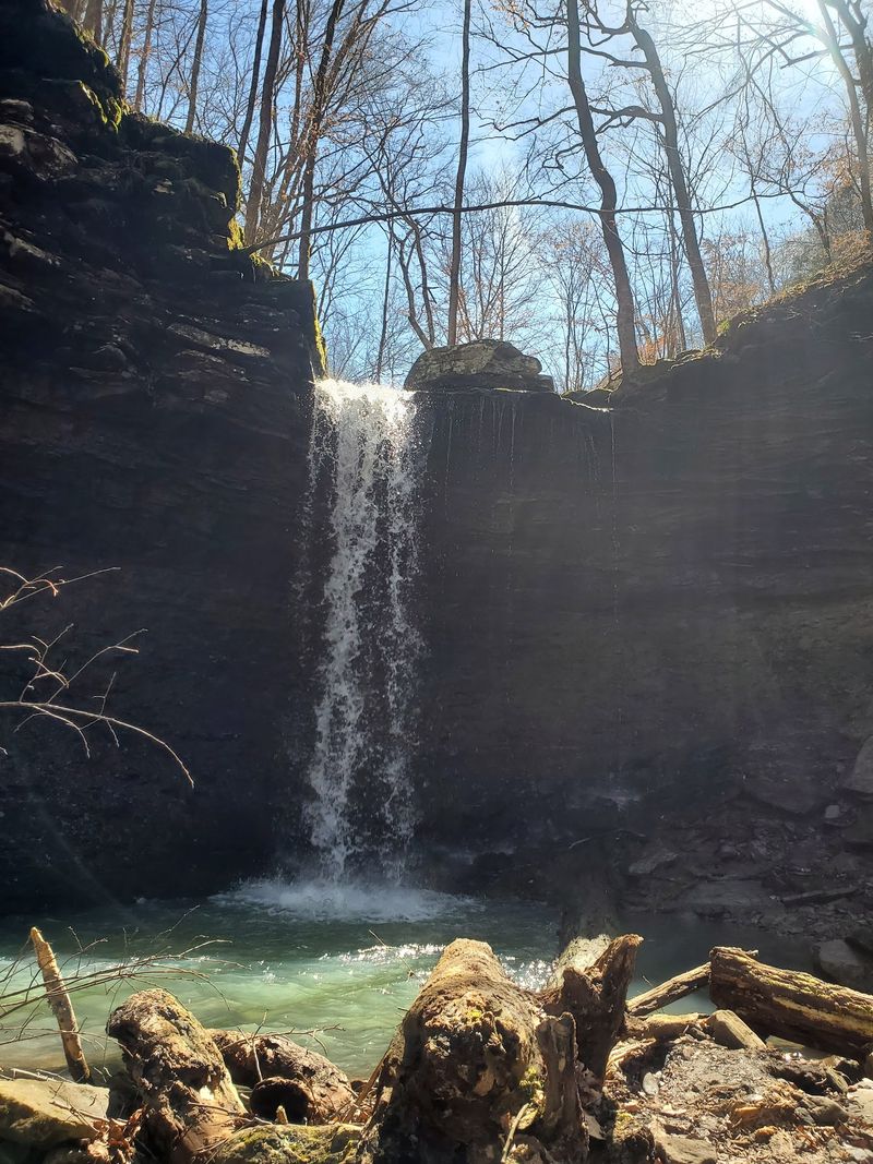
Timing matters more than almost anything else here. Pack Rat Falls looks especially impressive after wet weather, though its flow can vary considerably.
After a solid rain, the water often splits into two streams. Cascades, slides, and pools along the creek wake up too.
Dry spells tell a different story. The lower creek can shrink to a trickle, though the green canyon still looks lovely.
Spring tends to be a strong bet in the Ozarks. Rainy stretches during other seasons can work well, too.
There’s a catch, of course. More water means higher crossings and slicker rocks.
Parts of the path may vanish under the creek. You might end up wading where you hoped to walk.
Check the forecast before heading out. Flash floods are a real concern in this area.
A low-water bridge at the campground entrance can become impassable during high water. The campground may even close temporarily.
Aim for a visit after rainfall has passed and creek levels have returned to safe conditions. Avoid flooded crossings, even when the waterfall looks especially impressive.
Forget The Trail Signs Because There Aren’t Any
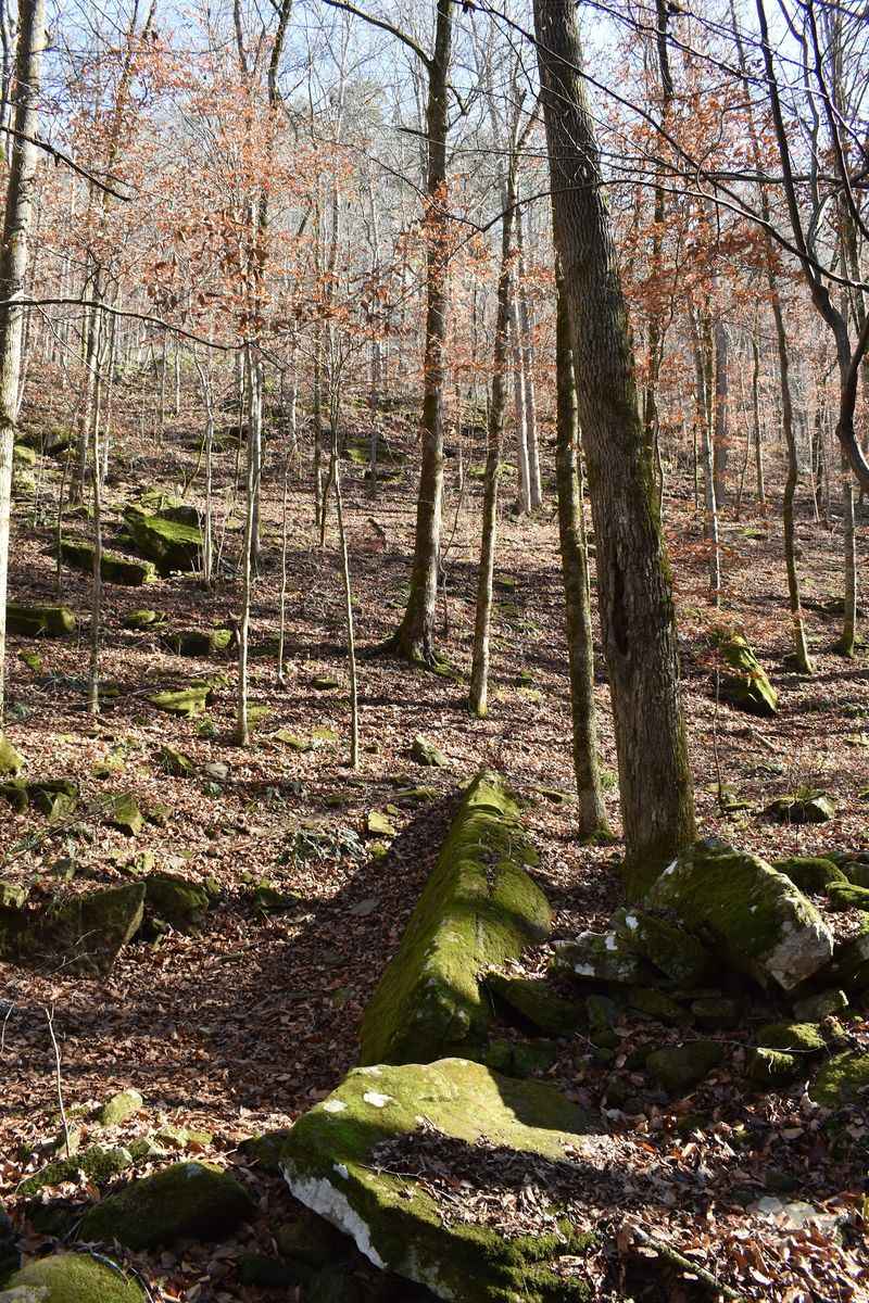
Here’s a fun twist. The route to Pack Rat Falls isn’t an official, marked trail at all.
Instead, hikers follow a volunteer path that hugs the creek. In spots, the path fades and you simply walk up the creek bed.
The general idea is simple. Start at the back of Haw Creek Falls Campground and keep heading upstream.
The trail leads off behind one of the campsites. It’s trodden enough that you can usually tell where to go, but not always.
Downloading a topographic map or using a GPS app is smart. The route appears on AllTrails, where it’s rated moderate.
Cell signal in the Ozarks can be spotty, so save your map offline before leaving home. Your future self will thank you.
Rain can wipe out sections of the path. Fallen trees sometimes block the way, too, which means a little climbing.
Take your time and assess the conditions carefully. The unmarked route and slippery creek crossings require caution, even on a short hike.
And yes, finding it on your own feels great. A creek is a surprisingly honest guide.
Little Waterfalls Keep Interrupting The Walk In The Best Way
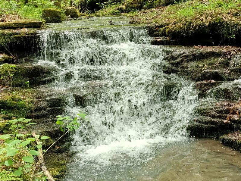
Getting there is half the fun, and that’s not just a polite saying. The creek serves up mini cascades all along the way.
Smooth rock slides send water skating downhill. Clear pools collect below them like tiny mountain bathtubs.
Lush forest crowds both sides of the creek. Rocky outcrops and unusual formations pop up around bends.
The whole walk feels tucked away from the busy world. It’s quiet enough to hear every splash.
Keep an eye out for a giant sycamore tree near the route. Its pale bark stands out against the green.
Photographers will want extra time here. Each small falls makes a solid warm-up shot before the main event.
Kids may treat the creek like a playground. Just remind them that wet rocks are not trampolines.
Moss coats a lot of the stone in the canyon. On a damp day, everything glows in deep shades of green.
You could easily spend an hour on a quarter mile. Nobody’s timing you, so let the creek set the pace.
Bonus Points Wait Above The Main Falls
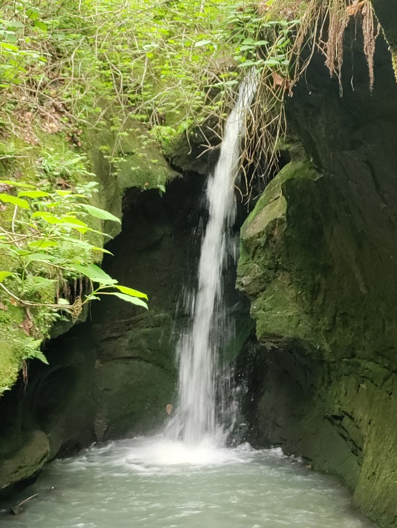
Feeling ambitious? A second waterfall, often called Upper Pack Rat Falls, sits roughly 325 feet upstream.
It’s close on paper. Getting there, however, takes real effort.
You’ll climb a steep hill above the lower falls. Then comes bushwhacking through brush without much of a path.
The prize is a short waterfall inside a small box canyon. Rock walls wrap tightly around it, creating a hidden pocket of a spot.
This side quest isn’t for everyone. Skip it if you’re hiking with young children or feel unsteady on steep ground.
Good boots matter even more on this stretch. Gloves can help when you need to grab rocks or roots.
Go up carefully and come down even more carefully. Steep descents on loose dirt are where many slips happen.
Give yourself plenty of daylight for this extra climb. Bushwhacking in fading light is nobody’s idea of fun.
If you make it, you’ll have seen two waterfalls most visitors never reach. That’s a pretty sweet double feature for a short hike.
Free Camping Sits Right At The Starting Line
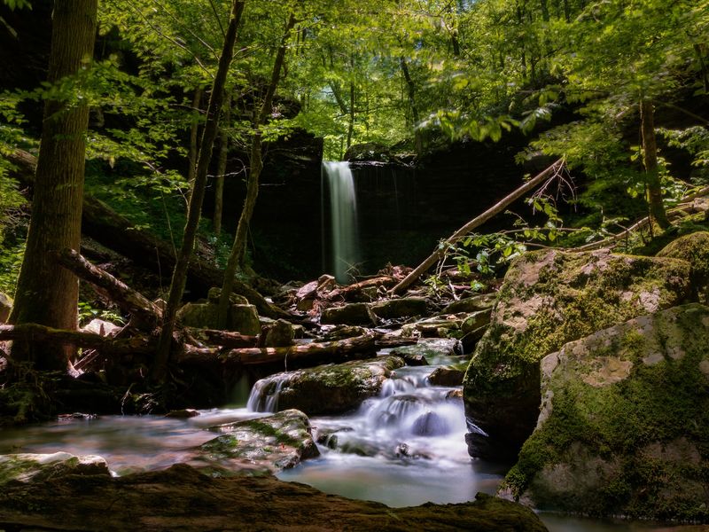
Good news for budget travelers. Haw Creek Falls Campground, the jumping-off point, charges no fees for day use or camping.
It’s open year-round, though high water can force temporary closures. The setup is simple and primitive.
Sites include picnic tables and fire rings. Vault toilets handle the basics.
You won’t find hookups, electricity, or drinkable water. Bring everything you need, including plenty of water.
The campground follows a pack-it-in, pack-it-out rule for trash. Leave your site cleaner than you found it.
Staying overnight makes a lot of sense here. You can catch the falls in morning light before the day gets going.
The Big Piney Ranger District of the Ozark National Forest oversees the area. Its office sits at 12000 AR-27, Hector, AR 72843.
Remember that low-water bridge at the entrance. Storms can make it impassable, so watch the weather closely.
A campfire, a creek nearby, and a waterfall within reach? That’s a strong lineup for a free weekend in Arkansas.
Two Waterfalls For One Parking Spot Is A Great Deal
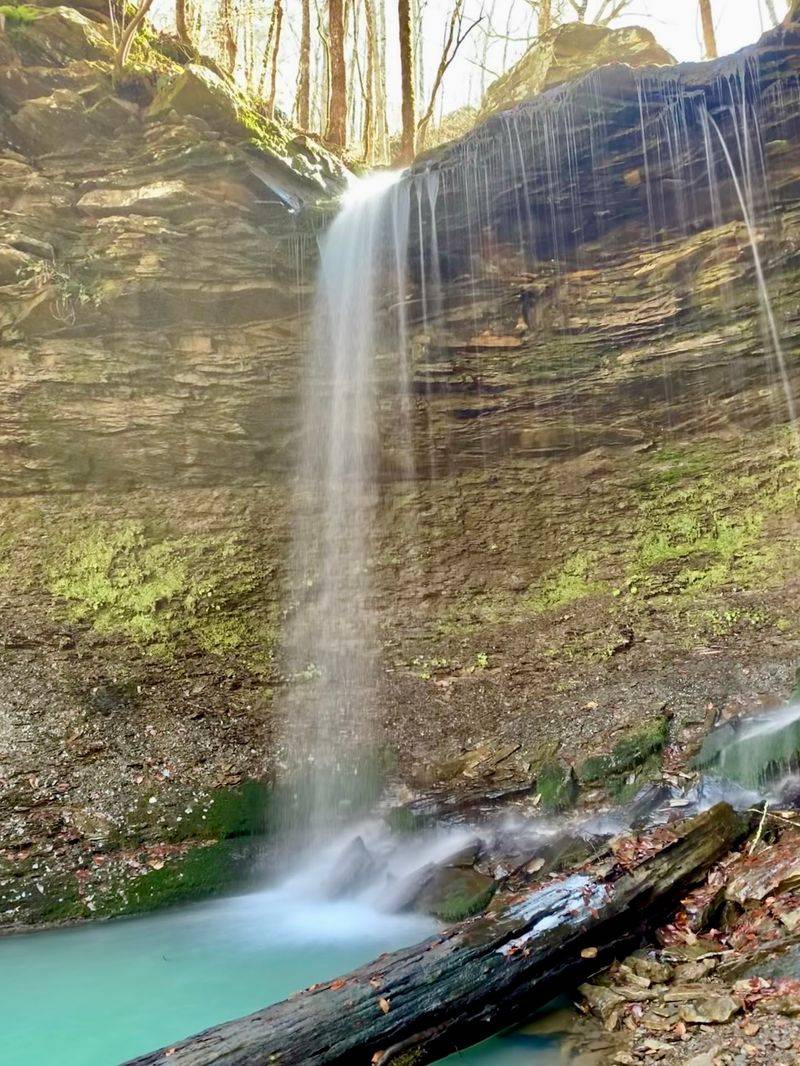
Haw Creek Falls sits right beside the campground. It’s the waterfall most people come for, and it’s easy to see.
Wide rock ledges spread the water across the creek. You barely have to leave the car to enjoy it.
That convenience is exactly why Pack Rat Falls gets skipped. Visitors check one waterfall off and head home happy.
You, however, now know better. Start with Haw Creek Falls, then head upstream for the sneakier sibling.
The Ozark Highlands Trail also passes through this area. Long-distance hikers use it to cross a big chunk of the Ozarks.
Even a short stretch adds forest views to your day. Just keep track of where you’re going.
Combining stops makes the drive worth it. One parking spot unlocks two waterfalls and a famous trail.
Pack a lunch for the picnic tables. Eating between waterfalls feels like a small victory.
It’s a lot of scenery in one tight space. Few places in Arkansas offer this much for so little walking.
Winding Highway Miles Lead To This Mossy Payoff
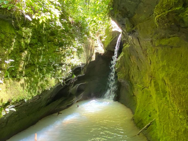
Getting here is a scenic road trip on its own. Pack Rat Falls is listed at MPFW+3G, Hagarville, AR 72839, though you’ll really aim for the campground.
Haw Creek Falls Campground sits on Arkansas Highway 123. It’s about 14 miles north of Hagarville.
Coming from the other direction, it’s roughly 12 miles west of Pelsor. Either way, expect curvy forest roads.
Set your map before losing signal. The Ozarks love to swallow cell service whole.
Fill your gas tank in a bigger town first. Services are thin once you head into the national forest.
Plan to arrive with plenty of daylight. You’ll want time to explore without rushing the creek.
Leave no trace while you’re here. Carry out wrappers, stay on durable rock where possible, and keep the canyon pristine.
Visiting with friends is smart for safety. Someone can steady a crossing or snap your waterfall photo.
A short, rugged walk and a mossy canyon wait at the end. Not bad for a place so many people drive past.