
8 Secret Arkansas Hiking Trails That Most Visitors Completely Miss
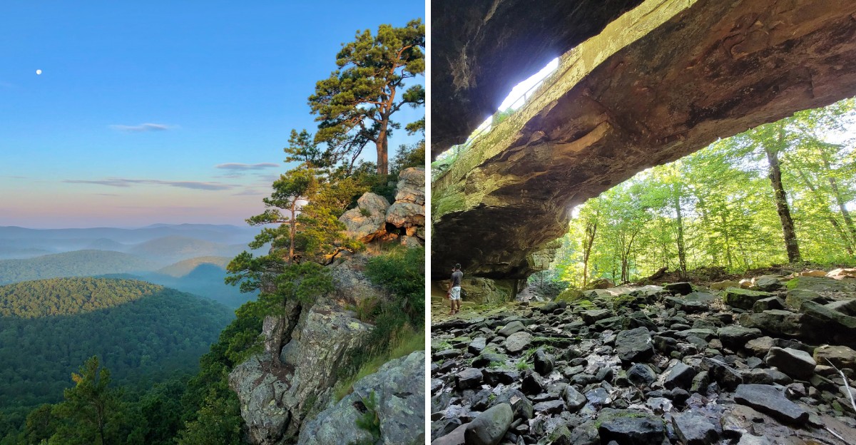
One Arkansas hiking trail starts with a boat ride, because the mountain sits on an island in a lake. I love that, since a little extra planning keeps most crowds away.
Another trail sits at the end of a long dirt and rocky road with barely any cell service. A third hides its trailhead so well that pink ribbons help point the way.
I think those small hurdles are exactly why these places stay so quiet. I like how each one rewards a bit of effort with a natural bathtub, an 80-foot waterfall, a stone bridge, or rock towers shaped like giant mushrooms.
So pack a bright flashlight, download your maps before the signal fades, and fill up the gas tank. Which one would you try first?
1. Pam’s Grotto
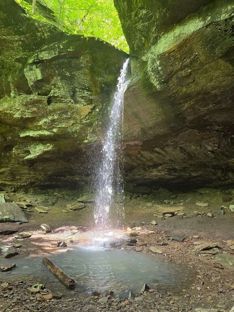
No big sign, no fancy kiosk, just a few pink ribbons leading the way. That low-key start is part of the fun at this waterfall near Hagarville.
The trailhead itself is unmarked, so slow down along AR-123. A free parking lot sits across the road from the trail.
Look for a yellow sign from an adventure club near the entrance. Once you spot it, pink ribbons on the trees act as waypoints.
The good news is that the path is well-worn and easy to follow. During the growing season, though, it can get narrow as plants crowd in.
Expect a bit of steepness early on. The real test comes on the descent toward the falls, where boulders turn the trail into a scramble.
Shoes with solid grip make a big difference here. Leave the flip-flops in the car unless you enjoy sliding on rocks.
Your reward is a gorgeous waterfall pouring off a cliff face into a grotto. Big boulders scatter around the base, giving the spot a wild, secluded feel.
Kids with steady feet can make the trip with a helping hand. Take the downhill sections slowly and keep little ones close near the rocks.
Pack water even though the hike isn’t long. Climbing back out after the scramble will remind your legs they had a workout.
Hagarville is a small rural community in Johnson County, deep in Ozark country. You won’t find a restaurant at the site, so bring your own snacks.
A camera is worth carrying in a zippered pocket. You’ll want your hands free for the boulders on the way down.
This is the kind of spot that feels like a secret, mostly because it acts like one. Follow the ribbons, take your time, and let the falls do the talking.
Address: AR-123, Hagarville, AR 72839
2. Sugar Loaf Mountain Nature Trail
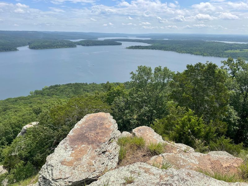
Most trails ask you to bring hiking boots. This one also asks you to catch a boat.
Sugar Loaf Mountain Nature Trail sits on an island in Greers Ferry Lake. You can’t just pull into a parking lot and start walking.
Instead, you’ll need to arrange boat transportation to the island. Check with nearby marinas about seasonal shuttle availability, or use your own boat.
Call ahead and plan your day around the ride. Ask about pickup times so you know how long you can spend on the mountain.
Once you land, the trail climbs toward the summit. It’s well-marked, so you won’t spend your energy guessing which way to go.
Save some of that energy, though. Steep wooden stairs help you up the tougher sections, and your calves will notice.
The island’s nature trail follows a winding route with a loop section, allowing you to explore the mountain before returning to the boat dock. Take care on the descent, especially if your legs feel wobbly.
The big reward waits at the top. Views from the summit spread out over the lake and surrounding land in a way that feels earned.
Bring plenty of water, since there’s no quick store on an island. A light snack makes the summit even better.
Weekdays tend to be calmer, while weekends may attract more hikers during the warmer months.
A small backpack works better than a bulky one here. You’ll want your hands free for the railings on the stairs.
Wear shoes with good grip for the climb. Wooden steps can feel slick, especially after morning dew or rain.
Few hikes start with a lake breeze and end with a mountaintop view. That combo makes this one well worth the phone call.
Access: By boat from Greers Ferry Lake, with nearby marinas at Sugar Loaf and Fairfield Bay.
3. Pedestal Rocks & Kings Bluff Trailhead
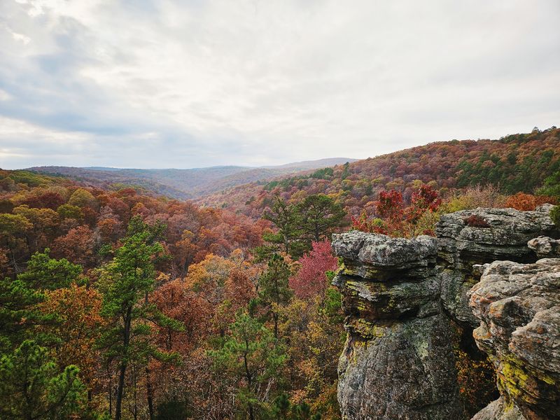
Some rocks just refuse to look normal. Out near Pelsor, they rise from the forest like ancient ruins with skinny bases and broad tops.
Pedestal Rocks & Kings Bluff Trailhead gives you two loop trails from one starting point. Both bring you back to your car, so no backtracking is required.
The Pedestal Rock loop shows off the strange formations that give the area its name. Their narrow bases support broader tops that seem to balance against the sky.
That same loop also passes cave-like shelters and rocky overhangs. Kids tend to treat this part like a real treasure hunt.
Over on the Kings Bluff loop, the big draw is a waterfall. Rainy weather gives it the best chance to put on a show.
Bluffs line the route, adding drama to the walk. Stay back from the edges and keep a close eye on younger hikers.
Shade covers much of the area, which helps on hot Arkansas afternoons. You’ll still want water, but the trees make summer visits easier.
The trails are easy to follow, so you can focus on the scenery. Both loops carry a moderate rating, so plan for some effort.
Dogs are allowed outside, which means your pup can join the adventure. Bring a leash, since bluffs and pets need careful handling.
Weekdays usually offer a quieter experience. Weekend afternoons may draw more visitors, especially during pleasant weather.
This trailhead sits in the Ozark Mountains along AR-16. The rural setting means you should stock up on snacks before you arrive.
Can’t decide which loop to tackle? Do both, and you’ll see rock towers, cave-like shelters, bluffs, and a waterfall in one outing.
Address: AR-16, Pelsor, AR 72856
4. Flatside Pinnacle Trailhead
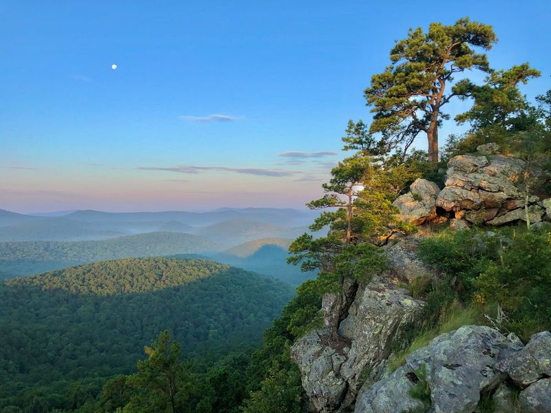
The hike itself takes about as long as finding your sunglasses. The drive is the real adventure here, so plan for it.
Flatside Pinnacle Trailhead sits off County Road 53 in rural Perry County, inside the Ouachita National Forest. Expect a lengthy drive along gravel and rocky forest roads before you reach the start.
Cell service shrinks to barely a bar out there. Download your maps at home, because your phone won’t help much once the pavement ends.
Once you park, the payoff comes fast. The trail runs only about 0.2 miles to an isolated spot with a sweeping view.
That view stretches across a huge spread of the Ouachita National Forest. It’s the kind of scene that makes a long, bumpy drive feel like a fair trade.
The path is a short out-and-back route, but it has steep, rocky sections that require careful footing. Families with children and casual walkers should be prepared for uneven terrain.
Because the walk is so short, you can spend most of your visit at the top. Bring a snack, find a safe place to sit, and soak up the quiet.
Photographers will appreciate how little gear hauling this requires. You can carry a camera bag without worrying about miles of climbing.
Timing can help you dodge company. Weekdays may offer a quieter experience, while weekends and sunset visits can attract more hikers.
A vehicle that handles rough roads well will make the trip less stressful. Check your tires and fill your gas tank before leaving town.
Sunset fans should think carefully, though. Driving those rough roads in the dark is no one’s idea of fun.
Leave a little extra daylight for the trip back. Bumpy dirt roads feel much longer once the sun starts sinking.
Few Arkansas hikes give you this much scenery for so little walking. Just remember that the road earns the view, not your legs.
Address: Co Rd 53, Perryville, AR 72126
5. Sweden Creek Falls Trailhead
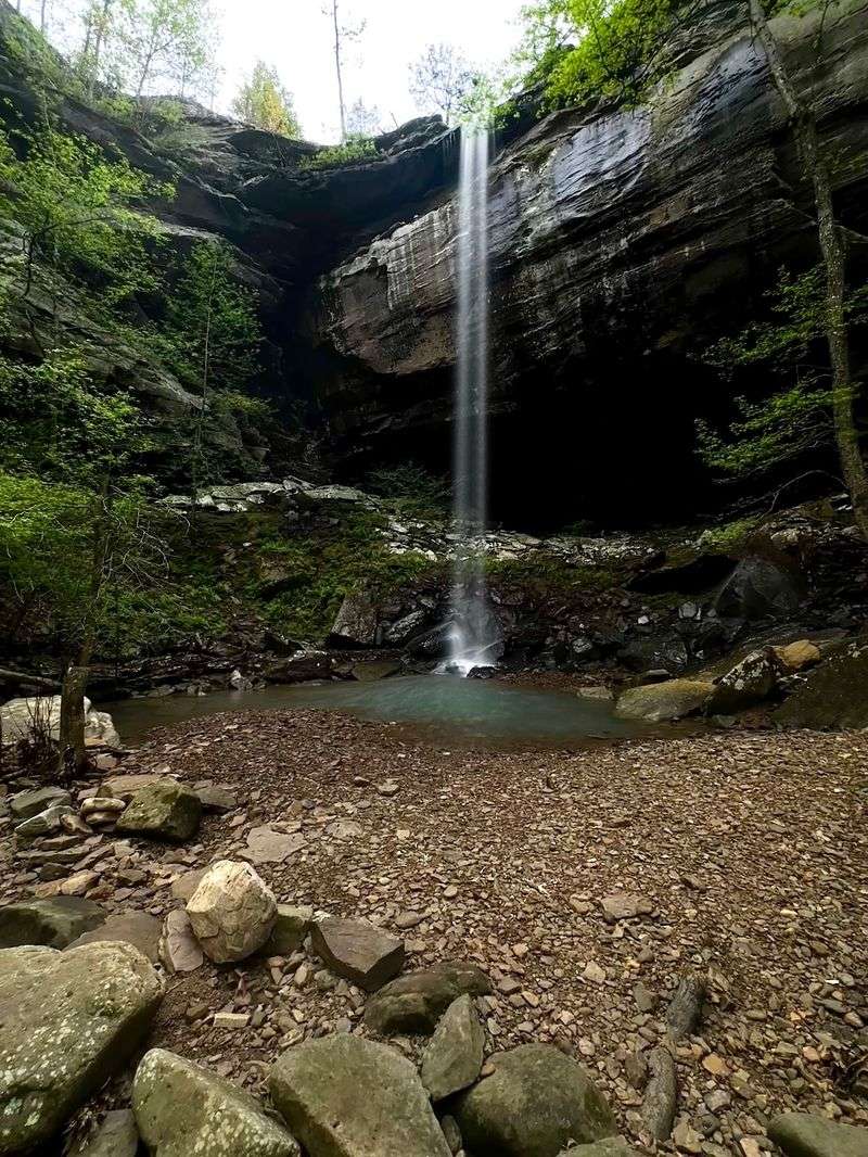
Eighty feet of falling water, and you don’t have to hike for miles to see it. That’s a pretty sweet deal in the Ozarks.
Sweden Creek Falls drops about 80 feet into a scenic canyon. The trail getting there is approximately 1.5 miles round-trip, with an easy-to-moderate difficulty rating.
Most of the challenge happens behind the wheel. Coming from the Boxley area, you’ll drive a little over three miles of dirt road to reach the trailhead.
Take that stretch slowly and enjoy the countryside. Kingston is a small rural hamlet in Madison County, so the backroads come with the territory.
Once you park, follow the blue trail markers along the bluff line toward the falls. The trail eventually splits, offering routes toward the top and bottom of the waterfall.
Timing matters more than usual here. The falls look most impressive after a good rain, when the creek has plenty to give.
During dry spells, the flow can shrink a lot. Check recent weather before you go so you don’t drive out for a trickle.
If you’re hiking with a dog, check the natural area’s current pet rules before visiting. Bring water and be prepared for uneven terrain.
Parking is free in the designated lot. Roadside parking is not permitted, so plan another visit if the lot is full.
Weekends can see more visitors, especially Saturday mornings and afternoons. The trail stays relatively short either way, so a little company won’t slow you down much.
Bring a towel if you plan to sit near the pool. Mist from a big waterfall has a habit of finding your shirt.
For families comfortable with uneven terrain, this can be a rewarding waterfall hike. The distance is manageable, and the wow factor runs high.
Address: 697 Madison 3795, Kingston, AR 72742
6. Alum Cove Natural Bridge Recreation Area
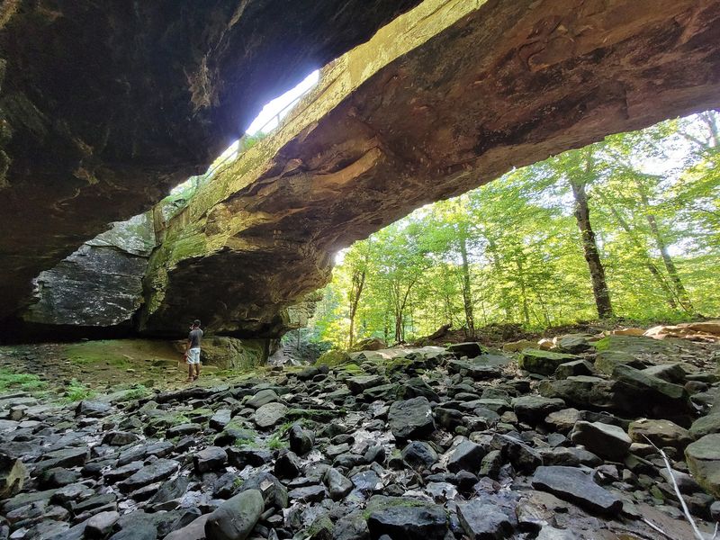
Nature built a bridge here long before anyone thought to pour concrete. You can walk right up to it on a relatively short trail.
Alum Cove Natural Bridge Recreation Area sits near the tiny mountain community of Deer in Newton County. It belongs to the Ozark National Forest, so expect thick woods and rugged hills.
The star of the show is the natural bridge, a rock span you reach after a short walk. The trail is well-marked, but its moderate difficulty and steep sections mean families should take their time.
Keep going and the hike gets even better. Cave-like shelters, streams, and smaller natural bridges add surprises along the route.
Any seasonal waterfalls depend on the weather, so they flow best after rain. Plan a visit following a wet stretch if falling water tops your wish list.
Little explorers will love peeking into the cave-like shelters. Bring a small flashlight and remind everyone to watch their footing.
Here’s a perk many trails lack: real picnic setups. A pavilion, picnic tables, and fire grills make this a great spot for lunch.
The area also has a vault toilet, a useful convenience when you’ve got kids in tow.
Check current recreation area hours and any posted gate restrictions before visiting. Arrive with enough time to explore without rushing back to the car.
Crowds can vary throughout the week. Visiting during quieter periods may give you more time to enjoy the natural bridge without company.
Pack a cooler, some charcoal, and your hiking shoes for a full afternoon. You can hike first and grill after, or the other way around.
It’s rare to find a trail this rewarding that still feels so relaxed. Alum Cove proves a small hike can carry big scenery.
Address: Deer, AR 72628
7. Indian Rockhouse Trail
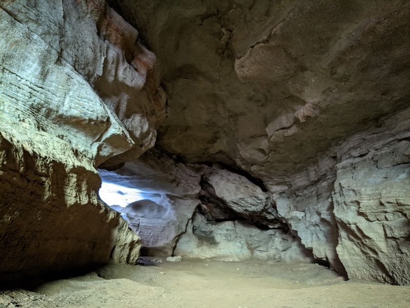
A trail with its own bathtub sounds like a joke, but it’s real. Mother Nature carved it out of rock, and no plumber was involved.
Indian Rockhouse Trail runs about 3.5 miles round-trip near Yellville in Marion County. The National Park Service manages it, and it packs a lot into one hike.
Along the way, you’ll pass clear streams and sinkholes. Then comes a waterfall, followed by that famous natural bathtub.
The grand finale is the rockhouse itself, a massive cave-like shelter. Its sheer size is the reason many hikers make the trip.
Bring a bright flashlight for this part. Your phone light won’t do the job inside such a big, shadowy space.
The trail carries a moderate-to-strenuous rating, with steep inclines and declines. Allow plenty of time for the hike and take breaks when needed.
Sinkholes add a fun science lesson to the hike. They show how water shapes the land below your feet over time.
Visitor numbers can vary throughout the week. Expect to encounter other hikers, particularly during popular hiking seasons.
Pack lunch and plenty of water for the full hike. Three and a half miles goes faster when snacks are waiting at the rockhouse.
Sturdy shoes are a must around wet rocks near the waterfall and streams. Slippery stones can surprise even careful hikers.
Kids may love the bathtub and the giant shelter most, but families should be prepared for steep, rocky terrain. Adults tend to fall for the clear water and peaceful woods.
Yellville is a small Ozark town, so this trail feels far from busy city life. Charge that flashlight and go see the rockhouse for yourself.
Address: AR-268, Yellville, AR 72687
8. White Rock Overlook Trailhead
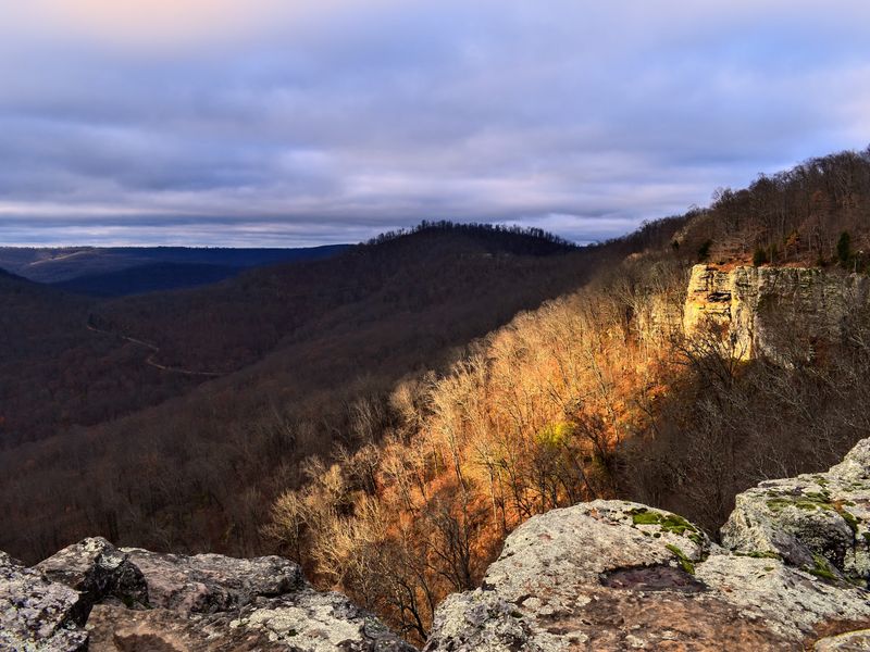
Why settle for one view when you can circle an entire mountaintop? The rim trail here hands out scenery at nearly every turn.
White Rock Overlook Trailhead sits in the Boston Mountains near the rural town of Winslow. An easy loop wraps around the top of the mountain.
That loop delivers astonishing mountain views without a punishing climb. It’s a great choice if you want big scenery and a relaxed pace.
Getting there takes some planning. A car that handles dirt roads well will make the drive much smoother.
The site offers more than a hike. Picnic tables, cabins, and campsites turn a short visit into a full getaway.
Want to see the sky change colors? Day-use areas are open from sunrise to sunset, making sunset viewing possible.
Overnight stays require appropriate lodging or camping arrangements.
Cabins give you a roof over your head if tents aren’t your thing. Campsites work well for those who prefer sleeping closer to the stars.
Pack a picnic and claim a table between hikes. Lunch with a mountain view beats a drive-thru any day.
Crowds vary throughout the week. Weekends and pleasant-weather afternoons may attract more visitors.
Bring a jacket, even on mild days. Mountaintops can feel breezier than the valleys below.
Families will like how easy the loop feels underfoot. Keep kids close near the overlooks, though, since the views come with drop-offs.
For a slow, scenic weekend in Arkansas, this spot checks plenty of boxes. Come for the overlook and stay for a night under the mountain sky.
Address: Co Rd 103, Winslow, AR 72959