11 Colorado Scenic Byways That Prove The Drive Can Be The Destination
The best road trips do not begin with a destination, they begin with a window worth rolling down. Colorado is known for snow-capped peaks and ski-town postcards, but some of its most unforgettable moments unfold mile by mile, with the radio low and the horizon doing all the talking.
These scenic drives are not just pretty stretches of pavement. They are moving stories, carrying you past golden prairie light, stone canyons, old cliffside history, thick forests, and sudden views that make everyone in the car go quiet.
That is the magic of choosing the slower route. A spare afternoon can become a memory, and a full weekend can feel like an expedition without ever needing a boarding pass.
Colorado’s roads reward curiosity, patience, and a willingness to pull over for one more photo. Pack snacks, fill the tank, and let the journey steal the spotlight before the engine cools down.
1. Pawnee Pioneer Trails — Northeast Colorado

Most people picture Colorado as a wall of mountains, so the Pawnee Pioneer Trails has a way of quietly rewriting that assumption. This 128-mile route through Pawnee National Grassland and ranchland feels more like stepping into a painting than driving a highway.
The sky here is enormous, the kind that makes you feel both small and strangely calm at the same time.
Parts of the byway use unpaved county roads, which keeps the crowds thin and the experience genuinely off-the-radar. You will pass through quiet plains towns that feel untouched by tourist traffic, which is honestly refreshing.
Birdwatchers love this stretch, especially during spring migration when the grassland comes alive with activity.
Budget around three hours for the full drive, though you will probably want to stop more than you planned. The Pawnee Buttes are worth a short hike if conditions allow.
I find this byway particularly satisfying for anyone who thinks Colorado has nothing to offer beyond ski towns, because it proves the state has a whole different personality once you head east and let the plains do the talking.
2. South Platte River Trail — Julesburg / Northeast Colorado

At just 19 miles, the South Platte River Trail is Colorado’s shortest scenic byway, but calling it minor would be a serious mistake. Julesburg packs more history per mile than almost anywhere else in the state, layering Pony Express stories, Fort Sedgwick heritage, railroad history, and old townsite lore into a compact and surprisingly moving drive.
This is the kind of route that rewards people who actually read the roadside signs instead of blowing past them. The river scenery is gentle and unhurried, matching the pace that this byway seems to encourage.
Most visitors skip northeast Colorado entirely on their way to the mountains, which means you will likely have this road almost entirely to yourself.
A half-day is plenty of time, making it an easy add-on if you are already passing through the region on I-76. History fans will get the most out of it, but even casual drivers tend to leave with a new appreciation for how much happened on these quiet plains.
Personally, I love that a byway this short can carry this much weight. Sometimes the smallest roads tell the biggest stories.
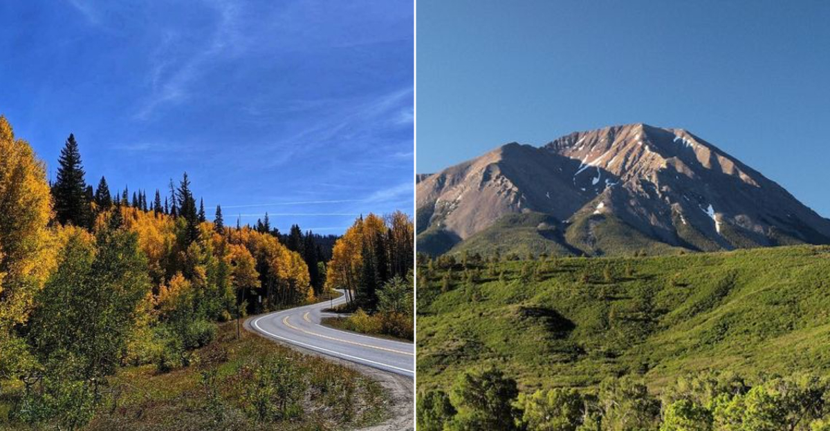
3. Flat Tops Trail — Meeker to Yampa / Northwest Colorado

There is a particular kind of quiet that settles over you on the Flat Tops Trail, the sort that reminds you how much of Colorado remains genuinely wild and unhurried. This 82-mile drive between Meeker and Yampa passes through working ranch country, thick forest, and wildlife habitat that feels far removed from the state’s busier corridors.
Trappers Lake access and the Flat Tops Wilderness are the scenic anchors here.
CDOT notes that sections of this byway close in winter, so late spring through fall is your window. That seasonal limitation actually adds to the appeal, because it means the route stays fresh and feels like something you have to earn a little.
Elk sightings are common, especially in early morning or evening hours.
Plan for a full day if you want to stop and explore properly, because rushing this one would be a genuine waste. The landscape shifts noticeably as you gain and lose elevation, keeping the drive visually interesting throughout.
For anyone craving a northwest Colorado adventure that feels more authentic than curated, this byway delivers exactly that kind of raw, unhurried satisfaction that is increasingly hard to find on a weekend road trip.
4. Grand Mesa Scenic Byway — Cedaredge / Mesa County / Western Colorado

Climbing from canyon country up to forests sitting around 11,000 feet, the Grand Mesa Scenic Byway delivers one of the most dramatic elevation transitions in western Colorado.
The 63-mile route through Mesa County passes lakes, overlooks, hiking trailheads, and fishing spots that feel genuinely accessible without the elbow-to-elbow crowds you find on more famous mountain drives.
Fall color here is extraordinary. The aspen groves light up in a way that feels almost theatrical, and because this byway flies under the radar compared to routes near Aspen or Telluride, you can actually stop and enjoy it without circling a parking lot for twenty minutes.
Cedaredge serves as a friendly gateway town worth a short stroll before you begin the climb.
Summer visits reward hikers and anglers, while autumn brings photographers and leaf-peepers who have clearly done their homework. The views from the top of Grand Mesa feel earned even from inside your car, which is a rare quality in a drive.
I would put this on any western Colorado itinerary without hesitation, particularly for families or couples who want mountain scenery without the mountain-resort price tag that so often comes attached to it.
5. Cache la Poudre–North Park Scenic Byway — Fort Collins to Walden

Starting from Fort Collins and winding 101 miles to Walden, the Cache la Poudre–North Park Scenic Byway is one of those drives that earns genuine respect from people who take road trips seriously.
The canyon section along the Poudre River is dramatic and tight, with rushing water and rocky walls pressing in close on both sides before the road climbs toward Cameron Pass.
Once you cross Cameron Pass and drop into North Park, the whole mood shifts. The open basin stretches wide and quiet, with big Sangre de Cristo-style views and a sky that seems to expand in every direction.
State Forest State Park offers camping and moose habitat, making this a strong overnight option for families willing to pack a tent.
The Fort Collins end of the byway gets more traffic, but the further northwest you travel, the more the crowds thin out. Walden itself is a small, no-frills ranching town where a cup of coffee and a honest conversation feel like the local currency.
I find the contrast between canyon and basin on this drive genuinely thrilling, because very few byways manage to deliver two completely different landscapes within a single 101-mile stretch.
6. Highway of Legends — Trinidad / Cuchara / La Veta / Spanish Peaks

Few byways in Colorado come with a name this cinematic, and the Highway of Legends actually earns it. This 82-mile loop weaves through Spanish Peaks views, towering red rock walls, Cuchara Pass, mining history, and small mountain towns that feel like they belong in a different era entirely.
Trinidad anchors the southern end with its own fascinating arts and history scene.
The Spanish Peaks themselves are hard to stop staring at. Geologists love them because the dramatic rock walls radiating outward, called dikes, are among the most striking volcanic formations in North America.
You do not need to know the science to appreciate the view, but the backstory makes it even better.
CDOT notes that the Cordova Pass extension involves gravel and closes in winter, so check conditions before adding that section to your plans. La Veta is a wonderful stop for lunch and a short walk, with the kind of small-town charm that feels genuine rather than performed.
Personally, this is one of my favorite southern Colorado drives because it combines geology, history, and mountain scenery into a single loop that most out-of-state visitors have never even heard of, which makes it feel like a real discovery.
7. Santa Fe Trail Scenic Byway — Trinidad to La Junta / Southeast Colorado

History has a way of pressing up against you on the Santa Fe Trail Scenic Byway, which stretches 188 miles through southeast Colorado from Trinidad to La Junta. This is prairie driving at its most contemplative, with the ghosts of wagon trains, traders, and soldiers all sharing the same corridor you are traveling today.
Bent’s Old Fort is the undisputed highlight and genuinely worth the stop.
Comanche National Grassland adds a wild, open quality to the southern stretches, and Raton Pass history gives the Trinidad end a dramatic finish. The landscape here is not showy in the way that mountain routes are, but it has a deep, slow-building beauty that sneaks up on you around mile fifty and never quite lets go.
This byway is tailor-made for travelers who prefer historical weight over alpine altitude, and for families who want to turn a road trip into something genuinely educational without it feeling like a school field trip. Allow a full day and bring good snacks, because the distances between towns are real.
I think southeast Colorado is one of the most underestimated corners of the state, and this byway makes the strongest possible argument for taking it seriously.
8. Trail of the Ancients — Cortez / Dolores / Southwest Colorado

Southwest Colorado holds some of the most significant cultural landscapes in North America, and the Trail of the Ancients is the byway that connects them. Running 116 miles through the Cortez and Dolores area, this route passes Ancestral Puebloan sites, rock art panels, Hovenweep National Monument, and Canyons of the Ancients, all within a single driving day.
Most visitors to this region make a beeline for Mesa Verde and nothing else, which means the Trail of the Ancients offers a quieter, richer alternative for anyone willing to look beyond the most obvious stop. The landscape itself is striking, with red canyon country and wide desert views framing each site in a way that feels almost cinematic.
Dolores is a friendly base town with good river access, and the drive between sites has enough visual variety to keep passengers fully engaged throughout. Bring water, comfortable shoes, and genuine curiosity, because the best parts of this byway reward people who get out of the car and look closely.
Personally, I find this route deeply affecting in a way that is hard to explain until you are standing in front of a thousand-year-old structure and feeling the scale of time settle around you like dust.
9. Unaweep–Tabeguache Scenic Byway — Grand Junction to Naturita / Western Slope

Unaweep Canyon is one of Colorado’s great geological puzzles, a canyon with two creeks flowing in opposite directions, suggesting it was carved by a river that no longer exists. The Unaweep-Tabeguache Scenic Byway runs 133 miles from Grand Junction to Naturita through this canyon and beyond, delivering red sandstone cliffs, mining history, and dinosaur-era geology that feels almost prehistoric in the best possible way.
Gateway is a worthwhile stop along the route, sitting at the base of dramatic canyon walls that make you instinctively reach for your camera. The desert scale here is different from the mountain scale you find in central Colorado, wider and more ancient-feeling, like the landscape has been quietly doing its thing for millions of years without needing anyone’s approval.
This byway genuinely feels designed for people who believe the road itself should be the main event, not just the connector between attractions. The visual variety is remarkable for a western slope drive, shifting from canyon walls to open mesa country as you roll toward Naturita.
I would rank this among the most underrated drives in the entire state, and I say that as someone who has driven a lot of Colorado roads and developed strong opinions about which ones actually deliver.
10. Frontier Pathways — Pueblo / Rye / Westcliffe / South-Central Colorado

Sitting between Pueblo and Westcliffe, the Frontier Pathways Scenic Byway covers 103 miles of south-central Colorado that most road trippers simply never discover. The route passes through old frontier country, mountain meadows, canyons, and Victorian-era towns while providing generous access to San Isabel National Forest, which is one of Colorado’s most quietly spectacular natural areas.
Westcliffe is the kind of small mountain town that makes you wonder why you have not been coming here for years. It sits in the Wet Mountain Valley with the Sangre de Cristo range rising dramatically to the west, creating a backdrop that feels almost unreasonably beautiful for a town this size.
The drive from Rye up into the mountains is particularly rewarding in spring when wildflowers take over the roadsides.
For a southern Colorado day drive, this byway is genuinely hard to beat. The traffic stays manageable, the scenery shifts constantly, and the combination of history and natural beauty gives you plenty to talk about on the drive home.
I always feel like Frontier Pathways is the byway that south-central Colorado residents keep quietly to themselves, and honestly, after driving it myself, I completely understand why they might prefer to keep it that way.
11. Los Caminos Antiguos — San Luis Valley / Alamosa / San Luis / Conejos

Colorado’s oldest surviving community sits along this route, and that fact alone gives the Los Caminos Antiguos a sense of depth that most scenic byways simply cannot match. Running 129 miles through the San Luis Valley, this byway connects Alamosa, San Luis, and the Conejos area while passing historic churches, Fort Garland, valley farmland, and enormous Sangre de Cristo views that stretch across the eastern edge of the valley like a painted backdrop.
The San Luis Valley has a particular quality of light that photographers chase obsessively, flat and clean and somehow more honest than mountain light. San Luis itself is worth a slow walk, with murals and a hilltop shrine that carry genuine cultural weight.
Fort Garland offers a compact but meaningful history stop that adds context to the whole region.
The pace here is unhurried by design, and trying to rush this byway would miss the entire point. Great Sand Dunes National Park sits nearby, making a natural extension to the day if your legs want more adventure.
I find the San Luis Valley to be one of the most spiritually calming places in Colorado, and Los Caminos Antiguos is the route that finally gives it the road trip framework it has always deserved.