
Michigan’s Newest International Day Trip: The Gordie Howe Bridge
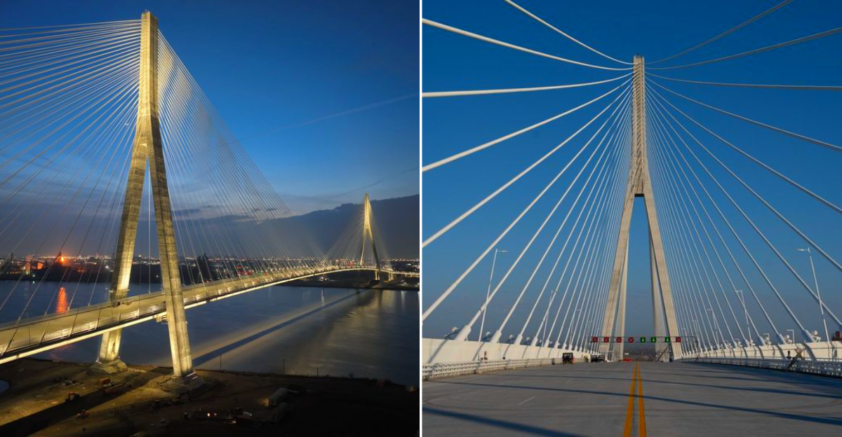
I have crossed the border more times than I can count, but never like this. The newest bridge between this state plus Canada lets you walk across for free.
Let me say that again. Free. The pedestrian path opened recently, plus the views alone are worth every single step you take.
You stand above the river with cargo ships passing below, skylines stretching in both directions, plus six thousand LED lights that turn the towers into a glowing sculpture after sunset. The crossing takes less than an hour on foot.
On the other side, Windsor waits with walking tours through historic neighborhoods, over two hundred murals scattered across the city, plus a riverside park system that makes you forget you just left another country minutes ago.
The newest international bridge turns a Michigan day trip into something that feels impossibly grand and entirely within reach.
Bring The Right Border Documents
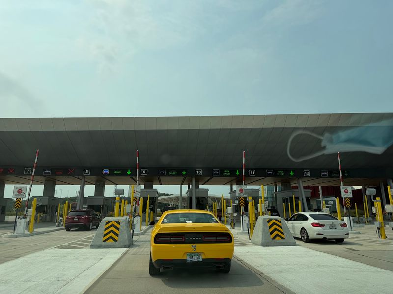
Nothing ends a cheerful bridge walk faster than realizing your passport is at home. Even though the multi-use path is free, pedestrians and cyclists still clear customs at dedicated processing lanes on both sides.
A passport or NEXUS card is the practical starting point, and families should check document rules for every traveler before leaving.
Keep papers where you can reach them without turning a backpack upside down at the inspection booth. Rules can change, so checking official border guidance the night before is smarter than trusting memory.
The bridge feels modern and easy, but the international line is still very real, and officers expect the same calm preparation you would bring to any other crossing on either side that day.
I-75 Now Has A Direct Route To Canada
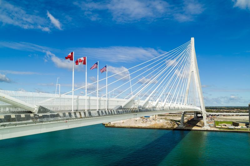
The Gordie Howe International Bridge crosses the Detroit River between southwest Detroit, Michigan, and Windsor, Ontario. Drivers approaching from Michigan should remain on I-75 and follow the new overhead signs for the bridge and United States Port of Entry.
The final approach separates international traffic from the surrounding Detroit street grid and leads directly into border inspection and toll lanes. Keep passports or other accepted border documents ready, follow lane-control signs carefully, and expect delays during busy travel periods.
There is no visitor parking or casual roadside viewing area at either port of entry. Drivers continue through inspection and across the bridge toward Highway 401, while pedestrians and cyclists use a separate path entrance rather than entering through the vehicle lanes.
Choose Your Crossing Style
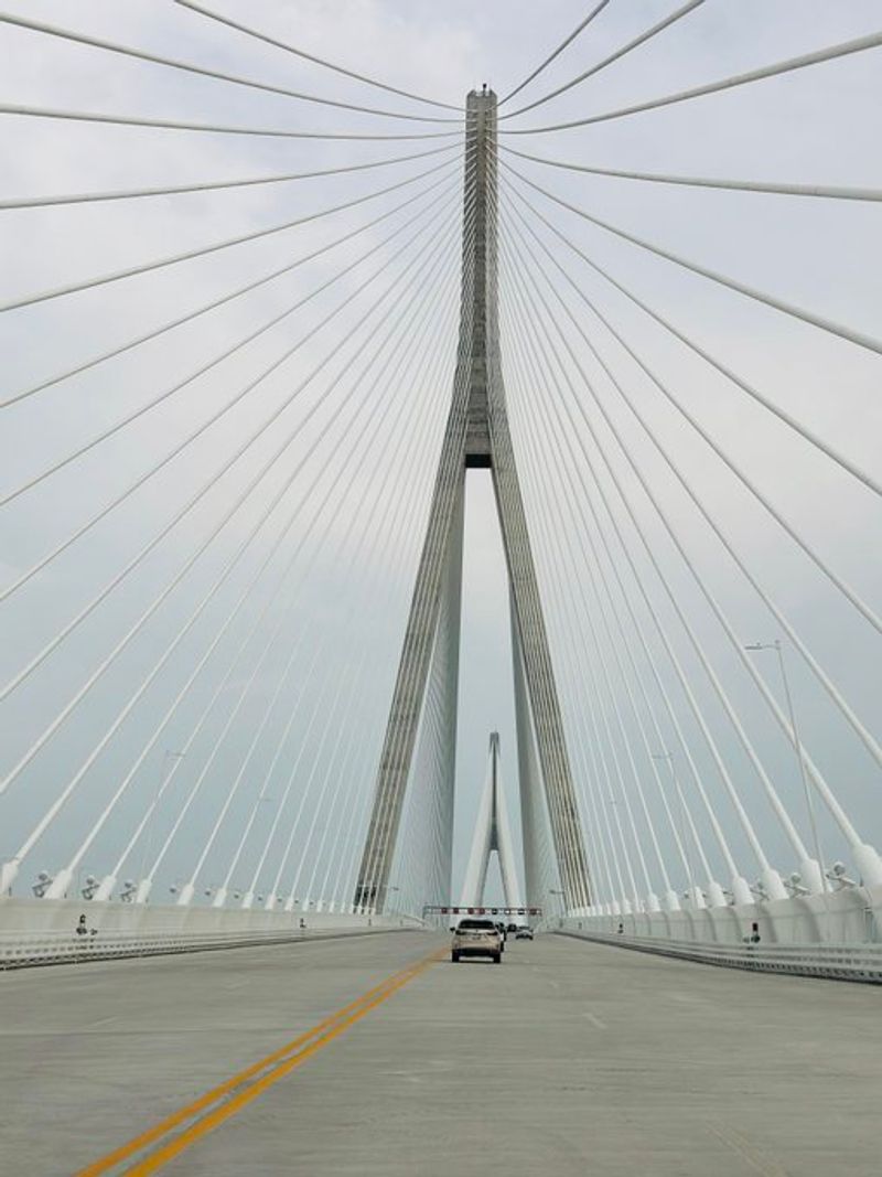
Here is the fun choice: car, bike, or your own two feet. The bridge carries six lanes for vehicles, plus a separate multi-use path about 3.6 meters, nearly 12 feet, wide for walkers and cyclists.
Riding across takes about 20 minutes one way, while walking is closer to 45, so your plan shapes the whole day.
Drivers get the fastest point-to-point trip between I-75 and Highway 401, especially if the goal is a quick meal or errand across the border. Walkers and riders get the storybook version, with more time to notice the towers, cables, and river.
Pick the style that matches your energy, your documents, and your weather tolerance, because changing your mind at the port is not simple.
Start From The Trailheads
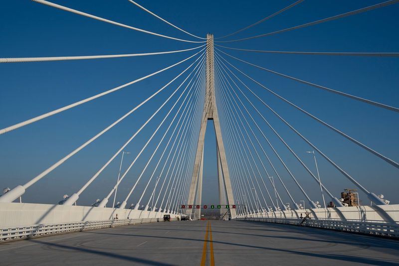
Parking is one of those small details that can quietly wreck a good outing. There is no parking directly at the Ports of Entry, so path users should start from the Clark Park trailhead in Detroit or the Malden Park trailhead in Windsor.
Both spots connect you to the crossing without the awkward last-minute search for a legal place to leave the car.
Clark Park gives the Detroit side a neighborhood feel before the big infrastructure takes over. Malden Park is handy on the Windsor side and links into trails.
If you are walking or cycling, save the trailhead address in your phone before leaving home, because the customs complex is huge, and a missed turn there is not graceful.
Look Up At The Towers
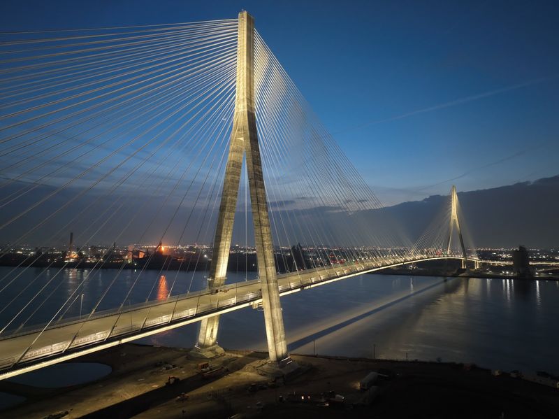
The first thing that grabs your eye is how the towers seem to lean into motion. Each A-shaped tower rises about 220 meters, or 722 feet, and the design was meant to suggest the movement of a hockey stick during a slapshot.
Named for Gordie Howe, the bridge wears that sports reference lightly, but it is there once you know where to look.
From far away, the cables make the structure look almost stitched into the sky. Up close, the scale is more startling than graceful, which is part of the appeal.
If you want the best reaction from kids or camera-happy friends, do not explain everything first. Let the towers appear, then watch people go quiet for a second.
Appreciate The Record Span
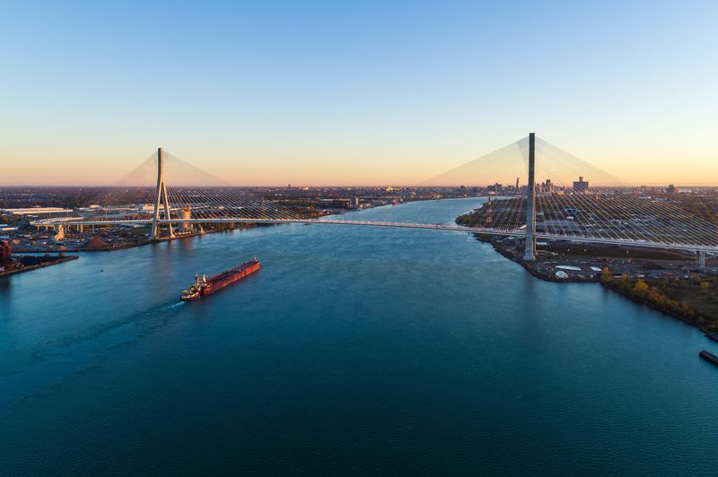
A bridge fact can sound dry until you stand beside the river and picture the distance. The Gordie Howe International Bridge has the longest main span of any cable-stayed bridge in North America, stretching 853 meters, or 2,799 feet.
Better yet for engineering nerds and curious kids alike, no piers were built in the Detroit River itself.
That choice keeps the waterway clearer and adds to the bridge’s clean, bold look. I found that detail more memorable than many larger numbers, maybe because it says something about restraint as well as ambition.
When you cross, glance at the open sweep beneath you and remember that the river is part of the design story, not just scenery under the deck below.
Notice How The Route Connects
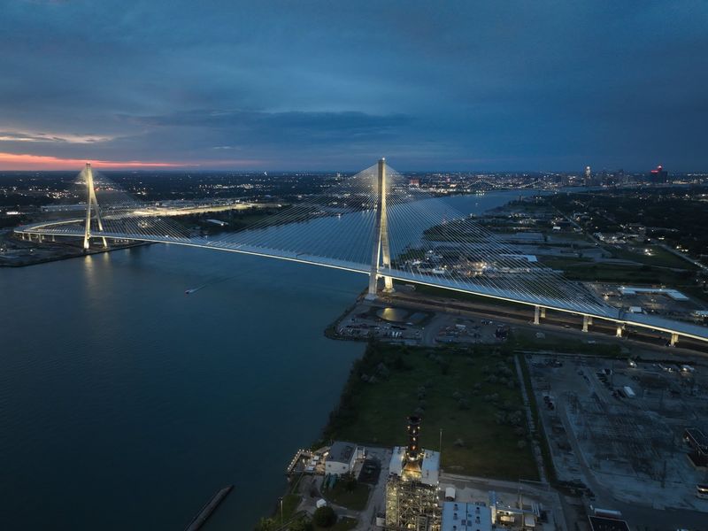
One clever part of this bridge is that it does not dump freeway traffic onto neighborhood streets. The crossing links Interstate 75 in Detroit directly with Highway 401 in Windsor, creating uninterrupted freeway flow for vehicles.
That matters to day-trippers because smoother approach roads mean less confusion, and it matters even more to communities that have long dealt with heavy border traffic.
On the ground, you feel that logic in the way ramps, signs, and inspection lanes are organized for movement rather than drama. The trip still involves customs, of course, but the route design is trying hard not to waste your patience.
If you are used to older crossings, the surprising feature may be how direct the connection feels.
Expect Big Ports Of Entry
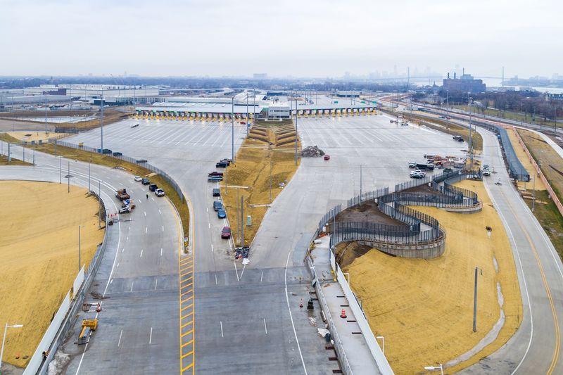
The bridge itself is dramatic, but the Ports of Entry are the quiet giants of the experience. The Canadian side covers about 53 hectares, roughly 130 acres, and the United States side is larger at around 68 hectares, or 167 acres.
Those numbers explain why the border area feels more like a small logistics city than a simple toll booth.
Separated lanes for passenger and commercial traffic help the place function without all the streams tangling together. There is also public art and landscaping that reflect the Windsor-Detroit region, which softens the industrial mood more than you might expect.
Give yourself minutes to read signs here, because scale can make decisions, like which lane you need, feel high stakes today.
Use Tolls And Traffic Tools Wisely
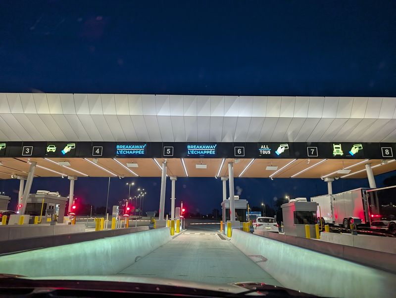
Money talk is not glamorous, yet it can smooth the trip more than any scenic plan. Vehicle tolls vary by class, axle count, and height, and payment options include cash, debit or credit cards, contactless methods, and the Breakaway discount program.
Real-time systems also share border wait times, traffic cameras, and weather information through highway advisories in Michigan and Ontario.
Before leaving home, check conditions instead of guessing from a map screenshot taken yesterday. A bridge this new attracts both regular commuters and curious first timers, so traffic patterns can change fast.
Drivers who plan around busy periods will spend more time in Windsor or Detroit and less time staring at brake lights, which is a trade everyone can support.
Treat The Path As The Main Event
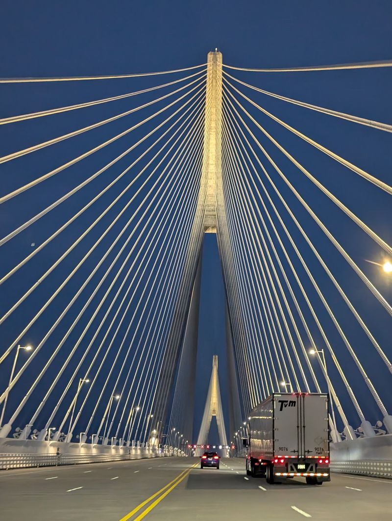
Steel and cable usually belong to the background of a trip, but here they are the attraction. The multi-use path is free, wide enough to feel comfortable, and connected to bigger trail networks on both sides of the border.
In Windsor it ties into the Trans Canada Trail, and in Detroit it links with the Joe Louis Greenway and Iron Belle Trail.
That network connection gives the crossing a feeling of continuity, like the bridge is not an isolated stunt but part of movement. Bring water, shoes, and a phone enough for maps, photos, and customs questions.
I liked knowing the walk could begin and end on trails, which keeps the experience tied to the cities it joins so well.
Remember What The Name Means
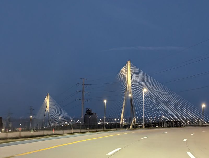
Every new crossing needs a practical reason, and this one has several, but the name gives it heart. Gordie Howe spent 25 years with the Detroit Red Wings, so the bridge honors a figure deeply linked to both Detroit and Canada.
Standing there, you can feel how the project is about freight and commuting, yet also about shared memory across a very busy border.
The need for a crossing was studied in the early 2000s, and the project was built to add capacity and improve processing. Canada funded the approximately CA$3.8 billion bridge, with costs meant to be recovered through tolls.
For a tripper, that policy story lands clearly: one ride, one walk, and two countries meeting in sight together.