
Stone Ruins Of A 1880s Mill Town Sit Quietly Along The River At Arizona’s Fairbank
A restored schoolhouse is now the liveliest building in a town where the last residents packed up in the 1970s. It holds a museum, a bookstore, and volunteers who know the stories behind every crooked wall.
Outside, an old adobe store still stands on what was once the main street. A walking trail leads past a hilltop cemetery to the stone walls of a silver mill.
That mill once processed ore hauled from one of the most famous mining towns in the West.
I like that nobody turned this Arizona spot into a costume party. There are no staged shootouts and no souvenir saloons.
There is just a quiet river, rustling mesquite, and the bones of a real railroad town.
It costs nothing to wander here. So why does almost nobody talk about it?
A Real Ghost Town Waits Beside The San Pedro River
Fairbank Historic Townsite sits along the San Pedro River in southeast Arizona, roughly ten miles west of Tombstone. The Bureau of Land Management looks after it today.
That detail matters more than you might expect. Instead of a theme park, you get a protected piece of the past with honest signs and well-kept paths.
The townsite lives inside the San Pedro Riparian National Conservation Area. So the ruins come wrapped in cottonwoods, mesquite woodland, and a river corridor full of life.
State Route 82 runs right past it. Plenty of folks spot it while driving between Sierra Vista and Tombstone and pull over on a whim.
Here’s what waits beyond the parking lot. There’s a restored schoolhouse, a big adobe store, a handful of old homes, and a stone hotel foundation.
Farther out, trails lead to a hilltop cemetery and the walls of a silver mill. A loop of about four miles ties it all together with river views.
The best part is how calm it feels. You can read the town at your own pace, one building at a time, with nobody rushing you along.
Three Names In Two Years For One Busy Railroad Stop
Junction City. Then Kendall.
Then, finally, Fairbank, which became official on May 16, 1883.
The railroad arrived in 1881 and changed everything about this river crossing. Suddenly it was the closest rail link to the booming silver mines of Tombstone.
The final name honored N.K. Fairbank, a Chicago investor who helped fund the railroad.
Pretty good return on a bank loan, getting a whole town named after you.
Business followed the tracks fast. At its peak, the town had restaurants, shops, a telegraph station, and a Wells Fargo office.
Freight, mail, and passengers all funneled through here. Anyone heading to Tombstone likely passed this exact patch of riverbank first.
Picturing that traffic takes some effort now. The air today carries birdsong instead of train whistles and shouting freight crews.
Still, the layout tells the story if you look closely. Interpretive plaques around the grounds explain how a small stop grew into a vital supply hub for southeast Arizona.
History buffs will find plenty to chew on here. Even casual visitors tend to leave knowing far more about the railroad era than when they arrived.
How Flooded Mines Quietly Emptied The Streets
Water ended the party. In 1886, the Tombstone mines flooded and closed, and Fairbank lost its main reason for existing.
The town did not fold overnight, though. A rail connection to the copper mines of Bisbee in 1889 kept the trains rolling for a while longer.
Then came another twist in 1901. The Boquillas Land and Cattle Company bought the land, and many residents were eventually evicted.
Some people stayed on through the decades anyway. The last residents finally moved away in the 1970s, which is surprisingly recent for a ghost town.
Think about that for a moment. Folks were living here while bell-bottoms were in style.
The Bureau of Land Management acquired the property in 1986. Since then, the focus has been on keeping what remains standing and sharing its story with visitors.
That long, slow fade explains the mix you see today. Some buildings date to the boom years, while others reflect later chapters of ranching and rural life.
Knowing this backstory makes a walk through town far richer. Every empty doorway suddenly feels like a page from a long Arizona family album.
The Old Schoolhouse Now Runs The Show
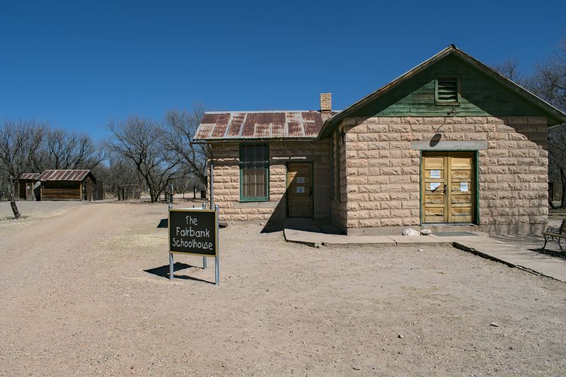
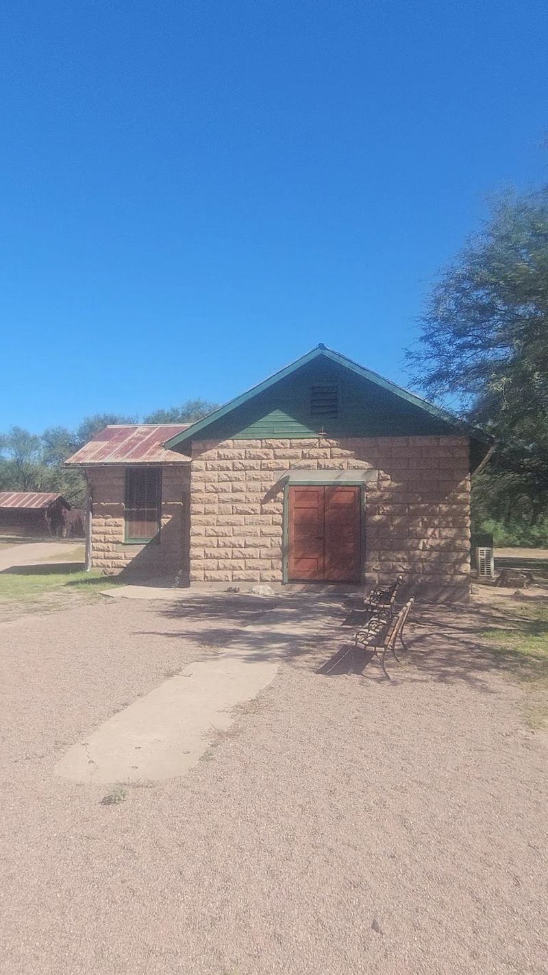
Recess ended a long time ago, yet the schoolhouse still teaches every weekend. Built in 1920 after the original one burned, it now serves as the heart of the townsite.
Inside, you’ll find a visitor contact station, a small museum, a bookstore, and a gift shop. Volunteers from the Friends of the San Pedro River help staff it.
The exhibits feature artifacts and photos from the Territorial days. There’s also a re-created classroom setup that shows how lessons once looked here.
One standout is a reproduction of an actual teacher’s contract. Reading the rules a frontier teacher had to follow is equal parts fascinating and humbling.
The bookstore is small but thoughtfully stocked. It’s a smart stop before hitting the trails, since you’ll understand the ruins better with some context.
Timing matters for this building. The schoolhouse keeps limited weekend hours, so a weekday visit may leave you peeking through windows.
Even then, the grounds stay worth exploring. But the museum adds so much color that it’s worth planning around if you can swing it.
Bring curious kids here first. A school they can actually walk into makes history feel a lot less like homework.
An Adobe Mercantile That Outlasted Almost Everything
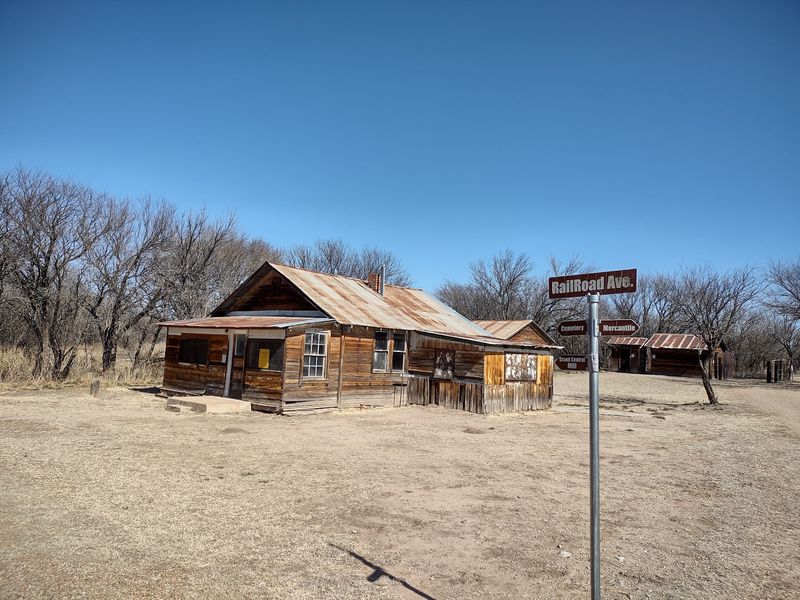
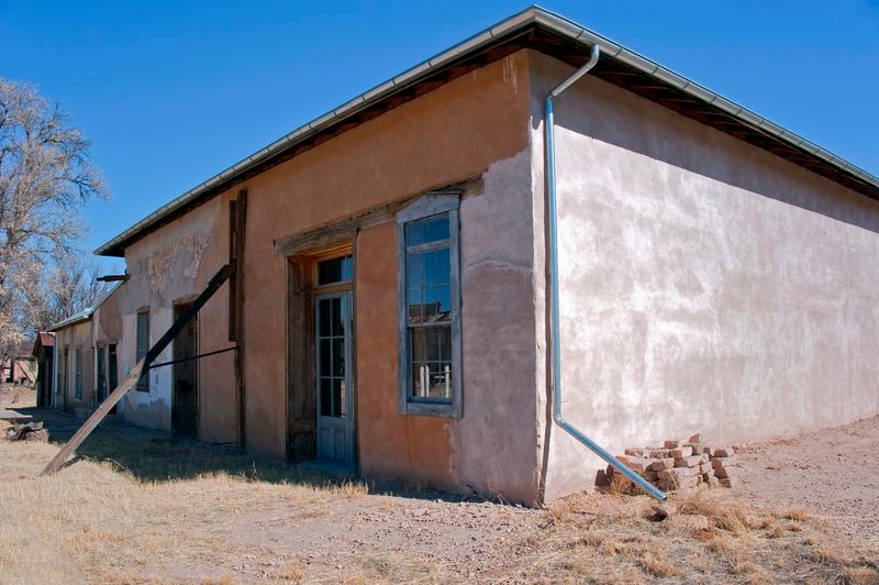
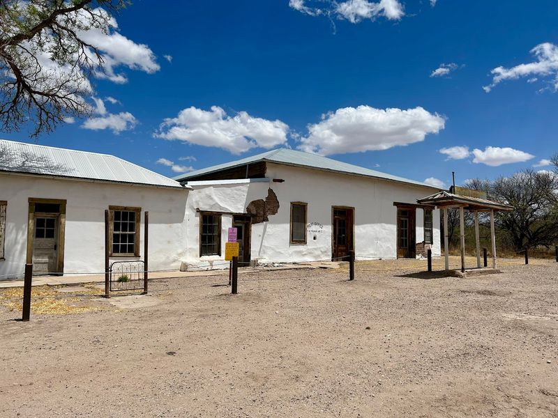
Mail, groceries, and gossip all once flowed through one big adobe building. The Mercantile is the most recognizable structure in town, and it shows its age proudly.
It originally housed the post office and a general store. Remarkably, it kept operating until the early 1970s.
That’s nearly a century of townsfolk walking through the same doorway. Few buildings in Arizona can claim that kind of steady service.
Today the Mercantile is closed to the public for safety. Time has been tough on its thick walls, and stabilizing large adobe structures is no small task.
Don’t let that disappoint you too much. The exterior alone is striking, and the window views give a glimpse of the space inside.
Photographers tend to linger here for good reason. Earthy adobe against a bright desert sky makes for a frame-worthy shot almost any time of day.
Stand back on the old Railroad Avenue line for the best view. From there, you can see how the store anchored the street.
It’s easy to imagine wagons pulling up and dust settling on the porch. The building feels less like a ruin and more like a patient old shopkeeper.
Stone Foundations And Small Homes Along Railroad Avenue
Only the stones remain of the Montezuma Hotel. Its foundation outlines a building that once welcomed travelers stepping off the train.
That’s one of the quieter thrills here. You trace a rectangle of rock on the ground and fill in the rest with imagination.
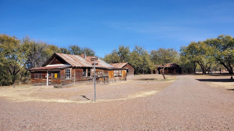
Elsewhere along the old Railroad Avenue, several structures still stand. Expect houses, a stable, a garage, a chicken coop, and a few old privies.
Yes, the outhouses made the history books too. Somebody had to preserve the full frontier experience.
Many of these buildings are closed to the public. Interpretive signs out front explain what each one did and who might have used it.
Reading those plaques is the secret to enjoying this stretch. They turn plain walls into a working neighborhood with chores, animals, and routines.
The scale feels refreshingly human. You can see the whole townsite in a short stroll, which leaves energy for the trails beyond.
Walk slowly and look for small details in the materials. Each building hints at how people made do with what the river valley offered.
Silver Mill Walls Rising Out Of The Mesquite
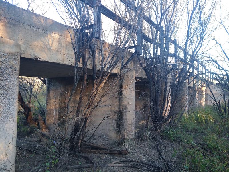
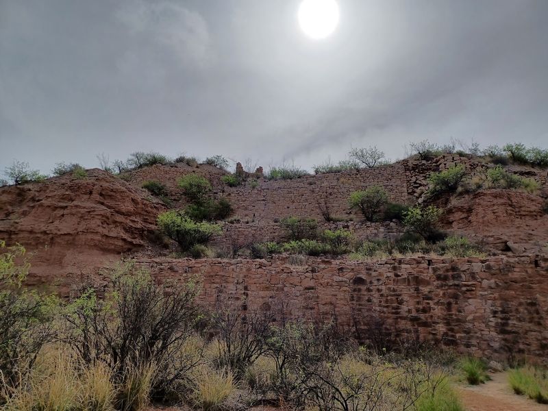
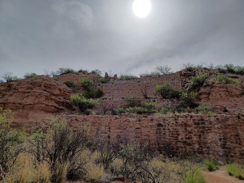
Partial stone walls loom above the brush like an old castle nobody finished. They belong to the Grand Central Mill, and they’re the star of the trail.
A compacted gravel path of about 1.25 miles heads north from the townsite toward the ruins. The walk is mostly flat and easy to follow.
This mill once processed silver ore hauled from Tombstone. It was part of the industrial muscle behind the region’s silver boom.
Today only foundations and wall sections survive. Still, you can get right up close and study the stonework terraced into the slope.
The view of the mill growing larger as you approach is half the fun. It sits in the distance for a while, teasing you forward.
Keep your eyes on the ground nearby too. Old metal pieces from the working days sometimes rest along the route, so look but leave everything in place.
Visiting in the morning gives softer light on the stone. Late afternoon works beautifully too, as long as you finish before the parking area closes.
Nothing here is reconstructed or dressed up. That honesty is exactly why the ruins feel so powerful.
A Hilltop Cemetery With Sweeping Valley Views
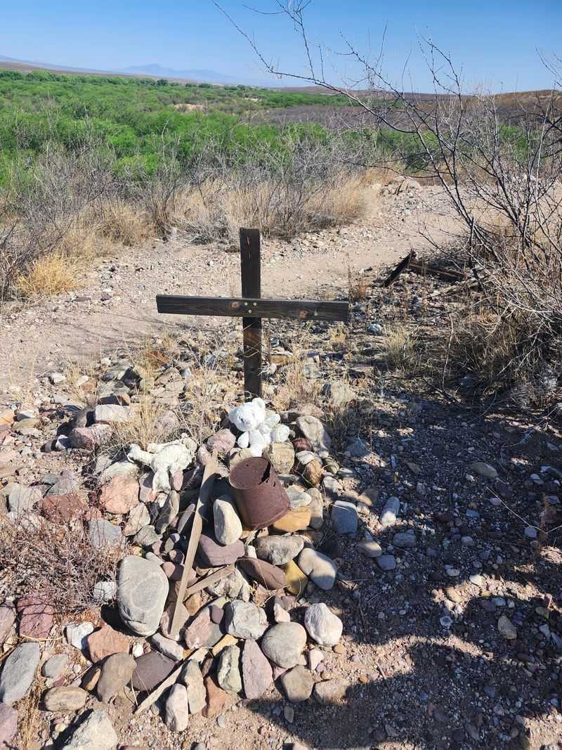
Rock-pile graves and weathered wooden crosses dot a rocky hill north of town. The Fairbank Cemetery is one of the most visited corners of the site.
Getting there takes a short hike from the townsite. The final climb is rocky, so sturdy shoes make a real difference.
Up top, the San Pedro Valley spreads out in every direction. It’s easy to see why someone picked this peaceful spot.
The markers are simple and clearly old. Many are fragile, so staying on the path and keeping hands off helps protect them for future visitors.
This place honors the miners, railroad workers, and families who called the town home. Their names may be faded, but the hillside still holds their stories.
Quiet comes naturally here. Most people lower their voices without even thinking about it.
The cemetery also connects to the larger loop trail. That makes it an easy add-on whether you’re out for a short stroll or the full route.
Pause for a moment at the top before heading down. With the river below and wide skies above, it might be the most reflective view on the whole property.
Four Miles Of Loop Trail That Covers Everything
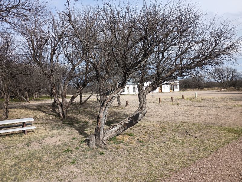
Four miles, give or take, and you’ve seen the whole story. The Fairbank loop strings together the town, the cemetery, the mill, and the river.
Most of the route is flat and well marked. Surfaces shift between packed dirt, loose sand, and the rocky bit near the cemetery.
Sand is the main challenge for tired legs. It slows you down a little, but nothing about the trail feels technical.
Benches appear along parts of the route. They’re handy spots for a water break or a quiet look at the woodland.
Habitats change as you walk, which keeps things interesting. You’ll move from open desert scrub into shady riparian forest and along a sandy river wash.
Pace yourself realistically. Folks who stop often for photos or rest can easily spend a couple of hours or more out here.
Bug spray is a smart addition in warmer, greener months. Sunscreen and a hat belong in your pack year-round in Arizona.
Trail signs suggest a counterclockwise direction. Follow them and the route flows naturally from one highlight to the next.
Cottonwoods, Birdsong, And A River With Moods
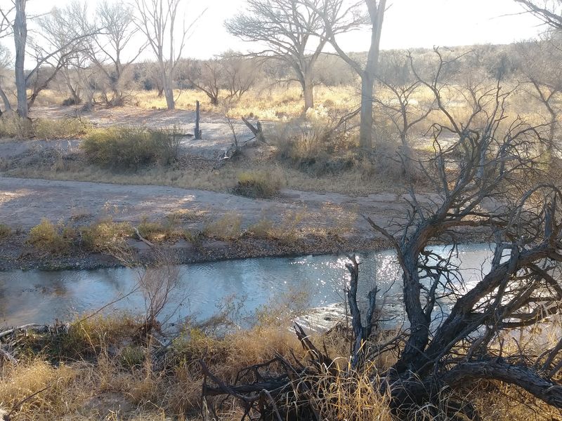
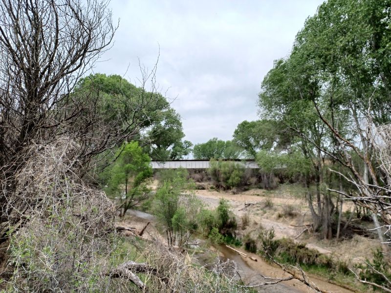
Some days the San Pedro trickles along, and some days the bed sits dry and sandy. Either way, the river shapes everything green around Fairbank.
The townsite lies within the San Pedro Riparian National Conservation Area. That means protected mesquite woodland and riverside habitat right next to the ruins.
Bird watchers, take note. The woodland is a fantastic spot for spotting and hearing birds, with calls drifting through the trees.
Other wildlife may cross your path as well. Deer, lizards, and butterflies are all part of the scene along these trails.
When water is flowing, the river access feels like a bonus prize. A quick splash on a mild day can be the perfect break from history mode.
Dry stretches have their own charm. Tracks pressed into the sand hint at who wandered through before you.
Wildflowers can brighten the edges of the trail in greener seasons. It’s a reminder that desert rivers support far more life than most people expect.
Binoculars are worth packing. Even if birds aren’t your thing, the canopy might change your mind.
Who Will Fall For This Quiet Corner
Leashed dogs are welcome, which instantly earns this place bonus points. Your four-legged hiking buddy gets a history lesson too.
Retirees and road-trippers will appreciate how easy it is to enjoy. The town walk from the parking area is only a couple hundred yards.
Accessible parking and a drop-off area sit near where the buildings begin. That thoughtful layout opens the site up to more people.
History lovers get plaques, a museum, and real structures to study. Photographers get adobe textures, stone ruins, and big skies.
Families can mix a short town loop with a hike to the cemetery. It’s an affordable outing that fills a morning without wearing everyone out.
What you won’t find matters too. There are no staged gunfights or crowded gift strips, just a well-preserved ghost town that never became a parody.
The mood is calm and unhurried. It suits anyone who likes discovering things slowly rather than being entertained nonstop.
Got a friend who loves Old West stories but hates tourist traps? This is the spot to send them, and maybe tag along yourself.
Cool-Weather Months Make The Best Visits
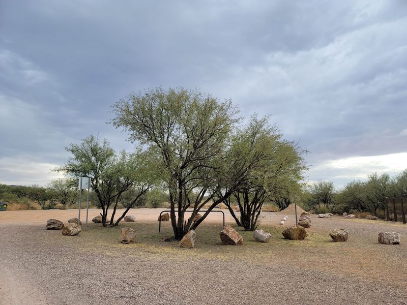
Sitting at roughly 4,000 feet doesn’t make summer here gentle. The San Pedro Valley still heats up fast, and much of the loop trail is exposed.
Late fall through early spring is the sweet spot. Cool mornings and mild afternoons make the full loop a pleasure instead of a slog.
Winter days near the river can feel calmer than surrounding high ground. The valley often offers a little shelter from blustery winds.
Spring brings green growth and the chance of wildflowers. It can also bring more bugs, so pack repellent along with your snacks.
If you do visit in warmer months, go early. Stick to the townsite and short walks, and skip the long hike when temperatures climb.
Partly cloudy days are a gift for photographers. Clouds add drama to the sky behind the mill walls and adobe store.
Remember that drinking water is not provided. Carry more than you think you’ll need, no matter the season.
Plan around the weekend schoolhouse hours if you can. A cool Saturday with the museum open is about as good as it gets.
Hours, Parking, And Getting There Without Fuss
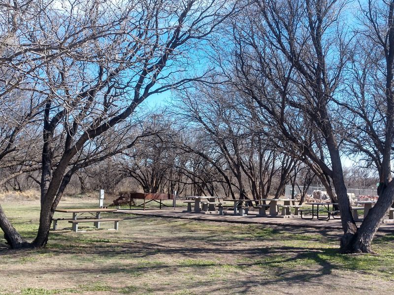
Free is the magic word. Fairbank Historic Townsite costs nothing to visit, and the parking is free too.
You’ll find it at N Old Fairbank Rd, Huachuca City, AZ 85616. It sits along State Route 82, between Huachuca City and Tombstone.
The parking area is open from sunrise to sunset. That gives you plenty of daylight for wandering the town and trails.
The schoolhouse museum keeps shorter hours. It’s open Friday through Sunday from 9:30 a.m. to 4:30 p.m. and closed Monday through Thursday.
Hours can change, so double-check before a long drive. Volunteer-staffed sites sometimes shift schedules.
Amenities are simple but welcome. Accessible vault toilets sit near the trailhead, and there’s a picnic area plus an info kiosk with trail maps.
Bring your own drinking water, since none is available on site. Cell reception can be spotty, so download maps before you arrive.
From Tucson or Sierra Vista, it makes an easy add-on to a Tombstone day. Many travelers stop here first, then roll on toward town for lunch.
Worth Pulling Off Highway 82 For, Every Single Time
Tombstone gets the headlines. Fairbank quietly kept the receipts.
Fairbank Historic Townsite offers something rare in Arizona. You get an honest ghost town, a real silver mill ruin, and a living river corridor in one free stop.
Nothing here shouts for attention. The schoolhouse, the old adobe store, and the stone foundations simply wait for curious people to notice them.
That restraint is the charm. It lets you form your own picture of frontier life instead of buying a scripted one.
Plan for a short visit or stretch it into a half-day hike. Both options feel worthwhile, and neither will drain your wallet.
Bring water, sturdy shoes, and maybe a pup on a leash. Toss in binoculars and a camera if you like birds or old walls.
Time a weekend trip to catch the museum open. The volunteers and exhibits tie every ruin together beautifully.
Southeast Arizona has plenty of famous stops. This quieter one by the San Pedro might be the one you keep telling friends about.
Save it for your next cool-weather drive. You’ll be glad you finally turned off the highway.