
The Views From This Maine Roadside Rest Stop Are Almost Too Beautiful To Describe
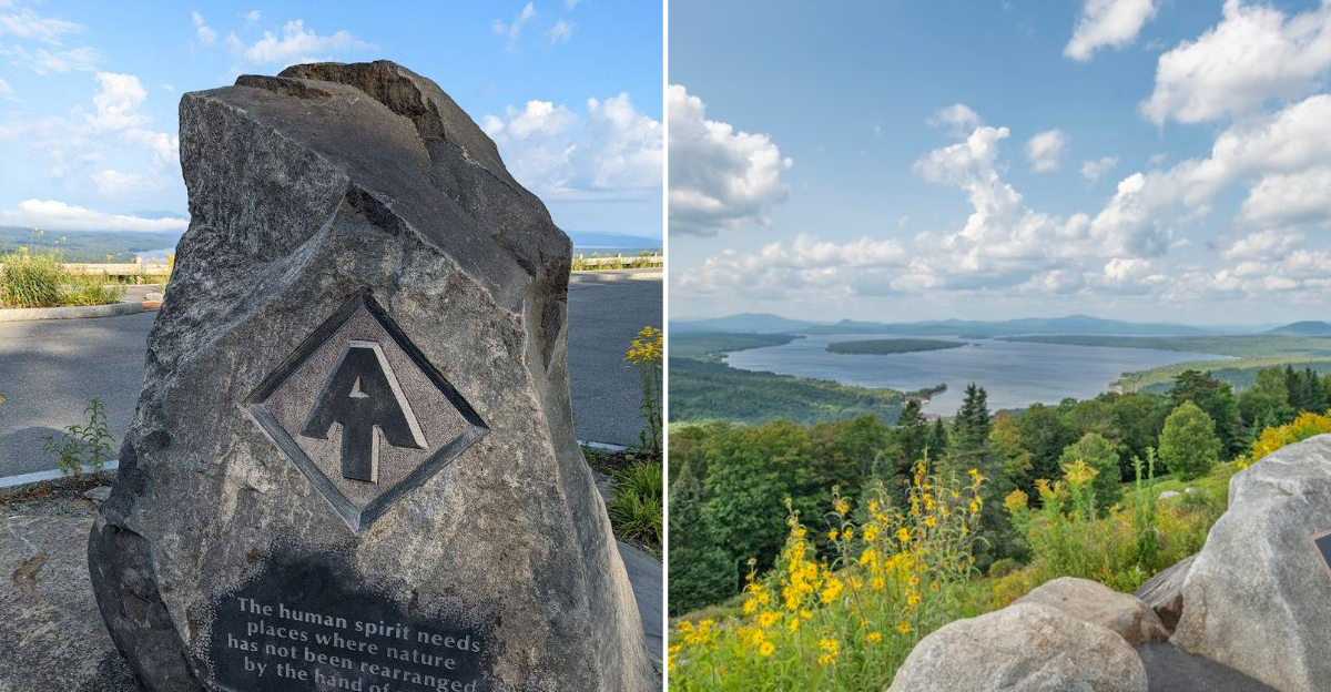
Some roads give you a view. One road in western Maine gives you a full pause in the middle of your day.
Along Route 17, the trees suddenly open, the pavement bends, and a vast sweep of lake, forest, and mountain appears with almost no warning. No long trail.
No difficult climb. Just a roadside pull-off with the kind of panorama that makes conversation stop for a moment.
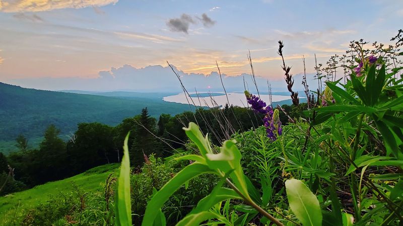
Below, the Rangeley Lakes region stretches wide and blue, framed by ridgelines that seem to keep rolling long after your eyes run out of room. The scene feels almost too grand for a quick stop, which is part of its magic.
In a state filled with beautiful places, this western Maine overlook still manages to feel like a secret waiting in plain sight.
The View That Stops Traffic
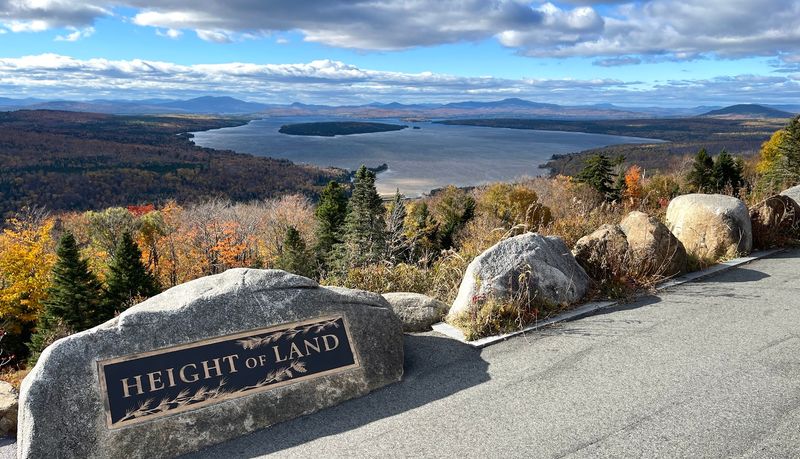
Standing at Height of Land feels less like a roadside stop and more like someone quietly lifted the roof off the world.
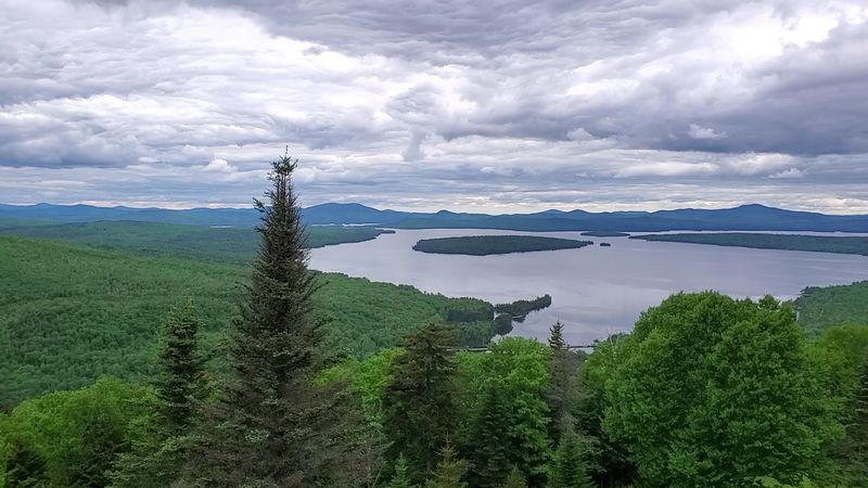
The view stretches across the Rangeley Lakes region in a sweeping arc that takes a few seconds to fully register. Mooselookmeguntic Lake glimmers below, framed by forested ridgelines that roll toward the horizon in every direction.
On a clear day, the visibility is extraordinary. On a clear day, the view can stretch toward the White Mountains, which makes the stop feel almost unreal for how accessible it is.
You do not need to hike a trail or earn the view with effort. You simply pull over, step out, and let the scenery do its thing.
The overlook sits at a naturally elevated position along ME-17, giving it an unobstructed sightline that most roadside stops can only dream about. Honestly, photos help, but they never quite close the gap between image and reality.
Why It’s Called Height Of Land
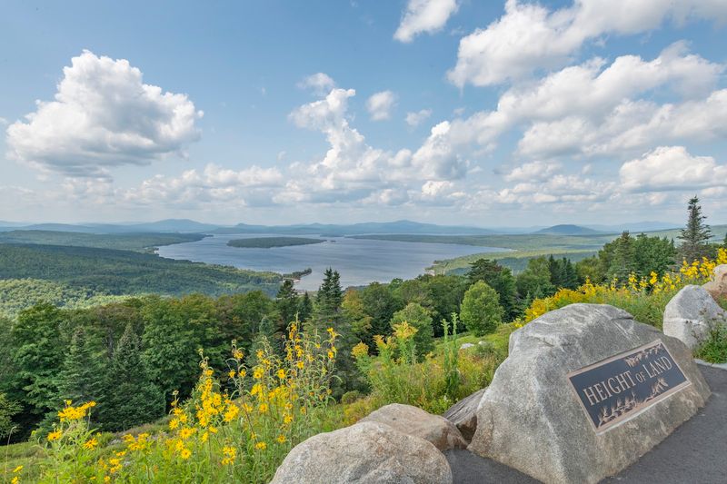
The name “Height of Land” is not just poetic phrasing. It is a literal geographic description of where you are standing.
The term refers to a high elevation point along a route where the land reaches its peak before descending again, and this particular spot on ME-17 does exactly that with dramatic flair.
The overlook sits along the Rangeley Lakes National Scenic Byway, a route recognized for the exceptional visual and natural character of the surrounding landscape.
Large interpretive signs at the overlook share the history of the region, including details about the lakes, the mountains, and the communities that have called this corner of Maine home for generations.
Reading those plaques while looking out at the view gives the stop a satisfying depth. You are not just seeing a pretty picture.
You are standing at a place with real geographic and cultural significance that stretches back well before the first car ever pulled off the road here.
Mooselookmeguntic Lake Up Close
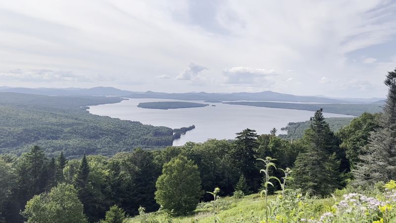
Few lakes in New England have a name as memorable as Mooselookmeguntic, and fewer still offer a view as striking as the one you get from Height of Land.
The lake is the largest in the Rangeley Lakes chain and covers more than 16,000 acres, making it a dominant and breathtaking feature of the landscape below the overlook.
On calm mornings, the surface of the lake can look almost mirror-like, reflecting the sky and the surrounding ridges in a way that makes the whole scene feel doubled.
On foggy days, the water disappears into a thick white layer that sits between the mountains like something out of a dream sequence. Both versions are worth seeing.
A secondary viewpoint across the road from the main parking area offers a slightly different angle toward the lake, giving visitors the chance to take in the water from two perspectives during a single visit. That small detail makes a big difference in how complete the experience feels.
Autumn Goes All In
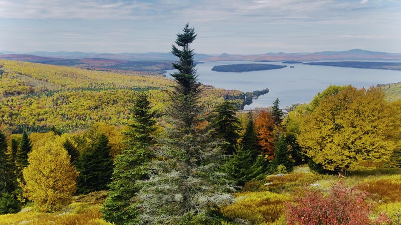
Autumn at Height of Land is the kind of seasonal event that makes people plan road trips months in advance.
When the foliage peaks, often from late September into early October in western Maine depending on the year, the hillsides surrounding the overlook transform into a layered tapestry of red, orange, gold, and deep burgundy.
The combination of the colorful forest, the dark blue water of Mooselookmeguntic Lake, and the wide-open sky above creates a visual composition that feels almost deliberately arranged.
It is no surprise that photographers, both amateur and professional, treat this location as a seasonal destination rather than just a passing stop.
Arriving early on fall weekends is genuinely important. The parking area fills up fast once the foliage hits its peak, and the experience is noticeably better when you have space to stand and absorb the view without a crowd pressing in around you.
Weekday mornings offer a quieter version of the same stunning scene.
Sunrise And Sunset Magic
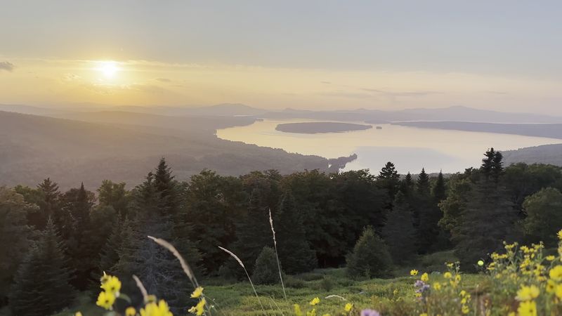
Because Height of Land is a roadside overlook, visitors often plan their stops around daylight, weather, and road conditions, which opens up some genuinely spectacular possibilities.
Sunrise from this elevation, with the early light spreading across the lake and the mountains catching the first colors of the day, is the kind of moment that makes waking up before dawn feel completely worth it.
Sunset visits offer a different but equally rewarding experience. The western-facing orientation of the overlook means the light falls across the landscape in a warm, golden way during the late afternoon and early evening hours.
The shadows from the ridgelines stretch across the water as the sun drops, creating a constantly shifting scene that rewards patience.
Fog adds another layer of interest entirely. On mornings when mist sits low over the lake, the overlook becomes something almost otherworldly, with just the tops of the mountains visible above a white blanket of cloud.
It is one of those sights that stays with you long after the drive home.
Practical Details Every Visitor Should Know
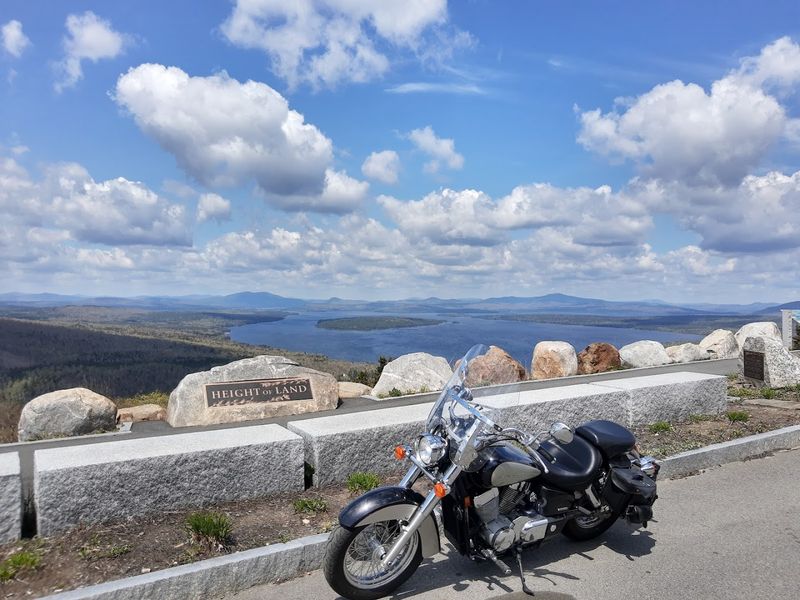
Height of Land sits along ME-17 in Township D near Rangeley Plantation, near Roxbury and Rangeley, with parking directly at the roadside overlook. Parking is limited, so traffic can slow down when the overlook gets busy during peak foliage weekends and holiday periods.
The site is handicap accessible, making the view available to a wider range of visitors than many natural overlooks in the region. There are no bathroom facilities on site, so planning ahead before you arrive is a smart move, especially if you are traveling with children or making a longer day trip out of the area.
Parking accommodates standard cars, motorcycles, and smaller RVs, though large rigs may find the space a tight fit.
The lot can fill up surprisingly fast on fall weekends and holiday periods, so arriving before 9 a.m. on those days gives you the best chance of finding a comfortable spot without circling and waiting.
The Drive Along Route 17
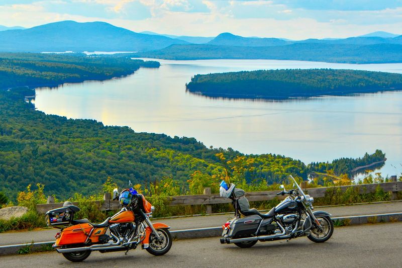
Getting to Height of Land is genuinely half the experience. Route 17 through western Maine is one of the most scenic drives in the entire state, winding through dense forests, past glittering lakes, and along mountain ridges that offer teaser views of what is coming before you reach the main overlook.
The road itself is well-maintained and clearly marked, with signs pointing toward the Height of Land parking area as you approach from either direction.
Coming up from Bethel to the south or down from Rangeley to the north, the landscape builds in intensity the closer you get, almost as if the road is setting the mood on purpose.
Motorcyclists in particular seem to love this stretch of highway, and it is easy to see why. The curves are satisfying, the scenery is constant, and the destination waiting at the top of the ridge makes the whole ride feel like a reward.
Keeping your speed reasonable also means you catch more of the views along the way.
More Than A Pretty View
The natural world around Height of Land is not limited to the view from the parking area. The surrounding forests and mountain terrain are home to a wide range of wildlife that makes the region feel alive in a way that goes beyond scenery.
Moose sightings along Route 17 are common enough that the road has earned a reputation among wildlife watchers.
Hikers who venture onto the trails near the overlook often encounter birds of prey riding thermals above the ridgeline, as well as smaller forest creatures moving through the undergrowth.
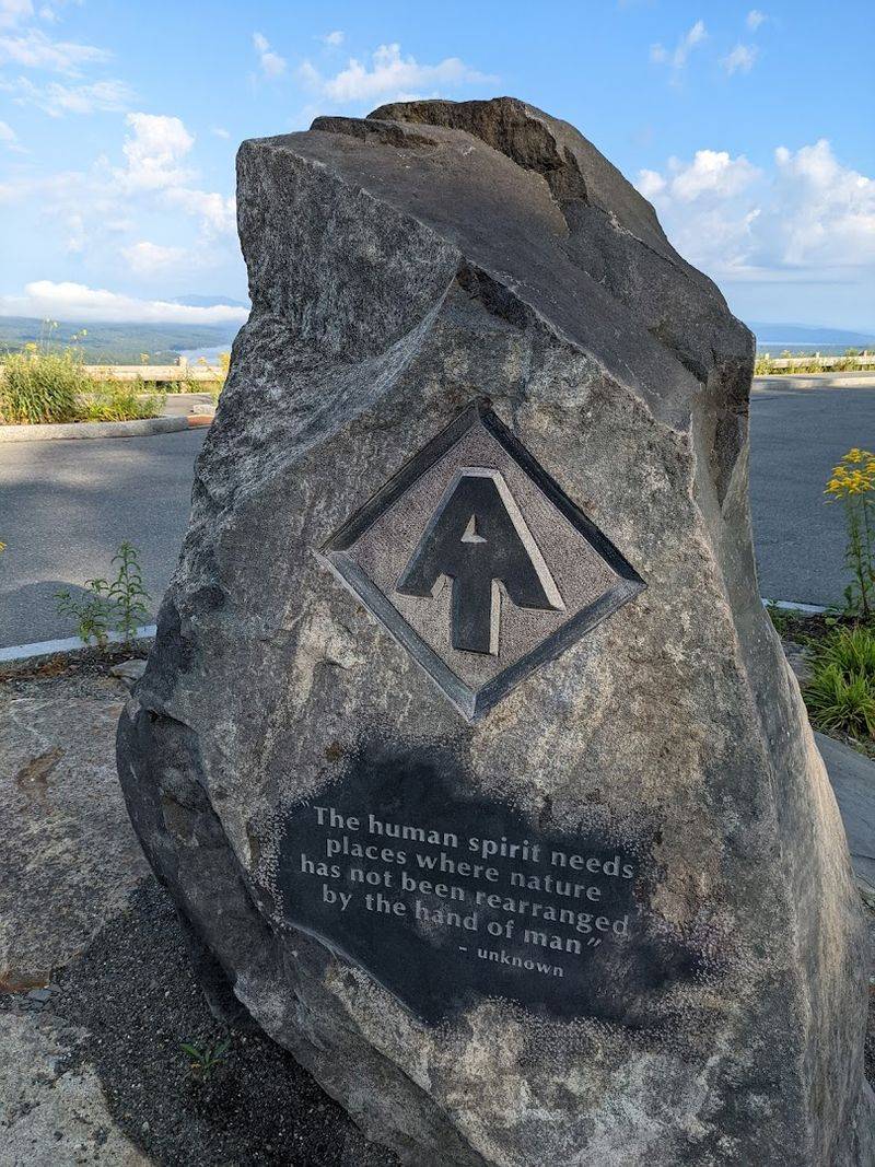
The Appalachian Trail passes through the broader Rangeley region, adding another layer of outdoor opportunity for visitors who want more than a quick stop.
Even without spotting a single animal, the air at this elevation has a quality to it that feels different from lower ground.
Cooler, cleaner, and carrying the faint scent of pine and open water, it is the kind of environment that makes you want to slow down and pay attention to everything happening around you, not just the horizon.
How To Catch The Shot
Capturing Height of Land in a photograph that does justice to the real thing is a genuine challenge, and knowing a few practical techniques before you arrive can make a meaningful difference.
The wide angle of the view means a standard smartphone frame will crop out a significant portion of what your eyes can see, so using panoramic mode or a wide-angle lens gives a more honest representation of the scene.
Golden hour, the period shortly after sunrise and before sunset, delivers the most flattering light for landscape photography here.
The low angle of the sun creates depth and texture across the mountain ridges and water surface that midday light simply cannot match. Foggy mornings add a moody, atmospheric quality that produces images unlike anything you get on a clear day.
The informational signs and the large “Height of Land” marker near the parking area also make for useful compositional foreground elements, grounding the viewer in the specific place rather than leaving the image feeling like a generic mountain scene from anywhere in New England.
Why This Pull-Off Belongs On Your Map?
Some roadside stops reward you with a decent view and a chance to stretch your legs. Height of Land rewards you with something closer to a full-on perspective shift.
The scale of the landscape visible from this single pullout along ME-17 is genuinely rare for a stop that requires zero hiking and zero planning beyond simply showing up.
The combination of easy roadside access and a view that changes character with every season and every weather condition makes this overlook the kind of place that holds up to repeat visits in a way that few destinations can claim.
Fog, snow, foliage, and summer clarity each bring their own version of the scene. For anyone building a western Maine road trip, placing Height of Land near the top of the list is a straightforward decision.
The drive along Route 17, the interpretive signs, the lake below, and the mountains beyond all work together to create an experience that feels complete and satisfying, the kind of stop you talk about long after the trip ends.