
This Illinois State Park Hides Eighteen Sandstone Canyons You Can Explore In One Long Weekend
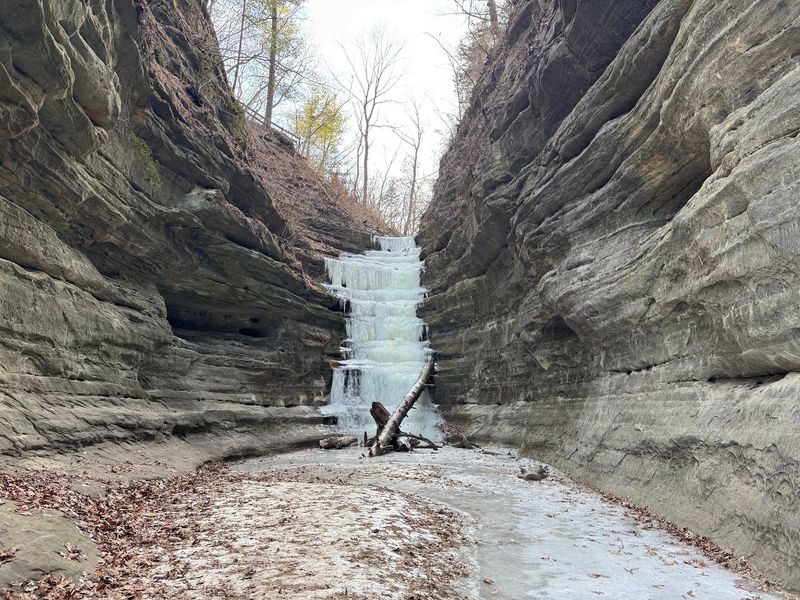
Starved Rock State Park in north-central Illinois holds 18 canyons carved from ancient sandstone, and that number alone makes it one of the most geologically striking places in the Midwest. A long weekend gives you enough time to work through the park’s major accessible canyon and overlook areas without feeling rushed.
The catch is that 18 canyons does not mean 18 open, marked trail destinations waiting on a single loop, and knowing that difference before you leave home makes for a far better trip.
What the 18-canyon count really tells you
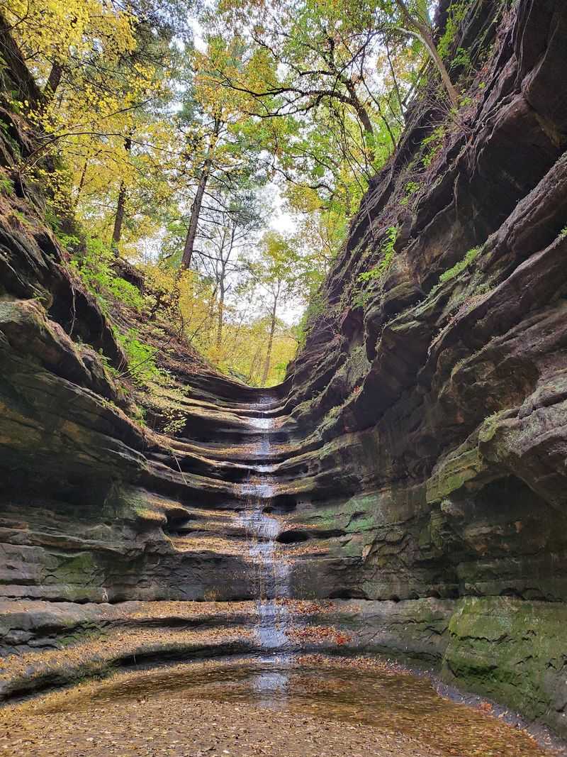
Starved Rock State Park is officially associated with 18 canyons, about 13 miles of marked hiking trails, and seven overlooks. That combination is more than enough to fill a long weekend, but the 18-canyon figure describes the park’s broader landscape rather than a roster of 18 independently accessible trail destinations.
IDNR’s park history, geology, and ecology interpretive materials identify only a subset of canyon areas as reachable by marked visitor trails, and the park does not offer one continuous circuit that threads every canyon together.
Older IDNR interpretive materials list eight accessible canyon waterfalls, while current activity guidance highlights a more limited set of recommended areas. The official list of accessible canyon names is not perfectly consistent across documents, so publishing a definitive “all 18 canyon names” checklist would misrepresent what visitors actually encounter.
Some canyons sit within the park’s geographic boundaries without a dedicated marked trail leading into them.
What the park does offer is a genuinely varied system of bluff trails, river trails, interior canyon routes, and overlooks spread across several trailheads. The official trail description and the Illinois State Archives historical record both support the 18-canyon count as a park-wide geographic fact.
Frame your weekend around exploring the major accessible canyon, bluff, river, and overlook areas rather than treating the number as a to-do list, and the park rewards that approach generously.
Primarily St. Peter Sandstone shapes the canyon walls
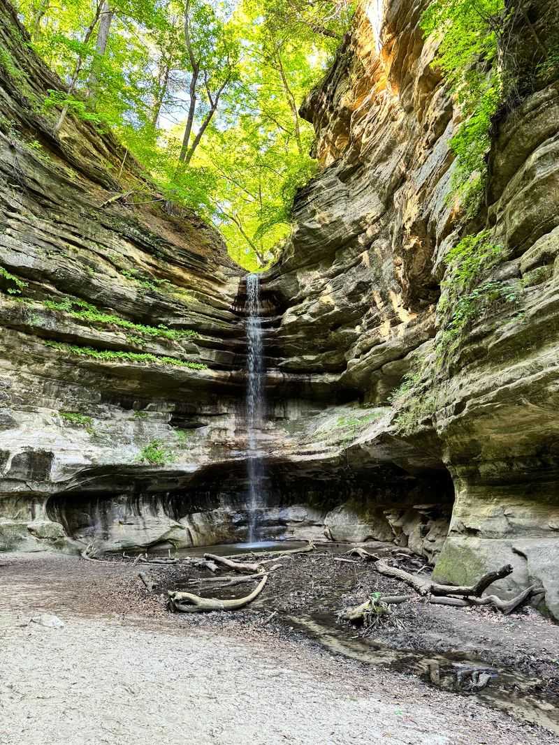
The walls rising on either side of Starved Rock’s accessible canyons are composed primarily of St. Peter Sandstone, a formation laid down roughly 450 million years ago when a shallow sea covered this part of North America. IDNR’s geology and ecology materials explain that differential weathering, the process by which different rock layers resist erosion at different rates, helps maintain the steep-sided canyon forms hikers see today.
Softer layers erode faster and retreat, while harder bands hold their position, producing the ledges, overhangs, and varied textures that make each passage feel distinct.
Across the accessible canyon areas, that geology translates into a range of visual experiences. Some passages narrow to just a few feet, with walls rising 50 feet or more overhead.
Others open into wider amphitheater-like chambers where water stains streak the stone in shades of rust, gold, and dark charcoal.
A practical point worth keeping in mind: the primary sandstone claim applies to the canyon walls as a group, not to identical geology in every one of the park’s 18 canyons. IDNR’s common questions document notes that waterfalls are intermittent features, but a dry canyon still offers plenty of geological interest.
The layered stone, the cool air trapped in narrow passages, and the carved overhangs remain compelling long after the water has stopped flowing.
Verify trail access before planning three days
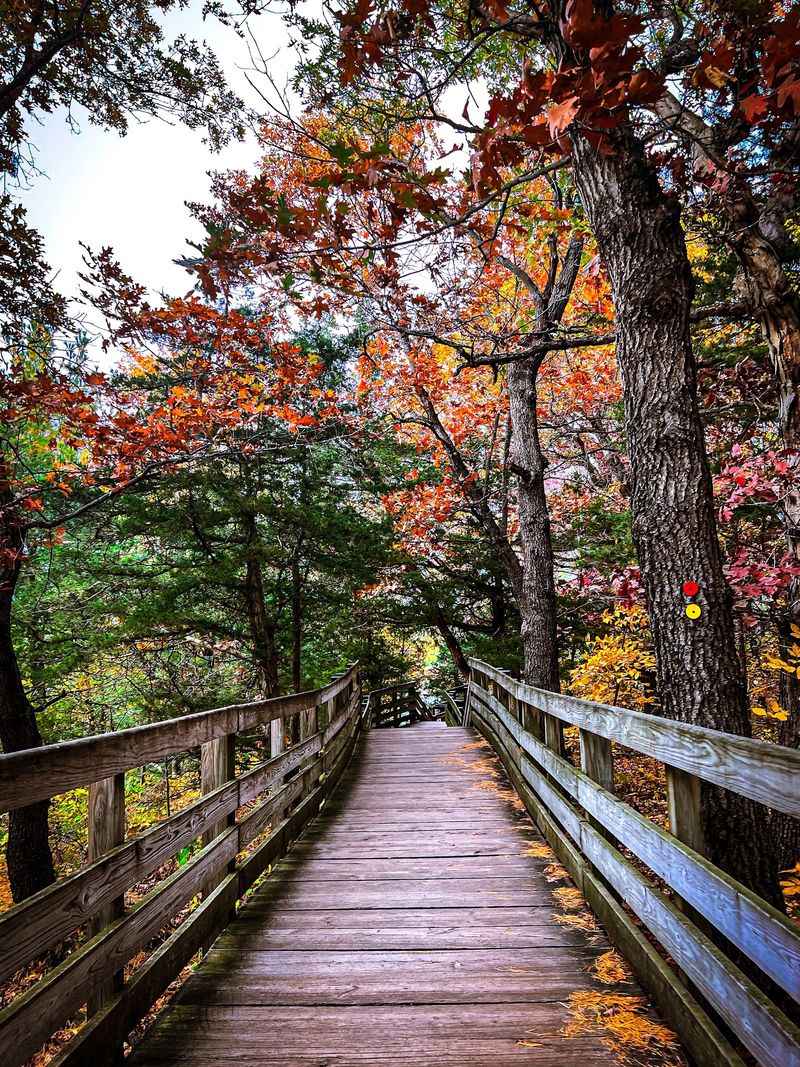
Trails at Starved Rock are generally open from 7 a.m. until sunset, but that schedule means nothing if a specific area is closed for construction when you arrive. IDNR’s Starved Rock hiking and activity page provides current hours and general guidance, while the color-coded trail system helps visitors navigate once they are on the ground.
Brown markers indicate bluff trails running along the canyon rims and high ground, red markers follow the river, and green markers lead into interior canyon areas and connecting routes between sections.
Those three categories behave differently. Bluff and river routes tend to be more continuous, while interior canyon routes often begin at specific trailheads and do not automatically connect to every other canyon area.
The official trail description document lists one-way distances from the visitor center but also notes that some areas are accessed from separate parking lots along Routes 71 and 178, which means mileage figures cannot simply be added together to produce a single daily total.
A 2026 trail-improvement project has added a layer of planning complexity. The IDNR project update page states that LaSalle Canyon, Tonti Canyon, Parkman’s Plain parking, and several connecting trails were closed beginning July 20, 2026, while French Canyon and Wildcat Canyon remain accessible from the visitor center and lodge area.
These conditions are subject to change as construction progresses, so treat any itinerary built around that project notice as a starting point rather than a guarantee.
Before finalizing your plans, check the IDNR current closures page, which is updated continuously. Check it again the day before departure.
A five-minute review of that page can save hours of frustration at a trailhead.
Start with the central area’s shorter canyon routes
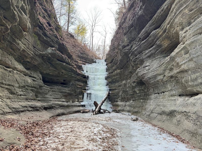
Opening day works well when it stays close to the visitor center and lodge, where parking is centralized and the trail signage is densest. IDNR’s activity guidance lists Starved Rock itself at approximately 0.6 mile round trip, French Canyon at approximately 0.8 mile, and Wildcat Canyon at approximately 2 miles.
Those distances are planning building blocks for separate routes, not automatically combined into one official loop, so check the current map before assuming any two of them connect without backtracking or road walking.
Treating these as individual outings rather than a single linked circuit also gives first-time visitors a chance to read the terrain before committing to longer routes the following days. The central area introduces the features that define the whole park: sandstone stairways descending into canyon interiors, overlook platforms with views across the Illinois River valley, and footing that can shift from packed dirt to slick stone within a few steps.
Pacing yourself here, taking photos, and testing your footwear on wet sandstone is more useful than rushing through three canyons before noon.
Access to the central area remains subject to the current project status. The 2026 trail-improvement notice identifies French and Wildcat Canyon access as available from the visitor center and lodge, but conditions can shift as work progresses.
The trail description document confirms French Canyon at 0.4 mile one way from the visitor center and Wildcat Canyon at 1 mile one way, which gives you a clear sense of how far each route actually extends before you decide how many to combine in a single morning.
Use separate trailheads for the longer canyon choices
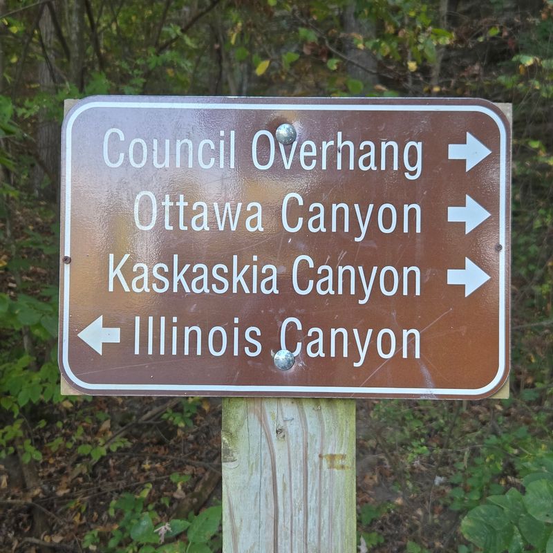
Longer canyon routes at Starved Rock require a different kind of planning because several of them start from parking areas along Routes 71 and 178 rather than from the main visitor center. Treating day two as a geographic exercise rather than a simple mileage calculation prevents the most common mistake hikers make at the park: assuming every canyon is within walking distance of the same lot.
IDNR’s activity guidance lists Aurora and St. Louis Canyon routes at approximately 3 miles collectively. The evidence does not verify that each individual route measures exactly 3 miles, so treat that figure as a combined reference rather than a per-canyon distance.
For context, the park’s own trail description places French Canyon at 0.4 mile one way and Wildcat at 1 mile one way, so the longer western routes represent a meaningful jump in commitment.
The official trail description lists Ottawa and Kaskaskia Canyons at approximately 4 miles one way from the visitor center and Illinois Canyon at approximately 4.7 miles one way. Illinois Canyon is also accessed from a dedicated parking area off Route 178, which makes it a practical stand-alone destination rather than the end point of a long continuous walk from the lodge.
Choosing between a focused shorter outing at one western canyon or a longer route through multiple areas depends on current access, your group’s pace, and how much daylight remains after morning preparation.
Before committing to any of these longer routes, verify their current status using the IDNR trail-improvement project page and the current map. Some areas listed in older materials may be affected by construction or require access approaches that differ from what earlier trip reports describe.
Let water and weather decide the flexible day
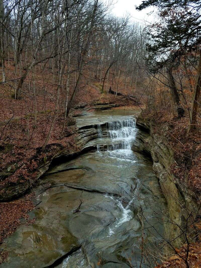
Building a third day around flexibility rather than a fixed destination is the smartest move a Starved Rock visitor can make. Waterfalls are one of the park’s most photographed features, but IDNR’s common questions document is clear that they are intermittent, weather-dependent features, not permanent attractions.
The strongest waterfall conditions generally appear from roughly March through June, driven by snowmelt and spring rainfall. Many canyon waterfalls can dry by late summer, though a significant rain event at any time of year can restore flow temporarily.
Checking recent weather near Utica before your trip gives a reasonable read on what to expect. A dry canyon is not a wasted visit, as the sandstone formations, narrow passages, and quiet canyon floor remain worthwhile, but managing expectations ahead of time prevents disappointment.
IDNR estimates a hiking pace of roughly 30 to 45 minutes per mile as a planning baseline, and that estimate assumes a steady walker on a clear trail.
Major staircases, rest breaks, photo stops, and route-finding at intersections all add time beyond what raw mileage suggests. Use the pace estimate to set a rough window, then build in extra margin rather than treating it as a guarantee.
The trail description document can help you identify which accessible routes fit the time and energy available on a third day, whether that means revisiting a canyon seen too quickly on day one, exploring a bluff trail for river views, or simply taking the river trail at an easy pace and watching for herons along the Illinois.
Match the route to terrain, access, and safety needs
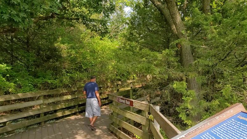
Mileage alone does not tell you how hard a route actually is at Starved Rock. Most canyon and overlook trails involve staircases, substantial elevation changes, and sandstone surfaces that become genuinely slippery when wet.
Carrying trekking poles, wearing shoes with real grip, and moving slowly on descents are practical habits rather than optional precautions.
IDNR’s accessibility information identifies Illinois Canyon as the only trail system in the park that lacks steps, though even that route includes a creek crossing. Every other canyon and overlook route in the park involves stairs or significant grade changes, which means visitors with limited mobility, joint issues, or young children need to assess specific routes rather than assuming the park is uniformly manageable.
A few rules apply park-wide and are worth knowing before you set out. IDNR’s hiking guidance requires dogs to remain leashed at all times and specifically advises against letting dogs drink from canyon waterfalls, creeks, or the Illinois River.
Stay on marked trails; off-trail scrambling, rock climbing, rappelling, wading, and swimming are all prohibited under park rules.
In an emergency, call 911. The trail description materials and IDNR’s common questions document both note that red QR codes posted at trail maps and intersections throughout the park help emergency dispatchers pinpoint a caller’s location.
Scanning one of those codes at the start of a route takes seconds and gives you a useful reference if conditions change unexpectedly.
Plan for a rewarding weekend, not a canyon-counting contest
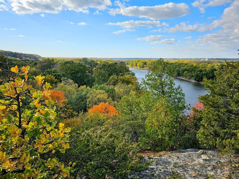
Starved Rock can fill a long weekend comfortably when visitors combine accessible canyon routes with overlooks, bluff trails, river walks, and geographically separate trailheads. The 18-canyon figure describes the park’s broader landscape, and approaching the weekend as an exploration of its best accessible areas rather than a complete canyon inventory leads to a more satisfying trip.
The official trail description and IDNR’s activity page together give you the distances, access points, and route options needed to build a realistic plan around your group’s stamina, daylight, and accessibility requirements. Match your daily choices to what the trail system actually offers on the dates you travel, not to what an older trip report or an optimistic headline promises.
Before you leave home, confirm current conditions using the IDNR current closures page, and check it again the morning of each hiking day. The park’s sandstone canyons have been forming for millions of years.
They will still be there if you need to swap one route for another.